National Register of Historic Places listings in Erie County, Ohio
Location of Erie County in Ohio
This is a list of the National Register of Historic Places listings in Erie County, Ohio.
This is intended to be a complete list of the properties and districts on the National Register of Historic Places in Erie County, Ohio, United States. Latitude and longitude coordinates are provided for many National Register properties and districts; these locations may be seen together in an online map.[1]
There are 178 properties and districts listed on the National Register in the county, including 2 National Historic Landmarks. The city of Sandusky is the location of 114 of these properties and districts; they are listed separately, while the remaining 64 sites, including both National Historic Landmarks, are listed here.
- This National Park Service list is complete through NPS recent listings posted October 11, 2018.[2]
Current listings
Sandusky
Outside Sandusky
| [3] | Name on the Register[4] | Image | Date listed[5] | Location | City or town | Description |
|---|---|---|---|---|---|---|
| 1 | Abbott-Page House | 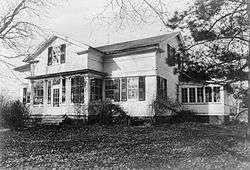 |
May 27, 1975 (#75001383) |
2.5 mi (4.0 km) northeast of Milan on Mason Rd. 41°20′12″N 82°35′02″W / 41.336528°N 82.583750°W |
Milan Township | |
| 2 | Ebenezer Andrews House | 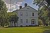 |
July 25, 1974 (#74001467) |
200 S. Main St. 41°17′27″N 82°35′59″W / 41.290778°N 82.599722°W |
Milan | |
| 3 | Anthony Wayne Shipwreck | 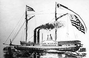 |
January 2, 2018 (#100001932) |
About 8 miles north of Vermilion 41°31′00″N 82°23′00″W / 41.516667°N 82.383333°W |
Vermilion vicinity | A 156-foot sidewheel steamer that was built in 1837 by Samuel L. Hubbel. She sank after her boilers exploded. She is the oldest shipwreck in Ohio waters.[6] |
| 4 | Barber Shop | 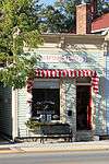 |
November 14, 1979 (#79003932) |
Liberty Ave. west of Main St. 41°25′20″N 82°21′54″W / 41.422167°N 82.365000°W |
Vermilion | |
| 5 | Baxtine House | 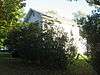 |
November 14, 1979 (#79003920) |
Junction of Ohio and Perry Sts. 41°25′11″N 82°22′08″W / 41.419861°N 82.368750°W |
Vermilion | |
| 6 | Louis Beatty House | October 25, 1984 (#84000106) |
South Shore Dr. 41°35′42″N 82°41′52″W / 41.595°N 82.697778°W |
Kelleys Island | ||
| 7 | Capt. Bradley's Second House | 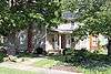 |
November 14, 1979 (#79003946) |
753 Decatur St. 41°25′13″N 82°22′09″W / 41.420278°N 82.369167°W |
Vermilion | |
| 8 | Capt. Alva Bradley House |  |
November 14, 1979 (#79003938) |
5679 Huron St. 41°25′25″N 82°22′02″W / 41.423611°N 82.367222°W |
Vermilion | |
| 9 | Cyrus Butler House | March 17, 1976 (#76001416) |
Edison Highway in Birmingham 41°19′55″N 82°21′03″W / 41.332083°N 82.350833°W |
Florence Township | ||
| 10 | Cargo Warehouse | 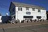 |
November 14, 1979 (#79003941) |
Liberty Ave., east of Exchange St. and west of Toledo St. 41°25′17″N 82°21′43″W / 41.421500°N 82.361806°W |
Vermilion | |
| 11 | Christ Episcopal Church | 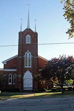 |
March 4, 1975 (#75001379) |
Park and Ohio Sts. 41°23′52″N 82°33′19″W / 41.397778°N 82.555278°W |
Huron | |
| 12 | Dean Road Bridge | 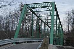 |
November 28, 1978 (#78002119) |
West of South Amherst at Dean Rd. and the Vermilion River 41°20′56″N 82°20′41″W / 41.348889°N 82.344722°W |
Florence Township | Extends into Lorain County |
| 13 | John Denzel House | 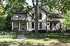 |
November 14, 1979 (#79003956) |
831 Douglas St. 41°25′08″N 82°21′44″W / 41.418889°N 82.362089°W |
Vermilion | |
| 14 | Thomas Alva Edison Birthplace | 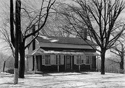 |
October 15, 1966 (#66000608) |
Edison Dr. 41°18′00″N 82°36′16″W / 41.300000°N 82.604444°W |
Milan | |
| 15 | Englebry's Dry Goods |  |
November 14, 1979 (#79003951) |
Main St., south of Liberty Ave. 41°25′18″N 82°21′53″W / 41.421556°N 82.364722°W |
Vermilion | |
| 16 | Dr. Englebry's Office |  |
November 14, 1979 (#79003922) |
Main St., south of Liberty Ave. 41°25′17″N 82°21′53″W / 41.421389°N 82.364722°W |
Vermilion | |
| 17 | Erie County Bank Building |  |
November 14, 1979 (#79003953) |
Junction of Liberty Ave. and Main St. 41°25′19″N 82°21′53″W / 41.421944°N 82.364722°W |
Vermilion | |
| 18 | Erie County Infirmary |  |
September 5, 1975 (#75001387) |
South of Sandusky on Columbus Rd. 41°25′38″N 82°41′38″W / 41.427222°N 82.693889°W |
Perkins Township | |
| 19 | Evangelical and Reformed Church | 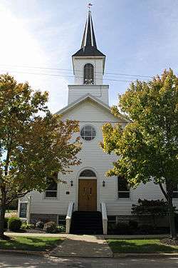 |
November 14, 1979 (#79003960) |
Junction of Grand and Ohio Sts. 41°25′13″N 82°21′59″W / 41.420278°N 82.366389°W |
Vermilion | |
| 20 | First Baptist Church | 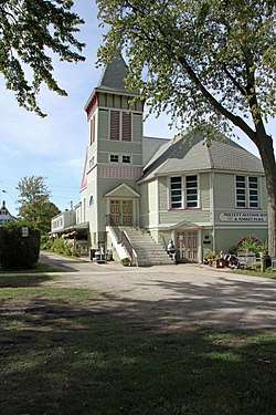 |
November 14, 1979 (#79003954) |
728 Main St. 41°25′14″N 82°21′55″W / 41.420556°N 82.365278°W |
Vermilion | |
| 21 | Florence Corners School | 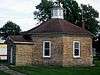 |
March 19, 1975 (#75001378) |
State Route 113 at Division St. in Florence 41°19′20″N 82°24′55″W / 41.322222°N 82.415278°W |
Florence Township | |
| 22 | JOSEPH FRANCIS IRON SURF BOAT | September 13, 1979 (#79001829) |
480 Main St. 41°25′29″N 82°22′00″W / 41.424861°N 82.366667°W |
Vermilion | ||
| 23 | Capt. Gilchrist House | 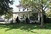 |
November 14, 1979 (#79003948) |
5644 Huron St. 41°25′26″N 82°22′03″W / 41.423889°N 82.367500°W |
Vermilion | |
| 24 | Capt. Gilchrist, Sr., House |  |
November 14, 1979 (#79003921) |
Junction of Ohio and Grand Sts. 41°25′11″N 82°21′57″W / 41.419861°N 82.365722°W |
Vermilion | |
| 25 | Great Lakes Historical Society Marine Museum |  |
November 14, 1979 (#79003925) |
Junction of Main and Huron Sts. 41°25′29″N 82°22′00″W / 41.424722°N 82.366667°W |
Vermilion | |
| 26 | Hart's Drug Store |  |
November 14, 1979 (#79003934) |
Junction of Main St. and Liberty Ave. 41°25′20″N 82°21′53″W / 41.422222°N 82.364861°W |
Vermilion | |
| 27 | Capt. Charles Horton House |  |
November 14, 1979 (#79003926) |
5564 Ferry St. 41°25′23″N 82°22′00″W / 41.423111°N 82.366667°W |
Vermilion | |
| 28 | House at 624 Washington St. | 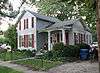 |
November 14, 1979 (#79003940) |
624 Washington St. 41°25′21″N 82°22′04″W / 41.422500°N 82.367778°W |
Vermilion | |
| 29 | House on Huron Ave. | 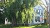 |
November 14, 1979 (#79003942) |
Junction of Huron and Washington Sts. 41°25′24″N 82°22′05″W / 41.423333°N 82.368056°W |
Vermilion | |
| 30 | Huron School | 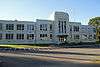 |
June 15, 2011 (#11000366) |
325 Ohio St. 41°23′43″N 82°33′32″W / 41.395278°N 82.558889°W |
Huron | Now McCormick Middle School |
| 31 | Inscription Rock | 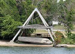 |
June 18, 1973 (#73001432) |
Kelleys Island 41°35′34″N 82°42′25″W / 41.592778°N 82.706944°W |
Kelleys Island | |
| 32 | Jenkins-Perry House | 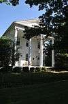 |
October 29, 1974 (#74001468) |
37 W. Front St. 41°17′51″N 82°36′31″W / 41.297500°N 82.608611°W |
Milan | |
| 33 | Kelleys Island South Shore District | 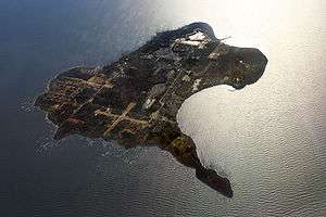 |
March 27, 1975 (#75001380) |
Water St. on the southern side of Kelleys Island; also the entire island[7] 41°35′44″N 82°43′05″W / 41.5956°N 82.7181°W |
Kelleys Island | "Entire island" represents a boundary increase of December 15, 1988, the Kelleys Island Historic District |
| 34 | Kishman Fish Company Buildings |  |
November 14, 1979 (#79003959) |
Main St., south of Huron St. and north of Liberty Ave. 41°25′22″N 82°21′51″W / 41.422778°N 82.364167°W |
Vermilion | |
| 35 | J.C. Lockwood House | 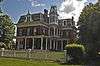 |
December 4, 1974 (#74001469) |
30 Edison Dr. 41°18′04″N 82°36′14″W / 41.301111°N 82.603889°W |
Milan | |
| 36 | Masonic Temple Building | 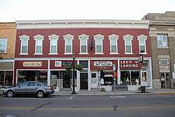 |
November 14, 1979 (#79003950) |
Main St., south of Liberty St. 41°25′18″N 82°21′53″W / 41.421750°N 82.364722°W |
Vermilion | |
| 37 | Capt. Meyers House | 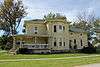 |
November 14, 1979 (#79003923) |
Junction of Ohio and Perry Sts. 41°25′13″N 82°22′08″W / 41.420278°N 82.368750°W |
Vermilion | |
| 38 | Milan Historic District | 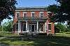 |
March 13, 1975 (#75001381) |
Main and Church Sts., both sides of Front St., and Edison Dr. 41°17′56″N 82°36′17″W / 41.298889°N 82.604722°W |
Milan | |
| 39 | Capt. Minch House | 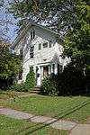 |
November 14, 1979 (#79003943) |
743 Grand St. 41°25′13″N 82°21′57″W / 41.420278°N 82.365833°W |
Vermilion | |
| 40 | Mitchell Historic District | 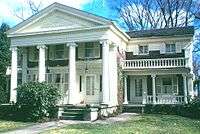 |
March 13, 1975 (#75001382) |
115-137 and 118-136 Center St. 41°17′42″N 82°36′07″W / 41.295000°N 82.601944°W |
Milan | |
| 41 | Oakland Cemetery Chapel and Superintendent's House and Office | 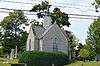 |
May 6, 1983 (#83001962) |
2917 Milan Rd., south of Sandusky 41°25′48″N 82°41′11″W / 41.430000°N 82.686250°W |
Perkins Township | |
| 42 | Ohio Soldiers' and Sailors' Home | 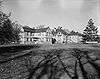 |
September 13, 1976 (#76001418) |
Southeast of Sandusky between U.S. Route 250 and S. Columbus Ave. 41°25′11″N 82°41′01″W / 41.419722°N 82.683611°W |
Perkins Township | |
| 43 | Old Funeral Parlor | 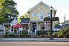 |
November 14, 1979 (#79003930) |
5596 Liberty St. 41°25′20″N 82°21′57″W / 41.422222°N 82.365833°W |
Vermilion | |
| 44 | Old Harbour Store | 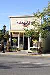 |
November 14, 1979 (#79003933) |
Liberty Ave., west of Main St. 41°25′20″N 82°21′54″W / 41.422222°N 82.365128°W |
Vermilion | |
| 45 | Old Interurban Station | 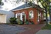 |
November 14, 1979 (#79003936) |
Junction of Liberty Ave. and Exchange St. 41°25′19″N 82°21′49″W / 41.421944°N 82.363500°W |
Vermilion | |
| 46 | Old Jib's Corner | 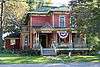 |
November 14, 1979 (#79003937) |
Junction of Liberty Ave. and Perry St. 41°25′19″N 82°22′06″W / 41.421833°N 82.368333°W |
Vermilion | |
| 47 | Old Mill | 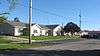 |
November 14, 1979 (#79003929) |
Junction of Exchange and Mill Sts. 41°25′00″N 82°21′47″W / 41.416667°N 82.363194°W |
Vermilion | |
| 48 | Old Nickel Plate Railroad Depot |  |
November 14, 1979 (#79003958) |
Junction of State Route 60 and Norfolk and Western railroad line 41°25′00″N 82°21′53″W / 41.416667°N 82.364722°W |
Vermilion | |
| 49 | Old Pelton Hotel |  |
November 14, 1979 (#79003952) |
5780 Liberty Ave. 41°25′20″N 82°22′09″W / 41.422222°N 82.369300°W |
Vermilion | |
| 50 | Old Union School Building |  |
November 14, 1979 (#79003957) |
Junction of South and Mill Sts. 41°24′59″N 82°21′54″W / 41.416389°N 82.365000°W |
Vermilion | |
| 51 | Old Vermilion Banking Company Building |  |
November 14, 1979 (#79003935) |
5581 Liberty Ave. 41°25′19″N 82°21′55″W / 41.421944°N 82.365389°W |
Vermilion | |
| 52 | Old Vermilion Mill |  |
November 14, 1979 (#79003928) |
Douglas St. 41°25′01″N 82°21′45″W / 41.416806°N 82.362500°W |
Vermilion | |
| 53 | Pelton House | 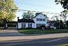 |
November 14, 1979 (#79003944) |
5345 South St. 41°25′08″N 82°21′46″W / 41.4188889°N 82.3627778°W |
Vermilion | |
| 54 | Capt. Rae House | 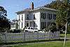 |
November 14, 1979 (#79003939) |
690 Decatur St. 41°25′17″N 82°22′12″W / 41.421389°N 82.370000°W |
Vermilion | |
| 55 | Sail Loft | 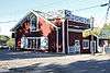 |
November 14, 1979 (#79003927) |
Main St., south of Ferry St. 41°25′24″N 82°21′54″W / 41.423333°N 82.365000°W |
Vermilion | |
| 56 | St. Mary Parish Hall | 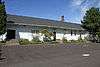 |
November 14, 1979 (#79003931) |
Exchange St. 41°25′15″N 82°21′48″W / 41.420944°N 82.363333°W |
Vermilion | |
| 57 | Spacecraft Propulsion Research Facility | 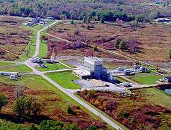 |
October 3, 1985 (#85002802) |
Lewis Research Center, Plum Brook Station 41°22′01″N 82°41′01″W / 41.366944°N 82.683611°W |
Oxford and Perkins Townships | |
| 58 | Stagecoach Inn | 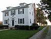 |
November 14, 1979 (#79003924) |
5798 Huron St. 41°25′24″N 82°22′11″W / 41.423333°N 82.369722°W |
Vermilion | |
| 59 | Starr-Truscott House | 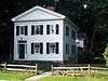 |
April 20, 1978 (#78002056) |
State Route 133 in Birmingham 41°19′52″N 82°21′20″W / 41.331111°N 82.355556°W |
Florence Township | |
| 60 | Steamboat Hotel | 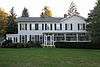 |
November 14, 1979 (#79003947) |
532 Main St. 41°25′26″N 82°21′58″W / 41.423889°N 82.366111°W |
Vermilion | |
| 61 | The Stone House | 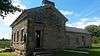 |
October 28, 2010 (#10000874) |
8217 Mason Rd., northeast of Berlin Heights 41°20′14″N 82°28′34″W / 41.337333°N 82.476°W |
Berlin Township | |
| 62 | Vermilion Town Hall | 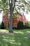 |
November 20, 1974 (#74001474) |
736 Main St. 41°25′13″N 82°21′54″W / 41.420278°N 82.365000°W |
Vermilion | |
| 63 | Capt. Henry Walper House | 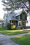 |
November 14, 1979 (#79003955) |
5475 South St. 41°25′08″N 82°21′50″W / 41.418889°N 82.363750°W |
Vermilion | |
| 64 | Capt. Young House | 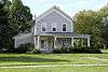 |
November 14, 1979 (#79003945) |
Junction of Decatur and Ohio Sts. 41°25′11″N 82°22′12″W / 41.419861°N 82.370000°W |
Vermilion |
See also
| Wikimedia Commons has media related to National Register of Historic Places in Erie County, Ohio. |
References
- ↑ The latitude and longitude information provided in this table was derived originally from the National Register Information System, which has been found to be fairly accurate for about 99% of listings. For about 1% of NRIS original coordinates, experience has shown that one or both coordinates are typos or otherwise extremely far off; some corrections may have been made. A more subtle problem causes many locations to be off by up to 150 yards, depending on location in the country: most NRIS coordinates were derived from tracing out latitude and longitudes from USGS topographical quadrant maps created under the North American Datum of 1927, which differs from the current, highly accurate WGS84 GPS system used by most on-line maps. Chicago is about right, but NRIS longitudes in Washington are higher by about 4.5 seconds, and are lower by about 2.0 seconds in Maine. Latitudes differ by about 1.0 second in Florida. Some locations in this table may have been corrected to current GPS standards.
- ↑ "National Register of Historic Places: Weekly List Actions". National Park Service, United States Department of the Interior. Retrieved on October 11, 2018.
- ↑ Numbers represent an ordering by significant words. Various colorings, defined here, differentiate National Historic Landmarks and historic districts from other NRHP buildings, structures, sites or objects.
- ↑ National Park Service (2008-04-24). "National Register Information System". National Register of Historic Places. National Park Service.
- ↑ The eight-digit number below each date is the number assigned to each location in the National Register Information System database, which can be viewed by clicking the number.
- ↑ "Found! A.B. Wayne". Ohio Shipwrecks. Retrieved 8 April 2018.
- ↑ Location of boundary increase derived from the area figure, which equals the area of the entire island; the NRIS lists the district as "Address Restricted"


Municipalities and communities of Erie County, Ohio, United States | ||
|---|---|---|
| Cities | | |
| Villages | ||
| Townships | ||
| CDPs | ||
| Unincorporated communities | ||
| Footnotes | ‡This populated place also has portions in an adjacent county or counties | |
This article is issued from
Wikipedia.
The text is licensed under Creative Commons - Attribution - Sharealike.
Additional terms may apply for the media files.