| [3] |
Name on the Register |
Image |
Date listed[4] |
Location |
City or town |
Description |
|---|
| 1 |
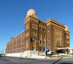
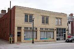
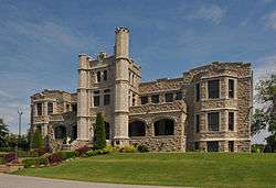
Abou Ben Adhem Shrine Mosque |
|
September 9, 1982
(#82003137) |
601 E. St. Louis
37°12′34″N 93°17′10″W / 37.209444°N 93.286111°W / 37.209444; -93.286111 (Abou Ben Adhem Shrine Mosque) |
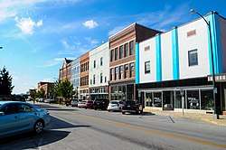
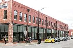
Springfield |
|
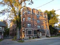
| 2 |
Ambassador Apartments |
|
October 29, 2008
(#08001023) |
1235 E. Elm St.
37°12′20″N 93°16′28″W / 37.205447°N 93.27455°W / 37.205447; -93.27455 (Ambassador Apartments) |
Springfield |
|
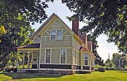
| 3 |
Elijah Teague Anderson House |
|
November 14, 1980
(#80002353) |
406 N. Pine St.
37°07′22″N 93°28′44″W / 37.122778°N 93.478889°W / 37.122778; -93.478889 (Elijah Teague Anderson House) |
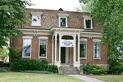
Republic |
|
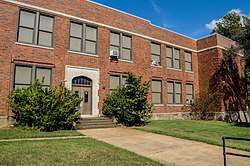
| 4 |
Bailey School |
|
November 2, 2016
(#16000749) |
501 W. Central St.
37°13′03″N 93°17′42″W / 37.217453°N 93.294892°W / 37.217453; -93.294892 (Bailey School) |
Springfield |
|
| 5 |
Bentley House |
|
November 14, 1980
(#80002354) |
603 E. Calhoun St.
37°13′21″N 93°17′06″W / 37.2225°N 93.285°W / 37.2225; -93.285 (Bentley House) |
Springfield |
|
| 6 |
Benton Avenue AME Church |
|
October 14, 2001
(#01001109) |
830 N. Benton Ave.
37°13′02″N 93°17′14″W / 37.217222°N 93.287222°W / 37.217222; -93.287222 (Benton Avenue AME Church) |
Springfield |
|
| 7 |
Berry Cemetery |
|
November 13, 2004
(#04001224) |
1431 W. Farm Road 74
37°19′26″N 93°36′00″W / 37.323889°N 93.6°W / 37.323889; -93.6 (Berry Cemetery) |
Ash Grove |
|
| 8 |
Beverly Apartments |
|
July 10, 2017
(#100001299) |
529 Cherry St.
37°12′15″N 93°17′14″W / 37.204133°N 93.287257°W / 37.204133; -93.287257 (Beverly Apartments) |
Springfield |
|
| 9 |
Boegel and Hine Flour Mill-Wommack Mill |
|
November 6, 1986
(#86003140) |
East side of N. Main St., south of its intersection with Route 125
37°22′59″N 93°09′01″W / 37.383056°N 93.150278°W / 37.383056; -93.150278 (Boegel and Hine Flour Mill-Wommack Mill) |
Fair Grove |
|
| 10 |
Nathan Boone House |
|
October 1, 1969
(#69000103) |
1.75 miles (2.82 km) north of Ash Grove on Highway V
37°20′46″N 93°34′35″W / 37.346111°N 93.576389°W / 37.346111; -93.576389 (Nathan Boone House) |
Ash Grove |
|
| 11 |
Camp Manor Apartments |
|
December 6, 2005
(#05001374) |
423 E. Elm St.
37°12′18″N 93°17′21″W / 37.205°N 93.289167°W / 37.205; -93.289167 (Camp Manor Apartments) |
Springfield |
|
| 12 |
Campbell Avenue Historic District |
|
June 25, 1999
(#99000714) |
200 and 300 blocks of S. Campbell Ave. and the 300 block of Park Central West; also 318 and 322-326 S. Campbell Ave.
37°12′30″N 93°17′38″W / 37.208333°N 93.293889°W / 37.208333; -93.293889 (Campbell Avenue Historic District) |
Springfield |
Second set of boundaries represents a boundary increase of December 23, 2005 |
| 13 |
Christ Episcopal Church |
|
March 26, 1987
(#87000514) |
601 E. Walnut St.[5]
37°12′25″N 93°17′11″W / 37.206944°N 93.286389°W / 37.206944; -93.286389 (Christ Episcopal Church) |
Springfield |
|
| 14 |
College Apartments |
|
May 1, 2003
(#03000319) |
408 E. Walnut St.
37°12′31″N 93°17′20″W / 37.208611°N 93.288889°W / 37.208611; -93.288889 (College Apartments) |
Springfield |
|
| 15 |
Commercial Street Historic District |
|
May 24, 1983
(#83000991) |
Commercial St.
37°13′47″N 93°17′23″W / 37.229722°N 93.289722°W / 37.229722; -93.289722 (Commercial Street Historic District) |
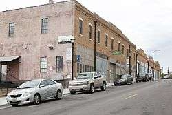
Springfield |
|
| 16 |
Day House |
|
November 7, 1976
(#76001110) |
614 South St.
37°12′12″N 93°17′31″W / 37.203333°N 93.291944°W / 37.203333; -93.291944 (Day House) |
Springfield |
|
| 17 |
Fallin Brothers Building |
|
July 25, 2012
(#12000435) |
211-229 S. Market Ave.
37°12′30″N 93°17′44″W / 37.208311°N 93.295611°W / 37.208311; -93.295611 (Fallin Brothers Building) |
Springfield |
part of the Springfield Multiple Property Submission |
| 18 |
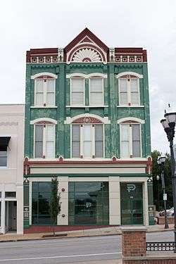
Finkbiner Building |
|
May 25, 2005
(#05000469) |
509-513 W. Oliver St.
37°12′43″N 93°17′46″W / 37.211944°N 93.296111°W / 37.211944; -93.296111 (Finkbiner Building) |
Springfield |
|
| 19 |
Franklin Springfield Motor Co. Building |
|
November 15, 2006
(#06001027) |
312-314 E. Olive St.
37°12′40″N 93°17′26″W / 37.211111°N 93.290556°W / 37.211111; -93.290556 (Franklin Springfield Motor Co. Building) |
Springfield |
|
| 20 |
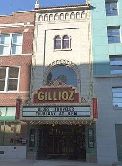
Gillioz Theater |
|
July 9, 1991
(#91000887) |
325 Park Central E.
37°12′30″N 93°17′20″W / 37.208333°N 93.288889°W / 37.208333; -93.288889 (Gillioz Theater) |
Springfield |
|
| 21 |
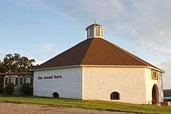
Gilmore Barn |
|
April 8, 1994
(#94000316) |
U.S. Route 160, 3.5 miles (5.6 km) east of Ash Grove
37°19′24″N 93°30′43″W / 37.323333°N 93.511944°W / 37.323333; -93.511944 (Gilmore Barn) |
Ash Grove |
|
| 22 |
Gottfried Furniture Company Building |
|
December 18, 2007
(#07001289) |
326 Boonville Ave.
37°12′45″N 93°17′31″W / 37.2125°N 93.291944°W / 37.2125; -93.291944 (Gottfried Furniture Company Building) |
Springfield |
|
| 23 |
Greene County Courthouse |
|
November 14, 2007
(#07001185) |
940 Boonville Ave.
37°13′12″N 93°17′31″W / 37.22°N 93.291944°W / 37.22; -93.291944 (Greene County Courthouse) |
Springfield |
|
| 24 |
Heer's Department Store |
|
October 24, 2002
(#02001207) |
138 Park Central Square
37°12′33″N 93°17′34″W / 37.209167°N 93.292778°W / 37.209167; -93.292778 (Heer's Department Store) |
Springfield |
|
| 25 |
Heercleff |
|
November 7, 2016
(#16000763) |
6405 S. Campbell Ave.
37°05′55″N 93°17′52″W / 37.098529°N 93.297760°W / 37.098529; -93.297760 (Heercleff) |
Springfield |
|
| 26 |
Holland Building |
|
November 15, 2000
(#00001373) |
205 Park Central East
37°12′33″N 93°17′28″W / 37.209167°N 93.291111°W / 37.209167; -93.291111 (Holland Building) |
Springfield |
|
| 27 |
Hotel Sansone |
|
May 5, 2000
(#00000430) |
312 Park Central East
37°12′32″N 93°17′25″W / 37.208889°N 93.290278°W / 37.208889; -93.290278 (Hotel Sansone) |
Springfield |
|
| 28 |
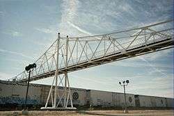
Jefferson Street Footbridge |
|
September 2, 2003
(#03000865) |
Jefferson Ave. between Commercial and Chase Sts.
37°13′58″N 93°17′21″W / 37.232778°N 93.289167°W / 37.232778; -93.289167 (Jefferson Street Footbridge) |
Springfield |
|
| 29 |
Keet-McElhany House |
|
March 22, 1984
(#84002545) |
435 E. Walnut St.
37°12′24″N 93°17′20″W / 37.206667°N 93.288889°W / 37.206667; -93.288889 (Keet-McElhany House) |
Springfield |
|
| 30 |
J.E. King Manufacturing Company |
|
July 27, 2005
(#05000751) |
1350 St. Louis St.
37°12′07″N 93°17′57″W / 37.201944°N 93.299167°W / 37.201944; -93.299167 (J.E. King Manufacturing Company) |
Springfield |
|
| 31 |
Robert B. and Vitae A. Kite Apartment Building |
|
January 28, 2004
(#03001504) |
769-771 South Ave.
37°12′09″N 93°17′34″W / 37.2025°N 93.292778°W / 37.2025; -93.292778 (Robert B. and Vitae A. Kite Apartment Building) |
Springfield |
|
| 32 |
Landers Theater |
|
August 12, 1977
(#77000806) |
311 E. Walnut
37°12′26″N 93°17′27″W / 37.207222°N 93.290833°W / 37.207222; -93.290833 (Landers Theater) |
Springfield |
|
| 33 |
Lincoln School |
|
May 31, 2000
(#00000508) |
815 N. Sherman Ave.
37°13′00″N 93°16′53″W / 37.216667°N 93.281389°W / 37.216667; -93.281389 (Lincoln School) |
Springfield |
|
| 34 |
Marquette Hotel |
|
May 5, 2000
(#00000431) |
400 East Walnut
37°12′25″N 93°17′21″W / 37.206944°N 93.289167°W / 37.206944; -93.289167 (Marquette Hotel) |
Springfield |
|
| 35 |
Marx-Hurlburt Building |
|
September 2, 2003
(#03000864) |
311-315 E. Park Central Sq.
37°12′40″N 93°17′26″W / 37.211111°N 93.290556°W / 37.211111; -93.290556 (Marx-Hurlburt Building) |
Springfield |
|
| 36 |
McDaniel Building |
|
October 22, 2014
(#14000871) |
316 Park Central E.
37°12′33″N 93°17′28″W / 37.2091°N 93.2910°W / 37.2091; -93.2910 (McDaniel Building) |
Springfield |
|
| 37 |
Mid-Town Historic District |
|
July 13, 1989
(#89000938) |
Roughly bounded by Pacific, Clay, Pythian, Summit, Calhoun, Washington, Central, Benton, Division, and Jefferson; also roughly along N. Robberson Ave. and N. Jefferson Ave.
37°13′22″N 93°17′06″W / 37.222778°N 93.285°W / 37.222778; -93.285 (Mid-Town Historic District) |
Springfield |
Second set of boundaries represents a boundary increase of August 9, 2002 |
| 38 |
Netter-Ullman Building |
|
April 18, 2003
(#03000255) |
317 Park Central East
37°12′40″N 93°17′15″W / 37.211111°N 93.2875°W / 37.211111; -93.2875 (Netter-Ullman Building) |
Springfield |
|
| 39 |
D.M. Oberman Manufacturing Co. Building |
|
April 18, 2002
(#02000379) |
600 N. Boonville Ave.
37°12′58″N 93°17′31″W / 37.216111°N 93.291944°W / 37.216111; -93.291944 (D.M. Oberman Manufacturing Co. Building) |
Springfield |
|
| 40 |
Old Calaboose |
|
November 14, 1980
(#80002355) |
409 W. McDaniel St.
37°12′30″N 93°17′40″W / 37.208333°N 93.294444°W / 37.208333; -93.294444 (Old Calaboose) |
Springfield |
|
| 41 |
Palace Hotel |
|
November 27, 2002
(#02001419) |
501 College St.
37°12′40″N 93°17′44″W / 37.211111°N 93.295556°W / 37.211111; -93.295556 (Palace Hotel) |
Springfield |
|
| 42 |
Pearl Apartments and Windsor Apartments |
|
December 6, 2005
(#05001376) |
728 and 722 S. Jefferson St.
37°12′07″N 93°17′21″W / 37.201944°N 93.289167°W / 37.201944; -93.289167 (Pearl Apartments and Windsor Apartments) |
Springfield |
|
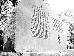
| 43 |
Pearson Creek Archeological District |
|
October 11, 1978
(#78001647) |
Address Restricted
|
Springfield |
|
| 44 |
Producers Ice and Manufacturing Company |
|
January 29, 2018
(#100002031) |
524 W Chase St.
37°13′51″N 93°17′47″W / 37.230905°N 93.296281°W / 37.230905; -93.296281 (Producers Ice and Manufacturing Company) |
Springfield |
|
| 45 |
Producers Produce Company Plant |
|
April 12, 2010
(#10000181) |
501 N. Main Ave.
37°07′26″N 93°28′49″W / 37.123933°N 93.480389°W / 37.123933; -93.480389 (Producers Produce Company Plant) |
Springfield |
|
| 46 |
Pythian Home of Missouri |
|
October 7, 2009
(#09000812) |
1451 E. Pythian St.
37°13′17″N 93°16′07″W / 37.221433°N 93.268678°W / 37.221433; -93.268678 (Pythian Home of Missouri) |
Springfield |
|
| 47 |
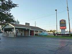
Rail Haven Motel |
|
May 10, 2010
(#10000245) |
203 S. Glenstone Ave.
37°12′30″N 93°15′46″W / 37.208456°N 93.262664°W / 37.208456; -93.262664 (Rail Haven Motel) |
Springfield |
|
| 48 |
Rock Fountain Court Historic District |
|
April 2, 2003
(#03000179) |
2400 W. College St.
37°12′31″N 93°19′28″W / 37.208611°N 93.324444°W / 37.208611; -93.324444 (Rock Fountain Court Historic District) |
Springfield |
|
| 49 |
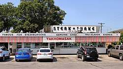
Route 66 Steak 'n Shake |
|
August 1, 2012
(#12000462) |
1158 E. St. Louis St.
37°12′34″N 93°16′35″W / 37.209328°N 93.276449°W / 37.209328; -93.276449 (Route 66 Steak 'n Shake) |
Springfield |
part of the Route 66 in Missouri Multiple Property Submission |
| 50 |
St. John's Mercy Hospital Building |
|
September 2, 2003
(#03000867) |
620 W. Scott
37°13′17″N 93°17′49″W / 37.221389°N 93.296944°W / 37.221389; -93.296944 (St. John's Mercy Hospital Building) |
Springfield |
|
| 51 |
St. Paul Block |
|
January 15, 2009
(#08001322) |
401 South Ave.
37°12′26″N 93°17′32″W / 37.207097°N 93.29235°W / 37.207097; -93.29235 (St. Paul Block) |
Springfield |
|
| 52 |
Henry Schneider Building |
|
August 24, 2006
(#06000535) |
600 College St.-219-231 S. Main Ave.
37°12′38″N 93°17′50″W / 37.210556°N 93.297222°W / 37.210556; -93.297222 (Henry Schneider Building) |
Springfield |
|
| 53 |
South Avenue Commercial Historic District |
|
June 25, 1999
(#99000713) |
Walnut and Pershing Sts., South and Robberson Aves.
37°12′23″N 93°17′30″W / 37.206389°N 93.291667°W / 37.206389; -93.291667 (South Avenue Commercial Historic District) |
Springfield |
|
| 54 |
South-McDaniel-Patton Commercial Historic District |
|
March 7, 2003
(#03000088) |
Roughly bounded by S. Campbell Ave., W. McDaniel St., South Ave., and W. Walnut St.
37°12′34″N 93°17′35″W / 37.209444°N 93.293056°W / 37.209444; -93.293056 (South-McDaniel-Patton Commercial Historic District) |
Springfield |
|
| 55 |
Springfield Furniture Company |
|
July 5, 2006
(#06000536) |
601 N. National
37°12′58″N 93°16′35″W / 37.216111°N 93.276389°W / 37.216111; -93.276389 (Springfield Furniture Company) |
Springfield |
|
| 56 |
Springfield Grocer Company Warehouse |
|
July 8, 2010
(#10000462) |
323 North Patton Ave.
37°12′38″N 93°17′37″W / 37.210556°N 93.293611°W / 37.210556; -93.293611 (Springfield Grocer Company Warehouse) |
Springfield |
|
| 57 |
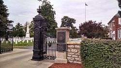
Springfield National Cemetery |
|
August 27, 1999
(#99001045) |
1702 E. Seminole St.
37°10′12″N 93°15′51″W / 37.17°N 93.264167°W / 37.17; -93.264167 (Springfield National Cemetery) |
Springfield |
|
| 58 |
Springfield Public Square Historic District |
|
May 5, 2006
(#06000331) |
149, 138, 137, 134, 127, 132, 124, and 122 Park Central Sq., and 219 and 221 South Ave.; also the eastern side of Public Square, part of the 300 block of Park Central E., and the northern side of the 200 block of W. Olive
37°12′40″N 93°17′34″W / 37.211111°N 93.292778°W / 37.211111; -93.292778 (Springfield Public Square Historic District) |
Springfield |
Second set of boundaries represents a boundary increase of January 13, 2010 |
| 59 |
Springfield Seed Co. Office and Warehouse |
|
September 14, 2006
(#06000863) |
319 N. Main Ave.
37°12′44″N 93°17′49″W / 37.212222°N 93.296944°W / 37.212222; -93.296944 (Springfield Seed Co. Office and Warehouse) |
Springfield |
|
| 60 |
Springfield Warehouse and Industrial Historic District |
|
June 25, 1999
(#99000715) |
E. Water, W. Mill and W. Phelps Sts. and Boonville Ave.
37°12′41″N 93°17′30″W / 37.211389°N 93.291667°W / 37.211389; -93.291667 (Springfield Warehouse and Industrial Historic District) |
Springfield |
|
| 61 |
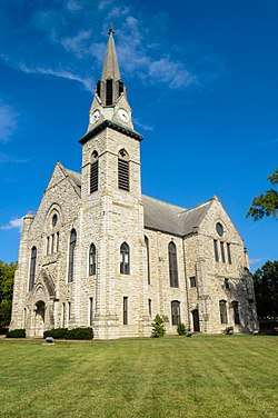
Stone Chapel |
|
October 21, 1982
(#82000583) |
Benton and Central Sts.
37°13′04″N 93°17′13″W / 37.217778°N 93.286944°W / 37.217778; -93.286944 (Stone Chapel) |
Springfield |
|
| 62 |
Trail of Tears Roadbed Segment on Josiah Danforth Farm |
|
July 23, 2018
(#16000342) |
Address Restricted
|
Strafford vicinity |
|
| 63 |
U.S. Customhouse and Post Office |
|
June 27, 1979
(#79001360) |
830 Boonville Ave.
37°12′57″N 93°17′31″W / 37.215833°N 93.291944°W / 37.215833; -93.291944 (U.S. Customhouse and Post Office) |
Springfield |
|
| 64 |
Walnut Street Commercial Historic District |
|
June 25, 1999
(#99000717) |
Walnut St.
37°12′26″N 93°17′27″W / 37.207222°N 93.290833°W / 37.207222; -93.290833 (Walnut Street Commercial Historic District) |
Springfield |
|
| 65 |
Walnut Street Historic District |
|
March 21, 1985
(#85000623) |
Roughly bounded by McDaniel, Walnut, and Elm Sts. and the Sherman Parkway; also roughly along E. Walnut St. in the 700 and 800 blocks
37°12′24″N 93°15′59″W / 37.206667°N 93.266389°W / 37.206667; -93.266389 (Walnut Street Historic District) |
Springfield |
Second set of boundaries represents a boundary increase of August 5, 2002 |
| 66 |
West Walnut Street Commercial Historic District |
|
March 20, 2002
(#02000211) |
Roughly the 300 and 400 blocks of W. Walnut St., and the 300 and 400 blocks of S. Campbell Ave.
37°12′32″N 93°17′40″W / 37.208889°N 93.294444°W / 37.208889; -93.294444 (West Walnut Street Commercial Historic District) |
Springfield |
|
| 67 |
E. M. Wilhoit Building |
|
January 31, 2005
(#04001576) |
300-330 E. Pershing St.
37°12′29″N 93°17′25″W / 37.208056°N 93.290278°W / 37.208056; -93.290278 (E. M. Wilhoit Building) |
Springfield |
|
| 68 |
Edward M. and Della C. Wilhoit House |
|
December 23, 2004
(#04001384) |
903 S. Weller Ave.
37°12′00″N 93°16′07″W / 37.2°N 93.268611°W / 37.2; -93.268611 (Edward M. and Della C. Wilhoit House) |
Springfield |
|
| 69 |
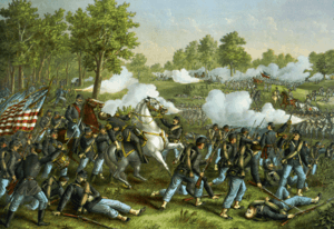
Wilson's Creek National Battlefield |
|
October 15, 1966
(#66000113) |
Southwest of Springfield on Route 174
37°06′06″N 93°24′31″W / 37.101667°N 93.408611°W / 37.101667; -93.408611 (Wilson's Creek National Battlefield) |
Springfield |
|
| 70 |
Wise Feed Company Building |
|
January 6, 2003
(#02001685) |
438-440 S. Campbell Ave.
37°12′20″N 93°17′34″W / 37.205556°N 93.292778°W / 37.205556; -93.292778 (Wise Feed Company Building) |
Springfield |
|
| 71 |
Woods-Evertz Stove Company Historic District |
|
October 23, 2003
(#03001071) |
Area bounded by N. Jefferson Ave., E Phelps St., N. Robberson Ave., and E. Tampa St.
37°12′55″N 93°17′26″W / 37.215278°N 93.290556°W / 37.215278; -93.290556 (Woods-Evertz Stove Company Historic District) |
Springfield |
|