| [3] |
Name on the Register[4] |
Image |
Date listed[5] |
Location |
City or town |
Description |
|---|
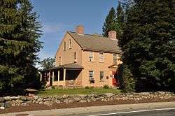
| 1 |
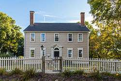
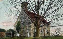
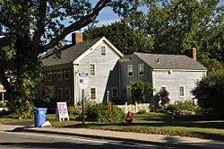
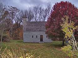
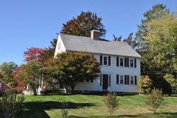
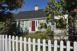
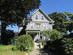
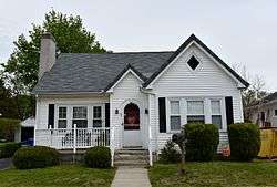
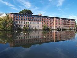
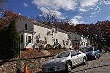
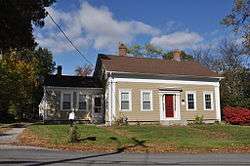
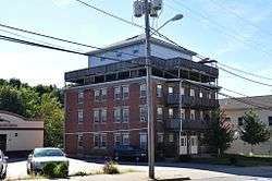
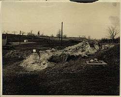
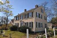
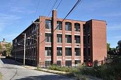
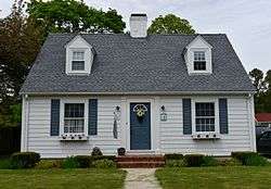
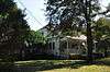
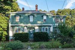
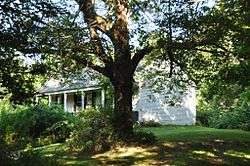
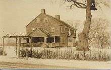
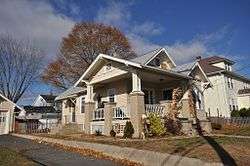
1761 Milestone |
|
November 24, 1982
(#82000131) |
640 S. Main St.
41°59′22″N 71°31′54″W / 41.989444°N 71.531667°W / 41.989444; -71.531667 (1761 Milestone) |
Woonsocket |
|
| 2 |
Albion Historic District |
|
July 19, 1984
(#84001899) |
Roughly bounded by Berkshire Dr., Willow Lane, Ledge Way, Kennedy Boulevard, and School and Main Sts.
41°57′06″N 71°27′26″W / 41.951667°N 71.457222°W / 41.951667; -71.457222 (Albion Historic District) |
Lincoln |
|
| 3 |
Allen Street Historic District |
|
September 13, 1990
(#90001349) |
Allen St.
42°00′06″N 71°30′50″W / 42.001667°N 71.513889°W / 42.001667; -71.513889 (Allen Street Historic District) |
Woonsocket |
|
| 4 |
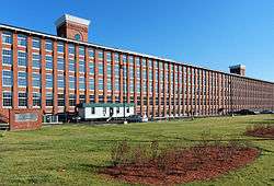
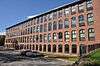
Allendale Mill |
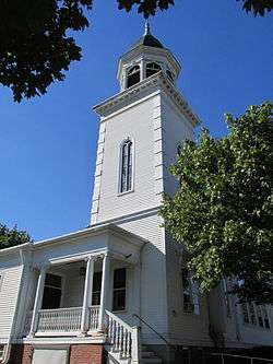
|
May 7, 1973
(#73000063) |
494 Woonasquatucket Ave.
41°51′00″N 71°28′51″W / 41.85°N 71.480833°W / 41.85; -71.480833 (Allendale Mill) |
North Providence |
|
| 5 |
Allenville Mill Storehouse |
|
January 20, 1972
(#72000033) |
5 Esmond St.
41°52′41″N 71°30′09″W / 41.878056°N 71.5025°W / 41.878056; -71.5025 (Allenville Mill Storehouse) |
Smithfield |
|
| 6 |
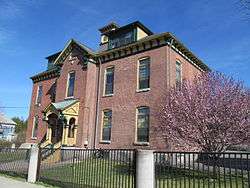
American Supply Company Building |
|
May 8, 2017
(#100000978) |
1420 Broad St.
41°53′56″N 71°23′24″W / 41.898913°N 71.390062°W / 41.898913; -71.390062 (American Supply Company Building) |
Central Falls |
|
| 7 |
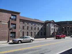
Andrews Mill Company Plant |
|
September 13, 2018
(#100002937) |
761 Great Rd.
42°00′00″N 71°33′13″W / 42.0000°N 71.5536°W / 42.0000; -71.5536 (Andrews Mill Company Plant) |
North Smithfield |
|
| 8 |
Andrews-Luther Farm |
|
June 19, 1985
(#85001352) |
Elmdale Rd.
41°51′08″N 71°36′04″W / 41.852222°N 71.601111°W / 41.852222; -71.601111 (Andrews-Luther Farm) |
Scituate |
|
| 9 |
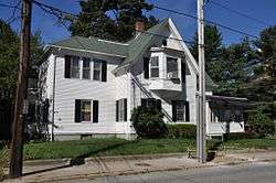
Daniel Angell House |
|
April 21, 1975
(#75000056) |
15 Dean Ave.
41°52′46″N 71°30′01″W / 41.879444°N 71.500278°W / 41.879444; -71.500278 (Daniel Angell House) |
Johnston |
|
| 10 |
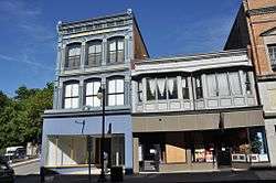
Otis Angell Gristmill |
|
November 3, 2017
(#100001779) |
1 Governor Notte Pkwy.
41°52′13″N 71°27′39″W / 41.870408°N 71.460828°W / 41.870408; -71.460828 (Otis Angell Gristmill) |
North Providence |
|
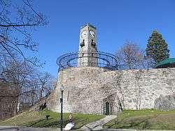
| 11 |
Angell-Ballou House |
|
March 18, 2004
(#04000196) |
49 Ridge Rd.
41°53′42″N 71°30′05″W / 41.895°N 71.501389°W / 41.895; -71.501389 (Angell-Ballou House) |
Smithfield |
|
| 12 |
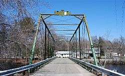
Arkwright Bridge |
|
December 12, 1978
(#78000061) |
Crosses the Pawtuxet River at Hill St.
41°43′49″N 71°32′49″W / 41.730278°N 71.546944°W / 41.730278; -71.546944 (Arkwright Bridge) |
Cranston |
Extends into Kent County |
| 13 |
Arnold Mills Historic District |
|
December 28, 1978
(#78000070) |
East of Cumberland Hill at Sneech Pond, Attleboro, and Abbott Run Valley Rds.
41°58′46″N 71°23′30″W / 41.979444°N 71.391667°W / 41.979444; -71.391667 (Arnold Mills Historic District) |
Cumberland |
|
| 14 |
Dexter Arnold Farmstead |
|
November 25, 1977
(#77001586) |
Chopmist Hill Rd.
41°48′59″N 71°39′54″W / 41.816389°N 71.665°W / 41.816389; -71.665 (Dexter Arnold Farmstead) |
Scituate |
|
| 15 |
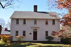
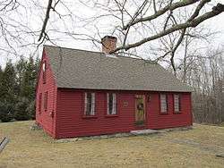
Eleazer Arnold House |
|
November 24, 1968
(#68000006) |
Great Rd. (RI 123) near its junction with RI 126
41°54′10″N 71°25′14″W / 41.902778°N 71.420556°W / 41.902778; -71.420556 (Eleazer Arnold House) |
Lincoln |
|
| 16 |
Israel Arnold House |
|
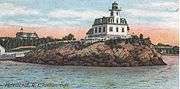
December 18, 1970
(#70000017) |
Great Rd.
41°54′17″N 71°25′35″W / 41.904722°N 71.426389°W / 41.904722; -71.426389 (Israel Arnold House) |
Lincoln |
|
| 17 |
John Arnold House |
|
November 24, 1982
(#82000132) |
99 Providence St.
41°59′41″N 71°31′22″W / 41.994722°N 71.522778°W / 41.994722; -71.522778 (John Arnold House) |
Woonsocket |
|
| 18 |
Peleg Arnold Tavern |
|
July 30, 1974
(#74000046) |
Woonsocket Hill Rd.
41°59′21″N 71°32′02″W / 41.989167°N 71.533889°W / 41.989167; -71.533889 (Peleg Arnold Tavern) |
North Smithfield |
|
| 19 |
Ashton Historic District |
|
November 1, 1984
(#84000367) |
Roughly Mendon, Scott, and Old Angell Rds., Store Hill Rd., Front and Middle Sts.
41°56′20″N 71°25′54″W / 41.938889°N 71.431667°W / 41.938889; -71.431667 (Ashton Historic District) |
Cumberland |
|
| 20 |
Ballou House |
|
August 30, 1984
(#84001908) |
Albion Rd.
41°56′48″N 71°28′21″W / 41.946667°N 71.4725°W / 41.946667; -71.4725 (Ballou House) |
Lincoln |
|
| 21 |
Ballou-Weatherhead House |
|
June 25, 1993
(#93000503) |
Tower Hill Rd. (Pole 68)
41°59′47″N 71°26′38″W / 41.996389°N 71.443889°W / 41.996389; -71.443889 (Ballou-Weatherhead House) |
Cumberland |
|
| 22 |
Battey-Barden House |
|
August 29, 1980
(#80000084) |
Plainfield Pike
41°47′30″N 71°37′08″W / 41.791667°N 71.618889°W / 41.791667; -71.618889 (Battey-Barden House) |
Scituate |
|
| 23 |
Belknap School |
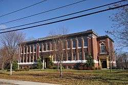
|
December 7, 2010
(#10000978) |
509 Greenville Ave.
41°50′48″N 71°30′05″W / 41.846667°N 71.501389°W / 41.846667; -71.501389 (Belknap School) |
Johnston |
|
| 24 |
Berkeley Mill Village |
|
February 23, 1972
(#72000036) |
Bounded roughly by Martin St., Mendon Rd., railroad, and cemetery
41°55′39″N 71°25′25″W / 41.9275°N 71.423611°W / 41.9275; -71.423611 (Berkeley Mill Village) |
Cumberland |
|
| 25 |
Bernon Worsted Mill |
|
June 10, 2005
(#05000585) |
828 Park Ave.
41°59′38″N 71°30′50″W / 41.993889°N 71.513889°W / 41.993889; -71.513889 (Bernon Worsted Mill) |
Woonsocket |
|
| 26 |
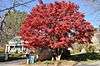
Bicknell-Armington Lightning Splitter House |
|
November 28, 1980
(#80000085) |
3591 Pawtucket Ave.
41°46′36″N 71°21′47″W / 41.776667°N 71.363056°W / 41.776667; -71.363056 (Bicknell-Armington Lightning Splitter House) |
East Providence |
|
| 27 |
Blackstone Canal |
|
May 6, 1971
(#71000030) |
From Steeple and Promenade Sts. in Providence to the Massachusetts border in North Smithfield
41°55′16″N 71°25′21″W / 41.921111°N 71.4225°W / 41.921111; -71.4225 (Blackstone Canal) |
Lincoln, Cumberland, Woonsocket, and North Smithfield |
Initial listing extended from Providence, through Pawtucket, and as far north as Lincoln; a 1991 expansion (#91001536) extended it to the state line; the canal itself extended into Worcester County, Massachusetts, where it is the subject of separate listings. |
| 28 |
Borders Farm |
|
July 29, 2009
(#09000576) |
31-38 N. Rd.
41°47′17″N 71°44′38″W / 41.787989°N 71.743828°W / 41.787989; -71.743828 (Borders Farm) |
Foster |
|
| 29 |
Boston and Providence Railroad Bridge |
|
November 28, 1980
(#80000086) |
Spans the Ten Mile River
41°50′05″N 71°21′45″W / 41.834722°N 71.3625°W / 41.834722; -71.3625 (Boston and Providence Railroad Bridge) |
East Providence |
|
| 30 |
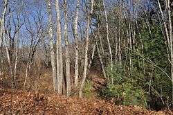
Breezy Hill Site (RI-957) |
|
September 28, 1985
(#85002700) |
Address Restricted
|
Foster |
|
| 31 |
Bridgeton School |
|
December 27, 2006
(#06001191) |
16 Laurel Hill Ave.
41°57′52″N 71°42′47″W / 41.964444°N 71.713056°W / 41.964444; -71.713056 (Bridgeton School) |
Burrillville |
|
| 32 |
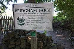
Bridgham Farm |
|
November 28, 1980
(#80000087) |
120, 148, 150, and 160 Pleasant St.
41°50′13″N 71°20′38″W / 41.836944°N 71.343889°W / 41.836944; -71.343889 (Bridgham Farm) |
East Providence |
|
| 33 |
Brown Avenue Historic District |
|
April 24, 1973
(#73000066) |
Brown Ave.
41°50′44″N 71°32′37″W / 41.845556°N 71.543611°W / 41.845556; -71.543611 (Brown Avenue Historic District) |
Johnston |
|
| 34 |
Burlingame-Noon House |
|
February 15, 1974
(#74000048) |
3261 Mendon Rd.
41°58′32″N 71°27′25″W / 41.975556°N 71.456944°W / 41.975556; -71.456944 (Burlingame-Noon House) |
Cumberland |
|
| 35 |
Carpenter, Lakeside, and Springvale Cemeteries |
|
November 28, 1980
(#80000091) |
Newman and Pawtucket Aves.
41°50′33″N 71°21′09″W / 41.8425°N 71.3525°W / 41.8425; -71.3525 (Carpenter, Lakeside, and Springvale Cemeteries) |
East Providence |
|
| 36 |
Cato Hill Historic District |
|
August 10, 1976
(#76002255) |
Bounded by Main, Railroad, Arnold and Blackstone Streets, including portions of Cato, Church, Boyden, and all of Clarkin Lane and Cato Lane
42°00′18″N 71°30′54″W / 42.005°N 71.515°W / 42.005; -71.515 (Cato Hill Historic District) |
Woonsocket |
|
| 37 |
Central Falls Congregational Church |
|
July 12, 1976
(#76000042) |
376 High St.
41°53′05″N 71°23′04″W / 41.884722°N 71.384444°W / 41.884722; -71.384444 (Central Falls Congregational Church) |
Central Falls |
|
| 38 |
Central Falls Mill Historic District |
|
July 2, 1976
(#76000007) |
Between Roosevelt Avenue and the Blackstone River; also 381, 396, 403, 404, 413, 548, 558 Roosevelt Ave.
41°53′11″N 71°22′55″W / 41.886389°N 71.381944°W / 41.886389; -71.381944 (Central Falls Mill Historic District) |
Central Falls |
Second set of addresses represents a boundary increase approved January 29, 2018 |
| 39 |
Central Street School |
|
April 6, 1979
(#79000004) |
379 Central St.
41°53′04″N 71°23′38″W / 41.884444°N 71.393889°W / 41.884444; -71.393889 (Central Street School) |
Central Falls |
|
| 40 |
Chepachet Village Historic District |
|
March 31, 1971
(#71000031) |
Both sides of U.S. Route 44 (roughly from the intersection of U.S. Route 44 and RI 102 north to the intersection of RI 100 and RI 102) and radiating
41°54′46″N 71°40′00″W / 41.912778°N 71.666667°W / 41.912778; -71.666667 (Chepachet Village Historic District) |
Glocester |
|
| 41 |
Cherry Valley Archeological Site, RI-279 |
|
November 1, 1984
(#84000358) |
Address Restricted
|
Glocester |
|
| 42 |
Clayville Historic District |
|
December 29, 1988
(#88003079) |
Roughly bounded by Cole Ave., Plainfield Pike, Field Hill Rd., and Victory Highway
41°46′37″N 71°40′35″W / 41.776944°N 71.676389°W / 41.776944; -71.676389 (Clayville Historic District) |
Foster and Scituate |
|
| 43 |
Clemence-Irons House |
|
July 2, 1973
(#73000068) |
38 George Waterman Rd.
41°50′21″N 71°29′04″W / 41.839167°N 71.484444°W / 41.839167; -71.484444 (Clemence-Irons House) |
Johnston |
|
| 44 |
John Cole Farm |
|
August 16, 1977
(#77000025) |
East of Manville on Reservoir Rd.
41°59′26″N 71°24′24″W / 41.990556°N 71.406667°W / 41.990556; -71.406667 (John Cole Farm) |
Cumberland |
|
| 45 |
Samuel B. Conant House |
|
April 6, 1979
(#79000005) |
104 Clay St.
41°52′59″N 71°23′25″W / 41.883056°N 71.390278°W / 41.883056; -71.390278 (Samuel B. Conant House) |
Central Falls |
|
| 46 |
Conant Thread-Coats & Clark Mill Complex District |
|
November 18, 1983
(#83003809) |
Roughly bounded by Lonsdale Avenue, Rand and Pine Streets.
41°52′51″N 71°23′53″W / 41.880833°N 71.398056°W / 41.880833; -71.398056 (Conant Thread-Coats & Clark Mill Complex District) |
Central Falls |
Extends into Pawtucket |
| 47 |
Amos Cooke House |
|
October 30, 1979
(#79000054) |
Chopmist Hill Rd.
41°48′31″N 71°39′41″W / 41.808611°N 71.661389°W / 41.808611; -71.661389 (Amos Cooke House) |
Scituate |
|
| 48 |
Cornell-Randall-Bailey Roadhouse |
|
May 10, 1984
(#84001943) |
2737 Hartford Ave.
41°49′57″N 71°33′29″W / 41.8325°N 71.558056°W / 41.8325; -71.558056 (Cornell-Randall-Bailey Roadhouse) |
Johnston |
|
| 49 |
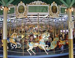
Crescent Park Looff Carousel |
|
April 21, 1976
(#76000045) |
Riverside Park
41°45′24″N 71°21′34″W / 41.756594°N 71.359431°W / 41.756594; -71.359431 (Crescent Park Looff Carousel) |
East Providence |
Restored 1895 carousel features some of Charles I.D. Looff's finest workmanship |
| 50 |
Nathaniel Daggett House |
|
November 28, 1980
(#80000092) |
74 Roger Williams Ave.
41°50′16″N 71°21′46″W / 41.837778°N 71.362778°W / 41.837778; -71.362778 (Nathaniel Daggett House) |
East Providence |
|
| 51 |
Henry Darling House |
|
November 26, 1982
(#82000136) |
786 Harris Ave.
42°00′50″N 71°31′40″W / 42.013889°N 71.527778°W / 42.013889; -71.527778 (Henry Darling House) |
Woonsocket |
|
| 52 |
James Dennis House |
|
November 28, 1980
(#80000095) |
3120 Pawtucket Ave.
41°47′21″N 71°21′53″W / 41.789167°N 71.364722°W / 41.789167; -71.364722 (James Dennis House) |
East Providence |
|
| 53 |
District 6 Schoolhouse |
|
November 28, 1980
(#80000096) |
347 Willett Ave
41°46′23″N 71°21′19″W / 41.773056°N 71.355278°W / 41.773056; -71.355278 (District 6 Schoolhouse) |
East Providence |
|
| 54 |
Capt. George Dorrance House |
|
March 16, 1972
(#72000039) |
2 Jencks Rd.
41°44′22″N 71°47′12″W / 41.739444°N 71.786667°W / 41.739444; -71.786667 (Capt. George Dorrance House) |
Foster |
|
| 55 |
Double L Site, RI-958 |
|
September 12, 1985
(#85002362) |
Address Restricted
|
Scituate |
|
| 56 |
Eddy Homestead |
|
August 13, 1986
(#86001511) |
2543 Hartford Ave.
41°49′57″N 71°32′56″W / 41.8325°N 71.548889°W / 41.8325; -71.548889 (Eddy Homestead) |
Johnston |
|
| 57 |
Edgewood Historic District-Aberdeen Plat |
|
November 22, 2016
(#16000833) |
Berwick Ln., Chiswick Rd., Strathmore Place and Road, portions of Broad St., and Narragansett Blvd.,
41°46′13″N 71°23′33″W / 41.770379°N 71.392584°W / 41.770379; -71.392584 (Edgewood Historic District-Aberdeen Plat) |
Cranston |
|
| 58 |
Edgewood Historic District-Anstis Greene Estate Plats |
|
August 3, 2015
(#15000497) |
Anstis, Broad & Swift Sts., Birchfield & Kensington Rds., Bluff, King, Marion & Rosewood Aves., Narragansett Blvd.
41°46′25″N 71°23′40″W / 41.7737°N 71.3944°W / 41.7737; -71.3944 (Edgewood Historic District-Anstis Greene Estate Plats) |
Cranston |
|
| 59 |
Edgewood Historic District-Arnold Farm Plat |
|
September 10, 2010
(#10000733) |
Arnold, Albert, Columbia Aves.; parts of Broad St., Pawtuxet Ave., Narragansett Blvd.
41°46′38″N 71°23′44″W / 41.777222°N 71.395556°W / 41.777222; -71.395556 (Edgewood Historic District-Arnold Farm Plat) |
Cranston |
|
| 60 |
Edgewood Historic District-Taft Estate Plat |
|
October 24, 2003
(#03001069) |
Roughly bounded by Windsor Rd., Narragansett Bay, Circuit Dr., and Broad St.; E. side of Narragansett Blvd. between Windsor Rd. & Ocean Ave.
41°46′14″N 71°23′27″W / 41.770556°N 71.390833°W / 41.770556; -71.390833 (Edgewood Historic District-Taft Estate Plat) |
Cranston |
Second set of addresses represents a boundary increase, 2014-12-22 |
| 61 |
Edgewood Historic District-Sally Greene Homestead Plats |
|
November 22, 2016
(#16000787) |
Fairview and Glen Aves., Harbour Terr., Hudson Pl., Massasoit Ave., and portions of Broad St. & Narragansett Blvd,
41°46′22″N 71°23′31″W / 41.772675°N 71.392016°W / 41.772675; -71.392016 (Edgewood Historic District-Sally Greene Homestead Plats) |
Cranston |
|
| 62 |
Edgewood Historic District-Shaw Plat |
|
March 27, 2013
(#13000120) |
Shaw and Marion Aves., parts of Narragansett Boulevard, and Broad St.
41°46′30″N 71°23′41″W / 41.775088°N 71.394829°W / 41.775088; -71.394829 (Edgewood Historic District-Shaw Plat) |
Cranston |
|
| 63 |
Edgewood Yacht Club |
|
February 23, 1989
(#89000072) |
3 Shaw Ave.
41°46′34″N 71°23′26″W / 41.776111°N 71.390556°W / 41.776111; -71.390556 (Edgewood Yacht Club) |
Cranston |
|
| 64 |
Elliot-Harris-Miner House |
|
August 30, 1984
(#84001984) |
1406 Old Louisquisset Pike
41°52′43″N 71°26′11″W / 41.878611°N 71.436389°W / 41.878611; -71.436389 (Elliot-Harris-Miner House) |
Lincoln |
|
| 65 |
Elm Tree Plat Historic District |
|
November 19, 2015
(#15000829) |
Charlotte & Elinora Sts., Fenner, Harvey & Willett Aves.
41°46′13″N 71°21′10″W / 41.7702°N 71.3528°W / 41.7702; -71.3528 (Elm Tree Plat Historic District) |
East Providence |
|
| 66 |
Esten-Bowen House |
|
December 30, 2011
(#11000978) |
299 Iron Mine Rd.
42°00′17″N 71°38′17″W / 42.00479°N 71.637936°W / 42.00479; -71.637936 (Esten-Bowen House) |
Burrillville |
|
| 67 |
David G. Fales House |
|
April 6, 1979
(#79000006) |
476 High St.
41°53′10″N 71°23′05″W / 41.886111°N 71.384722°W / 41.886111; -71.384722 (David G. Fales House) |
Central Falls |
|
| 68 |
Edwin H. Farnum House |
|
May 17, 1974
(#74000359) |
U.S. Route 44 at its junction with Collins St.
41°51′46″N 71°29′39″W / 41.862778°N 71.494167°W / 41.862778; -71.494167 (Edwin H. Farnum House) |
Johnston |
|
| 69 |
Thomas Fenner House |
|
March 2, 1990
(#90000143) |
43 Stony Acre Dr.
41°47′27″N 71°29′19″W / 41.790833°N 71.488611°W / 41.790833; -71.488611 (Thomas Fenner House) |
Cranston |
|
| 70 |
Forestdale Mill Village Historic District |
|
June 5, 1972
(#72000041) |
East and west along Main St. and north on Maple Ave.
41°59′51″N 71°33′50″W / 41.9975°N 71.563889°W / 41.9975; -71.563889 (Forestdale Mill Village Historic District) |
North Smithfield |
|
| 71 |
Foster Center Historic District |
|
May 11, 1974
(#74000050) |
Foster
41°47′07″N 71°43′18″W / 41.785278°N 71.721667°W / 41.785278; -71.721667 (Foster Center Historic District) |
Foster |
|
| 72 |
French Worsted Company Mill Historic District |
|
May 21, 2008
(#08000453) |
153 Hamlet Ave.
42°00′10″N 71°30′00″W / 42.002764°N 71.499919°W / 42.002764; -71.499919 (French Worsted Company Mill Historic District) |
Woonsocket |
Demolished in 2011.[6] |
| 73 |
Furnace Carolina Site |
|
May 10, 1993
(#93000341) |
Address Restricted
|
Cumberland |
|
| 74 |
Furnace Hill Brook Historic and Archeological District |
|
August 6, 1980
(#80000097) |
off Furnace Hill Road
41°45′20″N 71°29′15″W / 41.755483°N 71.487595°W / 41.755483; -71.487595 (Furnace Hill Brook Historic and Archeological District) |
Cranston |
|
| 75 |
Alphonse Gaulin Jr. House |
|
November 24, 1982
(#82000137) |
311 Elm St.
42°00′25″N 71°29′55″W / 42.006944°N 71.498611°W / 42.006944; -71.498611 (Alphonse Gaulin Jr. House) |
Woonsocket |
|
| 76 |
Georgiaville Historic District |
|
October 3, 1985
(#85002734) |
Roughly bounded by Stillwater Rd., Cross St., Whipple Ave., and Farnum Pike
41°53′18″N 71°30′26″W / 41.888333°N 71.507222°W / 41.888333; -71.507222 (Georgiaville Historic District) |
Smithfield |
|
| 77 |
Glenark Mills |
|
May 15, 1989
(#89000409) |
64 East St.
41°59′54″N 71°31′09″W / 41.998333°N 71.519167°W / 41.998333; -71.519167 (Glenark Mills) |
Woonsocket |
|
| 78 |
Glocester Town Pound |
|
September 22, 1970
(#70000021) |
Pound Rd. and Chopmist Hill Rd.
41°53′44″N 71°40′09″W / 41.895556°N 71.669167°W / 41.895556; -71.669167 (Glocester Town Pound) |
Glocester |
|
| 79 |
Great Road Historic District |
|
July 22, 1974
(#74000051) |
Great Rd.
41°54′21″N 71°25′41″W / 41.905833°N 71.428056°W / 41.905833; -71.428056 (Great Road Historic District) |
Lincoln |
|
| 80 |
Benjamin F. Greene House |
|
April 6, 1979
(#79000007) |
85 Cross St.
41°53′08″N 71°23′11″W / 41.885556°N 71.386389°W / 41.885556; -71.386389 (Benjamin F. Greene House) |
Central Falls |
|
| 81 |
Greystone Historic District |
|
January 2, 2008
(#07001343) |
1-16 Beckside Rd., 1-29 Greystone Ave., 1-24 Oakleigh Ave., 1-40 Langsberries Ave., 2-20 Larchmount Ave N, 1-16 S...
41°52′02″N 71°29′24″W / 41.867222°N 71.49°W / 41.867222; -71.49 (Greystone Historic District) |
North Providence and Johnston |
Mill complex and associated village and housing area |
| 82 |
Greystone Mill Historic District |
|
April 28, 2004
(#04000378) |
Greystone Ave.
41°51′53″N 71°29′28″W / 41.864722°N 71.491111°W / 41.864722; -71.491111 (Greystone Mill Historic District) |
North Providence and Johnston |
Mill complex along the Woonasquatucket River |
| 83 |
Grove Street Elementary School |
|
November 24, 1982
(#82000138) |
312 Grove St.
41°59′54″N 71°30′33″W / 41.998333°N 71.509167°W / 41.998333; -71.509167 (Grove Street Elementary School) |
Woonsocket |
|
| 84 |
Hanora Mills |
|
November 24, 1982
(#82000139) |
1 Main St.
42°00′02″N 71°30′58″W / 42.000556°N 71.516111°W / 42.000556; -71.516111 (Hanora Mills) |
Woonsocket |
|
| 85 |
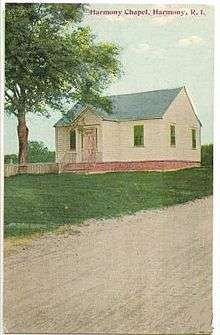
Harmony Chapel and Cemetery |
|
June 25, 1980
(#80000098) |
Putnam Pike
41°53′20″N 71°36′03″W / 41.888889°N 71.600833°W / 41.888889; -71.600833 (Harmony Chapel and Cemetery) |
Glocester |
|
| 86 |
Harris Warehouse |
|
July 1, 1976
(#76000047) |
61 Railroad St.
42°00′14″N 71°30′54″W / 42.003889°N 71.515°W / 42.003889; -71.515 (Harris Warehouse) |
Woonsocket |
|
| 87 |
Harrisville Historic District |
|
March 21, 1984
(#84002010) |
Roughly bounded by Wood and Sherman Rds., East Ave, and Main, Chapel, School, and River Sts.
41°57′59″N 71°40′33″W / 41.966389°N 71.675833°W / 41.966389; -71.675833 (Harrisville Historic District) |
Burrillville |
|
| 88 |
Hearthside |
|
April 24, 1973
(#73000069) |
Great Rd.
41°54′23″N 71°25′50″W / 41.906389°N 71.430556°W / 41.906389; -71.430556 (Hearthside) |
Lincoln |
|
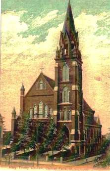
| 89 |
Holy Trinity Church Complex |
|
January 3, 1978
(#78000073) |
134 Fuller Ave.
41°53′19″N 71°23′47″W / 41.888611°N 71.396389°W / 41.888611; -71.396389 (Holy Trinity Church Complex) |
Central Falls |
Church demolished; only the parish house is extant. |
| 90 |
Honan's Block and 112-114 Main Street |
|
August 3, 1989
(#89000941) |
110-114 Main St.
42°00′08″N 71°30′53″W / 42.002222°N 71.514722°W / 42.002222; -71.514722 (Honan's Block and 112-114 Main Street) |
Woonsocket |
|
| 91 |
Hope Street School |
|
April 14, 2000
(#00000383) |
40 Hope St.
41°59′57″N 71°31′13″W / 41.999167°N 71.520278°W / 41.999167; -71.520278 (Hope Street School) |
Woonsocket |
|
| 92 |
Hope Village Historic District |
|
August 8, 1995
(#95000918) |
Roughly bounded by the Pawtuxet River, Hope Furnace Rd., Hope Mill Pond, North Rd., White Ln., and Harrington and Potter Sts.
41°44′00″N 71°33′45″W / 41.733333°N 71.5625°W / 41.733333; -71.5625 (Hope Village Historic District) |
Scituate |
|
| 93 |
Thomas H. Hughes House |
|
June 15, 1979
(#79000056) |
423 Central Ave.
41°48′28″N 71°29′51″W / 41.807778°N 71.4975°W / 41.807778; -71.4975 (Thomas H. Hughes House) |
Johnston |
|
| 94 |
Island Place Historic District |
|
September 13, 1990
(#90001348) |
Island Place and S. Main St. at Market Sq.
41°59′57″N 71°30′59″W / 41.999167°N 71.516389°W / 41.999167; -71.516389 (Island Place Historic District) |
Woonsocket |
|
| 95 |
Jenckes House |
|
August 30, 1984
(#84002019) |
81 Jenckes Hill Rd.
41°54′16″N 71°27′32″W / 41.904444°N 71.458889°W / 41.904444; -71.458889 (Jenckes House) |
Lincoln |
|
| 96 |
Jenckes House |
|
October 10, 1984
(#84000088) |
1730 Old Louisquisset Pike
41°53′44″N 71°26′55″W / 41.895556°N 71.448611°W / 41.895556; -71.448611 (Jenckes House) |
Lincoln |
|
| 97 |
Jenckes Mansion |
|
November 24, 1982
(#82000140) |
837-839 Social St.
42°00′44″N 71°30′07″W / 42.012222°N 71.501944°W / 42.012222; -71.501944 (Jenckes Mansion) |
Woonsocket |
|
| 98 |
Jenks Park & Cogswell Tower |
|
April 6, 1979
(#79000057) |
Adjoining 580 Broad St.
41°53′15″N 71°23′21″W / 41.8875°N 71.389167°W / 41.8875; -71.389167 (Jenks Park & Cogswell Tower) |
Central Falls |
|
| 99 |
Luke Jillson House |
|
August 12, 1982
(#82000141) |
2510 Mendon Rd.
41°57′41″N 71°26′41″W / 41.961389°N 71.444722°W / 41.961389; -71.444722 (Luke Jillson House) |
Cumberland |
|
| 100 |
Joy Homestead |
|
February 18, 1971
(#71000035) |
156 Scituate Ave.
41°46′57″N 71°28′36″W / 41.7825°N 71.476667°W / 41.7825; -71.476667 (Joy Homestead) |
Cranston |
|
| 101 |
Jules Desurmont Worsted Company Mill |
|
January 12, 2007
(#06001257) |
84 Fairmount St.
42°00′09″N 71°31′21″W / 42.0025°N 71.5225°W / 42.0025; -71.5225 (Jules Desurmont Worsted Company Mill) |
Woonsocket |
|
| 102 |
Knightsville Meetinghouse |
|
March 8, 1978
(#78000074) |
67 Phenix Ave.
41°46′54″N 71°28′08″W / 41.781667°N 71.468889°W / 41.781667; -71.468889 (Knightsville Meetinghouse) |
Cranston |
|
| 103 |
L'Eglise du Precieux Sang |
|
July 26, 1982
(#82000142) |
94 Carrington Ave. and 61 Park Ave.
42°00′06″N 71°30′33″W / 42.001667°N 71.509167°W / 42.001667; -71.509167 (L'Eglise du Precieux Sang) |
Woonsocket |
|
| 104 |
L'Union Saint Jean-Baptist d' Amerique |
|
March 12, 2018
(#100002194) |
1 Social St.
42°00′21″N 71°30′43″W / 42.005935°N 71.512022°W / 42.005935; -71.512022 (L'Union Saint Jean-Baptist d' Amerique) |
Woonsocket |
|
| 105 |
Lafayette Worsted Company Administrative Headquarters Historic District |
|
August 7, 2017
(#100001439) |
134 & 148 Hamlet Ave.
42°00′08″N 71°30′04″W / 42.002216°N 71.501246°W / 42.002216; -71.501246 (Lafayette Worsted Company Administrative Headquarters Historic District) |
Woonsocket |
|
| 106 |
Lime Kilns |
|
August 30, 1984
(#84002015) |
Off Louisquisset Pike, Sherman Ave., and Dexter Rock Rds.
|
Lincoln |
Ruined remnants of three colonial-era lime kilns at different locations. |
| 107 |
Limerock Village Historic District |
|
May 23, 1974
(#74000052) |
In an irregular pattern along Smith, Wilbur, and Great Rds., and Old Louisquisset Pike
41°55′40″N 71°27′22″W / 41.927778°N 71.456111°W / 41.927778; -71.456111 (Limerock Village Historic District) |
Lincoln |
|
| 108 |
Linton Block |
|
November 24, 1982
(#82000143) |
3-5 Monument Sq.
42°00′19″N 71°30′48″W / 42.005278°N 71.513333°W / 42.005278; -71.513333 (Linton Block) |
Woonsocket |
Destroyed by fire in 2000.[7] |
| 109 |
Lippitt Hill Historic District |
|
March 2, 1989
(#89000142) |
Hope Rd., Burlingame Rd., and Lippett Ave.
41°44′23″N 71°32′06″W / 41.739722°N 71.535°W / 41.739722; -71.535 (Lippitt Hill Historic District) |
Cranston |
|
| 110 |
Little Neck Cemetery |
|
November 28, 1980
(#80000100) |
Off Read St.
41°45′59″N 71°21′18″W / 41.766389°N 71.355°W / 41.766389; -71.355 (Little Neck Cemetery) |
East Providence |
|
| 111 |
Logee House |
|
November 24, 1982
(#82000001) |
225 Logee St.
41°59′41″N 71°30′43″W / 41.994722°N 71.511944°W / 41.994722; -71.511944 (Logee House) |
Woonsocket |
|
| 112 |
Lonsdale Historic District |
|
May 25, 1984
(#84002022) |
Lonsdale Ave., Blackstone Ct., and Front, Main, Cook, Broad, Mill, Cross and Blackstone Sts.
41°54′34″N 71°24′11″W / 41.909444°N 71.403056°W / 41.909444; -71.403056 (Lonsdale Historic District) |
Cumberland and Lincoln |
|
| 113 |
Lymansville Company Mill |
|
December 26, 2012
(#12001098) |
184 Woonasquatucket Ave.
41°50′21″N 71°28′32″W / 41.839194°N 71.475466°W / 41.839194; -71.475466 (Lymansville Company Mill) |
North Providence |
|
| 114 |
Main Street Historic District |
|
April 18, 1991
(#91000461) |
Roughly Main St. east of Market Sq. to Depot Sq.
42°00′09″N 71°30′52″W / 42.0025°N 71.514444°W / 42.0025; -71.514444 (Main Street Historic District) |
Woonsocket |
|
| 115 |
Manton-Hunt-Farnum Farm |
|
October 3, 1985
(#85002735) |
Putnam Pike
41°53′54″N 71°37′15″W / 41.898333°N 71.620833°W / 41.898333; -71.620833 (Manton-Hunt-Farnum Farm) |
Glocester |
|
| 116 |
Manville Company Worker Housing Historic District |
|
April 2, 2009
(#08001183) |
Bounded by Chestnut St., Angle St., Railroad St., Winter St., Fall St., Spring St., Park Way, Almeida Dr., and Main St.
41°58′13″N 71°28′18″W / 41.970278°N 71.471667°W / 41.970278; -71.471667 (Manville Company Worker Housing Historic District) |
Lincoln |
|
| 117 |
Mathewson Farm |
|
January 26, 2001
(#01000019) |
544 Greenville Ave.
41°50′44″N 71°30′16″W / 41.845556°N 71.504444°W / 41.845556; -71.504444 (Mathewson Farm) |
Johnston |
|
| 118 |
McGonagle Site, RI-1227 |
|
September 12, 1985
(#85002400) |
Address Restricted
|
Scituate |
|
| 119 |
Metcalf-Franklin Farm |
|
June 7, 2007
(#07000526) |
142 Abbott Run Valley Rd.
41°57′56″N 71°23′37″W / 41.965622°N 71.393511°W / 41.965622; -71.393511 (Metcalf-Franklin Farm) |
Cumberland |
|
| 120 |
Millrace Site, RI-1039 |
|
September 12, 1985
(#85002361) |
Address Restricted
|
Scituate |
|
| 121 |
Moosup Valley Historic District |
|
May 11, 1988
(#88000521) |
Roughly bounded by Harrington, Johnson, Moosup Valley and Barb Hill, and Cucumber Hill Rds.
41°44′25″N 71°45′23″W / 41.740278°N 71.756389°W / 41.740278; -71.756389 (Moosup Valley Historic District) |
Foster |
|
| 122 |
Moswansicut Pond Site, RI-960 |
|
September 12, 1985
(#85002363) |
Address Restricted
|
Scituate |
|
| 123 |
Mt. Hygeia |
|
August 12, 1977
(#77000008) |
Mt. Hygeia Rd.
41°50′48″N 71°45′17″W / 41.846667°N 71.754722°W / 41.846667; -71.754722 (Mt. Hygeia) |
Foster |
Also known as the Solomon Drown House. |
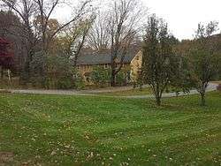
| 124 |
Mount Vernon Tavern |
|
May 8, 1974
(#74000001) |
199 Plainfield Pike (RI 14)
41°43′51″N 71°42′52″W / 41.730833°N 71.714444°W / 41.730833; -71.714444 (Mount Vernon Tavern) |
Foster |
|
| 125 |
Tyler Mowry House |
|
August 16, 1996
(#96000904) |
112 Sayles Hill Rd.
41°57′53″N 71°30′18″W / 41.964722°N 71.505°W / 41.964722; -71.505 (Tyler Mowry House) |
North Smithfield |
|
| 126 |
William Mowry House |
|
February 10, 1983
(#83000001) |
Farnum Pike
41°56′52″N 71°33′33″W / 41.947778°N 71.559167°W / 41.947778; -71.559167 (William Mowry House) |
North Smithfield |
|
| 127 |
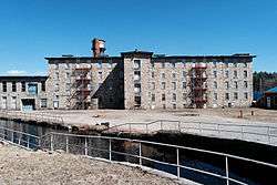
Naushon Company Plant |
|
December 13, 2016
(#16000854) |
32 Meeting St.
41°53′58″N 71°23′32″W / 41.899314°N 71.392193°W / 41.899314; -71.392193 (Naushon Company Plant) |
Cumberland |
|
| 128 |
Newman Cemetery |
|
November 28, 1980
(#80000002) |
Newman and Pawtucket Aves.
41°50′22″N 71°21′04″W / 41.839444°N 71.351111°W / 41.839444; -71.351111 (Newman Cemetery) |
East Providence |
|
| 129 |
Newman Congregational Church |
|
November 28, 1980
(#80000003) |
100 Newman Ave.
41°50′28″N 71°21′03″W / 41.841111°N 71.350833°W / 41.841111; -71.350833 (Newman Congregational Church) |
East Providence |
|
| 130 |
Hopkins Mill Historic District |
|
May 10, 1984
(#84002013) |
Old Danielson Pike, U.S. Route 6, Maple Rock and Rams Trail Rds.
41°49′21″N 71°42′25″W / 41.8225°N 71.706944°W / 41.8225; -71.706944 (Hopkins Mill Historic District) |
Foster |
Misspelled "Nopkins" in the National Register |
| 131 |
North End Historic District |
|
November 24, 1982
(#82000002) |
Roughly bounded by Verry, Highland, Winter, and Summer Sts.
42°00′31″N 71°31′15″W / 42.008611°N 71.520833°W / 42.008611; -71.520833 (North End Historic District) |
Woonsocket |
|
| 132 |
Norwood Avenue Historic District |
|
April 26, 2002
(#02000412) |
Roughly along Norwood Ave. between Roger Williams to Broad St.
41°46′51″N 71°24′12″W / 41.780833°N 71.403333°W / 41.780833; -71.403333 (Norwood Avenue Historic District) |
Cranston |
Extends into Providence. |
| 133 |
Oak Lawn Village Historic District |
|
November 25, 1977
(#77000004) |
Wilbur Ave. from Natick Rd. to Oaklawn Ave., includes Searle, Exchange, and Wheelock Sts.
41°44′57″N 71°29′06″W / 41.749167°N 71.485°W / 41.749167; -71.485 (Oak Lawn Village Historic District) |
Cranston |
|
| 134 |
Oakland Historic District |
|
September 9, 1987
(#87001359) |
Victory Highway
41°57′32″N 71°38′47″W / 41.958889°N 71.646389°W / 41.958889; -71.646389 (Oakland Historic District) |
Burrillville |
|
| 135 |
Ochee Spring Quarry |
|
May 5, 1978
(#78000003) |
Behind 767 Hartford Ave[8]
41°49′14″N 71°28′17″W / 41.820487°N 71.471441°W / 41.820487; -71.471441 (Ochee Spring Quarry) |
Johnston |
This site has been significantly encroached on by local development. |
| 136 |
Oddfellow's Hall |
|
November 28, 1980
(#80000004) |
63-67 Warren Ave.
41°49′01″N 71°22′56″W / 41.816944°N 71.382222°W / 41.816944; -71.382222 (Oddfellow's Hall) |
East Providence |
|
| 137 |
Old Ashton Historic District |
|
August 30, 1984
(#84002037) |
Lower River Rd. and Blackstone Canal Towpath
41°56′11″N 71°26′04″W / 41.936389°N 71.434444°W / 41.936389; -71.434444 (Old Ashton Historic District) |
Lincoln |
Now a site on the Blackstone River Bikeway State Park |
| 138 |
Old Congregational Church |
|
January 11, 1974
(#74000002) |
Off U.S. Route 6 on Greenville Rd. (RI 116)
41°50′03″N 71°35′14″W / 41.834167°N 71.587222°W / 41.834167; -71.587222 (Old Congregational Church) |
Scituate |
|
| 139 |
Capt. Stephen Olney House |
|
May 1, 1974
(#74000003) |
138 Smithfield Rd.
41°51′19″N 71°27′05″W / 41.855278°N 71.451389°W / 41.855278; -71.451389 (Capt. Stephen Olney House) |
North Providence |
|
| 140 |
Pascoag Grammar School |
|
November 21, 2006
(#06001062) |
265 Sayles Ave.
41°57′46″N 71°42′18″W / 41.962778°N 71.705°W / 41.962778; -71.705 (Pascoag Grammar School) |
Burrillville |
|
| 141 |
Patterson Brothers Commercial Building and House |
|
June 10, 1993
(#93000502) |
157, 159, and 161 Broad St.
41°54′10″N 71°23′32″W / 41.902778°N 71.392222°W / 41.902778; -71.392222 (Patterson Brothers Commercial Building and House) |
Cumberland |
Demolished 1998. Hardware store stands on the site.[9] |
| 142 |
Pawtuxet Village Historic District |
|
April 24, 1973
(#73000050) |
Bounded roughly by Bayside, S. Atlantic, and Ocean Aves., the Pawtuxet and Providence rivers, and Post Rd.
41°45′49″N 71°23′27″W / 41.763611°N 71.390833°W / 41.763611; -71.390833 (Pawtuxet Village Historic District) |
Cranston |
|
| 143 |
Phillipsdale Historic District |
|
September 15, 2011
(#11000675) |
Roughly bounded by Seekonk River, Roger Williams Ave. & Ruth Ave.
41°50′52″N 71°21′55″W / 41.847778°N 71.365278°W / 41.847778; -71.365278 (Phillipsdale Historic District) |
East Providence |
|
| 144 |
Philmont Worsted Company Mill |
|
April 19, 2006
(#06000296) |
685 Social St.
42°00′38″N 71°30′07″W / 42.010556°N 71.501944°W / 42.010556; -71.501944 (Philmont Worsted Company Mill) |
Woonsocket |
|
| 145 |
Pocasset Worsted Company Mill |
|
July 19, 2010
(#10000471) |
75 Pocasset St.
41°47′50″N 71°28′34″W / 41.797222°N 71.476111°W / 41.797222; -71.476111 (Pocasset Worsted Company Mill) |
Johnston |
|
| 146 |
Pomham Rocks Light Station |
|
July 9, 1979
(#79000001) |
Riverside Rd.
41°46′40″N 71°22′13″W / 41.777778°N 71.370278°W / 41.777778; -71.370278 (Pomham Rocks Light Station) |
East Providence |
|
| 147 |
Pothier House |
|
November 24, 1982
(#82000003) |
172 Pond St.
42°00′27″N 71°30′42″W / 42.0075°N 71.511667°W / 42.0075; -71.511667 (Pothier House) |
Woonsocket |
|
| 148 |
Potter-Remington House |
|
December 28, 1978
(#78000006) |
571 Natick Rd.
41°44′30″N 71°29′35″W / 41.741667°N 71.493056°W / 41.741667; -71.493056 (Potter-Remington House) |
Cranston |
|
| 149 |
Pullen Corner School |
|
August 30, 1984
(#84002039) |
Angell and Whipple
41°53′44″N 71°28′06″W / 41.895556°N 71.468333°W / 41.895556; -71.468333 (Pullen Corner School) |
Lincoln |
|
| 150 |
Rhodes-on-the Pawtuxet Ballroom and Gazebo |
|
December 12, 1978
(#78000007) |
Rhodes Pl.
41°46′04″N 71°23′32″W / 41.767778°N 71.392222°W / 41.767778; -71.392222 (Rhodes-on-the Pawtuxet Ballroom and Gazebo) |
Cranston |
|
| 151 |
Richmond Paper Company Mill Complex |
|
November 1, 2006
(#06000974) |
310 Bourne Ave.
41°50′31″N 71°22′14″W / 41.841944°N 71.370556°W / 41.841944; -71.370556 (Richmond Paper Company Mill Complex) |
East Providence |
|
| 152 |
Rosedale Apartments |
|
April 10, 2007
(#07000301) |
1180 Narragansett Boulevard
41°46′57″N 71°23′34″W / 41.7825°N 71.392778°W / 41.7825; -71.392778 (Rosedale Apartments) |
Cranston |
|
| 153 |
Rose Land Park Plat Historic District |
|
November 19, 2015
(#15000830) |
Florence St., Roseland Ct., Dartmouth, Princeton & Willett Aves.
41°46′09″N 71°21′03″W / 41.7692°N 71.3507°W / 41.7692; -71.3507 (Rose Land Park Plat Historic District) |
East Providence |
|
| 154 |
Rumford Chemical Works and Mill House Historic District |
|
November 28, 1980
(#80000007) |
N. Broadway, Newman, and Greenwood Aves.
41°50′22″N 71°21′16″W / 41.839444°N 71.354444°W / 41.839444; -71.354444 (Rumford Chemical Works and Mill House Historic District) |
East Providence |
|
| 155 |
Rumford Historic District |
|
November 28, 1980
(#80000008) |
Pleasant St. and Greenwood and Pawtucket Aves
41°49′50″N 71°20′55″W / 41.830556°N 71.348611°W / 41.830556; -71.348611 (Rumford Historic District) |
East Providence |
Boundary changes approved August 6, 2018 |
| 156 |
St. Andrews Episcopal Chapel |
|
November 24, 1982
(#82000005) |
576 Fairmont St.
42°00′03″N 71°31′54″W / 42.000833°N 71.531667°W / 42.000833; -71.531667 (St. Andrews Episcopal Chapel) |
Woonsocket |
|
| 157 |
St. Ann's Church Complex |
|
November 24, 1982
(#82000006) |
Cumberland and Elm Sts. and Gaulin Ave.
42°00′27″N 71°30′08″W / 42.0075°N 71.502222°W / 42.0075; -71.502222 (St. Ann's Church Complex) |
Woonsocket |
|
| 158 |
St. Charles Borromeo Church Complex |
|
February 24, 1983
(#83000003) |
N. Main, Daniels, and Earle Sts.
42°00′29″N 71°30′52″W / 42.008056°N 71.514444°W / 42.008056; -71.514444 (St. Charles Borromeo Church Complex) |
Woonsocket |
|
| 159 |
St. Joseph's Church Complex |
|
August 12, 1982
(#82000007) |
1303-1317 Mendon Rd.
41°56′03″N 71°25′40″W / 41.934167°N 71.427778°W / 41.934167; -71.427778 (St. Joseph's Church Complex) |
Cumberland |
|
| 160 |
St. Mary's Episcopal Church |
|
November 28, 1980
(#80000009) |
83 Warren Ave.
41°49′01″N 71°22′54″W / 41.816944°N 71.381667°W / 41.816944; -71.381667 (St. Mary's Episcopal Church) |
East Providence |
|
| 161 |
St. Matthew's Church |
|
April 6, 1979
(#79000008) |
Dexter and W. Hunt Sts.
41°53′21″N 71°24′07″W / 41.889167°N 71.401944°W / 41.889167; -71.401944 (St. Matthew's Church) |
Central Falls |
|
| 162 |
Saint Thomas Episcopal Church and Rectory |
|
July 2, 1987
(#87000993) |
Putnam Pike
41°52′16″N 71°33′12″W / 41.871111°N 71.553333°W / 41.871111; -71.553333 (Saint Thomas Episcopal Church and Rectory) |
Smithfield |
|
| 163 |
Sassafras Site, RI-55 |
|
November 1, 1984
(#84000360) |
Between Albion Rd. and the Blackstone River[10]
41°57′08″N 71°27′03″W / 41.952222°N 71.450833°W / 41.952222; -71.450833 (Sassafras Site, RI-55) |
Lincoln |
|
| 164 |
Saylesville Historic District |
|
August 30, 1984
(#84002049) |
Roughly bounded by Memorial Ave., Scotts Road, Industrial Circle, Smithfield Ave., and Woodland Court
41°53′33″N 71°24′37″W / 41.8925°N 71.410278°W / 41.8925; -71.410278 (Saylesville Historic District) |
Lincoln |
|
| 165 |
Saylesville Meetinghouse |
|
November 28, 1978
(#78000008) |
Smithfield Ave.
41°54′02″N 71°25′06″W / 41.900556°N 71.418333°W / 41.900556; -71.418333 (Saylesville Meetinghouse) |
Lincoln |
|
| 166 |
Second Battle of Nipsachuck Battlefield |
|
August 22, 2016
(#16000563) |
Address Restricted
|
North Smithfield |
Site of a battle during King Philip's War. |
| 167 |
Sheldon House |
|
January 5, 1989
(#88001123) |
458 Scituate Ave.
41°46′47″N 71°29′33″W / 41.779722°N 71.4925°W / 41.779722; -71.4925 (Sheldon House) |
Cranston |
|
| 168 |
Slatersville Historic District |
|
April 24, 1973
(#73000002) |
Main, Green, Church, and School Sts. and Ridge Rd.
41°59′53″N 71°34′57″W / 41.998056°N 71.5825°W / 41.998056; -71.5825 (Slatersville Historic District) |
North Smithfield |
|
| 169 |
Joseph Smith House |
|
November 28, 1978
(#78000009) |
109 Smithfield Rd.
41°51′22″N 71°27′00″W / 41.856111°N 71.45°W / 41.856111; -71.45 (Joseph Smith House) |
North Providence |
|
| 170 |
Smith-Appleby House |
|
May 1, 1974
(#74000005) |
Stillwater Rd. southeast of its junction with Capron Rd.
41°54′07″N 71°31′06″W / 41.901944°N 71.518333°W / 41.901944; -71.518333 (Smith-Appleby House) |
Smithfield |
|
| 171 |
Smith-Ballou House |
|
June 6, 2003
(#03000184) |
641 Harris Avenue
42°00′45″N 71°31′28″W / 42.0125°N 71.524444°W / 42.0125; -71.524444 (Smith-Ballou House) |
Woonsocket |
|
| 172 |
Smithfield Exchange Bank |
|
April 19, 2006
(#06000295) |
599 Putnam Pike
41°52′26″N 71°33′12″W / 41.873889°N 71.553333°W / 41.873889; -71.553333 (Smithfield Exchange Bank) |
Smithfield |
|
| 173 |
Smithfield Friends Meeting House, Parsonage & Cemetery |
|
November 24, 1982
(#82000008) |
126 Smithfield Rd.
41°59′21″N 71°31′49″W / 41.989167°N 71.530278°W / 41.989167; -71.530278 (Smithfield Friends Meeting House, Parsonage & Cemetery) |
Woonsocket |
|
| 174 |
Smithfield Road Historic District |
|
February 18, 1987
(#87000036) |
Old Smithfield Rd., just north of Sayles Hill Road
41°58′02″N 71°29′34″W / 41.967222°N 71.492778°W / 41.967222; -71.492778 (Smithfield Road Historic District) |
North Smithfield |
|
| 175 |
Smithville Seminary |
|
March 29, 1978
(#78003446) |
Institute Lane
41°50′02″N 71°35′00″W / 41.833889°N 71.583333°W / 41.833889; -71.583333 (Smithville Seminary) |
Scituate |
|
| 176 |
Smithville-North Scituate |
|
August 29, 1979
(#79000003) |
Danielson Pike and W. Greenville Road
41°50′00″N 71°35′07″W / 41.833333°N 71.585278°W / 41.833333; -71.585278 (Smithville-North Scituate) |
Scituate |
|
| 177 |
South Central Falls Historic District |
|
January 31, 1991
(#91000025) |
Roughly bounded by the Central Falls-Pawtucket boundary and Rand, Summit, Dexter and Broad Sts.
41°53′04″N 71°23′28″W / 41.884444°N 71.391111°W / 41.884444; -71.391111 (South Central Falls Historic District) |
Central Falls |
|
| 178 |
South Main Street Historic District |
|
November 24, 1982
(#82000009) |
Roughly bounded by Mason, Coe, Andrews St., and Bernice Ave.
41°59′37″N 71°31′35″W / 41.993611°N 71.526389°W / 41.993611; -71.526389 (South Main Street Historic District) |
Woonsocket |
|
| 179 |
Gov. William Sprague Mansion |
|
February 18, 1971
(#71000002) |
1351 Cranston St.
41°47′28″N 71°27′24″W / 41.791111°N 71.456667°W / 41.791111; -71.456667 (Gov. William Sprague Mansion) |
Cranston |
|
| 180 |
Squantum Association |
|
November 28, 1980
(#80000010) |
947 Veterans Memorial Parkway
41°47′24″N 71°22′25″W / 41.79°N 71.373611°W / 41.79; -71.373611 (Squantum Association) |
East Providence |
|
| 181 |
Stadium Building |
|
June 30, 1976
(#76000006) |
329 Main St.
42°00′19″N 71°30′46″W / 42.005278°N 71.512778°W / 42.005278; -71.512778 (Stadium Building) |
Woonsocket |
|
| 182 |
Ira B. Sweet House |
|
January 15, 2010
(#08000715) |
38 Esmond St.
41°52′31″N 71°30′13″W / 41.875369°N 71.503639°W / 41.875369; -71.503639 (Ira B. Sweet House) |
Smithfield |
|
| 183 |
Moses Taft House |
|
March 20, 2009
(#08000718) |
111 East Wallum Lake Road
41°57′59″N 71°43′02″W / 41.966389°N 71.717361°W / 41.966389; -71.717361 (Moses Taft House) |
Burrillville |
|
| 184 |
Three Dog Site, RI-151 |
|
November 1, 1984
(#84000362) |
Off Routes 5/104 near the Smithfield line[11]
|
North Smithfield |
|
| 185 |
Todd Farm |
|
February 10, 1983
(#83000004) |
670 Farnum Pike
41°57′57″N 71°32′26″W / 41.965833°N 71.540556°W / 41.965833; -71.540556 (Todd Farm) |
North Smithfield |
|
| 186 |
Lewis Tower House |
|
August 30, 1982
(#82000010) |
2199 Mendon Rd.
41°57′14″N 71°26′33″W / 41.953889°N 71.4425°W / 41.953889; -71.4425 (Lewis Tower House) |
Cumberland |
|
| 187 |
Tower-Flagg Barn Complex |
|
May 20, 1998
(#98000574) |
100 Abbott Run Valley Rd.
41°57′33″N 71°23′34″W / 41.959167°N 71.392778°W / 41.959167; -71.392778 (Tower-Flagg Barn Complex) |
Cumberland |
Demolished and replaced by housing development. |
| 188 |
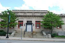
U.S. Post Office |
|
May 30, 1979
(#79003774) |
295 Main St.
42°00′17″N 71°30′46″W / 42.004722°N 71.512778°W / 42.004722; -71.512778 (U.S. Post Office) |
Woonsocket |
Now part of YMCA |
| 189 |
Union Village Historic District |
|
July 28, 1978
(#78000011) |
West of Woonsocket on RI 146A
41°59′28″N 71°32′13″W / 41.991111°N 71.536944°W / 41.991111; -71.536944 (Union Village Historic District) |
North Smithfield |
|
| 190 |
Valley Falls Mill |
|
April 26, 1978
(#78000012) |
1359 and 1361-63 Broad St.
41°53′55″N 71°23′20″W / 41.898611°N 71.388889°W / 41.898611; -71.388889 (Valley Falls Mill) |
Central Falls |
Boundary increase December 18, 1978. |
| 191 |
Phillip Walker House |
|
June 24, 1972
(#72000006) |
432 W. Massasoit Ave.
41°49′49″N 71°21′50″W / 41.830278°N 71.363889°W / 41.830278; -71.363889 (Phillip Walker House) |
East Providence |
|
| 192 |
Waterman-Winsor Farm |
|
June 27, 1980
(#80000012) |
79 Austin Ave.
41°52′55″N 71°33′45″W / 41.881944°N 71.5625°W / 41.881944; -71.5625 (Waterman-Winsor Farm) |
Smithfield |
|
| 193 |
Westcote |
|
August 3, 1988
(#88001126) |
101 Mountain Laurel Dr.
41°45′19″N 71°28′21″W / 41.755278°N 71.4725°W / 41.755278; -71.4725 (Westcote) |
Cranston |
|
| 194 |
Nathan Westcott House |
|
January 5, 1989
(#88001124) |
150 Scituate Ave.
41°46′42″N 71°28′46″W / 41.778333°N 71.479444°W / 41.778333; -71.479444 (Nathan Westcott House) |
Cranston |
|
| 195 |
Whipple-Angell-Bennett House |
|
July 28, 1995
(#95000917) |
157 Olney Ave.
41°50′57″N 71°27′54″W / 41.849167°N 71.465°W / 41.849167; -71.465 (Whipple-Angell-Bennett House) |
North Providence |
|
| 196 |
Whipple-Cullen House and Barn |
|
November 14, 1991
(#91001647) |
Old River Rd. south of its junction with George Washington Highway
41°55′49″N 71°26′31″W / 41.930278°N 71.441944°W / 41.930278; -71.441944 (Whipple-Cullen House and Barn) |
Lincoln |
|
| 197 |
Whipple-Jenckes House |
|
November 5, 1992
(#92001541) |
8 Fairhaven Road
41°57′25″N 71°24′02″W / 41.957057°N 71.400437°W / 41.957057; -71.400437 (Whipple-Jenckes House) |
Cumberland |
|
| 198 |
Whitcomb Farm |
|
November 28, 1980
(#80000013) |
36 Willett Ave.
41°46′37″N 71°21′45″W / 41.776944°N 71.3625°W / 41.776944; -71.3625 (Whitcomb Farm) |
East Providence |
|
| 199 |
Frank Wilbur House |
|
November 24, 1982
(#82000012) |
1273 Park Ave.
41°59′08″N 71°30′59″W / 41.985556°N 71.516389°W / 41.985556; -71.516389 (Frank Wilbur House) |
Woonsocket |
|
| 200 |
Stephen Winsor House |
|
October 6, 1975
(#75000004) |
113 Austin Ave.
41°53′08″N 71°33′55″W / 41.885502°N 71.565378°W / 41.885502; -71.565378 (Stephen Winsor House) |
Smithfield |
Listed at 93 Austin Ave. |
| 201 |
Arad Wood House |
|
August 3, 1988
(#88001125) |
407 Pontiac Ave.
41°46′30″N 71°26′18″W / 41.775°N 71.438333°W / 41.775; -71.438333 (Arad Wood House) |
Cranston |
|
| 202 |
Woonasquatucket River Site (RI-163) |
|
November 1, 1984
(#84000364) |
near Farnum Pike[12]
41°54′33″N 71°32′21″W / 41.90924°N 71.539285°W / 41.90924; -71.539285 (Woonasquatucket River Site (RI-163)) |
Smithfield |
|
| 203 |
Woonsocket City Hall |
|
May 1, 1974
(#74000007) |
169 Main St.
42°00′08″N 71°30′53″W / 42.002222°N 71.514722°W / 42.002222; -71.514722 (Woonsocket City Hall) |
Woonsocket |
|
| 204 |
Woonsocket Civil War Monument |
|
November 24, 1982
(#82000013) |
Monument Sq.
42°00′19″N 71°30′47″W / 42.005278°N 71.513056°W / 42.005278; -71.513056 (Woonsocket Civil War Monument) |
Woonsocket |
|
| 205 |
Woonsocket Company Mill Complex |
|
May 7, 1973
(#73000005) |
100-115 Front St.
42°00′05″N 71°30′46″W / 42.001389°N 71.512778°W / 42.001389; -71.512778 (Woonsocket Company Mill Complex) |
Woonsocket |
|
| 206 |
Woonsocket District Courthouse |
|
November 24, 1982
(#82000014) |
24 Front St.
42°00′06″N 71°30′39″W / 42.001667°N 71.510833°W / 42.001667; -71.510833 (Woonsocket District Courthouse) |
Woonsocket |
|
| 207 |
Woonsocket Rubber Company Mill |
|
May 1, 1989
(#89000334) |
60-82 S. Main St.
42°00′00″N 71°31′02″W / 42.0°N 71.5172°W / 42.0; -71.5172 (Woonsocket Rubber Company Mill) |
Woonsocket |
|
| 208 |
Woonsocket Senior High and Junior High Schools |
|
November 6, 2017
(#100001780) |
357 Park Place
42°00′15″N 71°30′16″W / 42.004279°N 71.504378°W / 42.004279; -71.504378 (Woonsocket Senior High and Junior High Schools) |
Woonsocket |
|
| 209 |
World War I Memorial |
|
October 19, 2001
(#01000466) |
Junction of Taunton Ave. and Weldon St.
41°49′10″N 71°22′15″W / 41.819444°N 71.370833°W / 41.819444; -71.370833 (World War I Memorial) |
East Providence |
|


_(extra_close)_(US48).svg.png)