| [2] |
Name on the Register[3] |
Image |
Date listed[4] |
Location |
City or town |
Description |
|---|
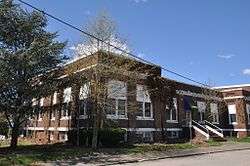
| 1 |
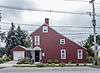
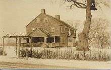
Bicknell-Armington Lightning Splitter House |
|
November 28, 1980
(#80000085) |
3591 Pawtucket Ave.
41°46′36″N 71°21′47″W / 41.776667°N 71.363056°W / 41.776667; -71.363056 (Bicknell-Armington Lightning Splitter House) |
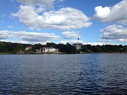
East Providence |
|
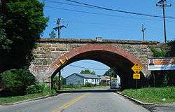
| 2 |
Boston and Providence Railroad Bridge |
|
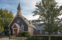
November 28, 1980
(#80000086) |
Spans the Ten Mile River
41°50′05″N 71°21′45″W / 41.834722°N 71.3625°W / 41.834722; -71.3625 (Boston and Providence Railroad Bridge) |
East Providence |
|
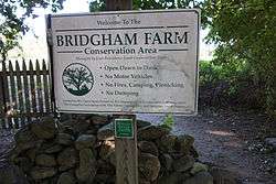
| 3 |
Bridgham Farm |
|
November 28, 1980
(#80000087) |
120, 148, 150, and 160 Pleasant St.
41°50′13″N 71°20′38″W / 41.836944°N 71.343889°W / 41.836944; -71.343889 (Bridgham Farm) |
East Providence |
|
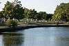
| 4 |
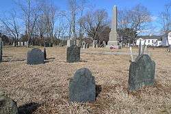
Carpenter, Lakeside, and Springvale Cemeteries |
|
November 28, 1980
(#80000091) |
Newman and Pawtucket Aves.
41°50′33″N 71°21′09″W / 41.8425°N 71.3525°W / 41.8425; -71.3525 (Carpenter, Lakeside, and Springvale Cemeteries) |
East Providence |
|
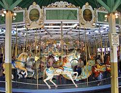
| 5 |
Crescent Park Looff Carousel |
|
April 21, 1976
(#76000045) |
Riverside Park
41°45′24″N 71°21′34″W / 41.756594°N 71.359431°W / 41.756594; -71.359431 (Crescent Park Looff Carousel) |
East Providence |
Restored 1895 carousel features some of Charles I.D. Looff's finest workmanship |
| 6 |
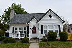
Nathaniel Daggett House |
|
November 28, 1980
(#80000092) |
74 Roger Williams Ave.
41°50′16″N 71°21′46″W / 41.837778°N 71.362778°W / 41.837778; -71.362778 (Nathaniel Daggett House) |
East Providence |
|
| 7 |
James Dennis House |
|
November 28, 1980
(#80000095) |
3120 Pawtucket Ave.
41°47′21″N 71°21′53″W / 41.789167°N 71.364722°W / 41.789167; -71.364722 (James Dennis House) |
East Providence |
|
| 8 |
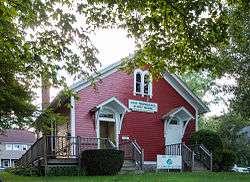
District 6 Schoolhouse |
|
November 28, 1980
(#80000096) |
347 Willett Ave
41°46′23″N 71°21′19″W / 41.773056°N 71.355278°W / 41.773056; -71.355278 (District 6 Schoolhouse) |
East Providence |
|
| 9 |
Elm Tree Plat Historic District |
|
November 19, 2015
(#15000829) |
Charlotte & Elinora Sts., Fenner, Harvey & Willett Aves.
41°46′13″N 71°21′10″W / 41.7702°N 71.3528°W / 41.7702; -71.3528 (Elm Tree Plat Historic District) |
East Providence |
|
| 10 |
Little Neck Cemetery |
|
November 28, 1980
(#80000100) |
Off Read St.
41°45′59″N 71°21′18″W / 41.766389°N 71.355°W / 41.766389; -71.355 (Little Neck Cemetery) |
East Providence |
|
| 11 |
Newman Cemetery |
|
November 28, 1980
(#80000002) |
Newman and Pawtucket Aves.
41°50′22″N 71°21′04″W / 41.839444°N 71.351111°W / 41.839444; -71.351111 (Newman Cemetery) |
East Providence |
|
| 12 |
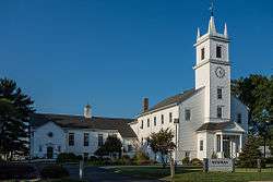
Newman Congregational Church |
|
November 28, 1980
(#80000003) |
100 Newman Ave.
41°50′28″N 71°21′03″W / 41.841111°N 71.350833°W / 41.841111; -71.350833 (Newman Congregational Church) |
East Providence |
|
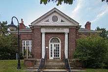
| 13 |
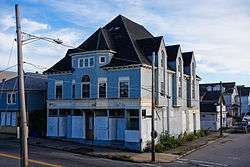
Oddfellow's Hall |
|
November 28, 1980
(#80000004) |
63-67 Warren Ave.
41°49′01″N 71°22′56″W / 41.816944°N 71.382222°W / 41.816944; -71.382222 (Oddfellow's Hall) |
East Providence |
|
| 14 |
Phillipsdale Historic District |
|
September 15, 2011
(#11000675) |
Roughly bounded by Seekonk River, Roger Williams Ave. & Ruth Ave.
41°50′52″N 71°21′55″W / 41.847778°N 71.365278°W / 41.847778; -71.365278 (Phillipsdale Historic District) |
East Providence |
|
| 15 |
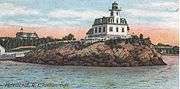
Pomham Rocks Light Station |
|
July 9, 1979
(#79000001) |
Riverside Rd.
41°46′40″N 71°22′13″W / 41.777778°N 71.370278°W / 41.777778; -71.370278 (Pomham Rocks Light Station) |
East Providence |
|
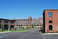
| 16 |
Richmond Paper Company Mill Complex |
|
November 1, 2006
(#06000974) |
310 Bourne Ave.
41°50′31″N 71°22′14″W / 41.841944°N 71.370556°W / 41.841944; -71.370556 (Richmond Paper Company Mill Complex) |
East Providence |
|
| 17 |
Rose Land Park Plat Historic District |
|
November 19, 2015
(#15000830) |
Florence St., Roseland Ct., Dartmouth, Princeton & Willett Aves.
41°46′09″N 71°21′03″W / 41.7692°N 71.3507°W / 41.7692; -71.3507 (Rose Land Park Plat Historic District) |
East Providence |
|
| 18 |
Rumford Chemical Works and Mill House Historic District |
|
November 28, 1980
(#80000007) |
N. Broadway, Newman, and Greenwood Aves.
41°50′22″N 71°21′16″W / 41.839444°N 71.354444°W / 41.839444; -71.354444 (Rumford Chemical Works and Mill House Historic District) |
East Providence |
|
| 19 |
Rumford Historic District |
|
November 28, 1980
(#80000008) |
Pleasant St. and Greenwood and Pawtucket Aves
41°49′50″N 71°20′55″W / 41.830556°N 71.348611°W / 41.830556; -71.348611 (Rumford Historic District) |
East Providence |
|
| 20 |
St. Mary's Episcopal Church |
|
November 28, 1980
(#80000009) |
83 Warren Ave.
41°49′01″N 71°22′54″W / 41.816944°N 71.381667°W / 41.816944; -71.381667 (St. Mary's Episcopal Church) |
East Providence |
|
| 21 |
Squantum Association |
|
November 28, 1980
(#80000010) |
947 Veterans Memorial Parkway
41°47′24″N 71°22′25″W / 41.79°N 71.373611°W / 41.79; -71.373611 (Squantum Association) |
East Providence |
|
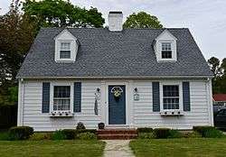
| 22 |
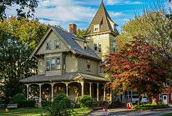
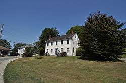
Phillip Walker House |
|
June 24, 1972
(#72000006) |
432 W. Massasoit Ave.
41°49′49″N 71°21′50″W / 41.830278°N 71.363889°W / 41.830278; -71.363889 (Phillip Walker House) |
East Providence |
|
| 23 |
Whitcomb Farm |
|
November 28, 1980
(#80000013) |
36 Willett Ave.
41°46′37″N 71°21′45″W / 41.776944°N 71.3625°W / 41.776944; -71.3625 (Whitcomb Farm) |
East Providence |
|
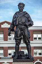
| 24 |
World War I Memorial |
|
October 19, 2001
(#01000466) |
Junction of Taunton Ave. and Weldon St.
41°49′10″N 71°22′15″W / 41.819444°N 71.370833°W / 41.819444; -71.370833 (World War I Memorial) |
East Providence |
|


_(extra_close)_(US48).svg.png)