Rose Land Park Plat Historic District
|
Rose Land Park Plat Historic District | |
 | |
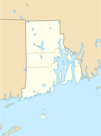  | |
| Location | Dartmouth Ave, Florence St, Princeton Ave, Roseland Ct, Willett Ave., East Providence, Rhode Island |
|---|---|
| Coordinates | 41°46′09″N 71°21′03″W / 41.7692°N 71.3509°WCoordinates: 41°46′09″N 71°21′03″W / 41.7692°N 71.3509°W |
| Area | 7 acres (2.8 ha) |
| NRHP reference # | 15000830[1] |
| Added to NRHP | November 19, 2015 |
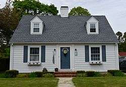
The Rose Land Park Plat Historic District encompasses an early 20th-century neighborhood of East Providence, Rhode Island, most of which was built by a single development group. It is located on the west side of Willett Avenue (Rhode Island Route 103), on Florence Street, Princeton and Dartmouth Avenues, and Roseland Court. The 7-acre (2.8 ha) district includes 38 residential buildings, and was mostly built between 1928 and 1939 as a streetcar suburb of Providence by Severin Carlson and Carl Johnson. The houses are mainly wood frame construction, and are stylistically English Revival, Colonial Revival, and traditional Cape Cod.[2]
The district was listed on the National Register of Historic Places in 2015.[1]
See also
References
- 1 2 National Park Service (2007-01-23). "National Register Information System". National Register of Historic Places. National Park Service.
- ↑ "NRHP nomination for Rose Land Park Plat Historic District" (PDF). Rhode Island Preservation. Retrieved 2015-11-28.
| Topics | |
|---|---|
| Lists by states |
|
| Lists by insular areas | |
| Lists by associated states | |
| Other areas | |
| |
This article is issued from
Wikipedia.
The text is licensed under Creative Commons - Attribution - Sharealike.
Additional terms may apply for the media files.