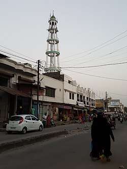
Sitarganj
| Sitarganj | |
|---|---|
| City | |
 | |
 Sitarganj Location in Uttarakhand, India  Sitarganj Sitarganj (India) | |
| Coordinates: 28°56′N 79°42′E / 28.93°N 79.70°ECoordinates: 28°56′N 79°42′E / 28.93°N 79.70°E | |
| Country |
|
| State | Uttarakhand |
| District | Udham Singh Nagar |
| Elevation | 298 m (978 ft) |
| Population (2001) | |
| • Total | 148,266 |
| Languages | |
| • Official | Hindi |
| Time zone | UTC+5:30 (IST) |
| PIN | 262405 |
| Telephone code | 05948 |
| Vehicle registration | UK 06 |
| Sex ratio | 798 ♂/♀ |
| Website |
sitarganj |
Sitarganj is a city and a municipal board in Udham Singh Nagar district in the Indian state of Uttarakhand.
Now it is home to the Integrated Industrial Estate Sitarganj (IIE) being developed by State Industrial Development Corporation of Uttarakhand(SIDCUL).[1]
Geography
Sitarganj is located at 28°56′N 79°42′E / 28.93°N 79.70°E.[2] It has an average elevation of 298 metres (978 feet). The City is located between three major water reservoirs naming:- Baigul Fish Reservoir, Dhora Reservoir and Nanak Sagar Reservoir which are used mainly for fisheries.
Baigul or Sukhi is a small tributary originating from the foothills of Kumaon Himalayas which was harnessed in 1967 for irrigation and flood control purpose. Baigul has an area of 2695 ha with an elevation of 211 m from the sea-level. The drainage area of 305 km² is fed from southwest monsoon and local catchment of wooded forest. The Plankton species in Baigul is rich comprising 17 genera of green algae, 4 genera of blue-green algae, 10 genera of desmids and 14 genera of diatoms.
Nanak Sagar Dam has been constructed on river Saryu or deoha at Nanak Matta forming Nanak Sagar which adds up to the beauty of Nanakmatta which is a nearby town to sitarganj. Length of the Dam is 19700 m and Volume of the dam is 3833 * 10³ m³. Irrigation potential of This dam is 39200 hectares, built with an estimated cost of 36.3 million Rs.

Dhora Dam is located near dineshpur constructed on river dhora, Length of the Dam is 9700 m and Volume of the dam is 50.700 * 10³ m³. Irrigation potential of This dam is 14600 hectares, built with an estimated cost of 11.1 million Rs.
Sitarganj comes under the Terai Agro Climatic zone of Uttarakhand. Its regional connectivity (50 – 100 km) to major towns and cities: Rudrapur, Haldwani, Moradabad, Rampur, Kashipur and across states (300 – 500 km) to U.P, Delhi, Haryana, H.P
It is near to Nainital (a hill station) and Indo-Nepalese border. Sitarganj is closer to Nanak Matta gurudwara temple which is a famous shrine and big nanak sagar dam(12 km from Sitarganj).
Coca-Cola will set up a bottling plant in Sitarganj in 70 acres of land that will be provided by the Uttarakhand government.[3]
Demographics
As of 2001 India census,[4] Sitarganj Tehsil had a population of 148266 in which 21893 population lives in main city.. Males constitute 53% of the population and females 47%. The SC and ST population is 14.3% and 13.1% respectively. In Sitarganj, 13% of the population is under 6 years of age.As of 2001 India census,[5] Sitarganj has a low proportion of primary and secondary schools than the district aggregate, but still Sitarganj has an average literacy rate of 76%, higher than the national average of 59.5%: with male literacy of 79%, and female literacy being 66%.
Education
Education has always been an integral part of Sitarganj's success. One of the best Schools currently standing tall are G.S Convent and Shelley School.It has made a huge difference in the lives of the residents there. Both of these schools has produced many nation builders from IITians, Doctors, Dentists, Badminton players to some social activists. The small city has been continuously revolutionizing the quality of education by improvising on the subject matter, content, social and physical building of the students living in and in the surrounding of Sitarganj. Currently the public schools hold their own association known as 'Public School Association Sitarganj' which is headed by the chairman Mr. B.C. Bhatt (Principal of S.M.Public School). Amongst the many Greenwood, Saraswati Vidya Mandir, Shelley School are among the oldest schools in town. Number of Senior Secondary schools in Sitarganj is 10, which are as follows:-
- Mohinder Singh Memorial Public School ( Aff. to C.B.S.E. )
- G.S. Convent (Aff. to C.B.S.E.)
- Shelley School
- Sarswati Vidya Mandir (Aff. to UK Board)
- S. M. Public School (Aff. to C.B.S.E.)
- Genie public school
- Greenwood Public School (Aff. to C.B.S.E.)
- Guru Nanak Public School.
- Government inter college ( intermediate college)
- Sarbodya Inter College.(Aff. To UK Board)
- Government Inter College
Now Sitarganj has Two Degree colleges
1.Dr. Shushela Tiwari Degree College (Kumaon University ) 2. Sitarganj Degree College (Kumaon University )
Sitarganj has also been a home of IITians, engineers, civil servants, doctors and most of the teens are studying in foreign colleges around the globe.
ESIP Sitarganj
Built on a 1200 acres of land Eldeco Sidcul Industrial Park, Sitarganj is developed jointly by Eldeco Infrastructure & Properties Limited and State Industrial Development Corporation of Uttranchal Limited (SIDCUL).
The site is about 300 km from Delhi and the nearest large town is Moradabad (U.P.), which is at a distance of about 100 km. The earmarked site (4749720.00 sq.m.) for the Integrated Industrial Estate lies 15 km north of Sitarganj town.
The nearest major rail head is Lalkuan railway station, about 15 km west of the site, and is on the main line connecting Kathgodam with New Delhi, Howrah, Dehradun and Lucknow. The other nearest railhead is at Kathgodam
- Amenities : Houses, School, Hospitals, Recreation
- Common Facilities : Administration Core, Warehouse, Transport Hub
- Utilities : Power, Water, Energy, Convergence
- Development : Levelling, Drainage, Sewerage, Internal Roads
- Connectivity : Road, Rail, Air
- Land : Identified, Acquired, Delineated
- Catalyst : Incentives, Exemptions, Concessions, Privileges
Availability of Industrial Plots in ESIP, Sitarganj Plot size up to 1 acre More than 1 acre and up to 4 acre More than 4 acre and up to 10 acres More than 10 acres 1 Acre = 4047 m2. or 4840 sq. yards.
Envisaged Activities
- 01. Entry to the ESIP
- 02. Built to suite Mix Industrial Plots
- 03. Truck Terminal
- 04. Commercial Hub with temporary kiosks/ rest area
- 05. Central Green Zone Management
- 06. Core Share Facility
- 07. Residential
- 08. Utility zone
- 09. Knowledge Corridor
- 10. 75m wide mian Spine Road Connectivity to national Highway
- 11. Intermediately Green Nodes
- 12. CETP & Waste Management System
- 13. Administration Block (Admin.)
- 14. Club House
Key Features
- Area sprawling over 1200 acres with land availability to spread more; as per current availability of industrial land, it is few of the largest tract of land available in NCR (National Capital Region) and surrounding region
- SIE has two way State Highway connectivity from two National Highways, which are proposed to be widened
- Broad gauge Rail head is just 15 km away (LalKuan and Kathgodam)
- Nearest airport is at Pant Nagar (50 km) which Government intends to upgrade
- Water is available in abundance, both ground and surface water
- Cheapest power in the country with hydro as source which is uninterrupted and rightly suitable for catering to peak load demands
- Skilled and semi skilled manpower is easy availability
- Best of the equitable climatic for production and populace
- Surrounding areas offers sufficient opportunities for residential development
References
- ↑ Industrial Estate Archived 24 March 2008 at the Wayback Machine. www.uttaranchalonline.
- ↑ Falling Rain Genomics, Inc - Sitarganj
- ↑ "Coca Cola to set up plant in Uttarakhand's Sitarganj". The Economic Times. Retrieved 7 December 2016.
- ↑ "Census of India 2001: Data from the 2001 Census, including cities, villages and towns (Provisional)". Census Commission of India. Archived from the original on 2004-06-16. Retrieved 2008-11-01.
- ↑ "Census of India 2001: Data from the 2001 Census, including cities, villages and towns (Provisional)". Census Commission of India. Archived from the original on 2004-06-16. Retrieved 2008-11-01.