Jaspur
| Jaspur | |
|---|---|
| Town | |
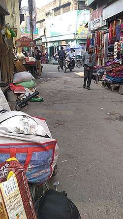 Gahlot market in Jaspur | |
 Jaspur Location in Uttarakhand, India  Jaspur Jaspur (India) | |
| Coordinates: 29°17′00″N 78°49′00″E / 29.283331°N 78.816673°ECoordinates: 29°17′00″N 78°49′00″E / 29.283331°N 78.816673°E | |
| Country |
|
| State | Uttarakhand |
| District | Udham Singh Nagar |
| Government | |
| • Type | Congress |
| Elevation | 220 m (720 ft) |
| Population (2011) | |
| • Total | 60,523 |
| Languages | |
| • Official | Hindi |
| Time zone | UTC+5:30 (IST) |
| Vehicle registration | UK 18 |
| Website |
uk |
Jaspur is a city and a municipal board in Udham Singh Nagar district in the Indian state of Uttarakhand.
Demographics
As of the 2001 India census,[1] Jaspur had a population of 39,048. Males constituted 53% of the population and females 47%. Jaspur had an average literacy rate of 60%, higher than the national average of 59.5%: male literacy was 67%, and female literacy was 52%. In Jaspur, 17% of the population was under 6 years of age. Hindi is the most common language here but some people also understand Punjabi language Urdu and English.
Geography
Jaspur is located at 29°17′N 78°49′E / 29.28°N 78.82°E.[2] It has an average elevation of 320 metres (1050 feet). It is a small city, 45 km from Corbett National Park, Ramnagar and 210 km from New Delhi. It is 110 km from Nainital. It is the border town of Uttarakhand.
Transportation
It is well connected to all major cities of the states and region. NH-74 connects Haridwar in Uttranchal with Bareilly in Uttar Pradesh via Pilibhit. The total length of NH 74 is 333 km. It connects Jaspur to major cities like Haldwani, Kashipur, Gadarpur, Rudrapur, Kicha, Ramnagar, Haridwar and Dehradun. However, there is no bus stand or railway station.
Culture
The majority of the population is Hindu, Punjabi or Sikh, along with a smaller muslim community. The city is an example of religious harmony and there has never been any incident of communal strife. All the people take part in each other's festivals. Hindus are invited to the Roza-Iftar party, and Muslims take part in Hindu festival Holi. All people are invited to the Buddhist festivals.
Economy
Jaspur has evolved from a village into a small town. Also known as wood city of India, it has a traditional wood mandi and some agro-processing industries. Many people in the city are self-employed and run small shops, though the economy of the city is mainly based on agriculture. There is a sugar mill at Nandehi near the city, and many rice and paper mills in the vicinity of the city.
Temples
Temples include the historical Buddhist Monastery at the village of Bahadurpur, the Shri Thakur Mandir, which is also called Manokamna Mandir, having the great statues of Abhimantrit Hanuman Ji along with Ram Parivar and Shri Radha Krishna Ji, and Bada Mandir. A Gayatri mata Mandir placed on the back of the indane gas agency . A Shiv Mandir also placed in Gopal Nagar, near Awas Vikas.
References
- ↑ "Census of India 2001: Data from the 2001 Census, including cities, villages and towns (Provisional)". Census Commission of India. Archived from the original on 2004-06-16. Retrieved 2008-11-01.
- ↑ Falling Rain Genomics, Inc – Jaspur