Adams Township, Morgan County, Indiana
| Adams Township | |
|---|---|
| Township | |
 Lamb's Creek Bridge, a historic landmark in Adams Township | |
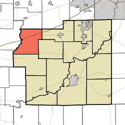 Location in Morgan County | |
| Coordinates: 39°33′34″N 86°37′13″W / 39.55944°N 86.62028°WCoordinates: 39°33′34″N 86°37′13″W / 39.55944°N 86.62028°W | |
| Country |
|
| State |
|
| County | Morgan |
| Government | |
| • Type | Indiana township |
| Area | |
| • Total | 29.82 sq mi (77.2 km2) |
| • Land | 29.81 sq mi (77.2 km2) |
| • Water | 0.02 sq mi (0.05 km2) 0.07% |
| Elevation | 748 ft (228 m) |
| Population (2010) | |
| • Total | 1,194 |
| • Density | 40.1/sq mi (15.5/km2) |
| Time zone | UTC-5 (Eastern (EST)) |
| • Summer (DST) | UTC-4 (EDT) |
| ZIP codes | 46125, 46151, 46157, 46180 |
| GNIS feature ID | 453079 |
Adams Township is one of fourteen townships in Morgan County, Indiana, United States. As of the 2010 census, its population was 1,194 and it contained 502 housing units.[1]
Geography
According to the 2010 census, the township has a total area of 29.82 square miles (77.2 km2), of which 29.81 square miles (77.2 km2) (or 99.97%) is land and 0.02 square miles (0.052 km2) (or 0.07%) is water.[1]
Unincorporated towns
Cemeteries
The township contains these four cemeteries: Crown Center, Shumaker, Walters and Whitaker-Patrick.
Major highways
School districts
- Eminence Community School Corporation
Political districts
- Indiana's 4th congressional district
- State House District 47
- State Senate District 37
References
- "Adams Township, Morgan County, Indiana". Geographic Names Information System. United States Geological Survey. Retrieved 2009-09-26.
- United States Census Bureau 2008 TIGER/Line Shapefiles
- IndianaMap
- 1 2 "Population, Housing Units, Area, and Density: 2010 - County -- County Subdivision and Place -- 2010 Census Summary File 1". United States Census. Retrieved 2013-05-10.
External links
- Indiana Township Association
- United Township Association of Indiana
- City-Data.com page for Adams Township
Places adjacent to Adams Township, Morgan County, Indiana | |
|---|---|
Municipalities and communities of Morgan County, Indiana, United States | ||
|---|---|---|
| City | ||
| Towns | ||
| Townships | ||
| CDP | ||
| Other unincorporated communities |
| |
| Footnotes | ‡This populated place also has portions in an adjacent county or counties | |
This article is issued from
Wikipedia.
The text is licensed under Creative Commons - Attribution - Sharealike.
Additional terms may apply for the media files.