Madison Township, Morgan County, Indiana
| Madison Township | |
|---|---|
| Township | |
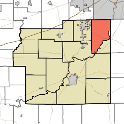 Location in Morgan County | |
| Coordinates: 39°34′57″N 86°18′10″W / 39.58250°N 86.30278°WCoordinates: 39°34′57″N 86°18′10″W / 39.58250°N 86.30278°W | |
| Country |
|
| State |
|
| County | Morgan |
| Government | |
| • Type | Indiana township |
| Area | |
| • Total | 27.9 sq mi (72 km2) |
| • Land | 27.5 sq mi (71 km2) |
| • Water | 0.4 sq mi (1 km2) 1.43% |
| Elevation | 732 ft (223 m) |
| Population (2010) | |
| • Total | 9,705 |
| • Density | 353/sq mi (136/km2) |
| Time zone | UTC-5 (Eastern (EST)) |
| • Summer (DST) | UTC-4 (EDT) |
| ZIP codes | 46113, 46158 |
| GNIS feature ID | 453595 |
Madison Township is one of fourteen townships in Morgan County, Indiana, United States. As of the 2010 census, its population was 9,705 and it contained 3,608 housing units.[1]
Geography
According to the 2010 census, the township has a total area of 27.9 square miles (72 km2), of which 27.5 square miles (71 km2) (or 98.57%) is land and 0.4 square miles (1.0 km2) (or 1.43%) is water.[1]
Cities, towns, villages
- Mooresville (east edge)
Unincorporated towns
- Crestview Heights at 39°35′06″N 86°18′59″W / 39.585047°N 86.316381°W
- Fields at 39°32′46″N 86°20′00″W / 39.546158°N 86.333325°W
- Five Points at 39°34′53″N 86°19′01″W / 39.581436°N 86.316936°W
- Fox Hill at 39°36′02″N 86°17′02″W / 39.600602°N 86.28388°W
- Landersdale at 39°37′10″N 86°15′47″W / 39.619491°N 86.263046°W
- Miller at 39°37′14″N 86°16′55″W / 39.620602°N 86.281935°W
- Wiser at 39°36′44″N 86°17′37″W / 39.612269°N 86.293602°W
(This list is based on USGS data and may include former settlements.)
Cemeteries
The township contains these two cemeteries: Mount Olive and Silon.
Airports and landing strips
- Owen Field
Lakes
- Leona Lake
- Popular Grove Lake
- Lambert Lake
School districts
- Mooresville Consolidated School Corporation
Political districts
- Indiana's 9th congressional district
- State House District 47
- State House District 91
- State Senate District 35
- State Senate District 37
References
- "Madison Township, Morgan County, Indiana". Geographic Names Information System. United States Geological Survey. Retrieved 2009-09-26.
- United States Census Bureau 2008 TIGER/Line Shapefiles
- IndianaMap
- 1 2 "Population, Housing Units, Area, and Density: 2010 - County -- County Subdivision and Place -- 2010 Census Summary File 1". United States Census. Retrieved 2013-05-10.
External links
- Indiana Township Association
- United Township Association of Indiana
- City-Data.com page for Madison Township
Places adjacent to Madison Township, Morgan County, Indiana | |
|---|---|
Municipalities and communities of Morgan County, Indiana, United States | ||
|---|---|---|
| City | ||
| Towns | ||
| Townships | ||
| CDP | ||
| Other unincorporated communities |
| |
| Footnotes | ‡This populated place also has portions in an adjacent county or counties | |
This article is issued from
Wikipedia.
The text is licensed under Creative Commons - Attribution - Sharealike.
Additional terms may apply for the media files.