Marine Park, Brooklyn

Marine Park is the name of a neighborhood and the largest public park in the New York City borough of Brooklyn,[1] that lies between Flatlands and Mill Basin to the east, and Gerritsen Beach, Midwood, and Sheepshead Bay to the south and west. The neighborhood is mostly squared off in area by Gerritsen Avenue, Flatbush Avenue, Avenue U and Kings Highway. The eponymous park is within the neighborhood. The neighborhood is largely made up of ethnic groups such as Italians, Irish, Greeks, and Jews. The area is part of Brooklyn Community Board 18.[2] Charles Downing Lay won a silver medal in town planning at the 1936 Olympics for the planning of Marine Park.[3]
History
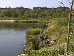
The neighborhood is situated around Gerritsen Creek, the westernmost inlet of Jamaica Bay;[4] the creek's path within the neighborhood was covered in 1920.[5][6] During the last 5,000 years, strips of sand were deposited by ocean currents. These beach strips form a surf-barrier and allow salt marshes to thrive:
...Gerritsen Creek was a freshwater stream that once extended about twice as far inland as it does today. Around 1920 the creek north of Avenue U was converted into an underground storm drain. Yet it continues to supply the salt marsh with fresh water, which helps the marsh support a wide range of organisms. ...[7]
The area was a hunting and fishing ground for Native Americans from the nearby village of Keshawchqueren. Pits for cooking and preparing food dating from 800 to 1400 AD were uncovered in Marine Park, along with deer and turtle bones, oyster shells, and sturgeon scales. In the 17th century, the Dutch began to settle in the area, which had similarities to the marshland and coastal plains of the Netherlands. The land proved to be fairly good farmland and there was an abundance of clams, oysters, and game from the region as well.
...Fearing that the relatively pristine marshland around Gerritsen Creek would be destroyed, Frederick B. Pratt and Alfred T. White offered the city 150 acres (0.6 km2) in the area for use as a park in 1917. After a seven-year delay the City accepted the offer. The prospect of a new park inspired developers to erect new homes in the area and, in the year 1926, form the organization, Marine Park Civic Association, although park improvements were slow to follow. Fill deposited in the marshlands in the 1930s and now land purchases increased the park's area to 1,822 acres (7 km2) by 1937. That year the Board of Aldermen named the site Brooklyn Marine Park...[7]
In the 18th century George Washington made a stop for several days on the land nearby. There was a gristmill on the water at the time.
As early as 1910, developers began dredging ports within Jamaica Bay in an effort to develop a seaport district there.[8] Although the city allowed several piers to be constructed in 1918, only one was built on the former Barren Island. The pier, which was built in order to receive landfill for the other proposed piers, stretched 1 mile (1.6 km) northeast and was 700 feet (210 m) wide.[9] In 1931, the city took possession of 58 acres (23 ha) on the western side of Barren Island. That plot was combined with a 110-acre (45 ha) tract owned by Kings County to create the park named Marine Park.[10]:51 Urban planner Robert Moses expanded Marine Park in 1935, and the city acquired 1,822 acres (737 ha) of land. This comprised the entire island west of Flatbush Avenue.[10]:53 Barren Island's residents were mostly evicted by 1939, and part of the island became part of Marine Park, but much of the rest of the island became Floyd Bennett Field.[11]
In 1935, the mill burned down to the water level due to vandals, leaving only wood pilings across the water, which can be clearly seen to this day during low tide. In the mid-20th century the area was abused by trash and abandoned cars. At one point it became a landfill and trash piled up to 60 feet (18 m) in certain areas. After a massive cleanup effort in the 1990s the area was restored to its former glory, with exception of a few rusty car parts riddling the area, and teens littering and causing arson to the dry tall phragmite from time to time.
Demographics
Marine Park is located in zip code 11234, which also includes Mill Basin, Bergen Beach/Georgetown, and the southern portion of Flatlands. Based on data from the 2010 United States Census, the combined population of Georgetown, Marine Park, Bergen Beach, and Mill Basin was 45,231, an increase of 2,291 (5.3%) from the 42,940 counted in 2000. Covering an area of 1,662.88 acres (672.94 ha), the neighborhood had a population density of 27.2 inhabitants per acre (17,400/sq mi; 6,700/km2).[12]
By the end of the 20th century, the vast majority of Marine Park residents were white, as were most residents of adjacent neighborhoods such as Mill Basin and Bergen Beach.[13] By 2011, the number of black residents in Southeast Brooklyn had risen 241%, the steepest such increase of any area in the city. As of that year, the African American population in these neighborhoods represented 10.9% of the total population.[14] As of the 2010 Census, the racial makeup of Southeast Brooklyn was 73.8% (33,399) White, 10.9% (4,952) African American, 0.1% (47) Native American, 5.6% (2,521) Asian, 0.0% (7) Pacific Islander, 0.3% (144) from other races, and 1.3% (578) from two or more races. Hispanic or Latino of any race were 7.9% (3,583) of the population.[15]
Police and crime
Marine Park is patrolled by the NYPD's 63rd Precinct,[16] located at 1844 Brooklyn Avenue in Flatlands. The precinct also covers Bergen Beach, Mill Basin, and part of Flatlands.[17] As of 2017, the 63rd Precinct reported 3 murders (3 in 2001), 12 rapes (17 in 2001), 114 robberies (265 in 2001), 146 felonious assaults (161 in 2001), 97 burglaries (339 in 2001), 516 grand larcenies (536 in 2001), and 65 grand larceny auto (497 in 2001).[18]
Park


The neighborhood also contains a public park of the same name. The park's 530 acres (2.1 km2) of grassland and salt marsh surround the westernmost inlet of Jamaica Bay.[1] Most of the park's land was donated to New York City to be turned into public park land by the Whitney family in 1920 and by Frederic B. Pratt and Alfred Tredway White, who jointly donated 150 acres (0.61 km2) in 1917. The land donated consists of the area between the current day Fillmore Avenue and Gerritsen Avenue and East 38th Street. Originally almost two thousand acres (8 km2), over half of which has been donated to the National Park Service as part of the Gateway National Recreation Area, the park is mainly a fertile salt marsh which is supplied with freshwater from Gerritsen Creek. Marine Park, surrounded by the neighborhood it is named after, consists of recreational park areas and the Salt Marsh Nature Center, where myrtle warblers, grasshopper sparrows, cottontail rabbits, ring-necked pheasants, horseshoe crabs, and oyster toadfish can be found.[8]
The park used to be a fishing ground for the village of Keshawchqueren. With new land purchases in the 1930s, the park grew to 1822 acres (7.4 km2) by 1937. That same year, the Board of Aldermen named the site "Brooklyn Marine Park".
The park gained its land mass as a dump, a dynamic that led to so many rats in the area that local children hunted them with bows and arrows in the 1960s.[19] One neighborhood boy was even bitten by a rat in his sleep.[19]
Recreational facilities were built in the decades to follow, including the Pratt-White athletic field (1939) that was dedicated to the two fathers of Marine Park. A 210-acre (0.85 km2) golf course opened in 1963, and the John V. Lindsay Model Airport was dedicated in 1971. The golf course was designed by renowned course architect Robert Trent Jones and hosts several pro-am golf tournaments, including the Brooklyn Open and the Jamaica Open NY Golf Tournament. New ballfields were opened in 1979 and named for baseball-loving NYPD Officer Rocco Torre in 1997. Nature trails established along Gerritsen Creek in 1984-85 invite parkgoers to observe a wealth of flora and fauna. Ongoing improvements at the end of the 20th century include the reconstruction of basketball, tennis, and bocce courts; of baseball fields; and of Lenape Playground at Avenue U. A new nature center opened in 2000. The Carmine Carro Community Center, named for Carmine Carro, a local activist and park advocate who served as president for the Marine Park Civic Association, opened in March 2013.[20] The building's “green” elements include solar panels, a geothermal heating and cooling system, and a green roof. Because of these energy-saving features, the Parks Department is seeking LEED Silver certification for the building.[21] The park's playground, several sports fields, and 0.83 mile-long running path were all built on the ancient Keshawchqueren burial ground.[22]
Notable people
- Joel Benjamin (born 1964), chess Grandmaster.[23]
- Charlie Shrem (born 1989), entrepreneur and bitcoin advocate.[24]
- Gil Student (born 1972), book editor of the Orthodox Union's Jewish Action magazine, and former Managing Editor of OU Press.[25]
- Joe Torre (born 1940), former Major League Baseball player and manager for the Atlanta Braves, St. Louis Cardinals, New York Mets and New York Yankees and Los Angeles Dodgers, respectively, current baseball executive.[26]
Image gallery
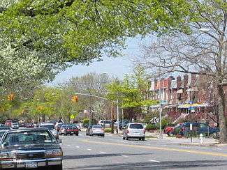
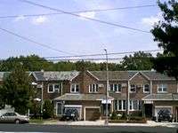 Brick row houses on Gerritsen Avenue
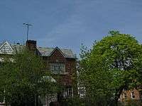 Old building
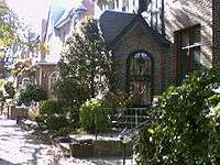 Porch on a row house
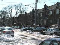 Row houses in winter
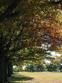
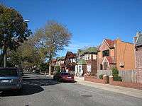 Row houses in fall
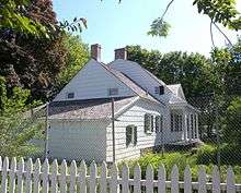 The Hendrick I. Lott House, in the neighborhood
See also
References
- 1 2 Marine Park, New York City Department of Parks and Recreation. Accessed September 24, 2016. "As Brooklyn's largest park, Marine Park has plenty of room to serve a lot of needs. Environmentally, it consists of 530 acres of grassland and precious salt marsh, protected as a Forever Wild preserve."
- ↑ "Brooklyn Community Boards". City of New York. Retrieved March 17, 2014.
- ↑ "And the Medal Goes to..." Brooklyn Public Library. Retrieved August 12, 2016.
- ↑ "Officials Celebrate the Gerritsen Creek Ecosystem Restoration Project in Marine Park". United States Army Corps of Engineers. 2012-08-14.
- ↑ Josephine Axt (2003). "Ecosystem restoration promotes understanding" (PDF). US Army Corps of Engineers.
- ↑ "FACT SHEET-Gerritsen Creek–MARINE PARK, NY: Ecosystem Restoration Project". US Army Corps of Engineers.
- 1 2 Marine Park Civic Association. "The History of Marine Park". Archived from the original on November 18, 2013. Retrieved July 24, 2006.
- 1 2 "Marine Park Highlights". New York City Department of Parks & Recreation. June 17, 2003. Retrieved January 6, 2018.
- ↑ Black, Frederick R. (1981). "JAMAICA BAY: A HISTORY" (PDF). United States Department of the Interior, National Park Service: 77–79.
- 1 2 Cody, Sarah K.; Auwaerter, John; Curry, George W. (2009). "Cultural Landscape Report for Floyd Bennett Field" (PDF). nps.gov. State University of New York, College of Environmental Science and Forestry.
- ↑ "BARREN ISLAND IS FADING; Marine Park Squeezing Out Community On the Sand Dunes in Jamaica Bay" (PDF). The New York Times. February 19, 1939. Retrieved January 7, 2018.
- ↑ Table PL-P5 NTA: Total Population and Persons Per Acre - New York City Neighborhood Tabulation Areas*, 2010, Population Division - New York City Department of City Planning, February 2012. Accessed June 16, 2016.
- ↑ Friedman, Andrew (2001-06-03). "NEIGHBORHOOD REPORT: SOUTHEAST BROOKLYN; Drops of Diversity in a Quiet Area". The New York Times. Retrieved 2018-01-15.
- ↑ Musumeci, Natalie; Durkin, Erin (September 22, 2011). "Black pop. growing in south Bk". NY Daily News. Retrieved 2018-01-15.
- ↑ Table PL-P3A NTA: Total Population by Mutually Exclusive Race and Hispanic Origin - New York City Neighborhood Tabulation Areas*, 2010, Population Division - New York City Department of City Planning, March 29, 2011. Accessed June 14, 2016.
- ↑ Teicher, Jordan G. (2015-07-08). "City Living: Bergen Beach satisfies your craving for real suburban living". am New York. Retrieved 2018-01-15.
- ↑ "NYPD – 63rd Precinct". www.nyc.gov. Retrieved October 3, 2016.
- ↑ "CompStat 63rd Precinct" (PDF). New York City Police Department. Retrieved January 19, 2018.
- 1 2 Tolchin, Martin (6 April 1965). "Brooklyn's Marine Park Filled with Garbage, Rats and Junk". New York Times.
- ↑ "Marine Park's Long-Awaited Green Community Center Now Open!". March 4, 2013. Retrieved March 17, 2013.
- ↑ "Carmine Carro Community Center Opens In Marine Park (press release)". New York City Department of Parks and Recreation. Retrieved 4 May 2014.
- ↑ Wall, Diana diZerega (2004). Touring Gotham's Archaeological Past: 8 Self-Guided Walking Tours through New York City. Yale University. pp. 173–175. ISBN 0300103883.
- ↑ Rimer, Sara. "Chess At New York Open: 'It's Like A War'", The New York Times, April 18, 1987. Accessed February 11, 2018. "In hopes of one day becoming a world champion, Mr. Benjamin, a Yale graduate from the Marine Park section of Brooklyn, said he will be moving to Barcelona next month to pursue chess under the tutelage of John Fedorowicz, a grandmaster from New York."
- ↑ Murphy, Doyle. "Bitcoin coming to Park Slope hotel? Not so fast, manager says", New York Daily News, June 17, 2014. February 11, 2018. "Shrem, who grew up in Marine Park, has become something of a rock star among the currency’s fervent followers. An early adopter, he began accepting bitcoin at his Manhattan bar EVR years ago and is a self-described millionaire at age 24."
- ↑ Weiss, Steven I. "Hirhurim Blogger Gil Student Hired by OU Press", The Jewish Channel, May 26, 2009. Accessed February 11, 2018. "Rabbi Student and his wife of 15 years, Miriam, live in the Marine Park section of Brooklyn with their four children."
- ↑ Newman, Andy. "Kind Words for Torre, From Marine Park to the Bronx", The New York Times, October 10, 2007. Accessed February 11, 2018. "Beside the ballfields at Marine Park in Brooklyn, where pudgy young Joe Torre grew up and where he smacked some of his first home runs, Bob Rosenstein, walking the track after a lunchtime run, spoke admiringly of Mr. Torre’s work for domestic violence victims and for young athletes."
External links
| Wikimedia Commons has media related to Marine Park, Brooklyn. |
Coordinates: 40°35′53″N 73°55′15″W / 40.59804°N 73.92083°W
| |||||||||||||||
| |||||||||||||||
| |||||||||||||||
| |||||||||||||||
| |||||||||||||||