Macaracas District
| Macaracas District | |
|---|---|
| District | |
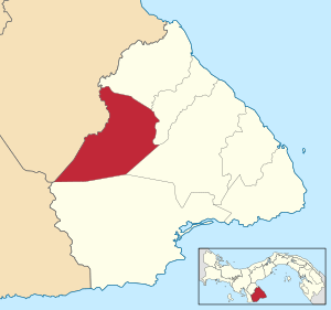 | |
 Macaracas District Location of the district capital in Panama | |
| Coordinates: 7°43′48″N 80°32′24″W / 7.73000°N 80.54000°W | |
| Country |
|
| Province | Los Santos Province |
| Capital | Macaracas |
| Area | |
| • Total | 195 sq mi (504 km2) |
| Population (2000) | |
| • Total | 9,137 |
| Time zone | UTC-5 (ETZ) |
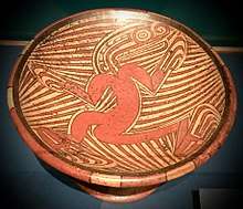
A Macaracas style Coclé bowl, from around 800-1000 AD. The background design is stingray spines.
Macaracas District is a district (distrito) of Los Santos Province in Panama. The population according to the 2000 census was 9,137.[1] The district covers a total area of 504 km². The capital lies at the city of Macaracas.[1]
The Macaracas style of Gran Coclé Precolumbian pottery was named for archaeological sites found in this District.
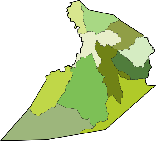
Administrative divisions
Macaracas District is divided administratively into the following corregimientos:
References
- 1 2 "Districts of Panama". Statoids. Retrieved April 12, 2009.
Capital: Las Tablas | ||
| Guararé District | 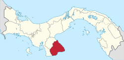 | |
| Las Tablas District | ||
| Los Santos District | ||
| Macaracas District | ||
| Pedasí District | ||
| Pocrí District | ||
| Tonosí District | ||
This article is issued from
Wikipedia.
The text is licensed under Creative Commons - Attribution - Sharealike.
Additional terms may apply for the media files.