Los Santos District
| Los Santos District | |
|---|---|
| District | |
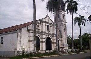 La Villa de los Santos | |
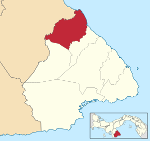 | |
 Los Santos District Location of the district capital in Panama | |
| Coordinates: 7°50′N 80°20′W / 7.833°N 80.333°W | |
| Country |
|
| Province | Los Santos Province |
| Capital | Las Tablas |
| Area | |
| • Total | 166 sq mi (429 km2) |
| Population (2000) | |
| • Total | 23,828 |
| Time zone | UTC-5 (ETZ) |
Los Santos District is a district (distrito) of Los Santos Province in Panama. The population according to the 2000 census was 23,828.[1]The district covers a total area of 429 km². The capital lies at the city of La Villa de los Santos.[1]
Administrative divisions
Los Santos District is divided administratively into the following corregimientos:
References
- 1 2 "Districts of Panama". Statoids. Retrieved April 12, 2009.
Capital: Las Tablas | ||
| Guararé District | 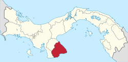 | |
| Las Tablas District | ||
| Los Santos District | ||
| Macaracas District | ||
| Pedasí District | ||
| Pocrí District | ||
| Tonosí District | ||
This article is issued from
Wikipedia.
The text is licensed under Creative Commons - Attribution - Sharealike.
Additional terms may apply for the media files.