Lufkin, Texas
| Lufkin | |
|---|---|
| City | |
| City of Lufkin | |
 Lufkin welcome sign acknowledges the importance of lumber to the area | |
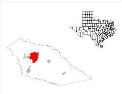 Location in Texas | |
 Lufkin Location in the United States | |
| Coordinates: 31°20′18″N 94°43′45″W / 31.33833°N 94.72917°WCoordinates: 31°20′18″N 94°43′45″W / 31.33833°N 94.72917°W | |
| Country |
|
| State |
|
| County | Angelina |
| Government | |
| • Type | Council-Manager |
| • City Council |
Mayor Bob Brown Rufus Duncan Don Langston R.L. Kuykendall Lynn Torres Phil Medford Robert Shankle |
| • City Manager | Keith Wright |
| Area | |
| • Total | 34.5 sq mi (89 km2) |
| • Land | 34.2 sq mi (89 km2) |
| • Water | 0.3 sq mi (0.8 km2) |
| Elevation | 312 ft (95 m) |
| Population (2017) | |
| • Total | 35,837 |
| • Density | 1,000/sq mi (400/km2) |
| Time zone | UTC−6 (Central (CST)) |
| • Summer (DST) | UTC−5 (CDT) |
| ZIP code | 75901, 75902, 75903, 75904, 75915 |
| Area code | 936 |
| FIPS code | 48-45072[1] |
| GNIS feature ID | 1382208[2] |
| Website |
cityoflufkin |
Lufkin is a city in and the county seat of Angelina County in eastern Texas, United States.[3] This city is 120 miles (190 km) northeast of Houston. Founded in 1882, the population was 35,837 at the 2017 census.[4]
Lufkin is situated in Deep East Texas.
History
.jpg)
The city is named for Abraham P. Lufkin, a cotton merchant and Galveston city councilman. Lufkin was the father-in-law of Paul Bremond, president of the Houston, East and West Texas Railway which developed the town.
In 1906 while living in Lufkin, writer Katherine Anne Porter married her first husband John Henry Koontze in a double ring ceremony that also had her sister Gay Porter marry T.H. Holloway. The minister who presided over the ceremony was Rev. Ira Bryce, serving at the time at Lufkin's First Methodist Church.
In 1907, Allan Shivers, the 37th Governor of Texas, was born in Lufkin. He served as governor from 1949 to 1957.
Debris from the Space Shuttle Columbia disaster fell over the Lufkin area on February 1, 2003.
Lufkin celebrated its 125th anniversary in October 2007.
A little league team from Lufkin won the U.S. Championship at the 2017 Little League World Series in Williamsport, Pennsylvania. The team finished as runners-up in the tournament behind the international championship team from Tokyo, Japan.
Geography
According to the United States Census Bureau, the city has a total area of 34.5 square miles (89 km2), of which, 34.2 square miles (89 km2) of it is land and 0.3 square miles (0.78 km2) is covered by water.[5]
Lufkin is at the crossroads of East Texas at the intersections of Highways US 59, future Interstate 69, which leads to Houston and the Rio Grande Valley to the south and Nacogdoches and Texarkana to the north, and US 69, which leads from the Golden Triangle of southeast Texas (Port Arthur and Beaumont) to points such as Jacksonville, Tyler, Dallas, and Oklahoma to the north.
Lufkin is 120 miles (190 km) northeast of Houston.[6]
National forests and grasslands
The headquarters of all four United States National Forests and two United States National Grasslands in Texas are located in Lufkin. They are the Angelina, Davy Crockett, Sabine, and Sam Houston National Forests, and the Caddo and Lyndon B. Johnson National Grasslands.
Climate
| Lufkin, Texas | ||||||||||||||||||||||||||||||||||||||||||||||||||||||||||||
|---|---|---|---|---|---|---|---|---|---|---|---|---|---|---|---|---|---|---|---|---|---|---|---|---|---|---|---|---|---|---|---|---|---|---|---|---|---|---|---|---|---|---|---|---|---|---|---|---|---|---|---|---|---|---|---|---|---|---|---|---|
| Climate chart (explanation) | ||||||||||||||||||||||||||||||||||||||||||||||||||||||||||||
| ||||||||||||||||||||||||||||||||||||||||||||||||||||||||||||
| ||||||||||||||||||||||||||||||||||||||||||||||||||||||||||||
- On average, the warmest month is August.
- The highest recorded temperature was 110 °F in 1909.
- On average, the coolest month is January.
- The lowest recorded temperature was -2 °F in 1930.
- The maximum average precipitation occurs in May.
Demographics
| Historical population | |||
|---|---|---|---|
| Census | Pop. | %± | |
| 1890 | 529 | — | |
| 1900 | 1,527 | 188.7% | |
| 1910 | 2,749 | 80.0% | |
| 1920 | 4,878 | 77.4% | |
| 1930 | 7,311 | 49.9% | |
| 1940 | 9,567 | 30.9% | |
| 1950 | 15,135 | 58.2% | |
| 1960 | 17,641 | 16.6% | |
| 1970 | 23,049 | 30.7% | |
| 1980 | 28,562 | 23.9% | |
| 1990 | 30,206 | 5.8% | |
| 2000 | 32,709 | 8.3% | |
| 2010 | 35,067 | 7.2% | |
| Est. 2016 | 36,159 | [7] | 3.1% |
| U.S. Decennial Census[8] | |||
As of the census of 2000, 32,709 people, 12,247 households, and 8,364 families resided in the city.[1] The population density was 1,225.1 people per square mile (473.0/km²). The 13,402 housing units averaged 502.0 per square mile (193.8/km²). The racial makeup of the city was 59.92% White, 26.58% African American, 0.26% Native American, 1.37% Asian, 0.01% Pacific Islander, 10.31% from other races, and 1.54% from two or more races. Hispanics or Latinos of any race were 17.59% of the population.
Of the 12,247 households, 32.9% had children under the age of 18 living with them, 49.4% were married couples living together, 14.7% had a female householder with no husband present, and 31.7% were not families; 27.9% of all households were made up of individuals, and 11.9% had someone living alone who was 65 years of age or older. The average household size was 2.58 and the average family size was 3.17.
In the city, the population was distributed as 27.0% under the age of 18, 10.6% from 18 to 24, 27.3% from 25 to 44, 20.1% from 45 to 64, and 15.1% who were 65 years of age or older. The median age was 34 years. For every 100 females, there were 88.9 males. For every 100 females age 18 and over, there were 84.5 males.
The median income for a household in the city was $32,989, and for a family was $40,591. Males had a median income of $30,922 versus $20,008 for females. The per capita income for the city was $17,613. About 15.0% of families and 18.8% of the population were below the poverty line, including 26.4% of those under age 18 and 12.6% of those age 65 or over.
Economy


Lufkin is home to Lufkin Industries, which manufactures and services oil field equipment and power transmission equipment, and supplies of creosote-treated utility poles. It is also home to the Atkinson Candy Company, the creator of the Chick-O-Stick, and Brookshire Brothers, a chain of grocery stores in Texas and Louisiana. Lufkin received Texas's first biomass power plant in late 2009. Aspen Power is building the power plant.
Some of the city's major employers include:
- Angelina College, community college with enrollment of 5,000
- Atkinson Candy Company, founded and headquartered in Lufkin, makers of Chick-O-Stick
- Brookshire Brothers, a regional grocery company founded and headquartered in Lufkin
- Lufkin Industries, founded and headquartered in Lufkin, oil pumping and power transmission equipment manufacturer
- Lufkin Independent School District
- Pilgrim's, poultry processor that employs more than 1,500 people
- Stephen F. Austin State University, state university (located in Nacogdoches; some employees reside in Lufkin)
- Temple-Inland is Fortune 500 company that produces paper, wood, and other related products. Headquartered in Diboll, 15 miles (24 km) south of Lufkin, it has employment in Lufkin, as well. Temple-Inland was sold to International Paper.)
According to the city's 2008 Comprehensive Annual Financial Report,[9] the top employers in the city are:
| # | Employer | # of Employees | Percentage of Total City Employment |
|---|---|---|---|
| 1 | Lufkin Industries | 1,000+ | 4.56% |
| 2 | Pilgrim's | 1,000+ | 4.42% |
| 3 | Lufkin Independent School District | 1,000+ | 3.91% |
| 4 | CHI St. Luke's Health Memorial | 1,000+ | 3.53% |
| 5 | Lufkin State School | 1,000+ | 2.84% |
| 6 | Angelina College | 500-999 | 2.72% |
| 7 | Temple-Inland Forest Products | 500-999 | 2.37% |
| 8 | Woodland Heights Medical Center | 500-999 | 1.83% |
| 9 | Brookshire Brothers | 500-999 | 1.80% |
| 10 | Burke Center | 500-999 | 1.62% |
Points of interest
- Ellen Trout Zoo, public zoo owned by the City of Lufkin with more than 500 animals[10]
- Ellen Trout Park, public park with a lake and playgrounds
- Crown Colony Country Club Golf Course, third-rated golf course in Texas by The Dallas Morning News
- Texas Forestry Museum, features exhibits about forestry of the Lufkin and East Texas area.
- Museum of East Texas, exhibits on regional history and art
- Lufkin Azalea Trail, 1.9-mile (3.1 km) public nature trail
- Medford Collection of American Western Art, contemporary art collection at the Lufkin City Hall
- Downtown Walking Tour, tour through historic downtown Lufkin
- First United Methodist Church
- Pines Theater, refurbished multiuse facility in downtown, seats 459
- Harmony Hill Baptist Church, largest church in Angelina County
- Naranjo Museum-Natural History
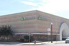
 Downtown
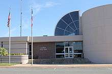
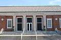 Ward R. Burke United States Courthouse
 Municipal Court
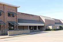
 Texas Forestry Museum
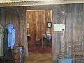 Replica of a sawmill worker's house at the Texas Forestry Museum
 Pines Theater
 Naranjo Auditorium
Government
Local government
According to the city's most recent Comprehensive Annual Financial Report, the city's various funds had $56.6 million in revenues, $52.8 million in expenditures, $192.2 million in total assets, $66.4 million in total liabilities, and $24.9 million in cash and investments.[11]
Lufkin has a council-manager form of government with all legislative and policy responsibilities vested in the city council and all administrative responsibilities vested in the city manager. The city council is composed of the mayor and council members representing six wards.
Education
Almost all of Lufkin is served by the Lufkin Independent School District, with a few small sections in the west within the Hudson Independent School District A very small portion of the town on Highway 69 is within Central ISD. Lufkin also has a small charter school, Pineywoods Community Academy, that serves grades K-12 and is an early college high school. Angelina College and Texas Bible College serve the area. A sizable number of people in Lufkin attend Stephen F. Austin State University in nearby Nacogdoches.
Media
Lufkin currently has a growing number of media.
Newspaper
Television
Radio
AM stations
FM stations
- KSAU: 90.1 Your East Texas Alternative (College)
- KYKS: Kicks 105 (Country)
- KJCS: 103 The Bull (Classic Country)
- KYBI: Y100 (Country)
- KSML-FM: Super Mix 101.9 (Regional Mexican)
- KAFX-FM: KFOX 95.5 (Top 40)
- KLDN: Red River Radio (NPR)
- KTBQ: Classic Rock Q107 (Classic Rock)
- KVLL: My 94.7 (Adult contemporary)
- KSWP: 90.9 KSWP (Contemporary Christian)
- KAVX: KAVX 91.9 (Christian talk)
- KXXE: The New Country Channel (Hot Country)
- KOYE: La Invasora 97.5 (Regional Mexican)
- KTHT: Country Legends 97.1 (Classic Country)
- KAGZ: Z93.9 (Hip Hop/R&B)
Infrastructure
Transportation
Lufkin is served by U.S. Highway 69, U.S. Highway 59, State Highway 94, and State Highway 103.
Lufkin will be served by the extension to Interstate 69 which is planned to run from the Canada–US border at Port Huron, Michigan, to the Texas/Mexico border.[12]
General aviation service is provided by Angelina County Airport.
The Coach USA bus lines serve Lufkin, carried under the Kerrville Bus Company.
Brazos Transit District (formerly Brazos Valley Transit Authority) provides regularly scheduled public bus service in the Lufkin area.[13]
The Angelina and Neches River Railroad (A&NR) runs through Lufkin. It has an approximate length of 20 miles (32 km) and connects with the Union Pacific Railroad lines.
Health care
Lufkin is served by two Hospitals, CHI St. Luke's Health Memorial (formerly Memorial Health System of East Texas at Lufkin) which includes the Arthur Temple Sr. Regional Cancer Center and Woodland Heights Medical Center.
Notable people
- Trent Ashby, member of the Texas House of Representatives from Lufkin
- Brandon Belt, San Francisco Giants first baseman and 2012 World Series champion
- Dez Bryant, former Oklahoma State University standout; former Dallas Cowboys wide receiver. Current NFL Free Agent
- Carrington Byndom – current Carolina Panthers cornerback
- Medford Bryan Evans, college professor, author, conservative political activist, born in Lufkin in 1907
- Corey Clark, American Idol contestant, famous for his alleged affair with Paula Abdul, and disqualification from the show for legal troubles
- Jermichael Finley, former Texas Longhorns football standout and Green Bay Packers tight end
- William Delbert Gann or WD Gann, finance trader
- Anthony Denman, American football player
- Rex Hadnot, former Houston Cougars guard; current San Diego Chargers guard
- Dante Hall, former Texas A&M running back; former Kansas City Chiefs and St. Louis Rams wide receiver and return specialist
- Max Hopper, pre-eminent modern-era CIO and a founding father of IT-inspired competitive advantage
- Ken Houston, Lufkin Dunbar graduate who played for the Houston Oilers and Washington Redskins; Pro Football Hall of Famer
- Ray Jones, NFL player
- Reagan Jones, founder and vocalist of electronica band Iris.
- Terrence Kiel, former Texas A&M University and San Diego Chargers safety
- Jorvorskie Lane, current Tampa Bay Buccaneer fullback, former Texas A&M University football player; held school record for career rushing touchdowns (49) for three years
- Abe Martin, college football coach
- Jamarkus McFarland, University of Oklahoma , San Diego Chargers (NFL) , BC Lions / Winnipeg Bluebombers (CFL) football player
- Reggie McNeal, former Texas A&M University quarterback and Cincinnati Bengals wide receiver
- Allen R. Morris, Emmy Award-winning producer/director/writer; 1972 Lufkin High School graduate; began TV career at KTRE
- Don Muhlbach, former Texas A&M University football player; current Detroit Lions deep snapper
- Tom Murphy, former Major League Baseball (MLB) pitcher
- Matt Purke, MLB baseball player
- Jim Reese, former guitarist for the Bobby Fuller Four lived there until his death in 1991 and is buried in the Garden of Memories cemetery.
- Joe Robb, former St. Louis Cardinals lineman
- Ryan Rottman – actor
- Pete Runnels, former Washington Senators, Boston Red Sox, and Houston Colt .45s infielder
- Kimberly Saenz, convicted serial killer
- Chris Seelbach, former Atlanta Braves pitcher[14]
- Jacoby Shepherd – former NFL cornerback
- Allan Shivers, 37th Texas governor, 1949–1957
- Buddy Temple, businessman and former politician
- T.J. Turner – former NFL defensive end
- Charlie Wilson, former U.S Representative best known for his involvement in Operation Cyclone, as depicted in the book and movie Charlie Wilson's War
- J. Frank Wilson, lead vocalist of J. Frank Wilson and the Cavaliers
References
- 1 2 "American FactFinder". United States Census Bureau. Retrieved 2008-01-31.
- ↑ U.S. Geological Survey Geographic Names Information System: Lufkin
- ↑ "Find a County". National Association of Counties. Retrieved 2011-06-07.
- ↑ "Geographic Identifiers: 2010 Demographic Profile Data (G001): Lufkin city, Texas". U.S. Census Bureau, American Factfinder. Retrieved August 9, 2013.
- ↑ "US Gazetteer Files 2016-Places-Texas". US Census. Retrieved 11 January 2017.
- ↑ Jacobus, Robert D. Houston Cougars in the 1960s: Death Threats, the Veer Offense, and the Game of the Century. Texas A&M University Press, November 18, 2015. ISBN 162349348X, 9781623493486. PT225 (Google Books)
- ↑ "Population and Housing Unit Estimates". Retrieved June 9, 2017.
- ↑ "Census of Population and Housing". Census.gov. Retrieved June 4, 2015.
- ↑ City of Lufkin CAFR Retrieved 2009-08-18
- ↑ Vernon N. Kisling, Jr., ed. (2001). "Zoological Gardens of the United States (chronological list)". Zoo and Aquarium History. USA: CRC Press. ISBN 978-1-4200-3924-5.
- ↑ City of Lufkin CAFR Retrieved 2009-08-18
- ↑ . Alliance for I-69 Texas http://www.i69texasalliance.com/i69.html. Retrieved 27 June 2014. Missing or empty
|title=(help) - ↑ . Brazos Transit District http://www.btd.org/. Retrieved 17 March 2014. Missing or empty
|title=(help) - ↑
External links

Municipalities and communities of Angelina County, Texas, United States | ||
|---|---|---|
| Cities | 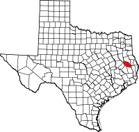 | |
| CDP | ||
| Other unincorporated communities | ||