List of locations in the Port of London

This is a list of about 680 former or extant wharves, docks, piers, terminals, etc. of the Port of London, the majority of which lie on the Tideway of the River Thames, listed from upstream to downstream.
Many of the docks closed after the mass uptake of containerisation changed the face of the industry and bringing about an end to an era, and a demise to the occupation of the docker as it then was.
Those marked with a † have at present the status of a safeguarded wharf. Those in italics are no longer used for port or river transit related activities. Further remarks are made in brackets, including in some cases the present operator or cargo handled.
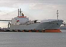
It is estimated that in 1937, at the height of London's trade, there were around 1,700 wharves between Brentford and Gravesend.[1] Today there are around 70 active terminals, each generally handling much greater volumes. Much of the cargo and commodities handling by the Port of London takes place in the downstream stretches of the Thames beyond Greater London, on the banks of south Essex (Thurrock) and north Kent. The Port of London Authority controls operations from its base in Gravesend. The main container terminal is currently at Tilbury, though in 2008 construction began on the London Gateway project, which will become the largest single component of the Port of London when completed.


South bank
Kew
Mortlake and Barnes

- Stag Brewery
- St Mary's Wharf[2]
- site of Mortlake Power Station[2]
- Mortlake Wharf
- Small Profits Draw Dock[2]
- Harrod's Wharf
Putney
Wandsworth
- River Wandle
- Feathers Wharf
- Western Riverside (solid waste transfer station) †
- Wandsworth Riverside Quarter Pier (TfL river service)
- Pier Wharf †
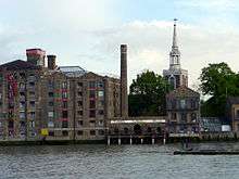
Battersea
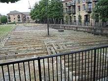
_-_geograph.org.uk_-_828400.jpg)

- Sherwood Wharf[3]
- Plantation Wharf,[3] site of Manbre & Gartons works (sugars)
- site of original Price's Candles works
- Shell Wharf
- Bridges Wharf
- Oyster Wharf
- site of jetty for Lombard Road Power Station
- Regent Wharf[3]
- site of original Morgan Crucible Company works
- site of C & J Fields candle works
- Ransomes Dock
- site of Albert Bridge flour mills
(Albert Bridge)
(Chelsea Bridge)
- former Battersea Power Station
- The Battersea Barge
- Cringle Dock †
- Metro Greenham (RMC Battersea) †
Vauxhall and Lambeth
- Middle Wharf (Cemex Vauxhall) †
- Prescot Wharf
- Bourne Valley Wharf
- St George Wharf
- Tamesis Dock
- White Hart Draw Dock (river access under the Albert Embankment)
- site of Royal Doulton pottery[5]
- Lambeth River fire station
- Lambeth Pier
(Lambeth Bridge)
(Westminster Bridge)
- Acre Wharf[6] (now County Hall)
- Waterloo Millennium Pier (TfL river service)
- College Wharf[6]
- India Store Depot[6]
- Bangor Wharf[6]
Southwark


- Festival Pier (TfL river service)
- Old Shot Tower Wharf[7]
- Commercial Wharf[7]
- Waterloo Dock[7]
- New Barge House Wharf[7]
- Old Jamaica Wharf[7]
- Old Bull Stairs Wharf[7]
- Greystone Lane Wharf[7]
- Jamaica Wharf[7]
- Blackfriars Bridge Wharf[7]
(Blackfriars Bridge)
(Blackfriars Railway Bridge)
- Foundry Wharf[8]
- Falcon Draw Dock[7]
- Holland Wharf[8]
- Iron Wharf[9][8]
- Honduras Wharf[7][9][8]
- Willow Wharf[7][9][8]
- Royal George Wharf[7][9][8]
- former Bankside Power Station[8][10]
- Travers & Crown Wharf[8]
- Queen's Wharf[7]
- Phoenix Wharf[8]
- Devonshire Wharf[7]
- Globe Wharf[7]
- British Lion Wharf[8]
- Greenmore Wharf[8]
- Stone Wharf[7]
- Bankside Pier/Jetty (TfL river service)
- Emmerson Wharf[8]
- Windsor Wharf[8]
- Benbow Wharf[8]
- Sturtivant Wharf[8]
- Bear Wharf[8]
- Bear Garden Wharf[8]
- St Helen's Wharf[8]
- Cast Iron Wharf[7]
- Scott's Wharf[7][8]
- Universal Wharf[8]
Upper Pool
- Fenning's Wharf [1][7][9]
- Sun Wharf [1]
- Topping's Wharf [1][7]
- St Olaf House (Hay's Wharf offices) [1]
- Chamberlain's Wharf [1][7]
- Cotton's Wharf [7][9]
- Humphery's Wharf [1]
- London Bridge City Pier/Hays Wharf Pier (TfL river service)
- Hay's Dock and Wharf [1][7]
- Wilson's Wharf [1][7][9]
- Griffin's Wharf [1]
- South Thames Wharf [1]
- Gun & Shot Wharves [7]
- Symon's Wharf [1][7]
- Stanton's Wharf [1][7]
- St Olave's Wharf [1]
- Pickle Herring Wharf [1]
- Mark Brown's Wharf [1]
- Tower Bridge Wharf [1]
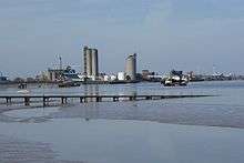
Bermondsey

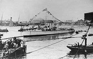
.jpg)

- Burtt's Portland Wharf [13]
- Anchor Brewhouse [1]
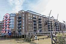
- Butler's Wharf [1][12]
- Horselydown Wharf [1]
- Coventry's Wharf [1]
- Cole's Upper and Lower Wharves [1][13]
- Newell's Wharf [13]
- Shad Thames
- St Saviour's Dock [14]
- St Andrew's Wharf [3]
- Meriton's Wharf,[1] later New Concordia Wharf [3]
- Reed's Wharf [1]
- Uveco Wharf[1]
- Deverell's Wharf [1]
- Downing's Wharf [1]
- Reed's Lower Wharf [1]
- Redman's Wharf [1]
- Springall's Wharf [1]
- Adlard's Wharf [1]
- Brunswick Wharf,[1] later Sterling Wharf
- Seaborne Coal Wharf [1]
- London Grist Mills [1]
- East Lane Wharf [1]
- Chamber's Wharves [1]
- Bond's Wharf [1]
- Fountain Dock [1]
- Darnell's Wharf [15]
- Fountain Stairs Wharf [1]
- Powell's Wharf [1]
- Farrand's Wharf [1]
- Cherry Garden Wharf [1]
- Cherry Garden Pier [1][11][12]
- Lucas and Spencer's Wharf [1]
Rotherhithe

- Corbett's Wharf [1]
- National Wharf [1]
- Platform Wharf [1][12]
- Platform Sufferance Wharf [1]
- Braithwaite & Dean's Wharf [16]
- Pace's Wharf [1]
- Pocock's Barge Yard [16]
- Cochin Wharf [1]
- Yardley's Wharf [1]
- Matthew's Wharf [1]
- Rotherhithe Wharf [1]
- Cannon Wharf [1]
- Abbot's Wharf [1]
- Gordon's Wharf [1][17]
- Prince's Wharf [1]
- Carr's Wharf [1]
- Beard's Wharf [1]
- East India Wharf [1][17]
- Bombay Wharf [1]
- Hope Wharf [1][17]
- Thames Tunnel Mills [1][17]
- Grice's Wharf [1]
- Claydon's Wharf [1]
- Genisi's Wharf [18]
- Brandram's Wharf [1]
- Charles Hay's Barge Yard [18]
- Fisher's Sufferance Wharf [18]
- Cumberland Wharf [1][17]
- Carolina Wharf [1][17]
- Ransome's Wharf [1][17]
- Norway Wharf [1][17]
- Clarence Wharf [1][17]
- Dinorwic Wharf [1][10]
- Surrey Commercial Docks
- Surrey Commercial Wharf [1]
- Bull Head Wharf [17][19]
- King and Queen Wharf [1]
- Bellamy's Wharf [1][19]
- Prince's Wharf [19]
- Lower King and Queen Wharf [1][19]
- Upper Globe Wharf [1][10][19] (rice); once Upper Globe Dock Shipyard
- Normandy Wharf [19]
- Crown Lead Works [1]
- Horseferry Wharf [1]
- Grand Surrey Wharf [19]
- Lavender Dock shipyard, later Lavender Wharf [1][10][17][19] (Castrol)
- Lavender Lock entrance to Lavender Pond [17][19]
- Pageant Wharf [1][17]
- Upper Ordnance Wharf [1][17][20] (Enthoven Lead Works)
- Sunderland Wharf [17][19][20]
- Cuckold's Point, once site of Limehouse Hole ferry
- Canada Wharf,[17][20] later Columbia Wharf,[1][19] now part of DoubleTree by Hilton Hotel London - Docklands Riverside
- Nelson Dock Pier
- Nelson Dry Dock [1][10][19][20]
- Danzig Wharf [1][19][20]
- Albion Wharf [1][17][19][20]
- Somerset Wharf [1][17]
- Lawrence's Wharf [1][10][19][20]
- Durand's Wharf [1][10][17][19][20]
- Trinity Wharf [1][10][17][19][20]
- Acorn Wharf,[17] later South Wharf [1][10][19]
- Barnard's Wharf,[19][20] later Odessa Wharf[1][10]
- Commercial Dock Pier [19] later Commercial Pier Wharf[10]
- Atkin's Wharf,[20] Redriff Wharf,[1][19] later New Caledonian Wharf[10]
- Greenland Dock [21]
- Greenland Dock Pier [21]
- South Dock Marina [21]
- St George's Wharf [1][10][22] later site of Manganese Bronze and Brass works[23]
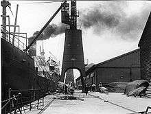
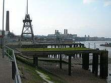
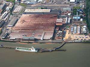
Deptford and Deptford Creek
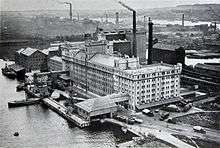
_-_geograph.org.uk_-_1971437.jpg)
- Deadman's Dock,[22] later Deadman's Wharf, later Deptford Wharf[1][23]
- site of Royal Victoria Victualling Yard [22][23]
- site of Deptford Supply Reserve Depot, part of the Deptford Dockyard [22][24] later the Foreign Cattle Market,[23][25] later Convoy's Wharf †
- Palmer's Wharf [10]
- Watergate Stairs, site of Deptford Ferry [24]
- site of Payne's Paper Wharf [1][10]
- site of Borthwick's Cold Stores [1][10]
- site of Deptford Power Station [1][10]
- site of The Stowage,[1][25][26][27] East India Company shipyard, later General Steam Navigation Co's Deptford Green Dockyard [22][28]
- Deptford Creek [29]
- Brewery Wharf (active aggregate wharf) [27] †
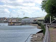
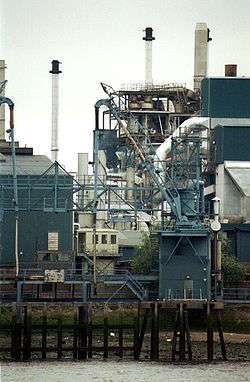
Greenwich
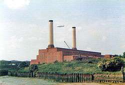
_-_geograph.org.uk_-_1987565.jpg)
- Phoenix Wharf (Phoenix Gas Light & Coke Co),[26][28] later Granophast Wharf [1]
- Dreadnought Yard [1] (originally J & G Rennie's shipyard)[26][28]
- Victoria & Norway Wharf [1][28]
- site of Greenwich Vehicular Ferry [26]
- Talbot's Wharf [1]
- Billingsgate Dock [1][26][27][28]
- Dodd's Wharf [1]
- Greenwich Pier (TfL river service)[26][27][28]
- former Dreadnought Seamen's Hospital (now part of University of Greenwich)
- former Royal Naval College, now National Maritime Museum
- High Bridge Wharf [27]
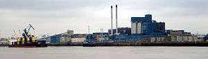
- Greenwich Power Station [10]
- Crowley's Wharf [26][27][28]
- Port of London Wharf [28]
- Union Wharf [26][27]
- Greenwich Wharf [26][27][28]
- Lovell’s Wharf [1][10] (status as a safeguarded wharf now lost)
- Granite Wharf [10][26][27] (status as a safeguarded wharf now lost)
- Badcock's Wharves [3]
- Piper's Wharf,[3][27] Thames craft dry docking[30]
Greenwich Peninsula
- Enderby's Wharf[10][26][27] (originally the rope works of a whaling company, subsequently a submarine cable works owned by a succession of firms from Glass Elliot (1857) including STC, currently Alcatel)
- Tunnel Glucose † (formerly Thames Soap and Candle Works)[26][28]
- Morden Wharf[26][27][28]
- Primrose Wharf[10]
- Bay Wharf[10] (site of Maudslay Son & Field shipyard)[31]
- Victoria Deep Water Terminal (Hanson Aggregates; originally Bessemer's steel works;[31] Victoria linoleum;[32][33] container terminal until the 1990s)[10] †
- Imperial Wharf[33]
- Sussex Wharf[32][33]
- Delta/Blackwall Wharf[10][33](originally Delta Metals brass, bronze etc. works) (major aggregates wharf now lost - redeveloped as part of the Greenwich Peninsula masterplan)
- Draw dock
- Ordnance Wharf[10][32][33] (originally Blakely's Ordnance Works making heavy guns)[31]
- site of Blackwall Point dry dock[32][33]
- Blackwall Point[31][32][33]
- site of South Metropolitan Gas Co's East Greenwich Gas Works[10][32][33]
- Queen Elizabeth II Pier (TfL river service) on site of gas works coaling jetty[10]
- Phoenix Wharf[3]
- site of Blackwall Point Power Station[10]
New Charlton

- Peartree Wharf
- Angerstein Wharf[10][34][35] † (aggregates wharf with rail head)
- Murphy’s Wharf (Tarmac, major existing aggregates terminal)†
- Cory's Barge Works[35]
- Charlton Parish Wharf[35]
- Durham Coal Wharf[35]
- Charlton Wharf[34]
- Charlton Ballast Wharf[34]
- Riverside Wharf † (Tarmac)
- Telegraph Wharf[35]
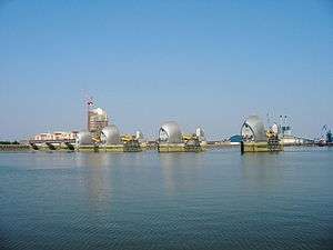
- Barrier Gardens Pier (Port of London Authority)
- Thames Barrier
Woolwich

- Warspite Wharf (site of Siemens Brothers telegraph works)
- Long's Wharf
- Trinity Wharf
- site of Woolwich Dockyard[36][37]
- Royal Dockyard Wharf[37]
- Parish Wharf[37]
- Woolwich Free Ferry southern landing stage[37]
- site of Woolwich Power Station[10]
- Woolwich Arsenal Pier (TfL river service)
- site of Woolwich Arsenal[10][36][37]
- Margaret or Tripcock Ness[10]
- Cross Ness
- Crown Wharf (off Globe Lane)
Belvedere, Erith and Crayford Ness
- Belvedere Incinerator
- site of Belvedere Power Station[38]
- Borax Wharf/Manor Wharf †
- Mulberry Wharf †
- Jenningtree Point
- Pioneer Wharf †
- Albion Wharf † (includes numerous jetties and landing stages)
- RMC Erith (jetty and landing stages) †
- site of BICC cable works
- ADM Erith
- Ballast Wharf
- Chalk Farm Wharf
- Erith Pier (formerly in commercial use, now rebuilt for leisure)
- Garden Wharf
- Railway Wharf (RMC) †
- Standard Wharf †
- European Metal Recycling
- Crayford Ness
Dartford, Greenhithe and Swanscombe
- Thames Europort
- CdMR Dartford (ro-ro ferry terminal).
- Johnson's Wharf (aggregates)
- Globe Wharf
- Bell Wharf
Northfleet and Gravesend
- Broadness
- Northfleet Wharf
- Britannia Terminal
- Seacon Terminals Tower Wharf (steel, forest products)
- Robin’s Wharf
- Brett Aggregates
- Bevan’s Wharf
- Northfleet Terminal (Kimberly-Clark)
- Red Lion Wharf
- Bowater's Wharf
- Fletchers Wharf, Gravesend
- Baltic Wharf
- West Street Pier
- Commercial Wharf
- Town Wharf, Gravesend
- Gravesend - Tilbury Ferry landing stages
- Town Pier, Gravesend
- Royal Terrace Pier and landing stage, Gravesend (headquarters of the Port of London Authority)
- Custom House Pier, Gravesend
- Gravesend Canal Basin
- Denton Wharf and Jetty, Gravesend (owned by the Port of London Authority and main base for PLA vessels)
- Jetty (Metropolitan Police training centre)
- Clubb’s Marine Terminal (sea-dredged aggregates)
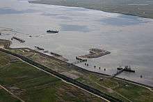
Cliffe
- North Sea Terminal (sea-dredged aggregates)
- Lower Hope Point
- Yantlet Creek
Below here lie the Medway ports including Thamesport, a container port on the site of BP's Kent oil refinery on the Isle of Grain and Sheerness on the Isle of Sheppey. These are not part of the Port of London.
North bank
Isleworth
Brentford and Strand-on-the-Green
- Brentford Dock[2] (formerly a major trans-shipment point between the river and the Great Western Railway)
- River Brent and Grand Union Canal entrance
- site of Thames Soap Works
- Point Wharf
- Goat Wharf[2]
Chiswick
(Chiswick Bridge)
(Barnes Railway Bridge)
- Lep Wharf
- Chiswick Pier
- River Wharf[2]
- Church Wharf,[2] site of Thornycroft's first torpedo boat yard, later Cherry Blossom shoe polish
- Chiswick Wharf[2]
- Fuller's Griffin Brewery[2]
- Chiswick Draw Dock
- Durham Wharf[2]
- St Peter's Wharf[2]
Hammersmith
- Queen's Wharf[2]
- Gwynne's Wharf[2]
- Chancellor's Wharf[2]
Fulham and Sands End

- Distillery Wharf[2] (site of Haig distillery)
- site of Manbre's sugar works (later Manbre & Garton)
- Duckham's Wharf[2] (formerly Duckham's Motor Oil works)
- Thames Wharf[2]
- Dorset Wharf[2] (formerly Anglo-American Oil Company)
- Tea Rose Jetty and Wharf[2]
- Palace Wharf[2]
- Crabree Wharf[2]
- Crabtree Draw Dock[2]
- Wheatsheaf Wharf
- Rosebank Wharf[2]
- Redline Wharf[2]
- Blakes Wharves[2]
- National Benzole Wharf[2]
- Eternit Wharf[3]
- Stevenage Wharf[2]
- Broomhouse Draw Dock
- Petrofina Wharf
- Whiffin Wharf
- Hurlingham Wharf[3] †
- Trinidad Wharf[3] (former asphalt wharf)
- Albert Wharf
- Swedish Wharf †
- Comley’s Wharf (RMC Fulham) †
- Fulham Wharf[3]
- site of Fulham Power Station
- Shell Wharf[3]
- Lensbury Wharf[3]
- site of Imperial Gas Works pier
- Nacovia Wharf[3]
- Chelsea Harbour Pier[3] (TfL river service)
- Chelsea Harbour marina[3] (formerly Chelsea Basin)
Chelsea

- Counter's Creek
- former Lots Road Power Station
- Cremorne Wharf[3] †
- Chelsea Wharf[3]
- Durham Wharf[4]
- Cadogan Pier[3] (TfL river service)
Westminster and City of London
- Dinorvic Wharf, now Westminster Boating Base [3]
- St George's Wharf [39]
- Somerset Wharf [39]
- Chester Wharf [39]
- Eagle Wharf [39]
- Baltic Wharf, site of Castle's Shipbreaking Company
- Millbank Millennium Pier (TfL river service)
(Lambeth Bridge)
(Westminster Bridge)
- Westminster Millennium Pier (TfL river service)
- PS Tattershall Castle
- RS Hispaniola
- Embankment Pier (TfL river service)
- Savoy Pier
- TS Queen Mary
- Temple Pier
- The Yacht (formerly PLA yacht St Katherine)
- HMS President
- Blackfriars Millennium Pier (TfL river service)
(Blackfriars Bridge)
(Blackfriars Railway Bridge)
- Puddle Dock[7]
- Wheatsheaf Wharf[7]
- England Wharf[7]
- Crown Wharf[7]
- Horseshoe Wharf[7]
- Anchor Wharf[7]
- Castle Baynard Dock[7]
- Lion Wharf[7]
- Paul's Wharf[7]

- Trig Wharf[7]
- Broken Wharf[7]
- Brook's Wharf[7]
- Maidstone Wharf[7]
- Queenhithe Dock[7]
- Kennet Wharf[7]

- Bell Wharf[9]
- Dowgate Dock
- Kennet Wharf[7]
- Walbrook Wharf[9] (waste transfer station) †
(Cannon Street Railway Bridge)
- Allhallows Pier[40][41]
- Red Bull Wharf[40]
- Dyers' Hall Wharf[40]
- Commercial Wharf[40]
- Swan Lane Pier/Dolphin Pontoon
- Old Swan Wharf[40]
- Fishmongers Hall Wharf[9][40]
Upper Pool

- London Bridge Wharf [1][40][41][42]
- Fresh Wharf [1][40]
- Cox and Hammond's Wharf [1]
- Nicholson's Wharf [1][40]
- Grant's Quay Wharf
- Billingsgate Market [1][40][41][42]
- Custom House Wharf [1][9][40][41][42]
- Custom House and Wool Quays [40][41][42]
- Galley Dock and Quay [1][40][41][42]
- Chester Quay [1][40]
- Brewer's Quay [1][40]
- Tower Millennium Pier (TfL river service)
Wapping and Shadwell


- Irongate Wharf [1][11][12]
- St Katharine Wharf [1][11][12]
- St Katharine Docks
- St. Katharine Pier (TfL river service)
- Harrison's Wharf [1]
- South Devon Wharf [1]
- British and Foreign Wharves [1]
- HMS President (stone frigate)
- Miller's Wharf [1]
- Carron Wharf [1][11][12]
- London and Continental Steam Wharf[1][11][12]
(Hermitage entrance to London Docks)
- Hermitage Steam Wharf [1]
- Colonial Wharves [1]
- Standard Wharves [1]
- Watson's Wharf [1]
- Black Eagle Wharf [1]
- Brewers Wharf [1]
- Albion Wharf [1]
- Hasties Wharf [1]
- St Helens Wharf [1]
(Wapping entrance to London Docks)
- Oliver's Wharf [1]
- Orient Wharf [1]
- Gun Wharf [1][11][12]
- St John's Wharf [1]
- Morocco Wharf [1][12]
- Eagle Sufferance Wharf [1][12]
- Eagle Wharf [1]
- Baltic Wharf [1]
- Old Aberdeen Wharf [1]
- Wapping Police Station
- St John's Wharf [1]
- Sun Wharf [1]
- Swan Wharf [1]
- Tunnel Pier [43]
- King Henry's Wharves [1]
- Gibb's Wharf [43]
- Gun Wharves [1]
- Middleton and St Bride's Wharf [1]
- Foundry Wharf [1]
- St Hilda's Wharf [1]
- New Crane Wharves [1]
- Lower Oliver's Wharf [44]
- Lushes Wharf [1]
- Metropolitan Wharf [1][17]
- Thorpe's and Queen Wharf [1][17]
- Pelican Wharf [1][17]
(Shadwell New Entrance to Shadwell Basin and London Docks)
Stepney (formerly Ratcliff) and Limehouse


- Sea-borne Coal Wharf[45]
- Bowle's Wharf [46]
- Free Trade Wharf [1][45][46]
- Hubbuck's Wharf [1][45][46]
- Ratcliff Cross Wharf [1][45]
- Lendrum's Wharf [1]
- Phoenix Wharf [1]
- Trinity Ballast Wharf [47]
- Marriage's Wharf[1]
- Roneo Wharf [1]
- London Wharf [1]
- Crown Mill Wharf [1][46]
- Eagle Wharf [1][46]
- New Sun Wharf [1]
- Vanes Wharf [1]
- Oporto Wharf [1]
- Old Sun Wharf [1][45][46]
- Chinnock's Wharf [1]
- entrance to Limehouse Basin (formerly Regent's Canal Dock) [48]
- Victoria Wharf [1][45]
- (former entrance to Limehouse Cut) [48]
- Hough's Wharf [1]
- Dover Wharf [1]
- Blyth Wharf, site of Stepney Power Station [49]
- Broadway Wharf [1]
- Etheridge's Wharf [1]
- Fielder's Wharf [1]
- Lamb's Wharf [1]
- Sparks' Wharf [1]
- Moline Wharf [1]
- Duke Shore Wharf [1][10][45]
- Anchor Wharf [45]
- Dunbar Wharf [45]
- Limekiln Dock [45]
- Dundee Wharf [1][45]
- River Plate Wharf [45]
- Limehouse Pier
- Buchanan's Wharf [1]
- Aberdeen Wharf [1]
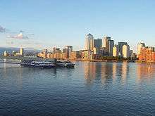
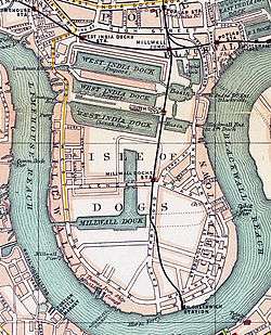
Millwall

- Mallinson's Wharf [1]
- Bridge Wharf [1] (site of original West India Docks Limehouse Upper Entrance)
- Charrington Barge Yard [1]
- Locke's Wharf [1][20]
- Union Docks,[20] later Union Docks Wharf [1]
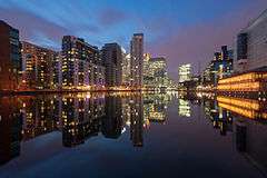
- Canary Wharf Pier (TfL river service)
(site of original West India Docks Limehouse Lower Entrance) [50]
- Morton's Sufferance Wharf [1][10][20]
- West India Dock Pier[10][20]
- Batson's & Regents Wharves [10]
- Regent Dry Dock [51]
- Oak Wharf [20]
- London Wharf [1][20]
- Bullivant Wharf [1][20] later Express Wharf [10] (Seacon London Steel Terminal, moved to Northfleet late 1990s)
- Hutching's Wharf [1][10][20]
- Ocean Wharf [1][10]
- Lion Wharf [1][20]
- Lollar Wharf [1]
- Glengall Wharf [52]
- site of Atlas Chemical Company,[17][20] later Atlas Wharf [10]
- Timothy's Wharf [1][17][20]
- Mellish Wharf [1][17][20][53] later Arnhem Wharf [10]
- Fenner's Wharf [1][20][53] later Klein's Wharf [10]
(site of original Millwall Dock entrance) [52]
- Phoenix Wharf [20][22][23][25][53]
- Snowdon's Wharf [1]
- Winkley's Wharf [10][23][25][53]
- Cyclops Wharf (site of Le Bas Tube Co works)[10][23]
- site of Millwall Pier [22][25][53]
- Victoria Wharf [23][25][53] (site of Crosse & Blackwell, later Le Bas Tube Co works)
- Anchor Wharf (site of Brown, Lenox & Co chain and anchor works) [22][23]
- Cutler's Wharf (site of Providence Iron Works, makers of boilers, gas holders etc.)
- Masthouse Terrace Pier
- site of Drunken Dock,[54] later Ferguson's Wharf,[10][23] Rose's Wharf [10][23] and St Andrew's Wharf [10][23][25]
- site of Tindall's Dry Dock, later Britannia Dock [22][25]
- Guelph Wharf [1][23]
- site of Napier Yard[23][25][26][27] and Millwall Iron Works [26][28]
- Venesta Wharf [1]
- Burrell's Wharf[10][26][27] (site of Burrell's & Co's paint works)
- Maconochie's Wharf [1][27]
- Nelson Wharf [1][26][27][28]
- Clyde Wharf,[28] later Langbourn Wharf,[26][27] later Shaw's Wharf [1][10]
- site of Millwall Lead Works,[26][27] later Locke's Wharf [1][10]
- St David's Wharf [1][27] (site of Manganese, Bronze & Brass Co, propellor makers)
- site of Antimony Works,[26] later Owen Parry's Wharf [1][27]
- site of Greenwich Vehicular Ferry,[26]
- Port of London Wharf,[27][28] later Felstead Wharf [1][10]
- Victoria Wharf,[28] later Millwall Boiler Works [1][26]
- Livingston Wharf [1]
- Midland Oil Wharf [1][27]
- Johnson's Draw Dock [1][26][27][28]
- Calder's Wharf [1]
Cubitt Town

- Honduras Wharf,[26] later Lukach Wharf[27] then Luralda Wharf[10]
- Invicta Wharf[10]
- Cumberland Mills[10][26][27]
- Newcastle Draw Dock[10][26][27][28]
- Grosvenor Wharf[10][26][27][28]
- Alpha Wharf[10][26][27]
- Poplar Dry Dock[26][27] later Empire Wharf[10]
- Storer's Wharf[26][27]
- Caledonian Wharf[10][27]
- Falcon Wharf[27]
- Cubitt Town Wharf[10][26][27]
- Plymouth Wharf[26][27][28]
- Pyrimont Wharf[26][27][28]
- Dudgeon's Wharf[26][27] (formerly shipbuilding yard of J & W Dudgeon)
- Plough Wharf,[26][28] later part of Millwall Wharf[10][27]
- London Yard[32] (Westwood, Baillie & Co shipyard; Yarrows; Morton's jam factory)[33]
- former site of Samuda Brothers shipyard[33]
- Elmer's Wharf[33]
- New Union Wharf[33]
- site of Blackwall Iron Works[31][32][33] later Ovex Wharf[10]
- Slipway Wharf[33]
- Canal Dockyard[31][32][33]
- entrance to West India Docks[31][32][33]
Blackwall and Leamouth

- Concordia Wharf[32][33]
- North Wharf[33]
- entrance to Poplar Dock and West India Docks via Blackwall Basin[31][32][33]
- Northumberland Wharf[33] † (now a waste transfer station)
- Blackwall Stairs
- Ashton Wharf[31]
- site of Blackwall Yard[31] (part later Midland Railway's Poplar Dock)[32][33]
- Brunswick Wharf[31][32][33]
- site of Brunswick Wharf Power Station[10]
- entrance to East India Docks[55]
- East India Dock Wharf[55]
- Orchard Wharf[55] †
- Trinity Buoy Wharf[31][32][33]
( Bow Creek)
Canning Town
- Eastern site of Thames Ironworks and Shipbuilding Company[31][32][55]
- Priors Wharf (Lower Lea Valley/Bow Creek) †
- Mayer Parry Wharf (EMR Canning Town) (Lower Lea Valley/Bow Creek) †
- Phoenix Wharf
- Thames Wharf[10][33] †
(site of original upper entrance to Royal Victoria Dock)
Silvertown


- Odam's Wharf (originally chemical manure works,[35] later Fisons[56])
- Clyde Wharf[35] (originally Duncan, Bell & Scott sugar refinery, later United Alkali Company)
- Hall's Wharf[35]
- Alexandra Wharf (formerly Carlsberg)
- Pinchin's Wharf, Nuplex resins (originally Pinchin Johnson & Associates paints,[56] later AkzoNobel)
- Peruvian Wharf (originally Peruvian Guano Wharf)[35] †
- Plaistow Wharf;[35] Tate & Lyle Golden Syrup works (now supplied from main site)
- site of Royal Primrose soap works
- Manhattan Wharf[10][35] †
- Mohawk Wharf
- Lyle Park
- Venesta Wharf (no longer usable) (formerly Venesta plywood factory, later Aluminium Foils Ltd)[56]
- Deanston Wharf
- Sunshine Wharf †
- Crescent Wharf[35] (formerly Brunner Mond,[56] site of Silvertown explosion, later ICI)
- Minoco Wharf (Minoco, later Gulf Lubricants)[56](status as a safeguarded wharf now lost)
- Prince Regent's Wharf (originally Burt, Boulton & Haywood chemical works[56]), now Thames Barrier Park
- Thames Barrier northern end
- Ward's Wharf
- Thames Road Industrial Estate
- Tay Wharf (formerly Keiller's marmalade factory,[35] later Crosse & Blackwell[56])
- site of Silver's India Rubber, Gutta Percha & Telegraph Co works[34][35] (later BTR Industries[56]), now Thameside Industrial Estate[10]
- Tate & Lyle Thames Refinery and jetty[37][56]
- Cairn Mills (formerly Loders & Nucoline,[56] later Loders Croklaan oil seed works)
North Woolwich
- site of Western Electric Co's cable works[37] (later STC)
- site of W.T. Henley's submarine cable works (later AEI)
- Woolwich Free Ferry north pier[37]
- Woolwich foot tunnel
- Hoba Wharf
- Gallions Point
- site of Harland & Wolff ship repairers[10]
- entrance to Royal Docks[10] (remains in use for boat exhibitioning)
- site of filled South Entrance to basin of Royal Albert Dock[10][37]
- North Entrance to basin of Royal Albert Dock,[10][37] now used for Gallions Point Marina
Beckton
- Gallions Jetty (formerly Cory & Son)
- New Beckton Wharf (formerly BP)
- site of Beckton Gas Works and coaling piers
- Beckton Reach Sewerage Works Pier
Barking Creek
The following wharves are located on the lower section of the River Roding, at Creekmouth.
- Welbeck Wharf †
- Pinns Wharf †
- Kierbeck & Steel Wharves †
- Debden Wharf (recently improved) †
- Rippleway Wharf †
- Alexander Wharf (no longer usable)
- Maple Wharf (in use?)
- Bowen Wharf (backland built over; not usable)
- New Free Trade Wharf (backland built over; not usable)
- Dockland Construction Wharf (has been redeveloped into industrial units)
- Docklands Wharf †
- Victoria Stone Wharf †
Creekmouth
- Lawes Wharf
- DePass Wharf †
- Barking or False Point
- original site of Barking Power Station[38]
- Barking Riverside Recycling Plant
Dagenham Dock
- RMC Roadstone †
- No 7 Jetty (ex-Rugby Cement) (currently vacant)
- Thunderer Jetty (TDG Dagenham, now Norbert Dentressangle - petrol, distillates, aviation fuel, biofuels, tallow, ethanol, fertilisers, urea etc.)
- Pinnacle Terminal †
- White Mountain Roadstone †
- Hunts Wharf (Van Dalen) †
- Hanson Aggregates †
- Ford Dagenham Terminal †
Rainham
- Phoenix Wharf/Frog Island †
- site of Murex works[38]
- Tilda Rice †
- Veolia jetty and landfill site
- Coldharbour Point
Purfleet


West Thurrock and Grays
- Lafarge Jetty (sea-dredged aggregates)
- Thurrock Marine Terminal (dry bulk cement)
- Vopak Terminal London (liquid bulks - petroleum products and chemicals - liquid fertilisers, gases; vegetable oils and fats)
- Stone Ness
- West Thurrock Jetty (ICL chemical works - dry bulks; chemical powders)
- Procter & Gamble detergent works
- Gibbs Wharf (dry bulk - limestone aggregate, coal and other minerals)
- Nustar Grays Terminal (diesel, gas oil, paraffin, petrol, ethanol)
- Bruce's Wharf[38]
- Goldsmith's Wharf[38]
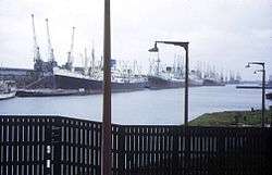
Tilbury
See Port of Tilbury for the main dock system.
- Tilbury Grain Terminal (cereals)
- Northfleet Hope Terminal (containers)
- Tilbury Ness
- London International Cruise Terminal, Tilbury
- Tilbury Power Station
- Coalhouse Point
- Mucking wharf (refuse)
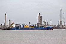
Shell Haven, Coryton, Canvey Island and Southend
- London Gateway port, formerly Shell Haven oil refinery
- Thames Haven
- Thames Oilport, formerly Coryton Refinery
- Hole Haven, proposed (1972) refinery, unused jetties extant
- Oikos Storage, formerly London & Coastal Oil Wharves Ltd, Canvey Island
- Texaco Ltd, formerly Regent Oil Company, Canvey Island (now closed)
- Calor Gas Terminal, formerly North Thames Gas Board/British Gas Corporation, Canvey Island
- Deadman's Point
- Billet wharf, Leigh-on-Sea (shellfish)
- Victoria wharf
- Strand wharf
- Bell wharf, Leigh-on-Sea
- Crow Stone, Southend (former seaward limit of Port of London)
- Southend pier
- Southend Corporation loading pier
- Gas works pier, Southend
- Barge pier, Shoeburyness
References
- 1 2 3 4 5 6 7 8 9 10 11 12 13 14 15 16 17 18 19 20 21 22 23 24 25 26 27 28 29 30 31 32 33 34 35 36 37 38 39 40 41 42 43 44 45 46 47 48 49 50 51 52 53 54 55 56 57 58 59 60 61 62 63 64 65 66 67 68 69 70 71 72 73 74 75 76 77 78 79 80 81 82 83 84 85 86 87 88 89 90 91 92 93 94 95 96 97 98 99 100 101 102 103 104 105 106 107 108 109 110 111 112 113 114 115 116 117 118 119 120 121 122 123 124 125 126 127 128 129 130 131 132 133 134 135 136 137 138 139 140 141 142 143 144 145 146 147 148 149 150 151 152 153 154 155 156 157 158 159 160 161 162 163 164 165 166 167 168 169 170 171 172 173 174 175 176 177 178 179 180 181 182 183 184 185 186 187 188 189 190 191 192 193 194 195 196 197 198 199 200 201 202 203 204 205 206 207 208 209 210 211 212 Craig, Charles; Diprose, Graham; Seaborne, Mike (2009). London's Changing Riverscape. London: Frances Lincoln Ltd. ISBN 9780711229419.
- 1 2 3 4 5 6 7 8 9 10 11 12 13 14 15 16 17 18 19 20 21 22 23 24 25 26 27 28 29 30 31 32 33 34 35 36 37 38 39 40 41 42 Rowing on the Tideway: A chart to accompany the code of practice for rowing on the tidal Thames above Putney (PDF) (Map). Port of London Authority. 2006.
- 1 2 3 4 5 6 7 8 9 10 11 12 13 14 15 16 17 18 19 20 21 22 23 Big London A-Z (Map). Geographers' A-Z Map Company Ltd. 1995. ISBN 0-85039-273-X.
- 1 2 Central London Map (Map). 1:10000. Ordnance Survey. 1981.
- ↑ "The Departure of Royal Doulton from Lambeth" (PDF). Archaeological Data Service.
- 1 2 3 4 London Sheet 7.84, Waterloo & Lambeth Marsh 1872 (Map). 1:1056 reduced to 1:1760. Old Ordnance Survey Maps, The Godfrey Edition. Alan Godfrey. 1993. ISBN 978-0-85054-634-7.
- 1 2 3 4 5 6 7 8 9 10 11 12 13 14 15 16 17 18 19 20 21 22 23 24 25 26 27 28 29 30 31 32 33 34 35 36 37 38 39 40 41 42 43 44 45 46 47 48 49 50 Stanford's Library Map of London (Map). Edward Stanford Ltd. 1877.
- 1 2 3 4 5 6 7 8 9 10 11 12 13 14 15 16 17 18 19 20 21 22 23 24 25 26 27 28 29 30 J.G. Eves, and R.F. Hazell (1954). River Thames Wharf Directory. London: Gaselee & Son.
- 1 2 3 4 5 6 7 8 9 10 11 12 13 14 15 Basemap, Londinium: A descriptive map and guide to Roman London (Map). Ordnance Survey. 1981.
- 1 2 3 4 5 6 7 8 9 10 11 12 13 14 15 16 17 18 19 20 21 22 23 24 25 26 27 28 29 30 31 32 33 34 35 36 37 38 39 40 41 42 43 44 45 46 47 48 49 50 51 52 53 54 55 56 57 58 59 60 61 62 63 64 65 66 67 68 69 70 71 Carr, R.J.M, ed. (1986). Dockland: An illustrated historical survey of life and work in east London. NELP/GLC. ISBN 0-7168-1611-3.
- 1 2 3 4 5 6 7 London Sheet 77, Bermondsey & Wapping 1894 (Map). 1:2500 reduced to 1:4340. Old Ordnance Survey Maps, The Godfrey Edition. Alan Godfrey. ISBN 978-0-85054-100-7.
- 1 2 3 4 5 6 7 8 9 10 11 London Sheet 77, Bermondsey & Wapping 1914 (Map). 1:2500 reduced to 1:4340. Old Ordnance Survey Maps, The Godfrey Edition. Alan Godfrey. 1983. ISBN 978-0-85054-922-5.
- 1 2 3 Ellmers, Chris; Werner, Alex (2000). London's Riverscape Lost and Found. London's Found Riverscape Partnership. p. 148. ISBN 1-874044-30-9.
- ↑ Ellmers & Werner, p. 146
- ↑ Ellmers & Werner, p. 140
- 1 2 Ellmers & Werner, p. 132
- 1 2 3 4 5 6 7 8 9 10 11 12 13 14 15 16 17 18 19 20 21 22 23 24 25 26 27 London Sheet 78, Rotherhithe 1868 (Map). 1:2500 reduced to 1:4340. Old Ordnance Survey Maps, The Godfrey Edition. Alan Godfrey. ISBN 1-84151-466-7.
- 1 2 3 Ellmers & Werner, p. 124
- 1 2 3 4 5 6 7 8 9 10 11 12 13 14 15 16 17 18 19 20 21 London Sheet 78, Rotherhithe 1914 (Map). 1:2500 reduced to 1:4340. Old Ordnance Survey Maps, The Godfrey Edition. Alan Godfrey. 1984. ISBN 0-907554-67-9.
- 1 2 3 4 5 6 7 8 9 10 11 12 13 14 15 16 17 18 19 20 21 22 23 24 25 London Sheet 78, Rotherhithe 1894 (Map). 1:2500 reduced to 1:4340. Old Ordnance Survey Maps, The Godfrey Edition. Alan Godfrey. ISBN 978-0-85054-042-0.
- 1 2 3 Ellmers & Werner, p. 102
- 1 2 3 4 5 6 7 8 9 London Sheet 91, Deptford (North) 1868 (Map). 1:2500 reduced to 1:4340. Old Ordnance Survey Maps, The Godfrey Edition. Alan Godfrey. ISBN 1-84151-687-2.
- 1 2 3 4 5 6 7 8 9 10 11 12 13 14 London Sheet 91, Deptford (North) 1914 (Map). 1:2500 reduced to 1:4340. Old Ordnance Survey Maps, The Godfrey Edition. Alan Godfrey. ISBN 978-0-85054-003-1.
- 1 2 Ellmers & Werner, p. 92
- 1 2 3 4 5 6 7 8 9 London Sheet 91, Deptford (North) 1894 (Map). 1:2500 reduced to 1:4340. Old Ordnance Survey Maps, The Godfrey Edition. Alan Godfrey. ISBN 978-1-84151-359-1.
- 1 2 3 4 5 6 7 8 9 10 11 12 13 14 15 16 17 18 19 20 21 22 23 24 25 26 27 28 29 30 31 32 33 34 35 London Sheet 92, Greenwich 1894 (Map). 1:2500 reduced to 1:4340. Old Ordnance Survey Maps, The Godfrey Edition. Alan Godfrey. ISBN 978-1-84151-404-8.
- 1 2 3 4 5 6 7 8 9 10 11 12 13 14 15 16 17 18 19 20 21 22 23 24 25 26 27 28 29 30 31 32 33 34 35 36 37 London Sheet 92, Greenwich & Isle of Dogs 1913 (Map). 1:2500 reduced to 1:4340. Old Ordnance Survey Maps, The Godfrey Edition. Alan Godfrey. ISBN 978-0-85054-155-7.
- 1 2 3 4 5 6 7 8 9 10 11 12 13 14 15 16 17 18 19 20 21 22 London Sheet 92, Greenwich & Isle of Dogs 1867 (Map). 1:2500 reduced to 1:4340. Old Ordnance Survey Maps, The Godfrey Edition. Alan Godfrey. ISBN 978-1-84784-232-9.
- ↑ Ellmers & Werner, p. 88
- ↑ "Assessment of Boatyard Facilities on the River Thames for the Greater London Authority" (PDF). Adams Henry Consulting. 2007.
- 1 2 3 4 5 6 7 8 9 10 11 12 13 London Sheet 79, West India Docks 1867 (Map). 1:2500 reduced to 1:4340. Old Ordnance Survey Maps, The Godfrey Edition. Alan Godfrey. ISBN 0-85054-466-1.
- 1 2 3 4 5 6 7 8 9 10 11 12 13 14 15 16 London Sheet 79, West India Docks & Greenwich Marshes 1894 (Map). 1:2500 reduced to 1:4340. Old Ordnance Survey Maps, The Godfrey Edition. Alan Godfrey. ISBN 1-84151-194-3.
- 1 2 3 4 5 6 7 8 9 10 11 12 13 14 15 16 17 18 19 20 21 22 23 24 London Sheet 79, West India Docks & Greenwich Marshes 1914 (Map). 1:2500 reduced to 1:4340. Old Ordnance Survey Maps, The Godfrey Edition. Alan Godfrey. ISBN 0-85054-444-0.
- 1 2 3 4 London Sheet 80, Silvertown 1867 (Map). 1:2500 reduced to 1:4340. Old Ordnance Survey Maps, The Godfrey Edition. Alan Godfrey. ISBN 1-84151-861-1.
- 1 2 3 4 5 6 7 8 9 10 11 12 13 14 London Sheet 80, Silvertown 1893 (Map). 1:2500 reduced to 1:4340. Old Ordnance Survey Maps, The Godfrey Edition. Alan Godfrey. ISBN 978-0-85054-073-4.
- 1 2 London Sheet 81, North Woolwich 1869 (Map). 1:2500 reduced to 1:4340. Old Ordnance Survey Maps, The Godfrey Edition. Alan Godfrey. ISBN 0-85054-044-5.
- 1 2 3 4 5 6 7 8 9 10 London Sheet 81, North Woolwich 1894 (Map). 1:2500 reduced to 1:4340. Old Ordnance Survey Maps, The Godfrey Edition. Alan Godfrey. ISBN 978-0-85054-203-5.
- 1 2 3 4 5 AA Greater London Street Atlas (Map). The Automobile Association. 1981. ISBN 0-86145-070-1.
- 1 2 3 4 "Dolphin Square Conservation Area" (PDF). City of Westminster. 2007.
- 1 2 3 4 5 6 7 8 9 10 11 12 13 14 15 London Sheet 63, Whitechapel, Spitalfields & The Bank 1873 (Map). 1:2500 reduced to 1:4340. Old Ordnance Survey Maps, The Godfrey Edition. Alan Godfrey. ISBN 978-0-85054-095-6.
- 1 2 3 4 5 6 London Sheet 63, Whitechapel, Spitalfields & The Bank 1894 (Map). 1:2500 reduced to 1:4340. Old Ordnance Survey Maps, The Godfrey Edition. Alan Godfrey. ISBN 978-0-85054-039-0.
- 1 2 3 4 5 London Sheet 63, Whitechapel, Spitalfields & The Bank 1913 (Map). 1:2500 reduced to 1:4340. Old Ordnance Survey Maps, The Godfrey Edition. Alan Godfrey. ISBN 978-0-907554-50-9.
- 1 2 Ellmers & Werner, p. 25
- ↑ Ellmers & Werner, p. 28
- 1 2 3 4 5 6 7 8 9 10 11 12 London Sheet 64, Stepney & Limehouse 1914 (Map). 1:2500 reduced to 1:4340. Old Ordnance Survey Maps, The Godfrey Edition. Alan Godfrey. ISBN 0-85054-069-0.
- 1 2 3 4 5 6 London Sheet 64, Stepney & Limehouse 1870 (Map). 1:2500 reduced to 1:4340. Old Ordnance Survey Maps, The Godfrey Edition. Alan Godfrey. ISBN 1-84151-255-9.
- ↑ Ellmers & Werner, p. 38
- 1 2 Ellmers & Werner, p. 41
- ↑ Ellmers & Werner, p. 45
- ↑ Ellmers & Werner, p. 54
- ↑ Ellmers & Werner, p. 56
- 1 2 Ellmers & Werner, p. 62
- 1 2 3 4 5 6 "Southern Millwall: The Byng Estate in Southern Millwall". Survey of London: volumes 43 and 44: Poplar, Blackwall and Isle of Dogs. 1994. pp. 452–462. Retrieved 4 April 2011.
- ↑ "Southern Millwall: Drunken Dock and the Land of Promise". Survey of London: volumes 43 and 44: Poplar, Blackwall and Isle of Dogs. 1994. pp. 466–480. Retrieved 4 April 2011.
- 1 2 3 4 London Sheet 65, Poplar & Canning Town 1867 (Map). 1:2500 reduced to 1:4340. Old Ordnance Survey Maps, The Godfrey Edition. Alan Godfrey. ISBN 1-84151-261-3.
- 1 2 3 4 5 6 7 8 9 10 "West Ham Industries". A History of the County of Essex: Volume 6 (1973), pp76-89.
- Mander, David, Notes to West India Docks 1914, London Sheet 79 of Old Ordnance Survey Maps, The Godfrey Edition, Alan Godfrey, 1991, ISBN 0-85054-444-0
External links
- Safeguarded Wharves - the official 2005 list and descriptions
- The Port of London today - many of the present-day terminals
- London Yard - Dockland's best kept secret
- Sweet taste of history - Manbre and Garton, Fulham
| Types |
|
|---|---|
| Individual sites |
|
| Rankings | |
| Port management |
|
| Conventions | |
| Organizations |
|
| |