| [2] |
Name on the Register[3] |
Image |
Date listed[4] |
Location |
City or town |
Description |
|---|
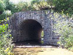
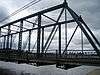
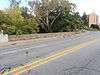
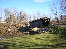
| 1 |
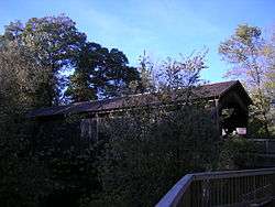
Ada Covered Bridge |
|
February 16, 1970
(#70000275) |
Across the Thornapple River
42°57′08″N 85°29′10″W / 42.952222°N 85.486111°W / 42.952222; -85.486111 (Ada Covered Bridge) |
Ada |
|
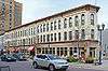
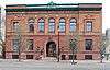
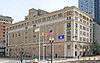
| 2 |
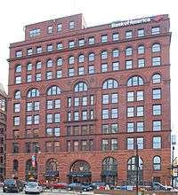
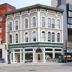
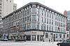
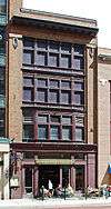
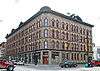
Aldrich Building |
|
November 12, 1982
(#82000536) |
98 Monroe Center, NW.
42°57′55″N 85°40′12″W / 42.965278°N 85.67°W / 42.965278; -85.67 (Aldrich Building) |
Grand Rapids |
|
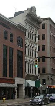
| 3 |
Godfrey Aldrich and White Block |
|
January 27, 1999
(#99000052) |
89-99 Monroe Center
42°57′53″N 85°40′13″W / 42.964722°N 85.670278°W / 42.964722; -85.670278 (Godfrey Aldrich and White Block) |
Grand Rapids |
|
| 4 |
Mathias Alten House and Studio |
|
June 23, 2009
(#08001102) |
1593 East Fulton Street
42°57′47″N 85°37′50″W / 42.963056°N 85.630417°W / 42.963056; -85.630417 (Mathias Alten House and Studio) |
Grand Rapids |
|
| 5 |
American Seating Company Factory Complex |
|
July 25, 2003
(#03000687) |
801 Broadway Ave., NW.
42°58′40″N 85°40′46″W / 42.977814°N 85.679506°W / 42.977814; -85.679506 (American Seating Company Factory Complex) |
Grand Rapids |
|
| 6 |
Berkey and Gay Furniture Company Factory |
|
December 20, 2000
(#00001486) |
940 Monroe Ave., NW.
42°58′44″N 85°40′18″W / 42.978889°N 85.671667°W / 42.978889; -85.671667 (Berkey and Gay Furniture Company Factory) |
Grand Rapids |
|
| 7 |
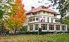
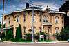
John W. Blodgett Estate |
|
July 28, 1983
(#83000877) |
250 Plymouth Rd., SE.
42°57′26″N 85°37′25″W / 42.957222°N 85.623611°W / 42.957222; -85.623611 (John W. Blodgett Estate) |
East Grand Rapids |
|
| 8 |
Business Route M-21 – Plaster Creek Bridge |
|
December 17, 1999
(#99001522) |
Business Loop Interstate 196/Chicago Drive over Plaster Creek
42°56′09″N 85°41′14″W / 42.935833°N 85.687222°W / 42.935833; -85.687222 (Business Route M-21 – Plaster Creek Bridge) |
Wyoming |
|
| 9 |
Central Furniture Company – H. E. Shaw Furniture Company Factory |
|
December 24, 2013
(#13000969) |
400 Ionia Avenue, SW
42°57′20″N 85°40′11″W / 42.955579°N 85.669647°W / 42.955579; -85.669647 (Central Furniture Company – H. E. Shaw Furniture Company Factory) |
Grand Rapids |
|
| 10 |
Division Avenue – Plaster Creek Bridge |
|
December 17, 1999
(#99001523) |
Division Ave. over Plaster Creek
42°55′05″N 85°39′58″W / 42.918056°N 85.666111°W / 42.918056; -85.666111 (Division Avenue – Plaster Creek Bridge) |
Grand Rapids |
Bridge was replaced in 2007 |
| 11 |
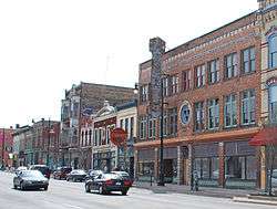
Downtown Lowell Historic District |
|
December 9, 1999
(#99001539) |
Roughly along Main St. between Hudson and Washington
42°56′04″N 85°20′16″W / 42.934444°N 85.337778°W / 42.934444; -85.337778 (Downtown Lowell Historic District) |
Lowell |
|
| 12 |
Eastern Avenue School |
|
September 4, 2013
(#13000666) |
758 Eastern Avenue, NE
42°58′36″N 85°38′56″W / 42.976748°N 85.648759°W / 42.976748; -85.648759 (Eastern Avenue School) |
Grand Rapids |
|
| 13 |
Fallasburg Covered Bridge |
|
March 16, 1972
(#72000627) |
Covered Bridge Rd.
42°58′51″N 85°19′38″W / 42.980833°N 85.327222°W / 42.980833; -85.327222 (Fallasburg Covered Bridge) |
Lowell |
|
| 14 |
Fallasburg Historic District |
|
March 31, 1999
(#98001217) |
Covered Bridge Rd.
42°58′56″N 85°19′24″W / 42.982222°N 85.323333°W / 42.982222; -85.323333 (Fallasburg Historic District) |
Vergennes Township |
|
| 15 |
Fine Arts Building |
|
November 12, 1982
(#82000537) |
220 Lyon St., NW.
42°58′01″N 85°40′26″W / 42.966944°N 85.673889°W / 42.966944; -85.673889 (Fine Arts Building) |
Grand Rapids |
|
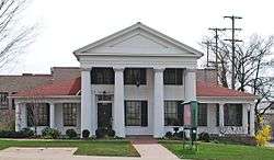
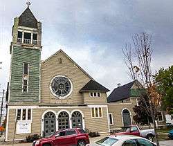
| 16 |
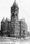
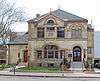
First (Park) Congregational Church |
|
November 12, 1982
(#82000538) |
10 E. Park Pl., NE.
42°57′51″N 85°39′56″W / 42.964167°N 85.665556°W / 42.964167; -85.665556 (First (Park) Congregational Church) |
Grand Rapids |
|
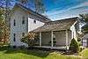
| 17 |
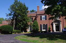
President Gerald R. Ford, Jr. Boyhood Home |
|
February 27, 1995
(#95000073) |
649 Union Ave., SE.
42°57′02″N 85°39′15″W / 42.950556°N 85.654167°W / 42.950556; -85.654167 (President Gerald R. Ford, Jr. Boyhood Home) |
Grand Rapids |
|
| 18 |
Goodspeed Brothers Building |
|
April 17, 1980
(#80001877) |
188 Monroe St., NW.
42°58′00″N 85°40′19″W / 42.966667°N 85.671944°W / 42.966667; -85.671944 (Goodspeed Brothers Building) |
Grand Rapids |
|
| 19 |
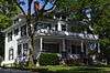
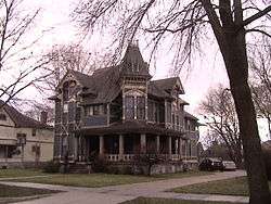
Graham House |
|
January 13, 1972
(#72000626) |
323-325 Main St.
42°56′04″N 85°20′31″W / 42.934444°N 85.341944°W / 42.934444; -85.341944 (Graham House) |
Lowell |
|
| 20 |
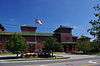
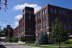
Grand Rapids Christian High School |
|
July 25, 2018
(#100002712) |
415 Franklin St., SE.
42°56′55″N 85°39′31″W / 42.9486°N 85.6586°W / 42.9486; -85.6586 (Grand Rapids Christian High School) |
Grand Rapids |
The school's old campus. |
| 21 |
Grand Rapids Cycle Company Factory |
|
June 16, 2004
(#04000600) |
514 Butterworth St. SW.
42°57′35″N 85°40′53″W / 42.959722°N 85.681389°W / 42.959722; -85.681389 (Grand Rapids Cycle Company Factory) |
Grand Rapids |
In 2007 the building was destroyed by fire. |
| 22 |
Grand Rapids Savings Bank Building |
|
December 28, 1990
(#90001956) |
60 Monroe Center, NW.
42°57′52″N 85°40′07″W / 42.964444°N 85.668611°W / 42.964444; -85.668611 (Grand Rapids Savings Bank Building) |
Grand Rapids |
|
| 23 |
Grand Rapids Storage and Van Company Building |
|
December 12, 2012
(#12001032) |
1415 Lake Dr. SE
42°57′27″N 85°38′04″W / 42.95742°N 85.63435°W / 42.95742; -85.63435 (Grand Rapids Storage and Van Company Building) |
Grand Rapids |
Built in 1926 |
| 24 |
Heartside Historic District |
|
March 2, 1982
(#82002844) |
Division, Commerce, and Ionia Aves., Fulton, Weston, Oakes, and Cherry Sts.
42°57′42″N 85°40′09″W / 42.961667°N 85.669167°W / 42.961667; -85.669167 (Heartside Historic District) |
Grand Rapids |
|
| 25 |
Heritage Hill Historic District |
|
March 11, 1971
(#71000399) |
Bounded by Michigan Ave. on the north, Pleasant St. on the south, Union Ave. on the east, and Clarendon Pl. and Jefferson Ave. on the west
42°57′35″N 85°39′25″W / 42.959722°N 85.656944°W / 42.959722; -85.656944 (Heritage Hill Historic District) |
Grand Rapids |
|
| 26 |
Keeler Building |
|
November 27, 2017
(#80004806) |
56 N Division Ave.
42°57′54″N 85°40′04″W / 42.965131°N 85.667664°W / 42.965131; -85.667664 (Keeler Building) |
Grand Rapids |
|
| 27 |
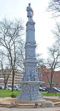
Kent County Civil War Monument |
|
July 14, 2004
(#04000690) |
Division Ave. at Monroe Ave.
42°57′49″N 85°40′04″W / 42.963611°N 85.667778°W / 42.963611; -85.667778 (Kent County Civil War Monument) |
Grand Rapids |
|
| 28 |
Ladies' Literary Club |
|
October 26, 1971
(#71000400) |
61 Sheldon St., SE.
42°57′45″N 85°40′01″W / 42.9625°N 85.666944°W / 42.9625; -85.666944 (Ladies' Literary Club) |
Grand Rapids |
|
| 29 |
Ledyard Block Historic District |
|
September 8, 1983
(#83000878) |
123-145 Ottawa Ave., and 104-124 Monroe Center, NW.
42°57′57″N 85°40′14″W / 42.965833°N 85.670556°W / 42.965833; -85.670556 (Ledyard Block Historic District) |
Grand Rapids |
|
| 30 |
Lexington School |
|
September 4, 2013
(#13000667) |
45 Lexington Avenue, NW
42°57′53″N 85°41′04″W / 42.964640°N 85.684467°W / 42.964640; -85.684467 (Lexington School) |
Grand Rapids |
|
| 31 |
Loraine Building |
|
November 24, 1982
(#82000539) |
124 E. Fulton St.
42°57′47″N 85°39′56″W / 42.963056°N 85.665556°W / 42.963056; -85.665556 (Loraine Building) |
Grand Rapids |
|
| 32 |
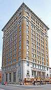
Medical Arts Building |
|
May 18, 2000
(#00000506) |
26 Sheldon Blvd. SE.
42°57′44″N 85°39′58″W / 42.962222°N 85.666111°W / 42.962222; -85.666111 (Medical Arts Building) |
Grand Rapids |
|
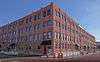
| 33 |
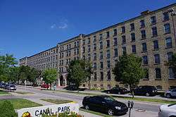
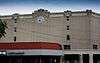
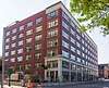
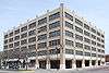
Metal Office Furniture Company (Steelcase) Plants No. 2 and 3 |
|
July 17, 2004
(#04000691) |
401 Hall St. SW.
42°56′34″N 85°40′41″W / 42.942778°N 85.678056°W / 42.942778; -85.678056 (Metal Office Furniture Company (Steelcase) Plants No. 2 and 3) |
Grand Rapids |
|
| 34 |
Michigan Trust Company Building |
|
February 24, 1983
(#83000879) |
40 Pearl St., NW.
42°57′58″N 85°40′12″W / 42.966111°N 85.67°W / 42.966111; -85.67 (Michigan Trust Company Building) |
Grand Rapids |
|
| 35 |
Monroe Avenue Water Filtration Plant |
|
July 31, 2002
(#02000815) |
1430 Monroe Ave. NW.
42°59′14″N 85°40′12″W / 42.987222°N 85.67°W / 42.987222; -85.67 (Monroe Avenue Water Filtration Plant) |
Grand Rapids |
|
| 36 |
Mt. Mercy Academy and Convent |
|
August 5, 1993
(#93000769) |
1425 Bridge St., NW.
42°58′22″N 85°42′11″W / 42.972778°N 85.703056°W / 42.972778; -85.703056 (Mt. Mercy Academy and Convent) |
Grand Rapids |
|
| 37 |
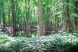
Norton Mound Group |
|
October 15, 1966
(#66000396) |
Between I-196 and Indian Mound Road[5]
42°56′12″N 85°43′19″W / 42.936667°N 85.721944°W / 42.936667; -85.721944 (Norton Mound Group) |
Grand Rapids |
|
| 38 |
Augustus Paddock House |
|
September 12, 1985
(#85002154) |
1033 Lake Dr., SE.
42°57′36″N 85°38′34″W / 42.96°N 85.642778°W / 42.96; -85.642778 (Augustus Paddock House) |
Grand Rapids |
|
| 39 |
Peck Block |
|
December 7, 2000
(#00001483) |
34-50 Monroe Center NW.
42°57′51″N 85°40′07″W / 42.964167°N 85.668611°W / 42.964167; -85.668611 (Peck Block) |
Grand Rapids |
|
| 40 |
Abram W. Pike House |
|
July 8, 1970
(#70000276) |
230 Fulton St., E.
42°57′42″N 85°39′47″W / 42.961667°N 85.663056°W / 42.961667; -85.663056 (Abram W. Pike House) |
Grand Rapids |
|
| 41 |
Porter Hollow Embankment and Culvert |
|
September 24, 2001
(#01001018) |
White Pine Trail at Stegman Creek, west of Summit Ave.
43°09′57″N 85°34′01″W / 43.165833°N 85.566944°W / 43.165833; -85.566944 (Porter Hollow Embankment and Culvert) |
Algoma Township |
|
| 42 |
Rood Building |
|
March 4, 1988
(#88000142) |
139 Pearl Street[6]
42°57′59″N 85°40′20″W / 42.966389°N 85.672194°W / 42.966389; -85.672194 (Rood Building) |
Grand Rapids |
|
| 43 |
Sixth Street Bridge |
|
August 13, 1976
(#76001030) |
Spans Grand River between Newberry and 6th St.
42°58′36″N 85°40′27″W / 42.976667°N 85.674167°W / 42.976667; -85.674167 (Sixth Street Bridge) |
Grand Rapids |
|
| 44 |
St. Cecilia Society Building |
|
December 9, 1971
(#71000401) |
24-30 Ransom Ave., NE.
42°57′49″N 85°39′53″W / 42.963611°N 85.664722°W / 42.963611; -85.664722 (St. Cecilia Society Building) |
Grand Rapids |
|
| 45 |
Third Reformed Church |
|
April 22, 1982
(#82002845) |
1009 Hermitage St., SE.
42°57′40″N 85°38′39″W / 42.961111°N 85.644167°W / 42.961111; -85.644167 (Third Reformed Church) |
Grand Rapids |
|
| 46 |
Thornapple River Drive Bridge |
|
April 18, 1990
(#90000570) |
Thornapple River Dr. over Thornapple River
42°56′23″N 85°29′29″W / 42.939722°N 85.491389°W / 42.939722; -85.491389 (Thornapple River Drive Bridge) |
Cascade Township |
|
| 47 |
Turner House |
|
July 8, 1970
(#70000277) |
731 Front St., NW.
42°58′35″N 85°40′35″W / 42.976389°N 85.676389°W / 42.976389; -85.676389 (Turner House) |
Grand Rapids |
|
| 48 |
U.S. Post Office |
|
July 10, 1974
(#74000990) |
Ionia and Pearl Sts.
42°57′58″N 85°40′06″W / 42.966111°N 85.668333°W / 42.966111; -85.668333 (U.S. Post Office) |
Grand Rapids |
|
| 49 |
Villa Maria |
|
March 27, 1987
(#86003373) |
1315 Walker NW.
42°59′01″N 85°42′02″W / 42.983611°N 85.700556°W / 42.983611; -85.700556 (Villa Maria) |
Grand Rapids |
|
| 50 |
Whitney Tavern Stand |
|
February 1, 2007
(#06001326) |
5283 Whitneyville Ave.
42°52′08″N 85°27′34″W / 42.868889°N 85.459444°W / 42.868889; -85.459444 (Whitney Tavern Stand) |
Cascade Township |
|
| 51 |
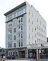
Willard Building |
|
January 14, 2013
(#12001172) |
150 E. Fulton St.
42°57′47″N 85°39′52″W / 42.963049°N 85.664468°W / 42.963049; -85.664468 (Willard Building) |
Grand Rapids |
Built in 1930. Home of E. A. Rood & Company, a china and glassware specialty store for many years. |
CongregationalChurchGrandRapidsMI.jpg)
_Plants_No-_2_and_3_2012-09-27_15-38-11.jpg)