Limalok
| Limalok | |
|---|---|
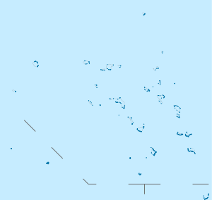
_Guyot.png) Bathymetry of Limalok and surroundings; Limalok is lower centre left | |
| Summit depth | 1,255 metres (4,117 ft) |
| Summit area | 636 square kilometres (246 sq mi) |
| Location | |
| Group | Ratak Chain |
| Coordinates | 5°36′N 172°18′E / 5.6°N 172.3°E[1]Coordinates: 5°36′N 172°18′E / 5.6°N 172.3°E[1] |
| Country | Marshall Islands |
| Geology | |
| Type | Guyot |
| Age of rock | Cretaceous |
Limalok (formerly known as Harrie) is a Cretaceous-Paleocene guyot or tablemount in the southeastern Marshall Islands, at a depth of 1,255 metres (4,117 ft), with a 636 square kilometres (246 sq mi) summit platform. One among a number of seamounts in the Pacific Ocean, it was probably formed by a hotspot in what is present-day French Polynesia. Limalok lies southeast of Mili Atoll and Knox Atoll which rise above sea level and Limalok is joined to them through a volcanic ridge.
The seamount is formed by basaltic rocks that probably formed a shield volcano first. It is believed that a number of hotspots such as the Macdonald hotspot, the Rarotonga hotspot, the Rurutu hotspot and Society hotspot may have been involved in the formation of Limalok. After the volcanic episode, a phase of erosion was followed by the formation of a carbonate platform during the Paleocene and Eocene. These carbonates were chiefly produced by red algae, forming an atoll or atoll-like structure with reefs.
The carbonate platform drowned 48 ± 2 million years ago (during the Eocene), perhaps because at that time it moved through the equatorial area which may have been too hot or too nutrient rich to support the growth of a coral reef. Thermal subsidence lowered the drowned seamount to its present depth. After a hiatus, sedimentation commenced on the seamount and led to the deposition of manganese crusts and pelagic sediments, some of which were later modified by phosphate.
Name and research history
Limalok was formerly known as Harrie Guyot[2] and is also known as Harriet Guyot.[3] Limalok is the name of a traditional chieftess of Mile Atoll.[4] Limalok was one of the seamounts that were targeted for drilling during the Ocean Drilling Program;[5] the low recovery rates during the drilling however made it difficult to reconstruct its geologic history.[6]
Geography and geology
Local setting
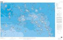
Limalok lies at the southernmost[7] end of the Ratak Chain[8] in the south[2]-eastern Marshall Islands in the western Pacific Ocean.[5] Mili Atoll is located 53.7 kilometres (33.4 mi) from Limalok,[2] between the two lies Knox Atoll as well.[9]
The relatively small[10] seamount rises from a depth of 4,500 metres (14,800 ft)[11] to a minimum depth of 1,255 metres (4,117 ft) below sea level.[12] The top of Limalok is 47.5 kilometres (29.5 mi) long[2] and broadens southeastward from less than 5 kilometres (3.1 mi) to more than 24 kilometres (15 mi),[9] forming a 636 square kilometres (246 sq mi) summit platform.[13] The carbonate platform of Limalok crops out at the edges of the summit plateau.[7] Wide terraces[7] and numerous fault blocks surround the summit plateau;[14] some of the latter may have formed after the carbonate platform ceased growing.[15]
Mili Atoll and Limalok emerge from a common pedestal[6] and are connected by a ridge at 1.5 kilometres (0.93 mi) depth;[11] the size of the two volcanoes and their connection have been compared to Tahiti.[16] The seafloor beneath Limalok is 152[17]-158 million years old,[18] but it is possible that Limalok rises from Cretaceous flood basalts in the area rather than the seafloor itself.[19] Volcaniclastic sediments in the Eastern Mariana Basin may come from this seamount.[20]
Regional setting
-1.svg.png)
The Pacific Ocean seafloor, especially the parts that are of Mesozoic age, contains most of the world's guyots (also known as tablemounts[21]). These are flat-topped submarine mountains[22] which are characterized by steep slopes, a flat top and usually the presence of corals and carbonate platforms.[1] It is not clear whether the Cretaceous guyots were atolls in the present-day sense[23] but many of these seamounts were, which today still exist. All these structures originally formed as volcanoes in the Mesozoic Ocean. First fringing reefs may have developed on the volcanoes, which then became barrier reefs as the volcano subsided and turned into an atoll. Continued subsidence balanced by upward growth of the reefs led to the formation of thick carbonate platforms.[24] Sometimes volcanic activity occurred even after the formation of the atoll or atoll-like landforms, and during episodes where the carbonate platforms were lifted above sea level erosional features such as channels and blue holes developed.[25] The crust underneath these seamounts tends to subside as it cools and thus the islands and seamounts sink.[26]
The formation of many such seamounts[27] including Limalok[28] has been explained with the hotspot theory, which discusses the formation of chains of volcanoes which get progressively older along the length of the chain, with an active volcano only at one end of the system.[27] Seamounts and islands in the Marshall Islands do not appear to have originated from such simple age-progressive hotspot volcanism as the age progressions in the individual island and seamount chains are often inconsistent with a hotspot origin.[29] One solution to this dilemma may be that more than one hotspot passed through the Marshall Islands,[30] as well as the possibility that hotspot volcanism was affected by extensional deformation of the lithosphere.[31] For Limalok, geochemical evidence shows affinities to the Rarotonga hotspot[32] which is unlike the geochemical trends in the other volcanoes of the Ratak Chain.[33] In terms of backtracked hotspot locations, the first hotspot to pass by Limalok was the Macdonald hotspot 95-85 million years ago, followed by the Rurutu hotspot and the Society hotspot by 75-65 million years ago.[34] The Rarotonga and especially the Rurutu hotspots are considered to be the most likely candidates for the hotspot that formed Limalok.[35] However, some paleogeographical inconsistencies indicate that lithospheric fractures secondary to hotspot activity were also involved.[36]
Based on plate motion reconstructions, the region of the Marshall Islands was located in the region of present-day French Polynesia during the time of active volcanism. Both regions display numerous island chains, anomalously shallow ocean floors and the presence of volcanoes.[37] About 8 hotspots have formed a large number of islands and seamounts in that region, with disparate geochemistries,[38] that geological province has been called "South Pacific Isotopic and Thermal Anomaly" or DUPAL anomaly.[39]
Composition
Limalok has erupted basaltic rocks[9] which have been classified as alkali basalts,[40] basanite[33] and nephelinite.[41] Minerals contained in the rocks are apatite,[42] augite,[35] biotite,[42] clinopyroxene, olivine,[43] nepheline[42] and plagioclase,[43] and there are ultramafic xenoliths.[44] Shallow crystal fractionation processes seem to have been involved in the genesis of Limalok magmas.[45]
Alteration of the original material has formed calcite, a mineral that could be celadonite, chlorite, clay, iddingsite, montmorillonite and zeolite.[35][42] Volcanogenic sandstones[46] and traces of hydrothermal alteration have also been found.[42]
Carbonate, clay,[9] manganese phosphate[lower-alpha 1] crust[48] materials and mudstones have been found in boreholes[23] or dredged from the seamount.[48] Aragonite, pyrite[49] and organic material formed by alteration of living beings within the clays and limestones.[50]
Carbonates take various forms, such as grainstone, packstone,[23] limestone,[51] rudstone and wackestone.[23] Porosity is usually low owing to cementation of the deposits.[51] The carbonate rocks show widespread evidence of diagenetic alteration.[52]
Geologic history
Axis scale: millions of years ago.
Limalok is the youngest guyot in the Marshall Islands.[3] Argon-argon dating has yielded ages of 69.2[55] and 68.2 ± 0.5 million years ago on volcanic rocks dredged from Limalok,[56] that is it existed by the Cretaceous;[28] Mili Atoll is probably not much younger than Limalok.[57] At that time Limalok was probably located in French Polynesia;[28] paleomagnetism indicates that Limalok formed at 15[58]-10 degrees southern latitude. Early limestones dredged from Limalok were considered to be of Eocene age before earlier Paleocene deposits were discovered as well.[6]
Volcanism and first biotic phenomena
Limalok first formed as a shield volcano.[28] The volcanic rocks were emplaced in the form of breccia,[12] pebbles encased within sediments,[46] but especially as lava flows[35] which thicknesses reaching 1–7 metres (3 ft 3 in–23 ft 0 in).[59]
Soils formed on the volcano[9] through the weathering of volcanic rocks,[40] reaching a thickness of 28.6 metres (94 ft);[41] claystones[40] and laterites were also generated through weathering.[41] These deposits formed over a long time on an island that rose at least several metres above sea level,[46] the estimated time it took to generate the soil profiles obtained in drill cores is about 1-3 million years.[17] Thermal subsidence of the crust[28] and erosion flattened the seamount before carbonate deposition commenced on Limalok,[48] and it is possible that the growth of another volcano south of Limalok 1-2 million years after Limalok developed may be responsible for a southward tilt of the seamount.[57]
The soils on Limalok were colonized by vegetation[28] that left plant cuticle and woody tissues; angiosperms including palms, ferns and fungi with an overall low diversity developed on the volcano.[41] Organisms burrowed into the soils, leaving cavities.[50] Limalok probably featured tropical to subtropical environments[41] with an annual precipitation of probably less than 1,000 millimetres per year (39 in/year).[60]
Platform carbonates and reefs
After the activity[61] and erosion of the volcanic island it took some time before carbonate platform growth commenced[62] with sedimentation beginning 57.5 ± 2.5 million years ago.[63] Starting in the Paleocene, carbonate deposition started on Limalok concomitant with one or two separate events where the seamount was flooded by seawater.[9] After a Paleocene phase with open sea or back-reef conditions lagoonal environments developed on the seamount during the Eocene,[64] which periodically emerged above sea level leading to erosion of the platform[48] although the existence of evidence for such an emersion has been debated.[65] It is not clear if the carbonate platform took the form of an actual present-day atoll or of a shallow platform that was shielded on one side by islands or shoals similar to the present-day Bahama Banks;[23][66] sea level rise at the Paleocene-Eocene transition may have triggered the transformation from a partially shielded platform to a true ring-shaped atoll.[67]
The carbonate platform reaches an overall thickness of 290 metres (950 ft) in one drill core.[12] Drill cores in the platform show variations between individual carbonate layers that imply that parts of the platform were submerged and emerged over time while the platform was still active,[40] possibly because of eustatic sea level variations.[68] Furthermore, the platform was affected by storms which redeposited the carbonatic material.[67] The duration of the carbonate platform is about 10 million years,[69] recording the and lasting through the Paleocene-Eocene Thermal Maximum with little impact.[70]
The dominant living beings on Limalok were red algae that occupied many ecological niches and formed rhodoliths. Other lifeforms were[9] as well as bivalves,[71] bryozoans,[11] corals, echinoderms, echinoids, foraminifera [lower-alpha 2], gastropods, molluscs and ostracods.[71] Species and genera composition did vary over time, leading to different species being found in different parts of the carbonate platform.[9] Red algae were important early colonizers,[62] and algal mats and oncoids were further contributed by algae and/or cyanobacteria.[72]
Drowning and post-drowning evolution
Limalok drowned during the early-middle Eocene, soon after the start of the Lutetian[48] 48 ± 2 million years ago.[63] This seamount is the most recent carbonate platform in the region to drown,[6] whereas the carbonate platform at neighbouring Mili Atoll is still active today[73] for reasons unknown.[74]
The drowning of carbonate platforms such as Limalok and also MIT, Takuyo-Daisan and Wōdejebato appears to have many causes. One of these appears to be a preceding sea level drop which causes much of the carbonate platform to emerge; this reduces the space that carbonate-forming organisms have to grow upward when sea level rises again. A second factor is that these carbonate platforms were not true reefs but rather piles of carbonate sediment formed by organisms; these constructs cannot easily out-grow sea level rises when growing on a constrained area.[75] Two final key factors are the passage of the platforms through nutrient-rich equatorial waters which cause the overgrowth of algae that hampered the growth of reef-forming organisms, and global temperature extremes that may overheat the carbonate platforms especially when close to the equator; present-day coral bleaching events are often triggered by overheating and Limalok and the other seamounts were all approaching the equator when they drowned.[76][77] In the case of Limalok and some other guyots, paleolatitude data support the notion that approaching the equator led to the demise of the carbonate platforms.[78]
After the carbonate platform ceased growing, subsidence lowered Limalok quickly below the photic zone.[62] Hardgrounds[79] and iron-manganese crusts formed on the drowned platform[5] which contain Oligocene sediments and planktonic fossils.[64] Some of the rocks were modified by phosphate[79] during three separate episodes in the Eocene and Eocene-Oligocene which may have been triggered by ocean upwelling events at that time.[80]
Until the Miocene, sedimentation on Limalok was hindered probably by strong currents.[81] Renewed sedimentation began at that point[64] after the drowning of Limalok, with sediments consisting mainly of foraminifera and other nannofossils. Some of the sediments were reworked after deposition. At least two layers formed during the Miocene and Pliocene-Pleistocene,[5] reaching a cumulative thickness of 100–140 metres (330–460 ft).[82][64] Chemically, most of the sediments are calcite[83] and they often occur in rudstone or wackestone form.[84]
Bivalves, echinoderms, foraminifera [lower-alpha 3][84] and ostracods are fossilized in the sediments,[82] which sometimes contain borings and other traces of biological activity.[84] Ostracod taxa include Bradleya, various cytherurids, Eucythere, Krythe and Tongacythere.[82]
Notes
- ↑ Asbolane, birnessite and buserite are found in the crusts.[47]
- ↑ Among the foraminifera genera found on Limalok are Alveolina, Asterocyclina, Coleiconus, Discocyclina, Glomalveolina, Guembelitroides, Nummulites.[9]
- ↑ Among the species of foraminifera are Acarinina sp., Braarudosphaera discula, Catapsydrax sp., Chiasmolithus solitus, Chiloguembelina sp., Cyclicargolithus abisectus, Dictyococcites bisectus, Discoaster tanii, Clavatorella bermudezi, Coccolithus eopelagicus, Dentoglobigerina altispira, Emiliania huxleyi, Fohsella sp., Gephyrocapsa sp., Globigerinatella sp., Globigerinatheca sp., Globigerinella sp., Globigerinoides sp., Globanomalina pseudoscitula, Globoquadrina sp., Globorotalia sp., Globorotaloides sp., Lenticulina sp., Nannotetrina cristata, Neogloboquadrina acostaensis, Orbulina sp., Paragloborotalia mayeri, Pemma sp., Praeorbulina glomerosa, Pseudoemiliania lacunosa, Pseudohastigerina sp., Pseudotriquetrorhabdus inversus, Pulleniatina sp., Reticulofenestra sp., Sphaeroidinella dehiscens, Sphaerodinellopsis paenadehiscens, Sphenolithus sp., Subbotina gortanii and Turborotalia sp..[85][86][87]
References
- 1 2 3 Arnaud Vanneau et al. 1995, p. 819.
- 1 2 3 4 Arnaud Vanneau et al. 1995, p. 829.
- 1 2 Israelson, C.; Pearson, P.N.; Buchardt, B. (December 1995), "Strontium Isotope Variations and Sediment Reworking of the Upper Oligocene-Neogene Interval from Sites 871 and 872" (PDF), Proceedings of the Ocean Drilling Program, 144 Scientific Results, Ocean Drilling Program, p. 411, doi:10.2973/odp.proc.sr.144.051.1995, retrieved 2018-07-14
- ↑ Hein, J.R.; Kang, Jung-Keuk; Schulz, M.S.; Park, Byong-Kwon; Kirschenbaum, Herbert; Yoon, Suk-Hoon; Olson, R.L.; Smith, V.K.; Park, Dong-Won (1990). "Geological, geochemical, geophysical, and oceanographic data and interpretations of seamounts and co-rich ferromanganese crusts from the Marshall Islands, KORDI-USGS R.V. FARNELLA cruise F10-89-CP". Open-File Report: 246. ISSN 2331-1258.
- 1 2 3 4 Israelson et al. 1995, p. 737.
- 1 2 3 4 Wyatt, Quinn & Davies 1995, p. 430.
- 1 2 3 Bergersen 1995, p. 566.
- ↑ Haggerty & Premoli Silva 1995, p. 935.
- 1 2 3 4 5 6 7 8 9 Arnaud Vanneau et al. 1995, p. 830.
- ↑ Castillo 2004, p. 364.
- 1 2 3 Schlanger, Campbell & Jackson 2013, p. 168.
- 1 2 3 Nicora, Premoli Silva & Arnaud Vanneau 1995, p. 127.
- ↑ Bergersen 1995, p. 567.
- ↑ Bergersen 1995, p. 568.
- ↑ Bergersen 1995, p. 570.
- ↑ Bergersen 1995, p. 569.
- 1 2 Larson et al. 1995, p. 919.
- ↑ Schlanger, Campbell & Jackson 2013, p. 166.
- ↑ Larson et al. 1995, p. 917.
- ↑ Castillo 2004, p. 365.
- ↑ Bouma, Arnold H. (September 1990). "Naming of undersea features". Geo-Marine Letters. 10 (3): 121. doi:10.1007/bf02085926. ISSN 0276-0460.
- ↑ Camoin et al. 2009, p. 39.
- 1 2 3 4 5 Ogg, Camoin & Arnaud Vanneau 1995, p. 236.
- ↑ Pringle et al. 1993, p. 359.
- ↑ Pringle et al. 1993, p. 360.
- ↑ Larson, R.L.; Erba, E.; Nakanishi, M.; Bergersen, D.D.; Lincoln, J.M. (December 1995), "Stratigraphic, Vertical Subsidence, and Paleolatitude Histories of Leg 144 Guyots", Northwest Pacific Atolls and Guyots: Sites 871–880 and Site 801 (PDF), Proceedings of the Ocean Drilling Program, 144, Ocean Drilling Program, p. 916, doi:10.2973/odp.proc.sr.144.063.1995, retrieved 2018-07-06
- 1 2 Koppers et al. 2003, p. 2.
- 1 2 3 4 5 6 Arnaud Vanneau et al. 1995, p. 833.
- ↑ Pringle et al. 1993, p. 368.
- ↑ Pringle et al. 1993, p. 299.
- ↑ Koppers et al. 2003, p. 35.
- ↑ Koppers et al. 2003, p. 26.
- 1 2 Koppers et al. 2003, p. 25.
- ↑ Haggerty & Premoli Silva 1995, p. 939.
- 1 2 3 4 Koppers et al. 1995, p. 537.
- ↑ Koppers et al. 2007, p. 26.
- ↑ Bergersen 1995, p. 561.
- ↑ Koppers et al. 1995, p. 535.
- ↑ Dieu 1995, p. 513.
- 1 2 3 4 Ogg, Camoin & Arnaud Vanneau 1995, p. 238.
- 1 2 3 4 5 Haggerty & Premoli Silva 1995, p. 942.
- 1 2 3 4 5 Christie, Dieu & Gee 1995, p. 497.
- 1 2 Koppers, Anthony A.P; Staudigel, Hubert; Wijbrans, Jan R (May 2000). "Dating crystalline groundmass separates of altered Cretaceous seamount basalts by the 40Ar/39Ar incremental heating technique". Chemical Geology. 166 (1–2): 145. doi:10.1016/S0009-2541(99)00188-6. ISSN 0009-2541.
- ↑ Dieu 1995, p. 514.
- ↑ Christie, Dieu & Gee 1995, p. 503.
- 1 2 3 Erba et al. 1995, p. 874.
- ↑ Novikov, G. V.; Yashina, S. V.; Mel’nikov, M. E.; Vikent’ev, I. V.; Bogdanova, O. Yu. (March 2014). "Nature of Co-bearing ferromanganese crusts of the Magellan Seamounts (Pacific Ocean): Communication 2. Ion exchange properties of ore minerals". Lithology and Mineral Resources. 49 (2): 152. doi:10.1134/s0024490214020072. ISSN 0024-4902 – via ResearchGate.
- 1 2 3 4 5 Arnaud Vanneau et al. 1995, p. 831.
- ↑ Buchardt & Holmes 1995, p. 897.
- 1 2 Buchardt & Holmes 1995, p. 898.
- 1 2 Wyatt, Quinn & Davies 1995, p. 431.
- ↑ Wyatt, Quinn & Davies 1995, p. 433.
- ↑ Retallack, G. J. (1997). "Neogene Expansion of the North American Prairie". PALAIOS. 12 (4): 380–390. doi:10.2307/3515337. JSTOR 3515337. Retrieved 2008-02-11.
- ↑ Zachos, J. C.; Kump, L. R. (2005). "Carbon cycle feedbacks and the initiation of Antarctic glaciation in the earliest Oligocene". Global and Planetary Change. 47 (1): 51–66. Bibcode:2005GPC....47...51Z. doi:10.1016/j.gloplacha.2005.01.001.
- ↑ Koppers et al. 2007, p. 19.
- ↑ Koppers et al. 2003, p. 22.
- 1 2 Bergersen 1995, p. 576.
- ↑ Haggerty & Premoli Silva 1995, p. 941.
- ↑ Christie, Dieu & Gee 1995, p. 496.
- ↑ Haggerty & Premoli Silva 1995, p. 943.
- ↑ Wilson et al. 1998, p. 892.
- 1 2 3 Nicora, Premoli Silva & Arnaud Vanneau 1995, p. 133.
- 1 2 Jenkyns, Hugh C.; Wilson, Paul A. (1 May 1999). "Stratigraphy, paleoceanography, and evolution of Cretaceous Pacific guyots; relics from a greenhouse Earth". American Journal of Science. 299 (5): 362. doi:10.2475/ajs.299.5.341. ISSN 0002-9599 – via CiteSeerX.
- 1 2 3 4 Ogg, Camoin & Arnaud Vanneau 1995, p. 233.
- ↑ Bergersen 1995, p. 564.
- ↑ Bergersen 1995, p. 573.
- 1 2 Ogg, Camoin & Arnaud Vanneau 1995, p. 239.
- ↑ Ogg, Camoin & Arnaud Vanneau 1995, p. 241.
- ↑ Haggerty & Premoli Silva 1995, p. 946.
- ↑ Robinson, S. A. (3 December 2010). "Shallow-water carbonate record of the Paleocene-Eocene Thermal Maximum from a Pacific Ocean guyot". Geology. 39 (1): 51. doi:10.1130/G31422.1. ISSN 0091-7613.
- 1 2 Nicora, Premoli Silva & Arnaud Vanneau 1995, p. 129.
- ↑ Ogg, Camoin & Arnaud Vanneau 1995, p. 237.
- ↑ Watkins et al. 1995, p. 675.
- ↑ Wilson et al. 1998, p. 890.
- ↑ Ogg, Camoin & Arnaud Vanneau 1995, p. 245.
- ↑ Ogg, Camoin & Arnaud Vanneau 1995, p. 246.
- ↑ Larson et al. 1995, p. 932.
- ↑ Wilson et al. 1998, pp. 892-893.
- 1 2 Erba et al. 1995, p. 873.
- ↑ Watkins, Premoli Silva & Erba 1995, pp. 115-116.
- ↑ Watkins et al. 1995, p. 680.
- 1 2 3 Whatley, R.; Boomer, I. (December 1995), "Upper Oligocene to Pleistocene Ostracoda from Guyots in the Western Pacific: Holes 871A, 872C, and 873B" (PDF), Proceedings of the Ocean Drilling Program, 144 Scientific Results, Ocean Drilling Program, p. 88, doi:10.2973/odp.proc.sr.144.072.1995, retrieved 2018-07-14
- ↑ Israelson et al. 1995, p. 742.
- 1 2 3 Watkins, Premoli Silva & Erba 1995, p. 99.
- ↑ Pearson, P.N.; Shackleton, N.J. (December 1995), "Neogene Multispecies Planktonic Foraminifer Stable Isotope Record, Site 871, Limalok Guyot" (PDF), Proceedings of the Ocean Drilling Program, 144 Scientific Results, Ocean Drilling Program, pp. 404–405, doi:10.2973/odp.proc.sr.144.054.1995, retrieved 2018-07-10
- ↑ Watkins, Premoli Silva & Erba 1995, pp. 99-100.
- ↑ Erba, E. (December 1995), "Quantitative Nannofossil Biostratigraphy of Quaternary Sequences from Guyots in the Central and Western Pacific Ocean" (PDF), Proceedings of the Ocean Drilling Program, 144 Scientific Results, Ocean Drilling Program, p. 8, doi:10.2973/odp.proc.sr.144.004.1995, retrieved 2018-07-14
Sources
- Arnaud Vanneau, A.; Bergersen, D.D.; Camoin, G.F.; Ebren, P.; Haggerty, J.A.; Ogg, J.G.; Premoli Silva, I.; Vail, P.R. (December 1995), "A Model for Depositional Sequences and Systems Tracts on Small, Mid-Ocean Carbonate Platforms: Examples from Wodejebato (Sites 873-877) and Limalok (Site 871) Guyots" (PDF), Proceedings of the Ocean Drilling Program, 144 Scientific Results, Ocean Drilling Program, doi:10.2973/odp.proc.sr.144.001.1995, retrieved 2018-07-10
- Bergersen, D.D. (December 1995), "Physiography and Architecture of Marshall Islands Guyots Drilled during Leg 144: Geophysical Constraints on Platform Development", Northwest Pacific Atolls and Guyots: Sites 871–880 and Site 801 (PDF), Proceedings of the Ocean Drilling Program, 144 Scientific Results, 144, Ocean Drilling Program, doi:10.2973/odp.proc.sr.144.019.1995, retrieved 2018-07-06
- Buchardt, B.; Holmes, M.A. (December 1995), "Initial Transgressive Phase of Leg 144 Guyots: Evidence of Extreme Sulfate Reduction" (PDF), Proceedings of the Ocean Drilling Program, 144 Scientific Results, Ocean Drilling Program, doi:10.2973/odp.proc.sr.144.060.1995, retrieved 2018-07-14
- Camoin, G. F.; Arnaud-Vanneau, A.; Bergersen, D. D.; Enos, P.; Ebren, Ph. (27 May 2009). "Development and Demise of Mid-Oceanic Carbonate Platforms, Wodejebato Guyot (NW Pacific)". Reefs and Carbonate Platforms in the Pacific and Indian Oceans. Blackwell Publishing Ltd.: 39–67. doi:10.1002/9781444304879.ch3. ISBN 9781444304879.
- Castillo, Paterno R. (1 January 2004). "Geochemistry of Cretaceous volcaniclastic sediments in the Nauru and East Mariana basins provides insights into the mantle sources of giant oceanic plateaus". Geological Society, London, Special Publications. 229 (1): 353–368. doi:10.1144/GSL.SP.2004.229.01.20. ISSN 0305-8719. (Subscription required (help)).
- Christie, D.M.; Dieu, J.J.; Gee, J.S. (December 1995), "Petrologic Studies of Basement Lavas from Northwest Pacific Guyots" (PDF), Proceedings of the Ocean Drilling Program, 144 Scientific Results, Ocean Drilling Program, doi:10.2973/odp.proc.sr.144.028.1995, retrieved 2018-07-14
- Dieu, J.J. (December 1995), "Mineral Compositions in Leg 144 Lavas and Ultramafic Xenoliths: The Roles of Cumulates and Carbonatite Metasomatism in Magma Petrogenesis" (PDF), Proceedings of the Ocean Drilling Program, 144 Scientific Results, Ocean Drilling Program, doi:10.2973/odp.proc.sr.144.029.1995, retrieved 2018-07-14
- Erba, E.; Premoli Silva, I.; Wilson, P.A.; Pringle, M.S.; Sliter, W.V.; Watkins, D.K.; Arnaud Vanneau, A.; Bralower, T.J.; Budd, A.F. (December 1995), "Synthesis of Stratigraphies from Shallow-Water Sequences at Sites 871 through 879 in the Western Pacific Ocean" (PDF), Proceedings of the Ocean Drilling Program, 144 Scientific Results, Ocean Drilling Program, doi:10.2973/odp.proc.sr.144.076.1995, retrieved 2018-07-14
- Haggerty, J.A.; Premoli Silva, I. (December 1995), "Comparison of the Origin and Evolution of Northwest Pacific Guyots Drilled during Leg 144" (PDF), Proceedings of the Ocean Drilling Program, 144 Scientific Results, Ocean Drilling Program, doi:10.2973/odp.proc.sr.144.074.1995, retrieved 2018-07-13
- Israelson, C.; Buchardt, B.; Haggerty, J.A.; Pearson, P.N. (December 1995), "Carbonate and Pore-Water Geochemistry of Pelagic Caps at Limalok and Lo-En Guyots, Western Pacific" (PDF), Proceedings of the Ocean Drilling Program, 144 Scientific Results, Ocean Drilling Program, doi:10.2973/odp.proc.sr.144.050.1995, retrieved 2018-07-10
- Koppers, A.A.P.; Staudigel, H.; Christie, D.M.; Dieu, J.J.; Pringle, Malcolm S. (December 1995), "Sr-Nd-Pb Isotope Geochemistry of Leg 144 West Pacific Guyots: Implications for the Geochemical Evolution of the "SOPITA" Mantle Anomaly", Northwest Pacific Atolls and Guyots: Sites 871–880 and Site 801 (PDF), Proceedings of the Ocean Drilling Program, 144, Ocean Drilling Program, doi:10.2973/odp.proc.sr.144.031.1995, retrieved 2018-07-06
- Koppers, Anthony A. P.; Staudigel, Hubert; Phipps Morgan, Jason; Duncan, Robert A. (June 2007). "Nonlinear Ar/Ar age systematics along the Gilbert Ridge and Tokelau Seamount Trail and the timing of the Hawaii-Emperor Bend". Geochemistry, Geophysics, Geosystems. 8 (6). doi:10.1029/2006GC001489.
- Koppers, Anthony A. P.; Staudigel, Hubert; Pringle, Malcolm S.; Wijbrans, Jan R. (October 2003). "Short-lived and discontinuous intraplate volcanism in the South Pacific: Hot spots or extensional volcanism?". Geochemistry, Geophysics, Geosystems. 4 (10). doi:10.1029/2003GC000533.
- Larson, R.L.; Erba, E.; Nakanishi, M.; Bergersen, D.D.; Lincoln, J.M. (December 1995), "Stratigraphic, Vertical Subsidence, and Paleolatitude Histories of Leg 144 Guyots" (PDF), Proceedings of the Ocean Drilling Program, 144 Scientific Results, Ocean Drilling Program, doi:10.2973/odp.proc.sr.144.063.1995, retrieved 2018-07-14
- Nicora, A.; Premoli Silva, I.; Arnaud Vanneau, A. (December 1995), "Paleogene Larger Foraminifer Biostratigraphy from Limalok Guyot, Site 871" (PDF), Proceedings of the Ocean Drilling Program, 144 Scientific Results, Ocean Drilling Program, doi:10.2973/odp.proc.sr.144.012.1995, retrieved 2018-07-10
- Ogg, J.G.; Camoin, G.F.; Arnaud Vanneau, A. (December 1995), "Limalok Guyot: Depositional History of the Carbonate Platform from Downhole Logs at Site 871 (Lagoon)" (PDF), Proceedings of the Ocean Drilling Program, 144 Scientific Results, Ocean Drilling Program, doi:10.2973/odp.proc.sr.144.042.1995, retrieved 2018-07-10
- Pringle, Malcolm S.; Sager, William W.; Sliter, William V.; Stein, Seth, eds. (1993). "The Mesozoic Pacific: Geology, Tectonics, and Volcanism: A Volume in Memory of Sy Schlanger". Geophysical Monograph Series. Geophysical Monograph Series. 77. doi:10.1029/gm077. ISBN 0-87590-036-4. ISSN 0065-8448. (Subscription required (help)).
- Schlanger, S. O.; Campbell, J. F.; Jackson, M. W. (2013-03-18), "Post-Eocene Subsidence of the Marshall Islands Recorded by Drowned Atolls on Harrie and Sylvania Guyots", Seamounts, Islands, and Atolls, American Geophysical Union, pp. 165–174, doi:10.1029/gm043p0165, ISBN 9781118664209, retrieved 2018-07-13, (Subscription required (help))
- Watkins, D.K.; Pearson, P.N.; Erba, E.; Rack, F.R.; Premoli Silva, I.; Bohrmann, H.W.; Fenner, J.; Hobbs, P.R.N. (December 1995), "Stratigraphy and Sediment Accumulation Patterns of the Upper Cenozoic Pelagic Carbonate Caps of Guyots in the Northwestern Pacific Ocean" (PDF), Proceedings of the Ocean Drilling Program, 144 Scientific Results, Ocean Drilling Program, doi:10.2973/odp.proc.sr.144.066.1995, retrieved 2018-07-13
- Watkins, D.K.; Premoli Silva, I.; Erba, E. (December 1995), "Cretaceous and Paleogene Manganese-Encrusted Hardgrounds from Central Pacific Guyots" (PDF), Proceedings of the Ocean Drilling Program, 144 Scientific Results, Ocean Drilling Program, doi:10.2973/odp.proc.sr.144.017.1995, retrieved 2018-07-14
- Wilson, Paul A.; Jenkyns, Hugh C.; Elderfield, Henry; Larson, Roger L. (April 1998). "The paradox of drowned carbonate platforms and the origin of Cretaceous Pacific guyots". Nature. 392 (6679): 889–894. doi:10.1038/31865. ISSN 0028-0836 – via ResearchGate.
- Wyatt, J.L.; Quinn, T.M.; Davies, G.R. (December 1995), "Preliminary Investigation of the Petregraphy and Geochemistry of Limestones at Limalok and Wodejebato Guyots (Sites 871 and 874), Republic of the Marshall Islands" (PDF), Proceedings of the Ocean Drilling Program, 144 Scientific Results, Ocean Drilling Program, doi:10.2973/odp.proc.sr.144.056.1995, retrieved 2018-07-10
Marshall Islands articles | |||||||
|---|---|---|---|---|---|---|---|
| History | |||||||
| Geography |
| ||||||
| Politics | |||||||
| Economy |
| ||||||
| Culture |
| ||||||
| |||||||