List of lighthouses and lightvessels in Australia
This is a list of lighthouses and lightvessels in Australia.
Australia has a coastline of 25,760 kilometres (16,010 mi),[1] with over 350 lighthouses and navigational aids around the Australian coastline,[2] and a single inland lighthouse, the Point Malcolm lighthouse.[3]
The first lighthouse was Macquarie Lighthouse, which was lit in 1793 as a tripod mounted wood and coal fired beacon.[2][4] The last manned lighthouse was Maatsuyker Island Lighthouse, off the south coast of Tasmania, which was automated in 1996.[2]
Listing
The lighthouses and lightvessels of Australia are listed in the National Geospatial-Intelligence Agency List of Lights publication 111.[5] They are listed by the United Kingdom Hydrographic Office on volume K of the Admiralty List of Lights & Fog Signals.[6] The ARLHS World List of Lights lists them with the prefix "AUS".[7]
On The Lighthouse Directory, the lighthouses of Australia are listed according to their location:
- Coral Sea Islands Territory[8]
- New South Wales, including Cape St George Lighthouse which is in Jervis Bay Territory.[9]
- Northern Territory[10]
- Queensland's East Coast, from Townsville southwards[11]
- Far North Queensland[12]
- South Australia[13]
- Tasmania[14]
- Victoria[15]
- Western Australia[16]
Another listing is held by Lighthouses of Australia Inc., which lists lighthouses by state[17]
- Western Australia[18]
- Northern Territory[19]
- South Australia[20]
- Queensland[21]
- New South Wales[22]
- Victoria[23]
- Tasmania[24]
Another list exists at Australian Lighthouses, a website which includes both an A-Z list[25] and a list by state.[26]
A list also exists at SeaSide Lights, which lists lighthouses by state:[27]
- Western Australia[28]
- Northern Territory[29]
- South Australia[30]
- Queensland[31]
- New South Wales[32]
- Victoria[33]
- Tasmania[34]
In order to be listed below, an active lighthouse has to appear at least in one of The Lighthouse Directory, Lighthouses of Australia Inc. or SeaSide Lights. Other lists mentioned above include many lights which are hard to describe as "lighthouses".[35] Historical lighthouses were sometimes included when they are mentioned in other reliable sources.
Management
Most of the lighthouses and lightvessels in Australia are managed by the Australian Maritime Safety Authority (AMSA), though the AMSA usually only manages the lighting equipment, with local authorities managing the lighthouses and parklands. In New South Wales the lighthouses and parklands are mostly managed by the Department of Environment, Climate Change and Water or the New South Wales Department of Lands.[9] In the Northern Territory some of the lighthouses are managed by the Darwin Port Corporation.[10] In South Australia some of the stations are managed by the Department of Environment, Water and Natural Resources.[13] In Tasmania, many lighthouses are managed by the Tasmania Parks and Wildlife Service.[14] In Victoria, harbour aids are maintained by the Port of Melbourne Corporation in the Melbourne area and by the Victorian Regional Channels Authority elsewhere,[36] while parklands are mostly managed by Parks Victoria.[15] In Western Australia some of the stations are managed by the Department of Environment and Conservation.
Lighthouses by state or territory
Jervis Bay Territory
| Location | Name | Image | Coordinates | Established | Automated | Deactivated | Remarks |
|---|---|---|---|---|---|---|---|
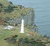
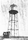
| Jervis Bay Village | Cape St George Lighthouse |  | 35°09′07″S 150°45′42″E / 35.15184°S 150.76154°E | 1860 | 1889 | Destroyed[37] |
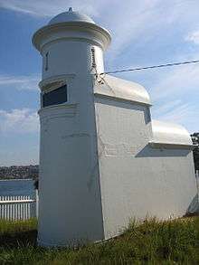
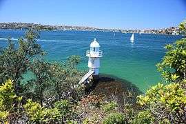
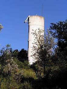
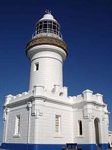
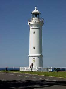
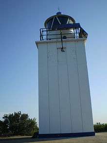
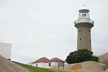
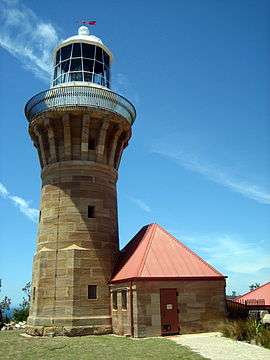
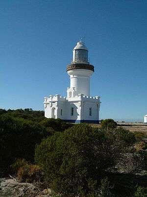
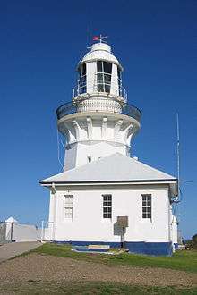
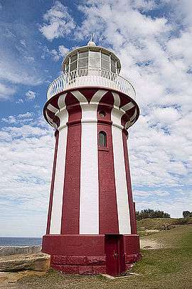
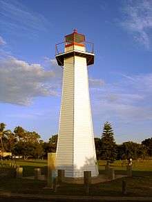
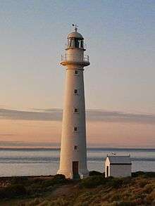
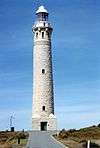
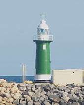
New South Wales
There are several lighthouse siblings in the vicinity – lighthouses that were designed by the same architect around the same time, which are very similar by design. These include:
- Wollongong Breakwater Lighthouse and Warden Head Light, built 1872–1873, initiated by Edward Orpen Moriarty MA MInstCE
- Crowdy Head Light, Fingal Head Light, Clarence River Light (the original, now demolished), Tacking Point Lighthouse and Richmond River Light, designed by James Barnet in 1878
- Point Perpendicular Light (1899), Cape Byron Light (1901) and Norah Head Light (1903), designed by Charles Assinder Harding
- Bradleys Head Light (1905) and Robertson Point Light (1910)
- The "Disney Castles", Grotto Point Light, Parriwi Head Light, Vaucluse Bay Range Front Light and Vaucluse Bay Range Rear Light, built 1910–1911 by Maurice Festu
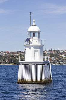
- The "Wedding Cakes", Eastern Channel Pile Light and Western Channel Pile Light built in 1924

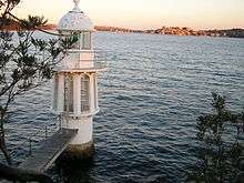


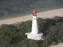
.jpg)


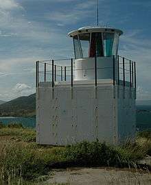
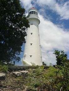
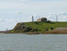
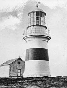
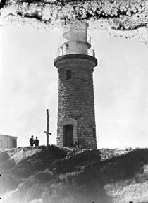
Northern Territory
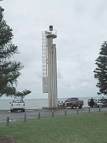
Most of the lighthouses in the Northern Territory were constructed by the Commonwealth Lighthouse Service during the "Golden Age of Australian Lighthouses", between 1913 and 1920. These include Cape Don Light, East Vernon Light, Emery Point Light, Cape Hotham Light and Cape Fourcroy.[50]
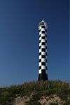
Of these five, three can be considered "siblings", Cape Hotham Light, Emery Point Light and Cape Fourcroy Light. They are almost identical white square skeletal towers, and they also share a similar light characteristic, three flashes every 15 second (Fl.(3) 15s).[51]
| Location | Name | Image | Coordinates | Year established | Year automated | Status | Remarks |
|---|---|---|---|---|---|---|---|
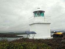
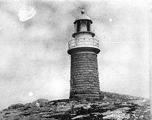
| Cobourg Peninsula | Cape Don Light | 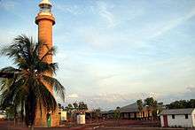 | 11°18′28″S 131°45′55″E / 11.30786°S 131.76515°E | 1917 | 1983 | active | solar powered[52] |
| Cape Fourcroy | Cape Fourcroy Light | 11°47′51″S 130°01′28″E / 11.79747°S 130.02434°E | active | ||||
| Clarence Strait | Cape Hotham Light | 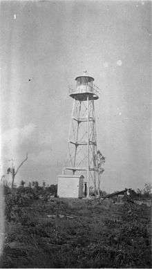 | 12°02′47″S 131°17′22″E / 12.04644°S 131.28946°E | 1928 | active | ||
| East Vernon Island | East Vernon Light |  | 12°04′38″S 131°05′43″E / 12.07722°S 131.09531°E | 1928 | active | ||
| Larrakeyah Barracks | Emery Point Light | 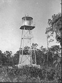 | 12°27′14″S 130°48′56″E / 12.45382°S 130.81555°E | 1900 | active | ||
| Cox Peninsula | Point Charles Light | 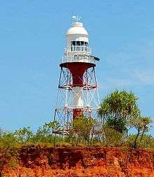 | 12°23′21″S 130°37′50″E / 12.38929°S 130.63068°E | 1893 | 1933 | active | survived cyclone Tracy;[53] solar powered[54] |
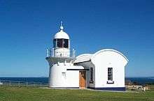
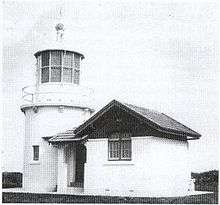
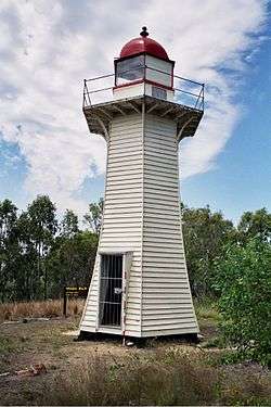
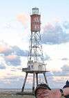
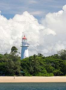
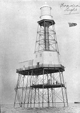
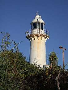
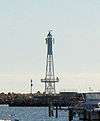
Queensland
Most lighthouses in Queensland were constructed in well established groups:
- Two lighthouses constructed using bolted prefabricated segments of cast iron: Sandy Cape Light and Bustard Head Light.[55]
- Eight lighthouses made of hardwood frame clad with corrugated iron: Little Sea Hill Light, Grassy Hill Light, Goods Island Light, Bay Rock Light, Old Caloundra Light, North Point Hummock Light (demolished), Gatcombe Head Light (demolished) and Bulwer Island Light.[56]
- Seven concrete towers erected between 1964 and 1979: Cape Capricorn Light, New Caloundra Light, Point Danger Light, New Burnett Heads Light, Fitzroy Island Light, Point Cartwright Light and Archer Point Light.[56]


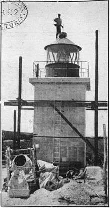
.jpg)

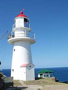


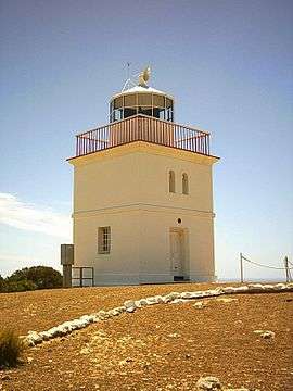
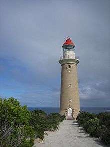
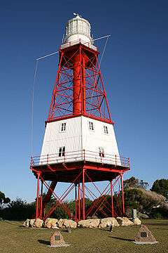
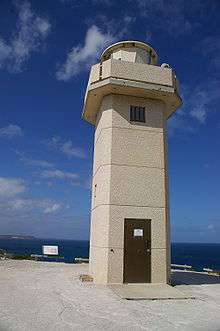
South Australia


Tasmania


Victoria


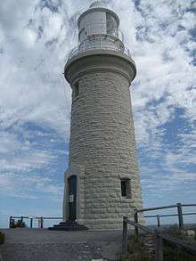
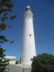
Western Australia


See also
References
- ↑ "Australia". CIA World Factbook. Retrieved 26 August 2010.
- 1 2 3 "Australian lighthouses – Australia's Culture Portal". cultureandrecreation.gov.au. Archived from the original on 20 September 2010. Retrieved 26 August 2010.
- 1 2 "The Point Malcolm Lighthouse". Lighthouses of South Australia. Lighthouses of Australia Inc. Retrieved 19 August 2010.
- 1 2 "The Macquarie Lighthouse, Australia's First Lighthouse". Lighthouses of New South Wales. Lighthouses of Australia Inc.
- ↑ List of Lights, Pub. 111: The West Coasts of North and South America (Excluding Continental U.S.A. and Hawaii), Australia, Tasmania, New Zealand, and the Islands of the North and South Pacific Oceans (PDF). List of Lights. United States National Geospatial-Intelligence Agency.
- ↑ Admiralty List Of Lights And Fog Signals vol. K Indian and Pacific Oceans, South of the Equator. United Kingdom Hydrographic Office. 2010. ISBN 978-0-7077-1764-7.
- ↑ "Australia". ARLHS. Amateur Radio Lighthouse Society.
- ↑ Rowlett, Russ. "Lighthouses of Australia: Coral Sea Islands Territory". The Lighthouse Directory. University of North Carolina at Chapel Hill.
- 1 2 Rowlett, Russ. "Lighthouses of Australia: New South Wales". The Lighthouse Directory. University of North Carolina at Chapel Hill.
- 1 2 Rowlett, Russ. "Lighthouses of Australia: Northern Territory". The Lighthouse Directory. University of North Carolina at Chapel Hill.
- 1 2 Rowlett, Russ. "Lighthouses of Australia: Queensland's East Coast". The Lighthouse Directory. University of North Carolina at Chapel Hill.
- ↑ Rowlett, Russ. "Lighthouses of Australia: Queensland's Far North". The Lighthouse Directory. University of North Carolina at Chapel Hill.
- 1 2 Rowlett, Russ. "Lighthouses of Australia: South Australia". The Lighthouse Directory. University of North Carolina at Chapel Hill.
- 1 2 3 Rowlett, Russ. "Lighthouses of Australia: Tasmania". The Lighthouse Directory. University of North Carolina at Chapel Hill.
- 1 2 Rowlett, Russ. "Lighthouses of Australia: Victoria". The Lighthouse Directory. University of North Carolina at Chapel Hill.
- ↑ Rowlett, Russ. "Lighthouses of Australia: Western Australia". The Lighthouse Directory. University of North Carolina at Chapel Hill.
- ↑
- "State Indexes". Lighthouses of Australia. Lighthouses of Australia Inc.
- ↑ "List of Lighthouses of Western Australia". Lighthouses of Australia. Lighthouses of Australia Inc.
- ↑ "List of Lighthouses of Northern Territory". Lighthouses of Australia. Lighthouses of Australia Inc.
- ↑ "List of Lighthouses of South Australia". Lighthouses of Australia. Lighthouses of Australia Inc.
- ↑ "List of Lighthouses of Queensland". Lighthouses of Australia. Lighthouses of Australia Inc.
- ↑ "List of Lighthouses of New South Wales". Lighthouses of Australia. Lighthouses of Australia Inc.
- ↑ "List of Lighthouses of Victoria". Lighthouses of Australia. Lighthouses of Australia Inc.
- ↑ "List of Lighthouses of Tasmania". Lighthouses of Australia. Lighthouses of Australia Inc.
- ↑ "Australian Lighthouses listed A to Z". lighthouses.net.au. Retrieved 26 August 2010.
- ↑ "Australian Lighthouses listed by state". lighthouses.net.au. Retrieved 26 August 2010.
- ↑ Searle, Garry. "Lighthouses of Australia". SeaSide Lights.
- ↑ Searle, Garry. "List of Lighthouses - Western Australia". Lighthouses of Australia. SeaSide Lights.
- ↑ Searle, Garry. "List of Lighthouses - Northern Territory". Lighthouses of Australia. SeaSide Lights.
- ↑ Searle, Garry. "List of Lighthouses - South Australia". Lighthouses of Australia. SeaSide Lights.
- ↑ Searle, Garry. "List of Lighthouses - Queensland". Lighthouses of Australia. SeaSide Lights.
- ↑ Searle, Garry. "List of Lighthouses - New South Wales". Lighthouses of Australia. SeaSide Lights.
- ↑ Searle, Garry. "List of Lighthouses - Victoria". Lighthouses of Australia. SeaSide Lights.
- ↑ Searle, Garry. "List of Lighthouses - Tasmania". Lighthouses of Australia. SeaSide Lights.
- ↑ See for example, Brush Island Light, a small concrete hut with an automated lamp on top of it, not listed on The Lighthouse Directory, Lighthouses of Australia Inc. and SeaSide Lights but listed on Australian Lighthouses, List of Lights, Admiralty List of Lights & Fog Signals and the ARLHS World List of Lights.
- ↑ "Role of VRCA". regionalchannels.vic.gov.au. Retrieved 26 August 2010.
- ↑ "The Ill-Fated Cape St George Lighthouse". Lighthouses of New South Wales. Lighthouses of Australia Inc. used as target practice for Australian warships
- ↑ "The Burrewarra Point Lighthouse near Batemans Bay". Lighthouses of New South Wales. Lighthouses of Australia Inc.
- ↑ "The Crookhaven Heads Lighthouse". Lighthouses of New South Wales. Lighthouses of Australia Inc.
- ↑ Steve Merson (July–August 2004). "Light the coast like a street with lamps". Lighthouses of Australia Inc Bulletin (4).
- ↑ "The Montague Island Lighthouse". Lighthouses of New South Wales. Lighthouses of Australia Inc.
- ↑ "The Point Perpendicular Lighthouse at Jervis Bay". Lighthouses of New South Wales. Lighthouses of Australia Inc.
- ↑ "The Point Stephens Lighthouse". Lighthouses of New South Wales. Lighthouses of Australia Inc.
- ↑ Ian Clifford (February 2000). "South & North Solitary Islands Trip Report". Lighthouses of Australia Inc Bulletin.
- ↑ "The South Solitary Lighthouse". Lighthouses of New South Wales. Lighthouses of Australia Inc.
- ↑ "The Sugarloaf Point Lighthouse". Lighthouses of New South Wales. Lighthouses of Australia Inc.
- ↑ "The Warden Head Lighthouse at Ulladulla". Lighthouses of New South Wales. Lighthouses of Australia Inc.
- ↑ "The Wollongong Breakwater Lighthouse". Lighthouses of New South Wales. Lighthouses of Australia Inc.
- ↑ "The Clarence River Lighthouse at Yamba". Lighthouses of New South Wales. Lighthouses of Australia Inc.
- ↑ Komesaroff, Michael B. (May 1977). "The Golden Age of Australian Lighthouses". The Victorian Historical Journal. 48 (2). reprinted in "The Golden Age of Australian Lighthouses". Lighthouses of Australia Inc Bulletin (5). September 2003.
- ↑ List of Lights, Pub. 111: The West Coasts of North and South America (Excluding Continental U.S.A. and Hawaii), Australia, Tasmania, New Zealand, and the Islands of the North and South Pacific Oceans (PDF). List of Lights. United States National Geospatial-Intelligence Agency. 2009. p. 187-188.
- ↑ "The Cape Don Lighthouse". Lighthouses of Northern Territory. Lighthouses of Australia Inc. Retrieved 26 August 2010.
- ↑ Mike Foley (1987). "Point Charles Lighthouse and the Military Occupation of the Cox Peninsula" (PDF). Darwin: Northern Territory Library Service.
- ↑ "The Point Charles Lighthouse". Lighthouses of Northern Territory. Lighthouses of Australia Inc. Retrieved 26 August 2010.
- ↑ "Sandy Cape Lightstation (listing QLD601712)". Australia Heritage Places Inventory. Department of Sustainability, Environment, Water, Population and Communities.
- 1 2 "Caloundra Lighthouses (entry 602746)". Queensland Heritage Register. Queensland Heritage Council. Retrieved 13 July 2015.
- ↑ Queensland Government: Woody Island Lighthouses & Ancillary Building Site
- ↑ Queensland Government: Woody Island Lighthouses & Ancillary Building Site
- ↑ "Booby Island Lighthouse". Lighthouses of Queensland. Lighthouses of Australia Inc. 240V
- ↑ "LIGHTHOUSES". maritimemuseum.com.au. Archived from the original on 18 February 2011. Retrieved 26 August 2010.
- ↑ "On the waterfront". anmm.gov.au. Archived from the original on 28 May 2010. Retrieved 26 August 2010.
- ↑ http://www.lighthouses.org.au/lights/QLD/Cleveland%20Point/Cleveland%20Point.htm possibly the first lighthouse to experiment with lasers, but the Point Danger Light officially lays claim to being the first, in 1971
- ↑ Richard Walding. "Moreton Island RAN7 Indicator Loop Station and Fort Cowan Cowan". indicatorloops.com. Retrieved 20 February 2011.
- ↑ "Signal Station (former) (entry 601097)". Queensland Heritage Register. Queensland Heritage Council. Retrieved 13 July 2015.
- ↑ "Booby Island Lightstation (listing QLD601724)". Australia Heritage Places Inventory. Department of Sustainability, Environment, Water, Population and Communities. Retrieved 24 November 2010.
- ↑ "Creal Reef Light, QLD, AN424-01" (PDF). Aids to Navigation Schedule Issue 10. Australian Maritime Safety Authority. December 2006.
- ↑ Rowlett, Russ. "Lighthouses of Australia: Queensland's East Coast". The Lighthouse Directory. University of North Carolina at Chapel Hill. . Moored at the Queensland Maritime Museum, Brisbane
- ↑ "Annual Report on Harbours and Lighthouses". The Queenslander. 22 November 1884.
- ↑ "Notice to Mariners No. 12 of 1952". The Courier-Mail. 10 December 1952.
- 1 2 "The Moreton Bay Pile Light". Lighthouses of Queensland. Lighthouses of Australia Inc.
- ↑ "The Pine Islet Lighthouse". Lighthouses of Queensland. Lighthouses of Australia Inc. moved to Mackay not operational as a navigational lighthouse
- ↑ http://www.lighthouses.org.au/lights/QLD/Point%20Danger/Point%20Danger.htm
- ↑ "The Bay Rock Lighthouse". Lighthouses of Queensland. Lighthouses of Australia Inc. moved to Townsville Maritime Museum
- ↑ "The Bay Rock Light House – Maritime Museum of Townsville". townsvillemaritimemuseum.org.au. Archived from the original on 29 November 2010. Retrieved 26 August 2010.
- ↑ "The Wharton Reef Lighthouse". Lighthouses of Queensland. Lighthouses of Australia Inc.
- ↑ "Wyborn Reef Light, QLD, AN299-01" (PDF). Aids to Navigation Schedule Issue 14. Australian Maritime Safety Authority. May 2006.
- ↑ "The Althorpe Island Lighthouse". Lighthouses of South Australia. Lighthouses of Australia Inc. Retrieved 19 August 2010.
- ↑ "The Cape Jaffa Lighthouse". Lighthouses of South Australia. Lighthouses of Australia Inc. Retrieved 19 August 2010. kerosene powered, non-operational
- ↑ Searle, Garry. "Cape Willoughby". Lighthouses of South Australia. SeaSide Lights. Retrieved 19 August 2010.
- ↑ "The old Penguin Island Lighthouse". Lighthouses of South Australia. Lighthouses of Australia Inc. Retrieved 19 August 2010.
- 1 2 http://www.unc.edu/~rowlett/lighthouse/sa.htm
- ↑ Searle, Garry. "Port Adelaide". Lighthouses of South Australia. SeaSide Lights. Retrieved 19 August 2010. This lighthouse originally stood at the entrance to the Port River in Port Adelaide. It was moved to South Neptune Island in 1901, and remained there until it was replaced in 1985. The old tower was subsequently returned to the South Australian Maritime Museum.
- ↑ "The Cape Northumberland Lighthouse". Lighthouses of South Australia. Lighthouses of Australia Inc. Retrieved 30 August 2010.
- ↑ "The South Neptune Island Lighthouse". Lighthouses of South Australia. Lighthouses of Australia Inc. Retrieved 19 August 2010. the original tower was returned to adelaide, see note regarding Port Adelaide Lighthouse
- ↑ "Shipwrecks and sea rescue: Lighthouses". samemory.sa.gov.au. Retrieved 26 August 2010.
- ↑ "The Troubridge Island Lighthouse". Lighthouses of South Australia. Lighthouses of Australia Inc. Retrieved 19 August 2010.
- ↑ Searle, Garry. "West Cape". Lighthouses of South Australia. SeaSide Lights. Retrieved 19 August 2010.
- ↑ Searle, Garry. "Wonga Shoal". Lighthouses of South Australia. SeaSide Lights. Retrieved 19 August 2010. Knocked over by a sailing ship, two lighthouse keepers were drowned.
- ↑ "The Currie Harbour Lighthouse". Lighthouses of Tasmania. Lighthouses of Australia Inc.
- ↑ "The Deal Island Lighthouse in Bass Strait". Lighthouses of Tasmania. Lighthouses of Australia Inc. At an elevation of 305 metres, deactivated 1992.
- ↑ "The Iron Pot Lighthouse". Lighthouses of Tasmania. Lighthouses of Australia Inc. Retrieved 19 August 2010.
- ↑ "The Low Head Lighthouse". Lighthouses of Tasmania. Lighthouses of Australia Inc. Retrieved 16 January 2011.
- ↑ "The Maatsuyker Island Lighthouse". Lighthouses of Tasmania. Lighthouses of Australia Inc. Retrieved 19 August 2010.
- ↑ "Australian Lighthouses". lighthouses.net.au. Retrieved 26 August 2010. De-manned in 1995
- ↑ Deborah Taylor (May 1999). "Tasmanian Expedition Report: (Part 1 of 4)". Lighthouses of Australia Inc Bulletin. Accessed 19 August 2010
- ↑ "The Cape Otway Lighthouse". Lighthouses of Victoria. Lighthouses of Australia Inc. Retrieved 19 August 2010.
- ↑ "The Cliffy Island Lighthouse". Lighthouses of Victoria. Lighthouses of Australia Inc. Retrieved 19 August 2010.
- ↑ "The Gabo Island Lighthouse". Lighthouses of Victoria. Lighthouses of Australia Inc. Retrieved 19 August 2010.
- ↑ "The Point Gellibrand Lightships & Pile Light". Lighthouses of Victoria. Lighthouses of Australia Inc. Retrieved 19 August 2010. struck by ship
- ↑ "The Griffiths Island Lighthouse". Lighthouses of Victoria. Lighthouses of Australia Inc. Retrieved 19 August 2010.
- ↑ "The Lady Bay Upper Lighthouse". Lighthouses of Victoria. Lighthouses of Australia Inc. Retrieved 19 August 2010.
- ↑ http://www.lighthouses.org.au/lights/VIC/South%20Channel%20Pile%20Light/South%20Channel%20Pile%20Light.htm
- ↑ "The Black Lighthouse at Fort Queenscliff". Lighthouses of Victoria. Lighthouses of Australia Inc. Retrieved 19 August 2010.
- ↑ "Parks Victoria: South Channel Pile Light page". parkweb.vic.gov.au. Archived from the original on 21 May 2010. Retrieved 26 August 2010.
- ↑ "The Williamstown Lighthouse and Timeball Tower". Lighthouses of Victoria. Lighthouses of Australia Inc. Retrieved 19 August 2010.
- ↑ "The Wilsons Promontory Lighthouse". Lighthouses of Victoria. Lighthouses of Australia Inc. Retrieved 19 August 2010. Most southernly lighthouse on mainland Australia.
- ↑ "Lighthouses of Western Australia – Arthur Head". members.upnaway.com. Retrieved 29 August 2010. demolished 1905
- ↑ http://www.lighthouses.org.au/lights/WA/Cape%20Naturaliste/Cape%20Naturaliste.htm
- ↑ Rowlett, Russ. "Lighthouses of Australia: Western Australia". The Lighthouse Directory. University of North Carolina at Chapel Hill. inactive
- ↑ "The Eclipse Island Lighthouse". Lighthouses of Western Australia. Lighthouses of Australia Inc. lantern room removed, solar powered beacon installed
- ↑ "The Jarman Island Lighthouse". Lighthouses of Western Australia. Lighthouses of Australia Inc.
- ↑ "North West Cape Light on Tower 11". members.upnaway.com. Retrieved 29 August 2010. on Tower 11 of the United States Naval Communication Station Harold E. Holt
- ↑ "The Point Cloates Lighthouse at Ningaloo". Lighthouses of Western Australia. Lighthouses of Australia Inc. abandoned in 1936
- ↑ "Point King Lighthouse Albany WA Conservation Plan". Archived from the original (PDF) on 23 February 2011.
- ↑ http://www.lighthouses.org.au/lights/WA/Rottnest%20Main/Rottnest%20Main.htm
External links
| Wikimedia Commons has media related to Lighthouses in Australia. |
- Lighthouses Australia Inc. a non-profit organisation which aims to create a higher profile for Australian lighthouses.
- West Australian Lighthouse website
- Australian and Oceania Lighthouses A private web site by Kevin vk2ce containing lists of Oceania Lighthouses with data taken from The British Admiralty vol K List of Lighthouses and Foghorns.
- Rowlett, Russ. "The Lighthouse Directory". University of North Carolina at Chapel Hill.
| Types |
| _-_cropped.jpg) | ||||||
|---|---|---|---|---|---|---|---|---|
| Fixtures | ||||||||
| Maintenance | ||||||||
| Locations | ||||||||
| Categories |
| |||||||
| Global organizations | ||||||||
| ||||||||