Wagait Shire
| Wagait Shire Northern Territory | |||||||||||||||
|---|---|---|---|---|---|---|---|---|---|---|---|---|---|---|---|
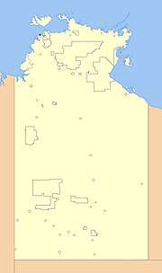 Location of Wagait Shire | |||||||||||||||
| Population | 463 (2016 census)[1] | ||||||||||||||
| • Density | 82.38/km2 (213.4/sq mi) | ||||||||||||||
| Established | 1995 | ||||||||||||||
| Area | 5.62 km2 (2.2 sq mi) | ||||||||||||||
| President | Peter Clee | ||||||||||||||
| Council seat | Wagait Beach | ||||||||||||||
| Region | outer Darwin | ||||||||||||||
| Territory electorate(s) | Daly | ||||||||||||||
| Federal Division(s) | Solomon | ||||||||||||||
|
| |||||||||||||||
| Website | Wagait Shire | ||||||||||||||
| |||||||||||||||
The Wagait Shire is a local government area in the Northern Territory. The council was established as the Cox Peninsula Community Government Council on 28 April 1995 and renamed with effect from 1 July 2008. The shire is located west of Darwin, Northern Territory, as a 15-minute ferry ride, or a 138 kilometres (86 mi) drive on fully sealed roads.
The council derived its previous name from the Cox Peninsula. It was named after Matthew Dillon Cox who was regarded as the Territory's first pastoralist, who applied for a lease over the peninsula in 1869, just after the establishment of Darwin. The current name is derived from the name of the township located near Wagait Beach.
Suburbs
See also
References
- ↑ Australian Bureau of Statistics (27 June 2017). "Wagait (S) (Local Government Area)". 2016 Census QuickStats. Retrieved 28 June 2017.

External links
Coordinates: 12°27′00″S 130°44′24″E / 12.4501°S 130.7401°E
This article is issued from
Wikipedia.
The text is licensed under Creative Commons - Attribution - Sharealike.
Additional terms may apply for the media files.