Mooloolaba
| Mooloolaba Sunshine Coast, Queensland | |||||||||||||||
|---|---|---|---|---|---|---|---|---|---|---|---|---|---|---|---|
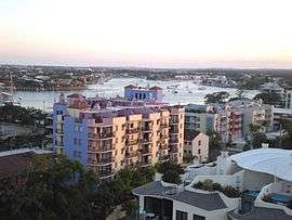 Apartments, 2008 | |||||||||||||||
 Mooloolaba | |||||||||||||||
| Coordinates | 26°40′55″S 153°07′05″E / 26.682°S 153.118°ECoordinates: 26°40′55″S 153°07′05″E / 26.682°S 153.118°E | ||||||||||||||
| Population | 7,730 (2016 census)[1] | ||||||||||||||
| • Density | 1,933/km2 (5,010/sq mi) | ||||||||||||||
| Postcode(s) | 4557 | ||||||||||||||
| Area | 4.0 km2 (1.5 sq mi) | ||||||||||||||
| Location |
| ||||||||||||||
| LGA(s) | Sunshine Coast Region | ||||||||||||||
| County | Canning | ||||||||||||||
| Parish | Mooloolah | ||||||||||||||
| State electorate(s) | Maroochydore | ||||||||||||||
| Federal Division(s) | Fisher | ||||||||||||||
| |||||||||||||||
Mooloolaba is a suburb and tourist resort township on the Sunshine Coast of Queensland, Australia. It is located 97 kilometres (60 mi) north of the state capital, Brisbane, and is part of the Maroochydore urban centre. At the 2016 Australian Census, the suburb recorded a population of 7,730.[1]
Etymology
Mooloolaba derives from the Aboriginal word mulu, meaning snapper fish, or mulla meaning Red-bellied Black Snake. Originally known as Mooloolah Heads, the name was changed to Mooloolaba by Thomas O'Connor in 1919 when he subdivided land for sale there.[2][3]
History
The original inhabitants of this region were the Gubbi Gubbi (Kabi Kabi) Nation of Aboriginal Peoples.
In 1861 Lieutenant Heath surveyed and charted the Mooloolah River mouth and harbour. The following year, Tom Petrie explored the region for timber resources. By 1864, the first land was purchased at the mouth of the Mooloolah River by William Pettigrew. Pettigrew dominated the timber trade in the Maroochy District for the next thirty years. He founded a timber depot and wharf to ship timber from Cotton Tree and Buderim to his Brisbane sawmill. In partnership with James Low, he also opened the first store in the district to serve the needs of the new settlers.
Mooloolah Heads was the gateway to the Maroochy District between 1870 and 1884. Due to the protection Point Cartwright offered, the port was preferred over the Maroochy River. Pettigrew's steamers 'Tarshaw,' 'Tadorna Radjah' and 'Gneering' operated along both rivers. The steamers carried produce, passengers and timber between Mooloolaba and Brisbane. In 1891, with the opening of the North Coast railway to Yandina, river transport deteriorated. Pettigrew transferred his activities to Maroochydore, establishing a sawmill there in 1891, leading to the further declination of the depot at Mooloolah Heads. Over the next decade little development occurred in the coastal areas.
By the year 1919, Mooloolah Heads industry had grown to include fishing and fruit growing. Thomas O'Connor bought Pettigrew's land from Sylvester Murphy and surveyed the first allotments of what was to become Mooloolaba. On 1 January 1921, the first sale of allotments was held. These extended along the river frontage from the surf beach to Tucker Creek.
It was then that the name Mooloolaba was embraced to distinguish between this developing area and the Mooloolah township on the railway.
Throughout the 1920s the population increased. The area had always been a desirable destination for Buderim settlers. Holiday cottages and houses were dotted along the river and the narrow spit. Boat hire and fishing were also very popular. As the roads and public amenities improved, Mooloolaba continued to develop as both a premier residential and holiday location.
Geography
Mooloolaba is bounded on the east by the Coral Sea, on the south by the Mooloolah River, on the north by Alexandra Headland and to the west by Buderim. Mooloolaba Harbour (actually the mouth of the Mooloolah River) is the home of a large fleet of fishing vessels, as well as being the northern base for the pilot vessels that control shipping through Moreton Bay and the Port of Brisbane. Due to its sheltered location in the lee of Point Cartwright, it is an all-weather harbour favoured by recreational sailors.
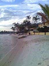
The esplanade facing Mooloolaba beach is a centre for tourist activity, containing the UnderWater World marine park, as well as many souvenir and clothing shops, bookshops, galleries and restaurants. Behind the apartments facing the beach are camping grounds, backpacker hostels and canal villas. It is also a tourism destination, with cruise ships regularly anchoring outside the port.
Mooloolaba is serviced by coach from Brisbane, by train and connecting bus via Nambour, Woombye, Landsborough station, and by air from Sunshine Coast Airport.
Amenities
The Sunshine Coast Regional Council operates a mobile library service which visits Moondarra Drive.[4]
Sports
Mooloolaba is also home to the Mooloolaba Triathlon and the Sydney to Mooloolaba Yacht Race. It is also home to various on beach events.[5]
In popular culture
Mooloolaba featured in the fourth season of the Amazing Race. Evangelist Peter Foxhall and Pastor Bill Furler pioneered an Assemblies of God church at the Mooloolaba Surf Lifesaving Club in the mid-1980s. The town was also the home of the Christian pop/rock band Newsboys, and is the fourth town mentioned in the original Australian version of the song "I've Been Everywhere".
See also
- Find a Crew, based in Mooloolaba
References
- 1 2 Australian Bureau of Statistics (27 June 2017). "Mooloolaba (State Suburb)". 2016 Census QuickStats. Retrieved 29 March 2018.

- ↑ South East Queensland - Place Names 16 December 2006 Archived 22 August 2006 at the Wayback Machine.
- ↑ Maroochy Council - Place Name Origins 16 December 2006 Archived 10 December 2006 at the Wayback Machine.
- ↑ "Libraries: Mobile timetable". Sunshine Coast Regional Council. Archived from the original on 30 January 2018. Retrieved 30 January 2018.
- ↑ "Sydney to Mooloolaba Yacht Race". Sunshine Coast Daily. Sunshine Coast Newspaper Company. Archived from the original on 2 July 2015. Retrieved 25 January 2015.
External links
| Wikimedia Commons has media related to Mooloolaba. |