Kotli Sattian Tehsil
| Kotli Sattian Tehsil | |
|---|---|
| Tehsil | |
 | |
| Country | Pakistan |
| Region | Punjab |
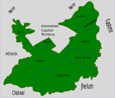
| District | Rawalpindi District |
| Capital | Kotli Sattian |
| Towns | 1 |
| Population (2017) | |
| • Total | 119,312 |
| Time zone | UTC+5 (PST) |
Kotli Sattian is a tehsil (subdivision) of Rawalpindi District in the Punjab province of Pakistan.[1]
Population
The population of the villages comprising Kotli Sattian Town (tehsil) was 83,255 in 1981, while the 1998 census shows the figure at 81,5244, a decrease 0.12 percent.
Location
Kotli Sattian is located in the Pir Panjal Range coming through Kashmir. It was earlier a part of Tehsil Murree. While establishing the Tehsil, some area of Tehsil Kahuta was also included in this separate tehsil. It is located at 50 km distance from Islamabad. It is situated with the bank of Jehlum river. Most front areas of AJK are Distt. Bagh, Rawalakot and Plandri. Jehlum River segregates Mallot Sattian, Badnian, Begal, Thoon and Plaay villages from AJK.
Gallery
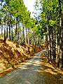 Danoi, Kotli Sattian
 Korana, Kotli Sattian
 Village view, Kotli Sattian
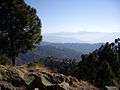 Hills, Kotli Sattian
References
- ↑ District Government of Rawalpindi Archived 2008-03-13 at the Wayback Machine.
This article is issued from
Wikipedia.
The text is licensed under Creative Commons - Attribution - Sharealike.
Additional terms may apply for the media files.