Mianwali District
| Mianwali ضِلع مِيانوالى | |
|---|---|
| District | |
 Salt Range in Mianwali | |
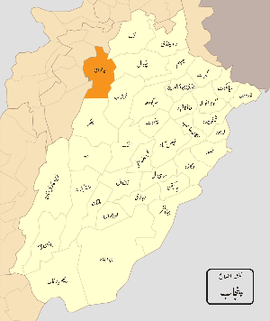 Mianwali District highlighted within Punjab Province | |
| Country | Pakistan |
| Province | Punjab |
| Headquarters | Mianwali |
| Government | |
| • DCO | Shozab Saeed |
| Area | |
| • Total | 5,840 km2 (2,250 sq mi) |
| Population (2017)[1] | |
| • Total | 1,546,094 |
| • Density | 260/km2 (690/sq mi) |
| Time zone | UTC+5 (PST) |
| Number of tehsils | 3 |
The Mianwali District (Urdu: ضِلع مِيانوالى; Pashto,Punjabi: ضلع میانوالی), is a district in the northwest of Punjab province, Pakistan. It is border district between Province of Punjab and Khyber Pakhtunkhwa. People of Mianwali understand and share the culture of Khyber Pakhtunkhwa and Punjab. Majority of Mianwalians are ethnic Pakhtuns and belong to the Niazi tribe.
Administration
The district is administratively divided into three tehsils 7 Municipal Committees and 51 union councils:[2]
| Name of tehsil | No. of union councils |
|---|---|
| Isakhel | 13 |
| Mianwali | 26 |
| Piplan | 12 |
| Total | 51 |
Geography
Mianwali district covers an area of 5,840 square kilometres (2,250 sq mi). The area in north is a continuation of the Pothohar Plateau and the Kohistan-e-Namak. Southern side of the district is a part of Thal Desert. Indus River flows through the district.
Climate
Mianwali district has an extreme climate, with a long, hot summer season and cold, dry winters. Summer lasts from May to September and winter lasts from November till February. June is the hottest month with average temperatures of 42 °C (highest recorded temperature 52 °C); in winter, December and January monthly average temperatures can be as low as 3 to 4 °C. The average rainfall in the district is about 385 mm.
| Month | Jan | Feb | Mar | Apr | May | Jun | Jul | Aug | Sep | Oct | Nov | Dec | Year |
|---|---|---|---|---|---|---|---|---|---|---|---|---|---|
| Avg high °C | 19 | 21 | 26 | 33 | 38 | 42 | 39 | 37 | 37 | 33 | 28 | 21 | 31 |
| Avg low temperature °C | 3 | 6 | 12 | 17 | 22 | 27 | 27 | 26 | 23 | 16 | 9 | 4 | 16 |
| Rainfall in. (cm) | 1.6 | 2.1 | 4.1 | 2.4 | 1.9 | 1.8 | 7.6 | 11 | 4.5 | 0.7 | 0.1 | 0.9 | 38.5 |
| Source: Weatherbase | |||||||||||||
Demographics
According to the 1998 census of Pakistan, the district had a population of 1,057,000, of which 21% resided in urban settlements.[3]:23 The first languages[4] spoken were Punjabi (74% of the population), Saraiki (12%), Pashto (10%) and Urdu (3.5%).[3]:27
Education
District Mianwali is ranked at the 50th position in the education score index of the Pakistan District Education Rankings 2017 published by Alif Ailaan. The education score is composed of the learning score, retention score and gender parity score. Retention is one of the biggest concerns in this district, with the relevant score being only 43.99 out of a potential 100 which is below the average.
In the middle school infrastructure score index, which focuses on availability of basic facilities and the building condition of schools, Mianwali ranks 36th. The facilities of electricity and drinking water in schools remain relatively good in the district with scores 95.12 and 98.78, respectively. However, the building conditions are comparatively low with a score of 63.41.
On the TaleemDo! App, residents of several areas within Mianwali have complained about the quality of the syllabus and outdated textbooks and shortage of basic facilities. Moreover, there is lack or absenteeism of subject specialists in the district. Other than that, another major issue is that there are very few high and higher secondary schools in the district.
History
Historically, all major rulers of South Asia governed this area in their turn. Mughal emperor Babur mentioned Isakhel while he was fighting against the Pakhtuns as part of his campaign to conquer the Punjab during the 1520s (ref. Baburnama). Prior to the invasion of Nadir Shah in 1738, there is little to relate concerning the history of the northern part of the district. The upper half of the district was ruled by the Gakhars, who became feudatories of the Mughal Empire, of which the district continued to form a part until the invasion of Nadir Shah. In 1738 a portion of his army entered Bannu, and by its atrocities so cowed the Bannuchis and Marwats that a heavy tribute was raised from them. Another portion of the army crossed the Darra Pezu and worked its way down to Dera Ismail Khan. Contingents raised from the neighbourhoods of Bannu and Dera Ismail Khan marched under Nadir Shah's banner to the sack of Delhi. In 1739 the area west of the Indus was surrendered by the Emperor of Delhi to Nadir Shah, and passed after his death to Ahmad Shah Abdali.
In 1748 a Durrani army under one of Ahmad Shah's generals crossed the Indus at Kalabagh, and drove out the Ghakkars, who still ruled in the cis-Indus tracts of the district, owing nominal allegiance to the Emperor at Delhi. Their stronghold, Muazzam Nagar, was razed to the ground, and with their expulsion was swept away the last vestige of authority of the Mughal Emperor in these parts. The armies of Ahmad Shah marched repeatedly through the district, the cis-Indus portion of which was, with the rest of the Punjab, incorporated in the Durrani Kingdom in 1756, and for the next sixty years a precarious hold was maintained on their eastern provinces, including this district, by Ahmad Shah and his successors to the throne of the newly created Kingdom of Kabul. Source:
People from the Mianwali District
- Tilok Chand Mehroom – Urdu poet from the Talokar tribe of Mianwali.
- Jagannath Azad – Urdu-Speaking poet of Hindu academic
- Maulana Kausar Niazi – poet, writer and former federal minister.
- Khan Bahadar Malik Muzaffar Khan Bhachar-has been elected three time[MLA] member of legislative assembly,1940-1954
- Khawaja Khurshid Anwar – filmmaker, writer, director and music composer.
- Malik Amir Mohammad Khan – Former Governor of West Pakistan
- Imran Khan – Former captain of the Pakistan cricket team who won the 1992 Cricket World Cup and has been elected twice the member of National Assembly of Pakistan from Mianwali and the 22nd Prime minsiter of Islamic Republic Of Pakistan .
- Attaullah Khan Esakhelvi – Folk Singer
- Abdul Sattar Khan Niazi – religious and political leader of Pakistan
- Misbah-ul-Haq – Pakistani Cricketer
- Tariq Niazi – Olympian Gold Medalist in Track and Field
- Sher Afgan Niazi – The Ex-Minister of Law and Member of Parliament
- Sardar Khan Niazi – Chief Editor and Publisher of Daily Pakistan, Daily The Patriot, Daily Pak Watan, Daily Action, Daily Nawa-e-Nawabshah, Monthly Naya Rukh, and also Chairman of Pakistan Group of Publications.
- Shadab Khan – Pakistani Cricketer
- Aqeela Asifi – Afghan refugee and teacher who has educated thousands of other Afghan refugee children in Mianwali
- ( Amjid Ali Khan ) two time Member of Parliament got 156700 vote in 2018 election (most popular leader in youth mianwali,
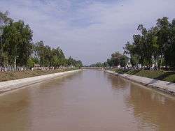
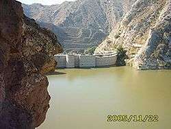
Places of interest
.jpg)
See also
Further reading
- "Wichara Watan" By Harish Chander Nakra, New Delhi, India
References
- ↑ "DISTRICT WISE CENSUS RESULTS CENSUS 2017" (PDF). www.pbscensus.gov.pk. Archived from the original (PDF) on 2017-08-29.
- ↑ Tehsils & Unions in the District of Mianwali - Government of Pakistan Archived 2008-06-11 at the Wayback Machine.
- 1 2 1998 District Census report of Mianwali. Census publication. 47. Islamabad: Population Census Organization, Statistics Division, Government of Pakistan. 1999.
- ↑ "Mother tongue": defined as the language of communication between parents and children, and recorded of each individual.
External links
Provincial capital: Lahore | ||
| Bahawalpur | _Districts.svg.png) | |
| Dera Ghazi Khan | ||
| Faisalabad | ||
| Gujranwala | ||
| Lahore | ||
| Multan | ||
| Rawalpindi | ||
| Sargodha | ||
| Sahiwal | ||
| Sheikhupura | ||
See also: Districts of Punjab, India | ||