Kharsawan State
| Kharsawan State ଖରସୁଆଁ - kharaswan[1] | |||||
| Princely State of British India | |||||
| |||||
 | |||||
 | |||||
| History | |||||
| • | Established | 1650 | |||
| • | Independence of India | 1948 | |||
| Area | |||||
| • | 1892 | 396 km2 (153 sq mi) | |||
| Population | |||||
| • | 1892 | 31,051 | |||
| Density | 78.4 /km2 (203.1 /sq mi) | ||||
Kharsawan State, also spelt Kharsua or kharaswan,[1] was a princely state in India during the era of the British Raj.[2] The state had a privy purse of 33,000 Rs. and was one of the nine Chota Nagpur States under the authority of the governor of Bengal Presidency.[3] It was one of the Odia Princely states of India during the period of the British Raj and the major language spoken in the area is Odia.
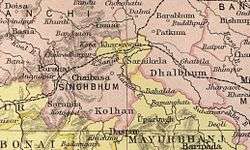
The capital was the city of Kharsawan and the former area of Kharsawan State is now a part of Jharkhand, where its district is named Seraikela Kharsawan district. Kumar Aditya Narayan Singh Deo and his father Maharaj Kumar Rudra Pratap Singh Deo appreciated the name change of the district.
History
Kharsawan estate was founded in 1650. The rulers of Kharsawan are descended from Kunwar Bikram Singh of Porahat, the first ruler of neighbouring Seraikela State. His second son, Kunwar Padam Singh was the founder of Kharsawan.[4] In 1857 Kharsawan estate was recognized as a state.
In 1912 Kharsawan came under the authority of the province of Bihar and Orissa, which had been carved from the eastern districts of Bengal. In 1936 the state was placed under the authority of the Orissa Province. Saraikela, along with 24 other princely states of the Eastern States Agency, acceded to the Government of India on 1 January 1948, with a will to merge the princely state with Orissa province of the Indian Republic.
As a result, both Kharsawan and Saraikela princely states were merged with Orissa in 1948. On 1 January 1948 itself, the tribals of these two princely states, who were in a majority, revolted against the merger with Orissa. This was supported by Patayet Sahib Maharajkumar Bhoopendra Narayan Singh Deo, third son of HH Raja Aditya Pratap Singh Deo, as a result of which he was imprisoned to ensure the popular movement died down. The central government appointed a commission under Mr. Baudkar to look into the matter. On the basis of the Baudkar commission report, Saraikela and Kharsawan princely states were merged with Bihar on 18 May 1948. These two princely states became part of Jharkhand when the state was separated from Bihar on 15 November 2000. From 18 May 1948 onward, many non-tribal Oriyas of the districts of Saraikela Kharsawan, East Singhbhum, and West Singhbhum have migrated and settled permanently in Orissa.
Rulers
Former rulers bore the title of 'Thakur' until 1917. They belonged to the Rathore dynasty of Videhas. The title of Raja was granted to Kharsawan rulers in 1902, beginning with Raja Ram Chandra Singh Deo.[5] The present head of the royal family is Raja Pradeep Chandra Singh Deo.
The last ruler of the state, HH Raja Siram Chandra Singh Deo, signed the merger agreement acceding to the Indian Union on 18 May 1948. The Maharaja of Darbhanga used to visit this state to pay respects as the trade route to the east coast ran through the thick jungles of Singhbhum and safety was guaranteed only to those who were in the good books.
Thakurs
- 1857 - 1863 Gangaram Singh Deo (b. 1836 - d. 18..) (personal style Raja from 1860)
- 1863 - 18.. Ram Narain Singh
- 18.. - 2 Mar 1884 Raghunath Singh Deo (b. 1841 - d. 1884)
- 2 Mar 1884 - 6 Feb 1902 Mahendra Narayan Singh Deo (b. 1869 - d. 19..)
- 6 Feb 1902 - 1917 Siram Chandra Singh Deo (b. 1892 - d. 19..)
Raja
- 1917 - 15 Aug 1947 Siram Chandra Singh Deo (s.a.)
See also
References
- 1 2 Mohapatra, Anil (April 2011). "The Unfinished Task of Orissa Formation" (PDF). Orissa Review.
- ↑ Imperial Gazetteer2 of India, Volume 22, page 83 - Imperial Gazetteer of India - Digital South Asia Library. Dsal.uchicago.edu. Retrieved 2012-07-11.
- ↑

- ↑ Rajput Provinces of India - Kharsawan (Princely State)
- ↑ Princely States of India