Khandpara State
| Khandpara State | |||||
| Princely State of British India | |||||
| |||||
 | |||||
 | |||||
| History | |||||
| • | Established | c. 1599 | |||
| • | Accession to the Union of India | 1948 | |||
| Area | |||||
| • | 1901 | 632 km2 (244 sq mi) | |||
| Population | |||||
| • | 1901 | 77,929 | |||
| Density | 123.3 /km2 (319.4 /sq mi) | ||||
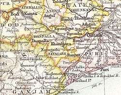
Khandpara State was one of the princely states of India during the period of the British Raj. It was located in present-day Nayagarh district, Odisha.
The state was bounded in the north by the Mahanadi River. The main town was Kantilo, but the capital was at Khandpara (Khandapada).[1]
History
Khandpara State was initially part of Nayagarh State, founded by a former ruler of Rewa State, but became a separate kingdom in 1599 when Jadunath Singh Mangraj, the first ruler of Khandpara received the title of 'Mangraj' from the Maharaja of Orissa. The rulers were Rajputs of the Baghela or Vaghela dynasty. The last Raja of Khandpara signed the instrument of accession to the Indian Union on 1 January 1948.
Rulers
The rulers of Khandpara State bore the title of Raja. The emblem of the Khandpara royal family was the head of a tiger; state symbols were identical in neighboring Nayagarh State.[2]
Rajas
- 1599 - 1675 Jadunath Singh Mangraj, 1st Raja of Khandpara
- 1675 - 1709 Narayan Singh Mangraj
- 1709 - 1723 Balunkeshwar Singh Mangraj
- 1723 - 1732 Banamali Singh Mardraj Bhramarbar Rai
- 1734 - 1770 Bairagi Singh Mardraj Bhramarbar Rai
- 1770 - 1794 Niladri Singh Mardraj Bhramarbar Rai
- 1794 - 1815 Narasimha Singh Mardraj Bhramarbar Rai
- 1815 - 1821 Purushottam Mardraj Bhramarbar Rai
- 1821 - 1842 Krishna Chandra Singh Bhramarbar Rai
- 1842 - 1867 Kunja Bihari Singh Bhramarbar Rai
- 28 Feb 1867 - 1905 Natobar Mardraj Bhramarbar Rai (b. 1837 - d. 1905)
- 1905 - 26 Dec 1922 Ram Chandra Singh Mardraj Bhramarbar Rai
- 26 Dec 1922 – 15 Aug 1947 Harihar Singh Deo Mardraj Bhramarbar Rai (b. 1914 - d. 1977)
See also
References
- ↑ Great Britain India Office. The Imperial Gazetteer of India. Oxford: Clarendon Press, 1908.
- ↑ Princely States of India
Coordinates: 20°15′50″N 85°12′51″E / 20.26389°N 85.21417°E