Khansama Upazila
| Khansama খানসামা | |
|---|---|
| Upazila | |
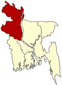
 Khansama Location in Bangladesh | |
| Coordinates: 25°55.7′N 88°44′E / 25.9283°N 88.733°ECoordinates: 25°55.7′N 88°44′E / 25.9283°N 88.733°E | |
| Country |
|
| Division | Rangpur Division |
| District | Dinajpur District |
| Government | |
| Area | |
| • Total | 179.72 km2 (69.39 sq mi) |
| Population (1991) | |
| • Total | 123,782 |
| • Density | 690/km2 (1,800/sq mi) |
| Time zone | UTC+6 (BST) |
| 5240 | 5240 |
| Website | Official Map of Khansama |
Khansama (Bengali: খানসামা) is an upazila of Dinajpur District in the Division of Rangpur, Bangladesh.[1]
Geography
Khansama is located at 25°55′40″N 88°44′00″E / 25.9278°N 88.7333°E; it has 23,735 households and total area 179.72 km².
Demographics
As of the 1991 Bangladesh census, Khansama has a population of 123782. Males constitute 50.85% of the population, and females 49.15%. This Upazila's eighteen up population is 60772. Khansama has an average literacy rate of 23.2% (7+ years); the national average is 32.4% literacy.[2] Historical Place: Aoo kora mosjid, Khansama Bridge Entertainment place: Anondo vubon , Shisupark
History
Mohammad Solim Uddin Ahmed was one of the few rich families in the region, very wealthy and wealthy. His father was Samrat Haji Mohammad Amarot Ullah. 18 Century was a prominent, influential, wealthy person in this region. His predecessors were believed to be kings and later zamindars. Mohammad Solim Uddin Ahmed had 6 sons and 3 daughters, among them the son of Colonel Mohammad Abdus Sabur.
Khansama Persian word. Its lexical meaning - servant or servant. It is said that a wealthy merchant in this upazila (somehow the British merchant in some sense) was a very loyal servant. The servant gained immensely reputation for honesty, fidelity and etiquette. In order to keep his memory memorable, this region is named after 'Khansamama'. Khanasama was named as 21 January 1891. Khanasama thana was created in 1891 and it was turned into an upazila in 1983.
Honorable and famous person:
1.Hazi Mohammad Amarot Ullah ( 18th century )
2.Mohammad Solim Uddin Ahmed (18-19 century )
3.Colonel Mohammad Abdu
Administration
Khansama has 6 unions/wards, 57 mauzas/mahallas, and 57 villages.
The Unions are
No. 1 Alokjhari Union
No. 2 Bherberi Union
No. 3 Angarpara Union
No. 4 khqmqrpra Union
No. 5 Vabki Union
No. 6 Goaldihi Union
Population data
According to the 2011 census, the total population is 1,78,314. Of these, males - 90,038 and females - 88,276. The population density is 956 / sq km
See also
References
- ↑ Mamtajur Alam (2012), "Khansama Upazila", in Sirajul Islam and Ahmed A. Jamal, Banglapedia: National Encyclopedia of Bangladesh (Second ed.), Asiatic Society of Bangladesh
- ↑ "Population Census Wing, BBS". Archived from the original on 27 March 2005. Retrieved 10 November 2006.
| Upazila/Thana: | ||
|---|---|---|