Kamakou
| Kamakou | |
|---|---|
 Eastern Molokai with a portion of Kamakou and Molokai Forest Reserve | |
| Highest point | |
| Elevation | 4,961 ft (1,512 m) [1] |
| Prominence | 4,961 ft (1,512 m) |
| Listing |
|
| Coordinates | 21°6′23″N 156°52′06″W / 21.10639°N 156.86833°WCoordinates: 21°6′23″N 156°52′06″W / 21.10639°N 156.86833°W |
| Geography | |
 Kamakou Hawaii  Kamakou Kamakou (Hawaii) | |
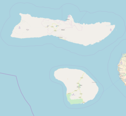
| Location | Molokai, Hawaii, U.S. |
| Parent range | Hawaiian Islands |
| Topo map | USGS |
| Geology | |
| Mountain type | Shield volcano (extinct) |
| Volcanic arc/belt | Hawaiian–Emperor seamount chain |
Kamakou is the highest peak on the island of Molokai, at 4,961 feet (1,512 m). It is part of the extinct East Molokai shield volcano, which comprises the east side of the island.[2] Kamakou is located within the 2,774 acres (11.23 km2; 4.334 sq mi) Molokai Forest Reserve,[3] estimated to contain more than 250 rare native Hawaiian plants, many of which exists only in this part of the world.[4] Two examples are the olomaʻo (Molokai thrush) and kākāwahie (Molokai creeper). Monthly tours are held by The Nature Conservancy.[5]
See also
References
- ↑ Daniel Harrington. "Moloka'i: Cultural/Historical Sites and Attractions". Hawaiian Encyclopedia. Mutual Publishing. Retrieved June 7, 2012.
- ↑ Giant Landslides of the Hawaiian Islands - University of Hawaii, Hilo
- ↑ Molokai Forest Reserve — Department of Land and Natural Resources
- ↑ Kamakou Preserve, Molokai | GoHawaii.com
- ↑ Ed Misaki-Safeguarding Moloka‘i | The Nature Conservancy
External links
Honolulu (capital) | ||
| Topics | ||
| Society | ||
| Main islands | ||
| Northwestern Islands | ||
| Communities | ||
| Counties | ||
| Sovereignty Movement | ||
This article is issued from
Wikipedia.
The text is licensed under Creative Commons - Attribution - Sharealike.
Additional terms may apply for the media files.