Kalu Ganga
| Kalu Ganga | |
|---|---|
 | |
| Native name | කළු ගඟ (Kalu Ganga) |
| Country | Sri Lanka |
| Physical characteristics | |
| Main source |
Adam's Peak 2,400 m (7,874 ft) |
| River mouth |
Indian Ocean Kalutara 06°34′10″N 79°57′44″E / 6.56944°N 79.96222°ECoordinates: 06°34′10″N 79°57′44″E / 6.56944°N 79.96222°E |
| Length | 129 km (80 mi) |
| Basin features | |
| Basin size | 2,766 km2 (1,068 sq mi) |
| Tributaries |
|
Kalu Ganga (Sinhalese: කළු ගඟ; literally: Black River) is a river in Sri Lanka. Measuring 129 km (80 mi) in length, the river originates from Sri Paadhaya and reach the sea at Kalutara. The Black River flows through the Ratnapura and the Kalutara District and pass the city Ratnapura. The mountainous forests in the Central Province and the Sinharaja Forest Reserve are the main sources of water for the river.[1]
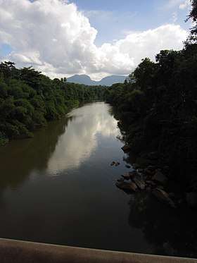
Downstream view, in Ratnapura.
See also
References
- ↑ Development of a Flood Forecasting Model For Kalu River and Kelani River Basins in Sri Lanka using Radial Basis Function Neural Networks
This article is issued from
Wikipedia.
The text is licensed under Creative Commons - Attribution - Sharealike.
Additional terms may apply for the media files.