Kendrapara district
| Kendrapara | |
|---|---|
| District | |
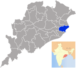 Location in Odisha, India | |
| Coordinates: 20°31′30″N 86°28′30″E / 20.525°N 86.475°ECoordinates: 20°31′30″N 86°28′30″E / 20.525°N 86.475°E | |
| Country |
|
| State | Odisha |
| Headquarters | Kendrapara |
| Government | |
| • Collector & District Magistrate | Shri Reghu G, IAS |
| • Superintendent of Police | Shri Dayanidhi Gochhait, OPS |
| • Member of Parliament | Shri Baijayant "Jay" Panda |
| Area | |
| • Total | 2,644 km2 (1,021 sq mi) |
| Population (2011) | |
| • Total | 1,439,891 |
| • Density | 492.38/km2 (1,275.3/sq mi) |
| Languages | |
| • Official | Odia, English |
| Time zone | UTC+5:30 (IST) |
| PIN | 754 xxx[1] |
| Vehicle registration | OD-29 |
| Sex ratio | 1.006 ♂/♀ |
| male | 7,17,695 |
| female | 7,22,196 |
| Literacy | 85.93% |
| Lok Sabha constituency | Kendrapara |
| Vidhan Sabha constituency |
5
|
| Climate | Aw (Köppen) |
| Precipitation | 1,501.3 millimetres (59.11 in) |
| Website |
www |
| This article is part of a series on |
| Odisha |
|---|
 |
| Governance |
|
| Topics |
| GI Products |
|
Districts Divisions |
|
|
Kendrapara District is an administrative district of Odisha state in eastern India. The town of Kendrapara is the district headquarters. Kendrapara District is situated in the eastern portion of the state, and is bounded on the north by Bhadrak District, on the east by the Bay of Bengal, on the south by Jagatsinghpur District, on the west by Cuttack District and on the northwest by Jajpur District.
Geography
Kendrapara District lies in 20° 20’ N To 20° 37’ N Latitude and 86° 14’ E To 87° 01’ E Longitude and situated in central coastal plain zone of the Odisha. The Bay of Bengal lies in the eastern part of the district. The coastline covers 48 km stretching from Dhamra Muhan to Batighar. Kendrapara district headquarters is 85 km from the State headquarters.
Kendrapara District lies in the river delta formed by the Brahmani and Baitarani and branch rivers of Mahanadi. The Bhitarkanika Mangroves, Bhitarkanika National Park, Gahirmatha Beach and Baladevjew Temple lie in the district. Other features in the district include Suka-Parikshita Ashram, Kudanagari, Landibata Mahapurusha Matha Chanpur, Pentha sea beach, Gogua PatharaKani Temple Harihar Kshetra Mahala, Gadadhara Gosain Pitha, and Korua. This district has 9 blocks named as Aali, Derabish, Garadpur, Mahakalapada, Marshaghai, Kendrapara, Rajanagar, Rajkanika, Patamundai.
Divisions
There are 9 Tahasilsand 9 blocks in Kendrapara district.[2] They are :
- Aali (Aul)
- Kanika
- Kendrapara
- Marshaghai
- Pattamundai
- Rajnagar
- Mahakalpada
- Derabish
- Garadpur
- Aali (Aul)
- Derabis
- Garadpur
- Kendrapara
- Mahakalpada
- Marshaghai
- Pattamundai
- Rajakanika
- Rajnagar
Demographics
According to the 2011 census Kendrapara district has a population of 1,439,891,[3] roughly equal to the nation of Swaziland[4] or the US state of Hawaii.[5] This gives it a ranking of 344th in India (out of a total of 640).[3] The district has a population density of 545 inhabitants per square kilometre (1,410/sq mi) .[3] Its population growth rate over the decade 2001-2011 was 10.59%.[3] Kendrapara has a sex ratio of 1006 females for every 1000 males,[3] and a literacy rate of 85.93%.[3] The mother tongue of most of the people here is Odia; there is a sizable number of Bengali and Urdu speaking people. Hindi is also widely understood.
Culture
Tourism
There are several tourist places in Kendrapara. Batighara is the first lighthouse installed in eastern coast of India. In front of the Batighar, False Point Port was the first modern port of the Odisha coast. This port was commissioned in the year 1855. Kanika Palace is one of the most popular tourist places in Kendrapara District. It is situated in Rajkanika block and around 50 km from Kendrapara. Aul Palace is another tourist site and it is an ancient palace spread over 40 acres of land. Other structures like Rajbati, Ranimahal, Ghodashala, Bhandar, Udyan, Pramoda Udyan, Debalaya, Devi mandir are included in the palace. Dhamara Port is an ancient port on the bank of river Baitarani, around 5 km from Kanika Palace. Kudanagari is an ancient center of maritime business, which is situated in Patkura constituency. A massive sand dune sprawling over 15 acres of land and of a height 25 feet, surrounded by deep forest is a pilgrim center. The district is known for its temples, fairs and wildlife sanctuaries. Notable tourist places are
- Baladevjew Temple, Kendrapara Town.
- Lakhmi Varaha Temple, Near Aul, a 40 km distance from Kendrapara Town.
- Bhitarkanika Mangroves
- Bhitarkanika National Park
- Gahirmatha Beach
Politics
Vidhan sabha constituencies
The following is the 5 Vidhan sabha constituencies[6][7] of Kendrapara district and the elected members[8] of that area
| No. | Constituency | Reservation | Extent of the Assembly Constituency (Blocks) | Member of 14th Assembly | Party |
|---|---|---|---|---|---|
| 96 | Patkura | None | Derabish, Garadapur, Marshaghai (part) | Bed Prakash Agarawalla | BJD |
| 97 | Kendrapara | SC | Kendrapara (M), Kendrapara, Pattamundai (part) | Shri Kishore Tarai | BJD |
| 98 | Aul | None | Aul, Rajkanika | Shri Debendranath Sharma | INC |
| 99 | Rajanagar | None | Pattamundai (NAC), Rajanagar, Pattamundai (part) | Anshuman Mohanty | INC |
| 100 | Mahakalapada | None | Mahakalapada, Marshaghai (part) | Atanu Sabyasachi Nayak | BJD |
References
- ↑ "PinCode: Kendrapara, Orissa, India, All Post Office Addresses Data, Pincode.net.in". pincode.net.in. Retrieved 11 January 2013.
KENDRAPARA 754211
- ↑ h http://orissa.gov.in/e-magazine/orissaannualreference/ORA-2005/pdf/list_of_districts.pdf
- 1 2 3 4 5 6 "District Census 2011". Census2011.co.in. 2011. Retrieved 2011-09-30.
- ↑ US Directorate of Intelligence. "Country Comparison:Population". Retrieved 2011-10-01.
Swaziland 1,370,424
- ↑ "2010 Resident Population Data". U. S. Census Bureau. Archived from the original on 2013-10-19. Retrieved 2011-09-30.
Hawaii 1,360,301
- ↑ Assembly Constituencies and their EXtent
- ↑ Seats of Odisha
- ↑ "List of Member in Fourteenth Assembly". ws.ori.nic.in. Archived from the original on 2 May 2007. Retrieved 19 February 2013.
MEMBER NAME
External links
Places adjacent to Kendrapara district | ||||||||||
|---|---|---|---|---|---|---|---|---|---|---|
| ||||||||||
| Governance |
|  | |||||
|---|---|---|---|---|---|---|---|
| Topics | |||||||
| GI Products | |||||||
| Districts and divisions |
| ||||||
| Cities | |||||||