Indore district
| Indore district इन्दौर ज़िला | |
|---|---|
| District of Madhya Pradesh | |
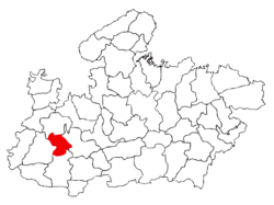 Location of Indore district in Madhya Pradesh | |
| Country | India |
| State | Madhya Pradesh |
| Administrative division | Indore |
| Headquarters | Indore |
| Government | |
| • Lok Sabha constituencies | Indore, Dhar |
| • Assembly seats | 9 |
| Area | |
| • Total | 3,989 km2 (1,540 sq mi) |
| Population (2011) | |
| • Total | 3,272,335 (provisional)[1] |
| Demographics | |
| • Literacy | 82.3%[2] |
| • Sex ratio | 924[1] |
| Average annual precipitation | 40 mm |
| Website | Official website |
The Indore District is a district of Madhya Pradesh state in central India. The name of the district comes from the city of Indore, which is its administrative capital. This district forms part of the Indore Division.
As of 2011, it is the most populous of the 50 districts in Madhya Pradesh.[3]
Geography
The Indore District has an area of 3,898 km²[4] and borders the districts of Ujjain to the north, Dewas to the east, Khargone (West Nimar) to the south, and Dhar to the west.
Rivers
The two main rivers of the Indore district are the Chambal, in the west, (originating in the Vindhya range south of Mhow) and the Kshipra, a tributary of the Chambal river, in the east. Other small rivers include the Gambhir and the Kanh, both tributaries of the Kshipra river.
Cities and Towns
Indore is the administrative centre and main city in the district. Dr. Ambedkar Nagar is an important cantonment town in the Indore District that contains three of the Indian Army's premier training institutes, as well as the Border Security Force's Central School of Weapons and Tactics (CSWT). Other towns in Indore include Depalpur, Sanwer and Hatod.
Divisions
The Indore district has four administrative divisions: Depalpur, Sanwer, Indore and Mhow. There are also four blocks in the district, with 36 police stations. There are a total of 335 Panchayats and 649 villages in the four blocks.
Since parliamentary and legislative assembly constituency boundaries were redrawn in 2008, there have been nine Vidhan Sabha constituencies in this district: Depalpur, Indore-1, Indore-2, Indore-3, Indore-4, Indore-5, Dr. Ambedkar Nagar-Mhow, Rau and Sanwer.[5] Dr. Ambedkar Nagar-Mhow is part of the Dhar Lok Sabha constituency and the others are part of the Indore Lok Sabha constituency. The current member of the Lok Sabha from the Indore constituency is Sumitra Mahajan of the Bharatiya Janata Party (BJP). She has been a Member of Parliament since 1989.
Demographics
According to the 2011 census, the Indore District has a population of 3,272,335,[3] which roughly equals the nation of Mauritania[6] or the US state of Iowa.[7] This makes it the 105th most populous in India (out of a total of 640) districts.[3] The district has a population density of 841 inhabitants per square kilometre (2,180/sq mi).[3] Its population growth rate over the decade 2001-2011 was 32.88%.[3] Indore has a sex ratio of 928 females for every 1,000 males,[3] and a literacy rate of 80.87% (male 87.25% and female 74.02%).[3]
Climate
| Climate data for Indore district | |||||||||||||
|---|---|---|---|---|---|---|---|---|---|---|---|---|---|
| Month | Jan | Feb | Mar | Apr | May | Jun | Jul | Aug | Sep | Oct | Nov | Dec | Year |
| Average high °C (°F) | 27.5 (81.5) |
28.8 (83.8) |
38.3 (100.9) |
42.7 (108.9) |
46.4 (115.5) |
36.2 (97.2) |
30.3 (86.5) |
28.2 (82.8) |
30.9 (87.6) |
32.4 (90.3) |
22.7 (72.9) |
16.9 (62.4) |
31.8 (89.2) |
| Average low °C (°F) | 5.8 (42.4) |
9.4 (48.9) |
16.2 (61.2) |
21.2 (70.2) |
24.4 (75.9) |
24.1 (75.4) |
22.6 (72.7) |
21.9 (71.4) |
21.1 (70) |
18.1 (64.6) |
11.9 (53.4) |
6.6 (43.9) |
16.9 (62.5) |
| Average precipitation mm (inches) | 4 (0.16) |
3 (0.12) |
1 (0.04) |
3 (0.12) |
11 (0.43) |
136 (5.35) |
279 (10.98) |
360 (14.17) |
185 (7.28) |
52 (2.05) |
21 (0.83) |
7 (0.28) |
1,062 (41.81) |
| Average precipitation days | 0.8 | 0.8 | 0.3 | 0.3 | 1.8 | 8.6 | 15.9 | 18.3 | 8.6 | 3.1 | 1.4 | 0.6 | 60.5 |
| Mean monthly sunshine hours | 288.3 | 274.4 | 288.3 | 306.0 | 325.5 | 210.0 | 105.4 | 80.6 | 180.0 | 269.7 | 273.0 | 282.1 | 2,883.3 |
| Source: HKO | |||||||||||||
References
- 1 2 "Distribution of population, sex ratio, density and decadal growth rate of population - State and District : 2011". Office of The Registrar General & Census Commissioner, India. Retrieved 18 July 2011.
- ↑ "Total Population, child population in the age group 0-6,literates and literacy rates by sex: 2011". Office of The Registrar General & Census Commissioner, Government of India. Retrieved 18 July 2011.
- 1 2 3 4 5 6 7 "District Census 2011". Census2011.co.in. 2011. Retrieved 2011-09-30.
- ↑ "Indore District - Statistics". Collectorate, Indore, Madhya Pradesh. Archived from the original on 21 July 2011. Retrieved 20 July 2011.
- ↑ "District Assembly list". Chief Electoral Officer, Madhya Pradesh website. Archived from the original on 1 December 2015. Retrieved 18 April 2010.
- ↑ US Directorate of Intelligence. "Country Comparison:Population". Retrieved 2011-10-01.
Mauritania 3,281,634 July 2011 est.
- ↑ "2010 Resident Population Data". U. S. Census Bureau. Archived from the original on 19 October 2013. Retrieved 30 September 2011.
Iowa 3,046,355
External links
Places adjacent to Indore district | ||||||||||
|---|---|---|---|---|---|---|---|---|---|---|
| ||||||||||