Huanghua
| Huanghua 黄骅市 | |
|---|---|
| County-level city | |
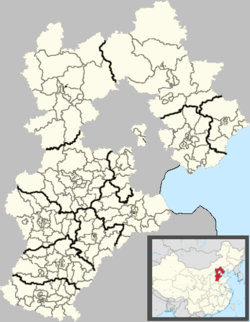 Huanghua Location in Hebei | |
| Coordinates: 38°22′N 117°21′E / 38.367°N 117.350°ECoordinates: 38°22′N 117°21′E / 38.367°N 117.350°E | |
| Country | People's Republic of China |
| Province | Hebei |
| Prefecture-level city | Cangzhou |
| Area | |
| • Total | 1,544 km2 (596 sq mi) |
| Population | |
| • Total | 419,700 |
| • Density | 270/km2 (700/sq mi) |
| Time zone | UTC+8 (China Standard) |
| Website |
huanghua |
Huanghua (simplified Chinese: 黄骅; traditional Chinese: 黄驊; pinyin: Huánghuá) is a county-level city located in the Bohai Gulf coastal region of Hebei province, China. It is under the jurisdiction of Cangzhou City.
Huanghua is named after Chinese Communist revolutionary Huang Hua. Previously it was known as Xinqing County (Chinese: 新青县). It has a total area of 1,544 km2 (596 sq mi), with a coastline of 65.8 km (40.9 mi). The total administrative population is 419,700 in the entire county, with 120,000 people living in the urban area of 18 km2 (6.9 sq mi).
Huanghua has a seaport, Huanghua Port. It is a stop on the Jinshan Expressway that connects Tianjin with Shantou, Guangdong.
Administrative divisions[1]
Subdistricts:
- Huazhong Subdistrict (骅中街道), Huadong Subdistrict (骅东街道), Huaxi Subdistrict (骅西街道)
Towns:
- Huanghua Town (黄骅镇), Nanpaihe (南排河镇), Jiucheng (旧城镇), Lüqiao (吕桥镇)
Townships:
- Guanzhuang Township (官庄乡), Changguo Township (常郭乡), Qijiawu Township (齐家务乡), Tengzhuangzi Township (滕庄子乡), Yang'erzhuang Hui Ethnic Township (羊二庄回族乡), Xincun Hui Ethnic Township (新村回族乡), Yangsanmu Hui Ethnic Township (羊三木回族乡)
Climate
Huanghua has a four-season, monsoon-influencedhumid continental climate (Köppen Dwa), with cold, dry winters, and hot, humid summers. The monthly 24-hour average temperature ranges from −3.8 °C (25.2 °F) to 26.6 °C (79.9 °F), while the annual mean is 12.46 °C (54.4 °F). Close to 60% of the annual rainfall of 567 mm (22.3 in) occurs in July and August alone.
| Climate data for Huanghua (1971−2000) | |||||||||||||
|---|---|---|---|---|---|---|---|---|---|---|---|---|---|
| Month | Jan | Feb | Mar | Apr | May | Jun | Jul | Aug | Sep | Oct | Nov | Dec | Year |
| Record high °C (°F) | 13.6 (56.5) |
21.8 (71.2) |
26.4 (79.5) |
32.7 (90.9) |
38.0 (100.4) |
41.0 (105.8) |
40.5 (104.9) |
37.3 (99.1) |
34.9 (94.8) |
31.3 (88.3) |
23.4 (74.1) |
17.6 (63.7) |
41 (105.8) |
| Average high °C (°F) | 1.9 (35.4) |
5.1 (41.2) |
11.6 (52.9) |
20.4 (68.7) |
26.4 (79.5) |
30.8 (87.4) |
31.4 (88.5) |
30.1 (86.2) |
26.5 (79.7) |
20.0 (68) |
11.0 (51.8) |
4.2 (39.6) |
18.3 (64.9) |
| Daily mean °C (°F) | −3.8 (25.2) |
−1.1 (30) |
5.3 (41.5) |
13.8 (56.8) |
19.8 (67.6) |
24.8 (76.6) |
26.6 (79.9) |
25.6 (78.1) |
20.8 (69.4) |
13.9 (57) |
5.2 (41.4) |
−1.4 (29.5) |
12.5 (54.5) |
| Average low °C (°F) | −8.2 (17.2) |
−5.7 (21.7) |
0.2 (32.4) |
7.8 (46) |
13.8 (56.8) |
19.3 (66.7) |
22.4 (72.3) |
21.6 (70.9) |
15.9 (60.6) |
9.0 (48.2) |
0.7 (33.3) |
−5.5 (22.1) |
7.6 (45.7) |
| Record low °C (°F) | −19 (−2) |
−18.2 (−0.8) |
−16.5 (2.3) |
−4.0 (24.8) |
4.5 (40.1) |
10.4 (50.7) |
15.0 (59) |
13.2 (55.8) |
6.1 (43) |
−1.8 (28.8) |
−12.0 (10.4) |
−18.7 (−1.7) |
−19 (−2) |
| Average precipitation mm (inches) | 3.6 (0.142) |
5.1 (0.201) |
8.6 (0.339) |
20.3 (0.799) |
35.2 (1.386) |
82.2 (3.236) |
199.2 (7.843) |
129.0 (5.079) |
43.3 (1.705) |
23.9 (0.941) |
12.8 (0.504) |
4.5 (0.177) |
567.7 (22.352) |
| Average precipitation days (≥ 0.1 mm) | 2.0 | 2.4 | 3.2 | 4.7 | 6.2 | 8.4 | 12.4 | 9.9 | 5.8 | 4.8 | 3.5 | 2.0 | 65.3 |
| Source: Weather China | |||||||||||||
References
External links
Counties of Cangzhou, Hebei province, China | ||
|---|---|---|
| Districts : | .png) | |
| County-level cities : | ||
| Counties : | ||
| Autonomous county : | ||