Stanardsville, Virginia
| Stanardsville, Virginia | |
|---|---|
| Town | |
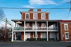
_at_Ford_Avenue_in_Stanardsville%2C_Greene_County%2C_Virginia.jpg) Central Stanardsville | |
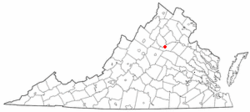 Location of Stanardsville, Virginia | |
 Stanardsville, Virginia Location in the United States | |
| Coordinates: 38°17′49″N 78°26′22″W / 38.29694°N 78.43944°WCoordinates: 38°17′49″N 78°26′22″W / 38.29694°N 78.43944°W | |
| Country | United States |
| State | Virginia |
| County | Greene |
| Area | |
| • Total | 0.36 sq mi (0.93 km2) |
| • Land | 0.36 sq mi (0.93 km2) |
| • Water | 0.0 sq mi (0.0 km2) |
| Elevation | 663 ft (202 m) |
| Population (2010) | |
| • Total | 367 |
| • Density | 1,027/sq mi (396.6/km2) |
| Time zone | UTC-5 (Eastern (EST)) |
| • Summer (DST) | UTC-4 (EDT) |
| ZIP code | 22973 |
| Area code(s) | 434 |
| FIPS code | 51-75008[1] |
| GNIS feature ID | 1500151[2] |
| Website |
www |
Stanardsville is a town in Greene County, Virginia, United States. The population was 367 at the 2010 census,[3] down from 476 at the 2000 census. It is the county seat of Greene County.[4] The name is from Robert Stanard, a benefactor who donated land for public use. It is part of the Charlottesville Metropolitan Statistical Area.
History
Stanardsville is named for Stanard family, landholders who surveyed the first lots for the town in 1794.[5] In 1838, Greene County was created from land previously contained within Orange County and Stanardsville was selected as the county seat.[6]
The Greene County Courthouse, Beadles House, Octonia Stone, Powell-McMullan House, and Stanardsville Historic District are listed on the National Register of Historic Places.[7]
Geography
Stanardsville is located in central Greene County at 38°17′49″N 78°26′22″W / 38.29694°N 78.43944°W (38.296852, -78.439367),[8] at the eastern foot of the Blue Ridge Mountains. U.S. Route 33 passes just south of the town, leading southeast 6 miles (10 km) to U.S. Route 29 at Ruckersville and northwest 8 miles (13 km) to Skyline Drive in Shenandoah National Park. State Highway 230 terminates at Business US 33 in the center of Stanardsville and leads northeast 11 miles (18 km) to US 29 near Madison.
According to the United States Census Bureau, Stanardsville has a total area of 0.3 square miles (0.9 km2), all of it land.[3]
Demographics
| Historical population | |||
|---|---|---|---|
| Census | Pop. | %± | |
| 1930 | 229 | — | |
| 1940 | 212 | −7.4% | |
| 1950 | 182 | −14.2% | |
| 1960 | 283 | 55.5% | |
| 1970 | 296 | 4.6% | |
| 1980 | 284 | −4.1% | |
| 1990 | 257 | −9.5% | |
| 2000 | 476 | 85.2% | |
| 2010 | 367 | −22.9% | |
| Est. 2016 | 384 | [9] | 4.6% |
| U.S. Decennial Census[10] | |||
As of the census[1] of 2000, there were 476 people, 183 households, and 116 families residing in the town. The population density was 1,361.0 people per square mile (525.1/km²). There were 196 housing units at an average density of 560.4 per square mile (216.2/km²). The racial makeup of the town was 88.87% White, 8.61% African American, 0.21% Native American, 1.05% from other races, and 1.26% from two or more races. Hispanic or Latino of any race were 0.84% of the population.
There were 183 households out of which 31.1% had children under the age of 18 living with them, 34.4% were married couples living together, 21.9% had a female householder with no husband present, and 36.6% were non-families. 34.4% of all households were made up of individuals and 14.2% had someone living alone who was 65 years of age or older. The average household size was 2.21 and the average family size was 2.73.
In the town, the population was spread out with 23.3% under the age of 18, 6.9% from 18 to 24, 22.5% from 25 to 44, 17.9% from 45 to 64, and 29.4% who were 65 years of age or older. The median age was 41 years. For every 100 females there were 74.4 males. For every 100 females age 18 and over, there were 65.2 males.
The median income for a household in the town was $24,643, and the median income for a family was $33,750. Males had a median income of $24,583 versus $18,889 for females. The per capita income for the town was $21,317. About 14.3% of families and 15.1% of the population were below the poverty line, including 24.5% of those under age 18 and 11.4% of those age 65 or over.
References
- 1 2 "American FactFinder". United States Census Bureau. Retrieved 2008-01-31.
- ↑ "US Board on Geographic Names". United States Geological Survey. 2007-10-25. Retrieved 2008-01-31.
- 1 2 "Geographic Identifiers: 2010 Demographic Profile Data (G001): Stanardsville town, Virginia". U.S. Census Bureau, American Factfinder. Retrieved March 29, 2017.
- ↑ "Find a County". National Association of Counties. Retrieved 2011-06-07.
- ↑ "About Stanardsville". Town of Stanardsville.
- ↑ Peters, John O.; Peters, Margaret T. (1995). Virginia's Historic Courthouses. Charlottesville, VA: University Press of Virginia. p. 71. ISBN 0-8139-1604-6.
- ↑ National Park Service (2010-07-09). "National Register Information System". National Register of Historic Places. National Park Service.
- ↑ "US Gazetteer files: 2010, 2000, and 1990". United States Census Bureau. 2011-02-12. Retrieved 2011-04-23.
- ↑ "Population and Housing Unit Estimates". Retrieved June 9, 2017.
- ↑ "Census of Population and Housing". Census.gov. Retrieved June 4, 2015.
Further reading
- Historic buildings on Stanardsville, Virginia by Gina Haney and Donald Covey. Published by Stanardsville Chamber of Commerce. No ISBN.
External links
| Wikimedia Commons has media related to Stanardsville, Virginia. |
Municipalities and communities of Greene County, Virginia, United States | ||
|---|---|---|
| Town | 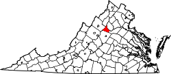 | |
| CDPs | ||
| Unincorporated communities | ||