Calgary Metropolitan Region
| Calgary Metropolitan Region Calgary Region | |
|---|---|
| Metropolitan area | |
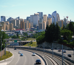 Downtown Calgary skyline | |
| Coordinates: 51°N 114°W / 51°N 114°WCoordinates: 51°N 114°W / 51°N 114°W | |
| Country |
|
| Province |
|
| Area (2016)[1] | |
| • CMA | 5,107.55 km2 (1,972.04 sq mi) |
| Population (2016)[1] | |
| • CMA | 1,392,609 |
| • CMA density | 272.5/km2 (706/sq mi) |
| Time zone | UTC-7 (MST) |
| • Summer (DST) | UTC-6 (MDT) |
| Area code(s) | 403, 587, 825 |

The Calgary Metropolitan Region (CMR), also commonly referred to as the Calgary Region, is a conglomeration of municipalities centred on Calgary, the largest city in Alberta.
With the Government of Alberta's establishment of the Calgary Metropolitan Region Board (CMRB) in 2017, the CMR's boundaries were legislated to include the City of Calgary, the Municipal District (MD) of Foothills No. 31 to the south, Rocky View County to the west, north, and east, and a western portion of Wheatland County further to the east.[2] Also within these boundaries are the cities of Airdrie and Chestermere, eight towns (Black Diamond, Cochrane, Crossfield, High River, Irricana, Okotoks, Strathmore, and Turner Valley), two villages (Beiseker and Longview), and two Indian reserves (Tsuu T'ina 145 and Eden Valley 216), though not all are participating members of the CMRB.
The Calgary census metropolitan area (CMA) as delineated by Statistics Canada is smaller than the CMR. The Calgary CMA includes Calgary, Rocky View County, Airdrie, Beiseker, Chestermere, Cochrane, Crossfield, Irricana, and Tsuu T'ina 145.
The Calgary Metropolitan Region is a major transportation hub for southern Alberta, Saskatchewan, eastern British Columbia, and parts of the northern United States. It is home to the Calgary International Airport, the third busiest airport in Canada in terms of total aircraft movements.[3]
Calgary CMA
The Calgary CMA, as defined by Statistics Canada, includes the following nine municipalities:[4]
- three cities (Airdrie, Calgary and Chestermere);
- one municipal district (Rocky View County, which includes Langdon – the CMA's largest hamlet);
- three towns (Cochrane, Crossfield, and Irricana);
- one village (Beiseker); and
- one First Nations reserve (Tsuu T'ina Nation, which includes the Townsite of Redwood Meadows).
In the 2011 Census, the Calgary CMA had a population of 1,214,839 living in 464,001 of its 488,451 total dwellings, a 12.6% change from its 2006 population of 1,079,310, making it the largest CMA in Alberta and the fifth largest in Canada. With a land area of 5,107.55 km2 (1,972.04 sq mi), it had a population density of 237.9 people per square kilometre in 2011.[5]
Also in terms of area, the Calgary CMA makes up approximately 40% of Statistics Canada's Division No. 6 in Alberta.[6][7] The balance of Division No. 6 includes the census consolidated subdivisions of the MD of Foothills No. 31 to the south and Mountain View County to the north.[8]
The MD of Foothills No. 31 and the municipalities within are often considered as part of Calgary's metropolitan area due to, among other things, the MDs shared boundary with the City of Calgary and the bedroom community nature of towns like Okotoks, High River, Black Diamond and Turner Valley.
Calgary Metropolitan Region Board
The Calgary Metropolitan Region Board (CMRB) was legislated through the enactment of the CMRB Regulation in 2017, and will be officially established on its effective date of January 1, 2018.[2] Municipalities that will be participating as members of the CMRB include the cities of Airdrie, Calgary, and Chestermere, the towns of Cochrane, Okotoks, High River and Strathmore, the MD of Foothills No. 31, Rocky View County, and Wheatland County.[9]
Calgary Regional Partnership
Founded in 1999,[10] the Calgary Regional Partnership (CRP) is a cooperative between 15 urban municipalities in the greater Calgary area that deals with regional growth and planning issues.[11] The CRP's motto is Thinking regionally... acting locally...[11]
Membership
The CRP's current membership includes three cities (Airdrie, Calgary and Chestermere), nine towns (Banff, Black Diamond, Canmore, Cochrane, Irricana, Nanton, Okotoks, Strathmore, and Turner Valley), and one townsite (Redwood Meadows).[11][12] Of these thirteen municipalities, four of the ten towns (Banff, Canmore, Nanton, and Strathmore) are outside, but in proximity to, the Calgary Region's boundaries as defined in this article. Of the remaining six towns, three of them (Black Diamond, Okotoks, and Turner Valley) are outside the Calgary CMA boundaries as defined by Statistics Canada.
Past members
Membership in the CRP once consisted of the four municipal districts and two additional towns. These included the MD of Bighorn No. 8, the MD of Foothills No. 31, Rocky View County, Wheatland County and the towns of Crossfield and High River. The MD of Bighorn No. 8 pulled out of the CRP in March 2009 due to the lack of opportunity for infrastructure connectivity to the balance of the Calgary Region.[13] In June 2009, the latter three opposed the Calgary Metropolitan Plan that was being considered for approval by the CRP's member municipalities.[14][15] All three subsequently withdrew from the CRP in September 2009.[15][16][17] Crossfield and High River withdrew from the CRP in December 2011 and April 2013 respectively citing concerns that the CRP was becoming another layer of government.[18][12]
In an attempt to bring the MD of Foothills No. 31 and Rocky View County back to the CRP, Alberta's Minister of Municipal Affairs, Doug Griffiths, requested that the two municipal districts and the CRP engage in mediation.[19] All parties agreed to participate and the mediation process has since concluded with a report delivered to Minister Griffiths for review and decision.[20]
List of municipalities


The following is a list of municipalities in the Calgary Region. Those municipalities that are within the region and are either part of the Calgary CMA, members of the CRP or both are indicated accordingly. CRP members that are proximate to, yet located outside, the Calgary Region, such as Banff, Canmore and Strathmore, are not listed as they are located within the neighbouring regions of Alberta's Rockies and southern Alberta.
| Municipality | Municipal status [21] |
Calgary CMA [22] |
CRP member [11][12] |
Population (2016) [23] |
Population (2011) [24] |
Population (2006) [25] |
|---|---|---|---|---|---|---|
| Airdrie | City | Y | Y | 61,581 | 42,564 | 28,927 |
| Beiseker | Village | Y | 819 | 785 | 804 | |
| Black Diamond | Town | Y | 2,700 | 2,373 | 1,900 | |
| Calgary | City | Y | Y | 1,239,220 | 1,096,833 | 988,193 |
| Chestermere | City | Y | Y | 19,887 | 14,824 | 9,564 |
| Cochrane | Town | Y | Y | 25,853 | 17,580 | 13,760 |
| Crossfield | Town | Y | 2,983 | 2,853 | 2,648 | |
| Eden Valley 216 | Indian reserve | 596 | 587 | 370 | ||
| Foothills No. 31, MD of | Municipal district | 22,766 | 21,258 | 19,736 | ||
| High River | Town | 13,584 | 12,920 | 10,716 | ||
| Irricana | Town | Y | Y | 1,216 | 1,162 | 1,243 |
| Longview | Village | 307 | 307 | 300 | ||
| Okotoks | Town | Y | 28,881 | 24,511 | 17,145 | |
| Rocky View County | Municipal district | Y | 39,407 | 36,461 | 34,171 | |
| Tsuu T'ina Nation 145 | Indian reserve | Y | 1,643 | 1,777 | ||
| Turner Valley | Town | Y | 2,559 | 2,167 | 1,908 | |
| Total Calgary CMA | 1,392,609 | 1,214,839 | 1,079,310 | |||
| Total Calgary Metropolitan Region | 1,464,002 | 1,278,962 | 1,131,385 | |||
See also
References
- 1 2 "Population and dwelling counts, for census metropolitan areas, 2016 and 2011 censuses – 100% data". Statistics Canada. August 28, 2017. Retrieved October 9, 2017.
- 1 2 "Calgary Metropolitan Region Board Regulation (Alberta Regulation 190/2017)" (PDF). Alberta Queen's Printer. 2017. Retrieved December 22, 2017.
- ↑ "Aircraft Movement Statistics: NAV CANADA Towers and Flight Service Stations: Annual Report (TP 577), 2011" (PDF). Statistics Canada. May 2012. p. 18. Retrieved December 2, 2012.
- ↑ "2006 Community Profiles, Geographic hierarchy – Calgary CMA". Statistics Canada. 2010-02-05. Retrieved 2010-09-06.
- ↑ "Population and dwelling counts, for census metropolitan areas, 2011 and 2006 censuses". Statistics Canada. 2012-02-08. Retrieved 2012-02-22.
- ↑ "Population and dwelling counts, for census metropolitan areas, 2006 and 2001 censuses - 100% data". Statistics Canada. 2010-01-06. Retrieved 2010-09-06.
- ↑ "Population and dwelling counts, for Canada, provinces and territories, and census divisions, 2006 and 2001 censuses - 100% data". Statistics Canada. 2010-01-06. Retrieved 2010-09-06.
- ↑ "2006 Community Profiles, Geographic hierarchy – Division No. 6". Statistics Canada. 2010-02-05. Retrieved 2010-09-06.
- ↑ "Calgary Metropolitan Region Board". Alberta Municipal Affairs. November 7, 2017. Retrieved December 22, 2017.
- ↑ Alan Mattson (2010-07-06). "CRP chief leaves reformed organization after seven years". Cochrane Eagle. Archived from the original on 2012-03-07. Retrieved 2010-09-03.
- 1 2 3 4 "About the Calgary Regional Partnership". Calgary Regional Partnership. Retrieved November 29, 2013.
- 1 2 3 Marco Vigliotti (April 15, 2013). "High River leaves Calgary Regional Partnership". High River Times. Canoe Sun Media. Retrieved November 29, 2013.
- ↑ Hamish MacLean (March 11, 2010). "Bighorn not in Calgary region (Partnership includes Canmore, Banff)". Canmore Leader. Canoe Sun Media. Archived from the original on 2011-09-29. Retrieved September 3, 2010.
- ↑ "2009 (What a year it has been)". Cochrane Times. Canoe Sun Media. December 30, 2009. Retrieved September 3, 2010.
- 1 2 John Barlow (January 6, 2010). "Year in Review". Okotoks Western Wheel. Great West Newspapers LP. Archived from the original on 2010-01-10. Retrieved September 3, 2010.
- ↑ "Rocky View withdraws from Regional Partnership". Rocky View County. September 14, 2009. Archived from the original on 2012-08-18. Retrieved September 3, 2010.
- ↑ Kirsten Mundy (September 23, 2009). "Wheatland County withdraws from the CRP". Strathmore Standard. Canoe Sun Media. Retrieved September 3, 2010.
- ↑ Marie Pollack (December 21, 2011). "Crossfield leaves Calgary Regional Partnership". Airdrie Echo. Canoe Sun Media. Retrieved November 29, 2013.
- ↑ Robson Fletcher (2013-02-14). "Decision on Calgary Regional Partnership mediation process expected next week". Metronews.ca. Retrieved 2013-11-27.
- ↑ Jason Markusoff (2013-11-21). "Tories to amend controversial civic planning bill". Calgary Herald. Retrieved 2013-11-27.
- ↑ "2010 Municipal Codes" (PDF). Alberta Municipal Affairs. 2010-04-01. Retrieved 2010-09-03.
- ↑ "2006 Community Profiles, Geographic hierarchy – Calgary (Census metropolitan area)". Statistics Canada. 2010-02-05. Retrieved 2010-09-03.
- ↑ "Population and dwelling count, for Canada, provinces and territories, and census subdivisions (municipalities), 2016 and 2011 censuses (Alberta)". Statistics Canada. 2017-02-06. Retrieved 2017-06-05.
- ↑ "Population and dwelling counts, for Canada, provinces and territories, and census subdivisions (municipalities), 2011 and 2006 censuses (Alberta)". Statistics Canada. 2012-02-08. Retrieved 2012-02-24.
- ↑ "Population and dwelling counts, for Canada, provinces and territories, and census subdivisions (municipalities), 2006 and 2001 censuses - 100% data (Alberta)". Statistics Canada. 2010-01-06. Retrieved 2012-02-24.
External links
| Features | |
|---|---|
| History | |
| Geography | |
| Economy | |
| Politics | |
| Public services | |
| Education |
|
| Culture | |
| Transportation | |
| |
| Subdivisions | |
|---|---|
| Communities | |
| Cities and urban service areas | |
| Regions | |
| |