Winnipeg Capital Region
| Winnipeg Capital Region | |
|---|---|
| Metropolitan area | |
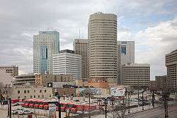 Downtown Winnipeg skyline | |
| Country |
|
| Province |
|
| Area (2011)[1] | |
| • Total | 5,303.09 km2 (2,047.53 sq mi) |
| Population (2018) | |
| • Total | 842,900 |
| • CMA density | 137.7/km2 (357/sq mi) |
| Time zone | UTC-6 (CST) |
| • Summer (DST) | UTC-5 (CDT) |
| Area code(s) | 204, 431 |
The Winnipeg Capital Region is a metropolitan area located in the Red River Valley in the south central portion of the province of Manitoba, Canada. It contains the provincial capital of Winnipeg and its surrounding rural municipalities, cities, and towns. It was created to co-ordinate land use policy and economic development between the City of Winnipeg and the surrounding municipalities. It is the most densely populated and economically important area of Manitoba.
Other communities with over 1,000 population in the region besides Winnipeg are the city of Selkirk and towns of Oakbank, Stonewall, Stony Mountain, Teulon, Lorette and Niverville.
Officially, the Winnipeg Capital Region comprises the following cities, towns and RMs. Their total population at the 2018 census is projected to be July 1, 2018 842,900 and their total land area is 7,784.63 km² (3,005.66 sq mi):
The population of the Winnipeg Capital Region is greatly concentrated within the city of Winnipeg itself, which has 86.5% of the Region's population residing in less than 6% of its land area. On the provincial level, the city has 54.9% of the province's population, while the Region's share is 63.5%.
However, there are some municipalities that are geographically entirely or largely within its territory that are not officially part of the Capital Region. These include the town of Teulon, the villages of Dunnottar and Garson, and the Indian reserve of Brokenhead Ojibway Nation.
The Winnipeg Capital Region includes the smaller Winnipeg census metropolitan area (CMA) with the exception of Brokenhead Ojibway Nation. The included CMA municipalities are:
- Winnipeg
- East St. Paul
- Headingley
- Ritchot
- Rosser
- Springfield
- St. Clements
- St. François Xavier
- Taché
- West St. Paul

See also
Places adjacent to Winnipeg Capital Region | |
|---|---|
References
- ↑ "Population and dwelling counts, for census metropolitan areas, 2011 and 2006 censuses". Statistics Canada. 2012-02-08. Retrieved 2012-02-13.
External links
- Government of Manitoba Community profiles: