Governor's Drive
| |
|---|---|
 Governor's Drive highlighted in red | |
.jpg) Governor's Drive in General Mariano Alvarez, Cavite | |
| Route information | |
| Maintained by Department of Public Works and Highways (DPWH) – Cavite 1st District Engineering Office, Cavite 2nd District Engineering Office, and Cavite Sub-District Engineering Office | |
| Length | 58.3 km (36.2 mi) |
| Existed | 1970s – present |
| Component highways | |
| Major junctions | |
| East end |
|
| West end |
|
| Location | |
| Provinces | Laguna, Cavite |
| Major cities | Biñan, Dasmariñas, General Trias, Trece Martires |
| Towns | Carmona, General Mariano Alvarez, Tanza, Naic, Maragondon, Ternate |
| Highway system | |
|
Roads in the Philippines | |
.svg.png)
.svg.png)
.svg.png)
.svg.png)

The Juanito Remulla Sr. Road, formerly and still referred as the Governor's Drive, is a two-to-nine lane, 58.3-kilometre (36.2 mi), network of primary, secondary and tertiary highways, and bridges traversing through the central cities and municipalities of the province of Cavite, Philippines.[1][2][3] It is the widest of the three major highways located in the province, the others are Aguinaldo Highway and Antero Soriano Highway.
The highway is a component part of the National Route 651, National Route 65, National Route 403, and National Route 405 of the Philippine highway network.
History
On August 1, 2016, the road was proposed to be renamed as Governor Juanito Remulla Sr. Road.[4]
Route description
The eastern terminus of the highway is at Carmona bridge in Carmona–Biñan boundary then it travels along Carmona, General Mariano Alvarez, Dasmariñas, General Trias, Trece Martires, southern Tanza, crosses Antero Soriano Highway in Naic and ends at the junction of Ternate–Nasugbu Road in Ternate.
The highway is mostly concrete paved, while some other parts are currently being rehabilitated and being overlaid with asphalt.
Dasmariñas to Biñan
Governor's Drive towards the provincial boundary with Laguna starts near SM City Dasmariñas at the Palapala intersection with Aguinaldo Highway. It then winds eastward, as it nears Manila Memorial Park, just on the side of the highway. It intersects Paliparan Road and then enters General Mariano Alvarez through a bridge on the Dasmariñas-GMA boundary. It passes through GMA's town centre before curving northeast at the GMA-Carmona boundary. At Carmona, it mostly runs through the town's industrial areas and bypasses the town centre on the north. It soon crosses the South Luzon Expressway and enters Biñan, where it continues as General Malvar Street.
Dasmariñas to Ternate
Governor's Drive toward Ternate starts also at the intersection with Aguinaldo Highway at Palapala, near Robinsons Place Dasmariñas. It is mostly a 6-lane highway when it runs westward towards General Trias. The highway passes through the western barangays of Dasmariñas, and then enters General Trias. It soon intersects Arnaldo Highway near the San Miguel and Purefoods-Hormel factories. The highway soon crosses Crisanto Mendoza de los Reyes Avenue at Manggahan. Then, it enters Trece Martires at Pulunan Bridge. Afterwards, it passes over Trece Martires city proper and continues toward Naic.
After passing Trece Martires, Governor's Drive continues westward on a slightly winding route toward Naic. It soon enters Naic, turns left toward Ternate, and intersects with Naic-Indang Road. The highway follows a straight route, turning right and soon ends at the bridge over the Maragondon River near Ternate.
Intersections
Intersections are numbered by kilometre post, with Rizal Park in Manila designated as kilometre 0. The kilometer count is discontinuous.
| Province | City/Municipality | km[5] | mi | Destinations | Notes |
|---|---|---|---|---|---|
| Laguna | Biñan | 34.28 | 21.30 | Continuation to Laguna as General Malvar Street. Traffic light intersection. | |
| Cavite–Laguna boundary | Carmona–Biñan boundary | 50.341– 35.693 | 31.280– 22.179 | Carmona Bridge over Carmona River. Cavite-Sub District Engineering Office–Laguna 2nd District Engineering Office highway boundary. Kilometer number reverses. | |
| Cavite | Carmona | 48.285 | 30.003 | Slex Bridge over South Luzon Expressway. | |
| 48.723 | 30.275 | Roundabout. Route number change from N651 to N65. | |||
| 47.000 | 29.204 | Route 651 reassurance sign. | |||
| Congressional Road | |||||
| 46.296 | 28.767 | Roundabout. Route number change from N65 to N651. | |||
| 43.000 | 26.719 | Route 65 reassurance sign. | |||
| General Mariano Alvarez–Silang Road – Silang | |||||
| General Mariano Alvarez–Carmona boundary | 40.563 | 25.205 | Bancal Bridge | ||
| General Mariano Alvarez | Congressional Road – General Mariano Alvarez | ||||
| General Mariano Alvarez–Dasmariñas boundary | 39.508 | 24.549 | Embarkadero Bridge | ||
| Dasmariñas | Paliparan Road | ||||
| 37.995 | 23.609 | Piela Bridge | |||
| 36.984 | 22.981 | Aguinaldo Bridge | |||
| 35.640 | 22.146 | San Marcelino Bridge | |||
| 35.170 | 21.854 | Paredes Bridge | |||
| Palapala Diversion Bridge | |||||
| 34.408 | 21.380 | Kilometer number reverses. | |||
| 34.493 | 21.433 | Bucal Bridge | |||
| 35.127 | 21.827 | Langkaan Bridge I | |||
| 36.000 | 22.369 | Route 65 reassurance sign. | |||
| 36.071 | 22.413 | Langkaan Bridge II | |||
| 36.574 | 22.726 | Langkaan Bridge III | |||
| Dasmariñas–General Trias boundary | 37.239 | 23.139 | Alang-Ilang Bridge over Ylang-Ylang River. Cavite Sub District Engineering Office–Cavite 1st District Engineering Office highway boundary. | ||
| General Trias | Arnaldo Highway | ||||
| 38.278 | 23.785 | Malabon Bridge | |||
| Crisanto Mendoza de los Reyes Avenue / Governor Ferrer Drive – Amadeo | Traffic light intersection. | ||||
| 39.740 | 24.693 | Manggahan Bridge over Matangilan River | |||
| General Trias–Trece Martires boundary | 40.873 | 25.397 | Panaysayan Bridge over Panaysayan River | ||
| Trece Martires | 41.232 | 25.620 | Pasong Elo Bridge | ||
| 42.118 | 26.171 | Patda Bridge | |||
| 42.831 | 26.614 | Pulunan Steel Bridge | |||
| 43.740 | 27.179 | Mag-asawang Layon Bridge | |||
| 44.000 | 27.340 | Route 65 reassurance sign. Trece Martires kilometer zero. | |||
| 44.320 | 27.539 | Route number change from N65 to N403. | |||
| 45.000 | 27.962 | Route 403 reassurance sign. | |||
| 45.647 | 28.364 | Puting Tubig Bridge | |||
| 46.047 | 28.612 | Pasong Balite Bridge | |||
| 47.016 | 29.214 | Vaquero Bridge | |||
| Tanza | No major intersections. | ||||
| Tanza–Naic boundary | 44.301 | 27.527 | Cavite 1st District Engineering Office–Cavite 2nd District Engineering Office highway boundary. | ||
| Naic | 45.947 | 28.550 | Change to unnumbered highway. Kilometre number reverses. | ||
| 46.562 | 28.932 | Naic Diversion Bridge | |||
| 48.214 | 29.959 | Change to numbered route, N405. Traffic light intersection. | |||
| 48.252 | 29.982 | Convento Bridge | |||
| Maragondon | 53.464 | 33.221 | |||
| 56.157 | 34.894 | Maragondon Bridge over Maragondon River | |||
| 57.782 | 35.904 | Sapang Bridge over Gapan River | |||
| Ternate | 67.075 | 41.678 | Continuation north as Caylabne Road. | ||
1.000 mi = 1.609 km; 1.000 km = 0.621 mi
| |||||
Landmarks
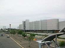
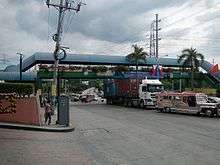
The Governor's Drive is also home to many known places and landmarks. Such malls like SM City Dasmariñas, SM City Trece Martires, Robinsons Place Dasmariñas, Puregold San Agustin (Trece Martires), Puregold Hugo Perez (Trece Martires), Walter Mart General Trias, Walter Mart Trece Martires and Walter Mart Carmona are located along the highway. Many industrial estates and factory plants are also located here such as the Golden Mile Business Park, People's Technology Complex, Mountview Industrial Complex, Grandville Industrial Complex, Dasmariñas Technopark, Monterey Meat Plant, the First Cavite Industrial Estate, Purefoods-Hormel Plant, Magnolia Plant, Sugarland Estates, Eagle Ridge Golf Course and the Royal Tern Ceramics Philippines.
References
- ↑ "Cavite". www.dpwh.gov.ph. Retrieved 2018-08-19.
- ↑ "Cavite 2nd". www.dpwh.gov.ph. Retrieved 2018-08-19.
- ↑ "Cavite Sub". www.dpwh.gov.ph. Retrieved 2018-08-19.
- ↑ "House Bill No. 2194" (PDF). www.congress.gov.ph. Retrieved 2018-08-02.
- ↑ "Road and Bridge Inventory". www.dpwh.gov.ph. Retrieved 2018-01-20.
External links
| Wikimedia Commons has media related to Governor's Drive. |
| Expressways |
| ||||||||
|---|---|---|---|---|---|---|---|---|---|
| National roads |
| ||||||||
| Arterial Routes |
| ||||||||
| Expressways |
| ||||||
|---|---|---|---|---|---|---|---|
| National highways |
| ||||||
| Provincial roads and other major roads |
| ||||||