Fort York (neighbourhood)
| Fort York | |
|---|---|
| Neighbourhood | |
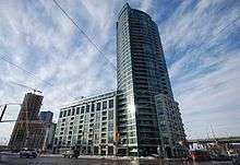
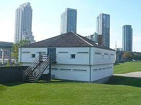 Skyline of Fort York neighbourhood from Fort York's Blockhouse 1 | |
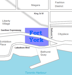 Vicinity | |
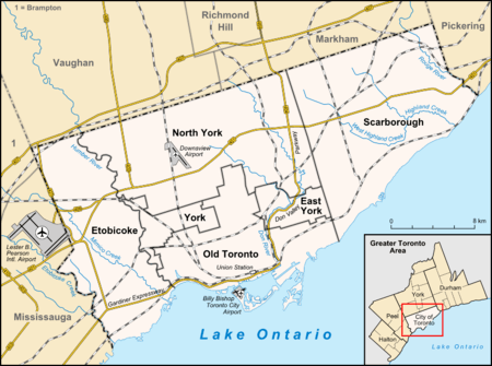 Location within Toronto | |
| Coordinates: 43°38′20″N 79°24′18″W / 43.639°N 79.405°WCoordinates: 43°38′20″N 79°24′18″W / 43.639°N 79.405°W | |
| Country |
|
| Province |
|
| City |
|
| Government | |
| • City Councillor | Joe Pantalone |
| • Federal M.P. | Olivia Chow |
| • Provincial M.P.P. | Rosario Marchese |
The Fort York neighbourhood, also known as Garrison, in Toronto, Ontario, Canada is located along and south of CN and CP railway corridors. The area used to be known as the Bathurst/Strachan Area and consists of eight-hectares (20-acres) of remediated brownfield sites.
History
The neighbourhood area consists of the former industrial lands immediately east and south of Fort York, built in 1793, and designated a National Historic Sites of Canada in 1923. The current Fort York Armoury was built in 1933, and still houses several units of the Canadian Forces. The neighbourhood is one of Toronto's most historically and cultural sensitive areas, and was the location of the lakeside Toronto Molson brewery before it was demolished in 2006.
The Fort York Neighbourhood Public Realm Plan is the next step in the planning and design for the Fort York Neighbourhood. The area's redevelopment plan was finalized in 2005, and establishes guidelines for an overall vision of the emerging neighbourhood. It set out the location of public spaces, density, height and built form so that the area's streetscapes, open spaces, parks and pedestrian areas are interconnected with private development.[1]
Recent developments
A 38-storey residential tower and 7- to 12-storey podium building was constructed in 2005 at the west end of the neighbourhood, at the corner of Fleet Street Fort York Boulevard. This was the first element of the planned redevelopment of the site into a mixed-use community, including 12 residential towers, podium buildings and stacked townhouses, with grade-level retail and commercial uses. The neighbourhood will eventually house an estimated 6000 units within the area north of Lake Shore Boulevard, south of Fort York Boulevard between Strachan Avenue and Dan Leckie Way (an extension of Portland Street).
It has been the site of a lot of condominium loft and row house development. The area is located close to the Fashion and Entertainment districts. Significant high-rise development has taken place within the Fort York Neighbourhood, south of the Gardiner Expressway between Fort York Blvd. and Fleet Street.[2]
Some of the main roads in the neighbourhood are:
- Bathurst Street
- Fleet Street
- Lake Shore Boulevard
- Fort York Boulevard
- Gardiner Expressway
Public transportation
.jpg)
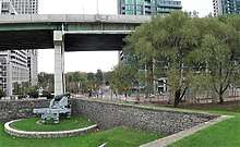
The Harbourfront is served by the 509 Harbourfront streetcar, which operates between Union and Exhibition Place running along a private right-of-way (ROW) on Queens Quay west to Bathurst and then along Fleet Street. Between September 2007 and March 2008, the Fleet Street portion of Route 509 was converted to a ROW. Streetcar track and overhead power line were also installed at the Fleet loop, which is located at the Fleet Street Lighthouse.[3][4]
See also
References
External links
Places adjacent to Fort York (neighbourhood) | ||||||||||
|---|---|---|---|---|---|---|---|---|---|---|
| ||||||||||