Dragaš
| Dragaš | |
|---|---|
| Town and municipality | |
|
Драгаш / Dragaš (Serbian) Dragash or Dragashi, Sharr or Sharri (Albanian) Драгаш (Macedonian) Dragaš / Драгаш (Bosnian) | |
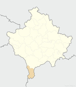 Location of the municipality of Dragaš within Kosovo | |
| Coordinates: 42°03′N 20°39′E / 42.050°N 20.650°E | |
| Country | Kosovo[lower-alpha 1] |
| District | District of Prizren |
| Government | |
| • Mayor | Salim Jenuzi |
| • Municipal | 430 km2 (170 sq mi) |
| Elevation | 1,050 m (3,440 ft) |
| Population (2011) | |
| • Urban | 1,098 |
| • Municipal | 34,827 |
| • Municipal density | 81/km2 (210/sq mi) |
| Time zone | UTC+1 (CET) |
| • Summer (DST) | UTC+2 (CEST) |
| Postal code | 22000 |
| Area code(s) | +381 |
| Car plates | 04 |
| Website |
kk |
Dragaš (Serbian, Bosnian and Macedonian: Драгаш), or Dragash or Sharr (Albanian: Dragashi or Sharri), is a town and municipality located in the Prizren District of Kosovo[lower-alpha 1]. According to the 2011 census, the town of Dragaš has 1,098 inhabitants, while the municipality has 34,827 inhabitants.[1] The Albanian name Sharri is a reference to the Šar Mountains (in Albanian Sharr). The Serbian name Dragaš comes from medieval Serbian lord Constantine Dragaš.[2]
Geography
The territory of the Dragaš municipality lies in the northern latitude of 41 52' 30" to 42 09' 03" and longitude of 20 35' 39" to 20 48' 26". The whole territory is surrounded by the Šar Mountains, then Koritnik Mountain, mountain Gjalic and Cylen in the direction of Prizren. Only one part of the territory in Prizren direction is hilly with a relatively slight slope by which this territory is connected with Prizren basin and through Prizren with the world.
History
Dragaš was named after Serbian medieval noble family of the same name which served Dušan the Mighty (r. 1331-1355) and Uroš the Weak (r. 1355-1371).
From 1877 to 1913, Dragash was part of Kosovo Vilayet
From 1929 to 1941, Dragaš was part of the Vardar Banovina of the Kingdom of Yugoslavia.
The Dragaš municipality was created by the United Nations Interim Administration Mission in Kosovo (UNMIK) by merging the two former municipalities of Gora and Opolje.
Municipality
Aside from the town of Dragaš, the following settlements consist the municipality:
- Baçkë/Bačka
- Bellobradë/Belobrod
- Blaç/Bljač
- Breznë/Brezna
- Brod/Brod
- Brodosanë/Brodosavce
- Brrut/Brut
- Buçë/Buča
- Buzez/Buzec
- Dikancë/Dikance
- Glloboçicë/Globočica
- Kapër/Kapra
- Kërstec/Donji Krstac
- Kosavë/Kosovce
- Krushevë/Kruševo
- Kuk/Kukovce
- Kukjan/Kukuljane
- Kuklibeg/Kuklibeg
- Leshtan/Leštane
- Lubovishtë/Ljubovište
- Mlikë/Mlike
- Orçushë/Orčuša
- Plavë/Plava
- Pllajnik/Plajnik
- Radeshë/Radeša
- Rapçë/Gornja Rapča
- (Rapçë)/Donja Rapča
- Restelicë/Restelica
- Rrenc/Rence
- Shajnë/Šajinovac
- Vranishtë/Vranište
- Xërxë/Zrze
- Zaplluzhë/Zaplužje
- Zgatar/Zgatar
- Zlipotok/Zli Potok
- Zym/Zjum Opoljski
Demographics
| Historical population | ||
|---|---|---|
| Year | Pop. | ±% p.a. |
| 1971 | 26,850 | — |
| 1981 | 35,054 | +2.70% |
| 1991 | 39,435 | +1.18% |
| 2011 | 34,827 | −0.62% |
According to the last official census done in 2011, the municipality of Dragaš has 34,827 inhabitants. The municipality's population mostly lives in rural areas (97%).
Ethnic groups
The municipality is split into the regions of Opolje and Gora. Most of the Gorani live in Gora, whilst Albanians make a majority in both regions. There also a significant number of Bosniaks in the municipality.
The ethnic composition of the municipality:
- 1971 – 13,867 (51.6%) Albanians; 11,076 (41.3%) Gorani and Bosniaks – total 26,850
- 1981 – 18,623 (53%) Albanians; 15,942 (45.5%) Gorani and Bosniaks – total 35,054
- 1991 – 22,785 (57.8%) Albanians; 16,129 (40.9%) Gorani and Bosniaks – total 39,435
OSCE estimates say the following:[1]
- January 1999 – 27,633 (61.3%) Albanians; 17,470 (38.7%) Gorani and Bosniaks – total 45,103
- March 2000 – 24,856 (78%) Albanians; 9,706 (28.1%) Gorani and Bosniaks – total 34,562
- January 2006 – 22,800 (55.9%) Albanians; 17,975 (44.1%) Gorani and Bosniaks – total 40,775
According to the census in 2011 there is a significant Bosniak community in Dragaš, numbering around 4,100 people.
Economy
The main employers in the area are the Municipality, UNMIK police, and private companies as “KUK Commerc”, “Meka” and former state-owned enterprises.[1]
All major local companies were formerly state-run and, as elsewhere in Kosovo, are currently under the responsibility of KTA. The original UNMIK strategy towards these public enterprises consisted of carrying out a process of ‘commercialisation’. This process was believed to be the best way to revive the enterprises, although no foreign investors decided to invest.[1]
Infrastructure
The municipality is mountainous and therefore has related infrastructural problems (e.g. problematic access to some villages during winter season). Its infrastructure was in a state of serious disrepair before the war, due to a combination of harsh winters and state neglect. Roads, in particular, (Zhur–Dragaš; Dragaš-Brod; Dragaš- Restelica) require urgent improvement for the social-economic development of the area. Bus connections between Dragaš town and the Opoja area continue to improve and the services to Gora are organized by the two OSCE-SIMF buses donated to the municipality. There is a free school bus service provided by the municipality along Gora routes. Taxi services exist but are largely unaffordable for the population. OSCE through SIMF/ ECSF funds supported also the rehabilitation of the Heath House.
Mobile coverage is also improving. Water supply is ensured in all villages.[1]
Symbol
The emblem of Dragaš includes an image of the Šarplaninac dog.[3]
Notes and references
- Notes
- 1 2 Kosovo is the subject of a territorial dispute between the Republic of Kosovo and the Republic of Serbia. The Republic of Kosovo unilaterally declared independence on 17 February 2008, but Serbia continues to claim it as part of its own sovereign territory. The two governments began to normalise relations in 2013, as part of the Brussels Agreement. Kosovo has received formal recognition as an independent state from 113 out of 193 United Nations member states.
- References
- Gora, Opolje i Sredska. Geografski institut "Jovan Cvijić" SANU. 1997. ISBN 978-86-80029-04-7.
- Milisav V. Lutovac (1955). Gora i Opolje: antropogeografska proučavanja. Naučna knjiga.
- 1 2 3 4 5 OSCE "municipal profile of Dragaš" (PDF). , June 2006. Retrieved on 21 February 2008.
- ↑ Cawley, Charles, Serbia, Medieval Lands database, Foundation for Medieval Genealogy ,
- ↑ Municipal Assembly of Dragaš Archived July 12, 2006, at the Wayback Machine.. – Retrieved on 20 November 2008.
External links
| Wikimedia Commons has media related to Dragaš. |
- "Municipality of Dragash". Republic of Kosovo.
| Ferizaj District |  | |
|---|---|---|
| Gjakova District | ||
| Gjilan District | ||
| Mitrovica District | ||
| Peć District | ||
| Pristina District | ||
| Prizren District | ||
1 Kosovo is the subject of a territorial dispute between the Republic of Kosovo and the Republic of Serbia. The Republic of Kosovo unilaterally declared independence on 17 February 2008, but Serbia continues to claim it as part of its own sovereign territory. The two governments began to normalise relations in 2013, as part of the Brussels Agreement. Kosovo has received formal recognition as an independent state from 113 out of 193 United Nations member states. | ||