Chappes, Ardennes
| Chappes | |
|---|---|
| Commune | |
 | |
 Chappes Location within Grand Est region  Chappes | |
| Coordinates: 49°36′40″N 4°16′14″E / 49.6111°N 4.2706°ECoordinates: 49°36′40″N 4°16′14″E / 49.6111°N 4.2706°E | |
| Country | France |
| Region | Grand Est |
| Department | Ardennes |
| Arrondissement | Rethel |
| Canton | Signy-l'Abbaye |
| Intercommunality | Crêtes Préardennaises |
| Government | |
| • Mayor (2008–2014) | Joseph Malcorps |
| Area1 | 9.59 km2 (3.70 sq mi) |
| Population (2008)2 | 93 |
| • Density | 9.7/km2 (25/sq mi) |
| Time zone | UTC+1 (CET) |
| • Summer (DST) | UTC+2 (CEST) |
| INSEE/Postal code | 08102 /08220 |
|
1 French Land Register data, which excludes lakes, ponds, glaciers > 1 km2 (0.386 sq mi or 247 acres) and river estuaries. 2 Population without double counting: residents of multiple communes (e.g., students and military personnel) only counted once. | |
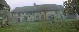
Chappes is a commune in the Ardennes department in northern France.
Population
| Historical population | ||
|---|---|---|
| Year | Pop. | ±% |
| 1962 | 110 | — |
| 1968 | 117 | +6.4% |
| 1975 | 95 | −18.8% |
| 1982 | 89 | −6.3% |
| 1990 | 71 | −20.2% |
| 1999 | 91 | +28.2% |
| 2008 | 93 | +2.2% |
See also
References
| Wikimedia Commons has media related to Chappes, Ardennes. |
This article is issued from
Wikipedia.
The text is licensed under Creative Commons - Attribution - Sharealike.
Additional terms may apply for the media files.