Saint-Quentin-le-Petit
| Saint-Quentin-le-Petit | |
|---|---|
| Commune | |
 | |
 Saint-Quentin-le-Petit Location within Grand Est region  Saint-Quentin-le-Petit | |
| Coordinates: 49°35′04″N 4°04′47″E / 49.5844°N 4.0797°ECoordinates: 49°35′04″N 4°04′47″E / 49.5844°N 4.0797°E | |
| Country | France |
| Region | Grand Est |
| Department | Ardennes |
| Arrondissement | Rethel |
| Canton | Château-Porcien |
| Intercommunality | Plaines du Porcien |
| Government | |
| • Mayor (2008–2014) | Thierry Douce |
| Area1 | 8.95 km2 (3.46 sq mi) |
| Population (2008)2 | 150 |
| • Density | 17/km2 (43/sq mi) |
| Time zone | UTC+1 (CET) |
| • Summer (DST) | UTC+2 (CEST) |
| INSEE/Postal code | 08396 /08220 |
|
1 French Land Register data, which excludes lakes, ponds, glaciers > 1 km2 (0.386 sq mi or 247 acres) and river estuaries. 2 Population without double counting: residents of multiple communes (e.g., students and military personnel) only counted once. | |
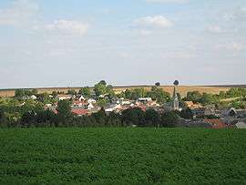
Saint-Quentin-le-Petit is a commune in the Ardennes department in northern France.
Population
| Historical population | ||
|---|---|---|
| Year | Pop. | ±% |
| 1962 | 127 | — |
| 1968 | 167 | +31.5% |
| 1975 | 131 | −21.6% |
| 1982 | 126 | −3.8% |
| 1990 | 163 | +29.4% |
| 1999 | 158 | −3.1% |
| 2008 | 150 | −5.1% |
See also
References
| Wikimedia Commons has media related to Saint-Quentin-le-Petit. |
This article is issued from
Wikipedia.
The text is licensed under Creative Commons - Attribution - Sharealike.
Additional terms may apply for the media files.