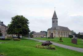
Neuville-lez-Beaulieu
| Neuville-lez-Beaulieu | ||
|---|---|---|
| Commune | ||
 | ||
| ||
 Neuville-lez-Beaulieu Location within Grand Est region  Neuville-lez-Beaulieu | ||
| Coordinates: 49°52′01″N 4°19′36″E / 49.8669°N 4.3267°ECoordinates: 49°52′01″N 4°19′36″E / 49.8669°N 4.3267°E | ||
| Country | France | |
| Region | Grand Est | |
| Department | Ardennes | |
| Arrondissement | Charleville-Mézières | |
| Canton | Rocroi | |
| Intercommunality | Ardennes Thiérache | |
| Government | ||
| • Mayor (2014–2020) | Nicolas Carpentier | |
| Area1 | 35.92 km2 (13.87 sq mi) | |
| Population (2015)2 | 336 | |
| • Density | 9.4/km2 (24/sq mi) | |
| Time zone | UTC+1 (CET) | |
| • Summer (DST) | UTC+2 (CEST) | |
| INSEE/Postal code | 08319 /08380 | |
| Elevation |
220–280 m (720–920 ft) (avg. 250 m or 820 ft) | |
|
1 French Land Register data, which excludes lakes, ponds, glaciers > 1 km2 (0.386 sq mi or 247 acres) and river estuaries. 2 Population without double counting: residents of multiple communes (e.g., students and military personnel) only counted once. | ||

Neuville-lez-Beaulieu is a commune in the Ardennes department and Grand Est region of north-eastern France.
Geography
The Sormonne River flows through the commune and forms part of its eastern border.
Population
| Historical population | ||
|---|---|---|
| Year | Pop. | ±% |
| 1946 | 360 | — |
| 1954 | 373 | +3.6% |
| 1962 | 352 | −5.6% |
| 1968 | 374 | +6.2% |
| 1975 | 374 | +0.0% |
| 1982 | 360 | −3.7% |
| 1990 | 298 | −17.2% |
| 1999 | 265 | −11.1% |
| 2007 | 318 | +20.0% |
| 2015 | 336 | +5.7% |
See also
References
| Wikimedia Commons has media related to Neuville-lez-Beaulieu. |
This article is issued from
Wikipedia.
The text is licensed under Creative Commons - Attribution - Sharealike.
Additional terms may apply for the media files.