Hagnicourt
| Hagnicourt | ||
|---|---|---|
| Commune | ||
 | ||
| ||
 Hagnicourt Location within Grand Est region  Hagnicourt | ||
| Coordinates: 49°36′34″N 4°35′09″E / 49.6094°N 4.5858°ECoordinates: 49°36′34″N 4°35′09″E / 49.6094°N 4.5858°E | ||
| Country | France | |
| Region | Grand Est | |
| Department | Ardennes | |
| Arrondissement | Rethel | |
| Canton | Signy-l'Abbaye | |
| Intercommunality | Crêtes Préardennaises | |
| Government | ||
| • Mayor (2008–2014) | Ghislain Renaud | |
| Area1 | 5.75 km2 (2.22 sq mi) | |
| Population (2008)2 | 63 | |
| • Density | 11/km2 (28/sq mi) | |
| Time zone | UTC+1 (CET) | |
| • Summer (DST) | UTC+2 (CEST) | |
| INSEE/Postal code | 08205 /08430 | |
|
1 French Land Register data, which excludes lakes, ponds, glaciers > 1 km2 (0.386 sq mi or 247 acres) and river estuaries. 2 Population without double counting: residents of multiple communes (e.g., students and military personnel) only counted once. | ||

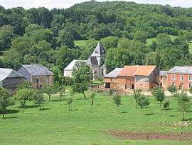
Hagnicourt is a commune in the Ardennes department in northern France.
Population
| Historical population | ||
|---|---|---|
| Year | Pop. | ±% |
| 1962 | 79 | — |
| 1968 | 82 | +3.8% |
| 1975 | 69 | −15.9% |
| 1982 | 72 | +4.3% |
| 1990 | 59 | −18.1% |
| 1999 | 64 | +8.5% |
| 2008 | 63 | −1.6% |
See also
References
| Wikimedia Commons has media related to Hagnicourt. |
This article is issued from
Wikipedia.
The text is licensed under Creative Commons - Attribution - Sharealike.
Additional terms may apply for the media files.