Tournes
| Tournes | ||
|---|---|---|
| Commune | ||
 | ||
| ||
 Tournes Location within Grand Est region  Tournes | ||
| Coordinates: 49°47′51″N 4°38′16″E / 49.7975°N 4.6378°ECoordinates: 49°47′51″N 4°38′16″E / 49.7975°N 4.6378°E | ||
| Country | France | |
| Region | Grand Est | |
| Department | Ardennes | |
| Arrondissement | Charleville-Mézières | |
| Canton | Charleville-Mézières-1 | |
| Intercommunality | Plaines et Forêts de l'Ouest ardennais | |
| Government | ||
| • Mayor (2008–2014) | Cécile Muller | |
| Area1 | 8.26 km2 (3.19 sq mi) | |
| Population (2008)2 | 1,058 | |
| • Density | 130/km2 (330/sq mi) | |
| Time zone | UTC+1 (CET) | |
| • Summer (DST) | UTC+2 (CEST) | |
| INSEE/Postal code | 08457 /08090 | |
| Elevation |
140–180 m (460–590 ft) (avg. 152 m or 499 ft) | |
|
1 French Land Register data, which excludes lakes, ponds, glaciers > 1 km2 (0.386 sq mi or 247 acres) and river estuaries. 2 Population without double counting: residents of multiple communes (e.g., students and military personnel) only counted once. | ||
.svg.png)
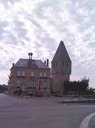
Tournes is a commune in the Ardennes department in northern France.
Population
| Historical population | ||
|---|---|---|
| Year | Pop. | ±% |
| 1962 | 459 | — |
| 1968 | 509 | +10.9% |
| 1975 | 836 | +64.2% |
| 1982 | 904 | +8.1% |
| 1990 | 1,073 | +18.7% |
| 1999 | 1,075 | +0.2% |
| 2008 | 1,058 | −1.6% |
Geography
The Sormonne River forms most of the commune's southern border.
See also
References
| Wikimedia Commons has media related to Tournes. |
This article is issued from
Wikipedia.
The text is licensed under Creative Commons - Attribution - Sharealike.
Additional terms may apply for the media files.