Lumes
| Lumes | ||
|---|---|---|
| Commune | ||
 | ||
| ||
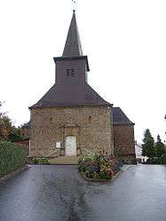
 Lumes Location within Grand Est region  Lumes | ||
| Coordinates: 49°44′09″N 4°47′05″E / 49.7358°N 4.7847°ECoordinates: 49°44′09″N 4°47′05″E / 49.7358°N 4.7847°E | ||
| Country | France | |
| Region | Grand Est | |
| Department | Ardennes | |
| Arrondissement | Charleville-Mézières | |
| Canton | Villers-Semeuse | |
| Intercommunality | Balcons de la Meuse | |
| Government | ||
| • Mayor (2008–2014) | Jean-Francois Frérot | |
| Area1 | 6.14 km2 (2.37 sq mi) | |
| Population (2008)2 | 1,121 | |
| • Density | 180/km2 (470/sq mi) | |
| Time zone | UTC+1 (CET) | |
| • Summer (DST) | UTC+2 (CEST) | |
| INSEE/Postal code | 08263 /08440 | |
| Elevation |
143–252 m (469–827 ft) (avg. 152 m or 499 ft) | |
|
1 French Land Register data, which excludes lakes, ponds, glaciers > 1 km2 (0.386 sq mi or 247 acres) and river estuaries. 2 Population without double counting: residents of multiple communes (e.g., students and military personnel) only counted once. | ||

Lumes is a commune in the Ardennes department in northern France.
Population
| Historical population | ||
|---|---|---|
| Year | Pop. | ±% |
| 1962 | 936 | — |
| 1968 | 951 | +1.6% |
| 1975 | 963 | +1.3% |
| 1982 | 1,116 | +15.9% |
| 1990 | 1,251 | +12.1% |
| 1999 | 1,225 | −2.1% |
| 2008 | 1,121 | −8.5% |
See also
References
| Wikimedia Commons has media related to Lumes. |
This article is issued from
Wikipedia.
The text is licensed under Creative Commons - Attribution - Sharealike.
Additional terms may apply for the media files.