Cemetery Road tram stop
| Cemetery Road | |
|---|---|
| Metrolink | |
.jpg) Cemetery Road tram stop in August 2015 | |
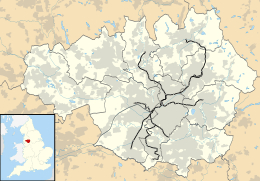 Cemetery Road Location of Cemetery Road in Greater Manchester | |
| Location | |
| Place | Droylsden |
| Local authority | Tameside |
| Coordinates | 53°28′48″N 2°09′18″W / 53.4799°N 2.1549°WCoordinates: 53°28′48″N 2°09′18″W / 53.4799°N 2.1549°W |
| Platforms | 2 |
| Fare zone information | |
| Metrolink Zone | N |
| Present status | In operation |
| Operations | |
| Original operator | Metrolink |
| History | |
| Opened |
8 February 2013 (preview)[1] 11 February 2013 (full)[2][3] |
|
| |
Cemetery Road is a tram stop on the East Manchester Line (EML) of Greater Manchester's light-rail Metrolink system. It opened on 11 February 2013,[2][3] after a three-day free trial for local residents.[1] The station was constructed as part of Phase 3a of the Metrolink's expansion, and is located in Droylsden at the junction of Manchester Road and Cemetery Road,[4] a part of Tameside, England.
Services
Services are mostly every 12 minutes on all routes.
Connecting bus routes
Cemetery Road is directly served by Stagecoach Manchester bus service 216, which stops next to the station on Manchester Road and replicates the tram route between Piccadilly Gardens and Ashton-under-Lyne. Stagecoach/JPT services 217 and 218, which also stops on Manchester Road, run circular routes between Manchester and Mossley serving Droylsden, Dukinfield, Ashton, Tameside General Hospital and Stalybridge.[5]
References
- 1 2 "It's the final countdown". Transport for Greater Manchester. 1 February 2013. Retrieved 7 February 2013.
- 1 2 Kirby, Dean (4 December 2012). "Opening of Metrolink tram service to Droylsden delayed until February 2013". Archived from the original on 7 December 2012. Retrieved 7 December 2012.
- 1 2 "Droylsden's new Metrolink line to open in February". Transport for Greater Manchester. 7 December 2012. Retrieved 7 December 2012.
- ↑ "Metrolink - Cemetery Road station" (PDF). Transport for Greater Manchester. Archived from the original (PDF) on 18 December 2010. Retrieved 26 June 2011.
- ↑ "Transport for Greater Manchester - Journey Planning - Network Maps". Transport for Greater Manchester. Retrieved 13 February 2013.
External links
| Preceding station | Following station | |||
|---|---|---|---|---|
towards Eccles | Eccles – Ashton-under-Lyne Line | towards Ashton-under-Lyne |
| Railway lines in Tameside | ||||||||||||||||||||||||||||||||||||||||||||||||||||||||||||||||||||||||||||||||||||||||||||||||||||||||||||||||||||||||||||||||||||||||||||||||||||||||||||||||||||||||||||||||||||||||||||||||||||||||||||||||||||||||||||||||||||||||||||||||||||
|---|---|---|---|---|---|---|---|---|---|---|---|---|---|---|---|---|---|---|---|---|---|---|---|---|---|---|---|---|---|---|---|---|---|---|---|---|---|---|---|---|---|---|---|---|---|---|---|---|---|---|---|---|---|---|---|---|---|---|---|---|---|---|---|---|---|---|---|---|---|---|---|---|---|---|---|---|---|---|---|---|---|---|---|---|---|---|---|---|---|---|---|---|---|---|---|---|---|---|---|---|---|---|---|---|---|---|---|---|---|---|---|---|---|---|---|---|---|---|---|---|---|---|---|---|---|---|---|---|---|---|---|---|---|---|---|---|---|---|---|---|---|---|---|---|---|---|---|---|---|---|---|---|---|---|---|---|---|---|---|---|---|---|---|---|---|---|---|---|---|---|---|---|---|---|---|---|---|---|---|---|---|---|---|---|---|---|---|---|---|---|---|---|---|---|---|---|---|---|---|---|---|---|---|---|---|---|---|---|---|---|---|---|---|---|---|---|---|---|---|---|---|---|---|---|---|---|---|---|---|---|---|---|---|---|---|---|---|---|---|---|---|---|---|---|
| ||||||||||||||||||||||||||||||||||||||||||||||||||||||||||||||||||||||||||||||||||||||||||||||||||||||||||||||||||||||||||||||||||||||||||||||||||||||||||||||||||||||||||||||||||||||||||||||||||||||||||||||||||||||||||||||||||||||||||||||||||||
| Tram stops |
|   | ||||||||||||||||||
|---|---|---|---|---|---|---|---|---|---|---|---|---|---|---|---|---|---|---|---|---|
| Operations |
| |||||||||||||||||||
| History (Timeline) |
| |||||||||||||||||||
| Proposed developments |
| |||||||||||||||||||