Ceded Districts
| Ceded Districts | |||||
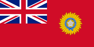
| Area of British India | |||||
| |||||
 | |||||
| History | |||||
| • | Districts ceded by the Nizam | 1800 | |||
| • | Indian independence | 1947 | |||
Ceded Districts is the name of an area in the Deccan, India that was 'ceded' to the British East India Company by the Nizam in 1800. The name was in use during the whole period of the British Raj, even though the denomination had no official weight for legal or administrative purposes.
History
Following the Treaty of Seringapatam the Tipu Sultan accepted to give his northern territory to the Nizam of Hyderabad in 1792 AD.
In 1796 AD, the then Nizam Asaf Jah II, harassed by the Marathas and Tipu Sultan, opted to get British military protection under Lord Wellesley's doctrine of Subsidiary Alliance. Now, as a part of this agreement, the Nizam ceded a large portion of the acquired territory to the British, to be added to the Madras Presidency. This area was also known as the Ceded Districts, a term still used for the areas, and included the present day districts of Anantapuram, Kadapa (Cuddapah), much of Karnoolu (Kurnool), Bellary, and parts of Tumkur (Pavagada taluk) and Davanagere (Harapanahalli taluk).[1]
After the defeat and death of Tipu Sultan in the Fourth Anglo-Mysore War at Srirangapattanam (Seringapatam), the Mysooru (Mysore) territories (Map[2]) were divided up between the Wodeyars, the Nizam and the British East India Company.
References
- ↑
The Imperial Gazetteer of India, Volume 7. Oxford: Clarendon Press. 1908-1931 [vol. 1, 1909]. pp. 158–176. Check date values in:
|date=(help) - ↑ Shepherd, William R (1923). "India Map 1700-1792, from The Historical Atlas R." Longmans, Green, and Co. Retrieved 2007-06-15.