Canal de São Vicente
| Canal de São Vicente | |
|---|---|
 The channel (Canal de São Vicente) as seen from Santo Antão's Porto Novo | |
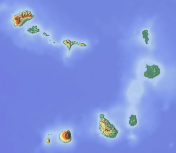 Canal de São Vicente Location in Cape Verde | |
| Coordinates | 16°56′N 25°5′W / 16.933°N 25.083°WCoordinates: 16°56′N 25°5′W / 16.933°N 25.083°W |
| Ocean/sea sources | Atlantic Ocean |
| Basin countries | Cape Verde |
| Max. length | 25 km (16 mi) |
| Max. width | 12 km (7.5 mi) |
| Islands | Ilhéu dos Pássaros[1] |
| Settlements | Porto Novo, Santo Antåo Island |
The Canal de São Vicente is a channel of the Atlantic Ocean separating the islands of Santo Antão and São Vicente, Cape Verde.[2]
Geography
At its narrowest point, it is 12 km wide.[3] The ferry route between the ports of Porto Novo on Santo Antão and Mindelo on São Vicente crosses the canal as well as ferry routes linking the islands of São Nicolau and Santiago to the south, until 1962, the ferry route between the two islands ran in the east and east of Ponta do Tumbo. The channel begins in São Vicente's northwesternmost cape near Monte Cara up to the headland Ponta de João d'Évora in the northeast. At the locations, it borders the remaining of the Atlantic in the west and northeast while it borders a part of Baía de Salamansa in the southeast.
The highest point is about 150 to 160 meters below sea level and the deepest is about 500 to 600 meters below. Within 1 to 1.5 kilometers from the island shore and the bay, it is about 100 meters below sea level.
History
During the Ice Age, the channel was very narrow and the islands were met by about 500 meters to a kilometer apart, over 8,000 to 6,000 years ago, it became ten kilometers wide.
Together with the islands, the channel was discovered by Diogo Afonso on January 1462. It is named after the island of São Vicente.
Nature
At the lowest parts of the channel, sea life are dominated and includes fishes and other marine sea creatures. At the west and east center parts, they are partly dominant. One of the rarest is the demosponge of the Amphilectus family, Amphilectus strepsichelifer founded in the deepest part of the channel, it was first described in the western part.[4]
In the north of the channel has a population of a cone snail Conus fernandesi which very heavy ferry traffic threatened their habitat in recent years and pollution impacts, it is an endangered species.[5]
References
- ↑ "Ilhéu dos Pássaros". Mapcarta. Retrieved 17 October 2016.
- ↑ NGA Sailing Directions-Enroute: 2008 West Coast of Europe and Northwest Africa, National Geospatial-Intelligence Agency, 2008. p. 181
- ↑ GoogleEarth
- ↑ van Soest, Rob W. M., Elly J. Beglinger & Nicole J. De Voogd, 2012: Sponges of the family Esperiopsidae (Demospongiae, Poecilosclerida) from northwest Africa. European journal of taxonomy, 18: 1–21.
- ↑ Tenorio, M.J. (2012). "Conus fernandesi". The IUCN Red List of Threatened Species. IUCN. 2012: e.T192823A2168622. doi:10.2305/IUCN.UK.2012-1.RLTS.T192823A2168622.en. Retrieved 2018-06-01.
External links
The island of São Vicente | ||
|---|---|---|
| Communities and settlements |  | |
| Mountains | ||
| Streams | ||
| Other geographical features | ||
| Topics | ||
| Culture | ||