Dakhlet Nouadhibou
| Dakhlet Nouadhibou Baie du Lévrier Bahía del Galgo | |
|---|---|
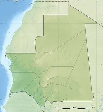 Dakhlet Nouadhibou Location of the bay in Mauritania | |
| Coordinates | 20°52′N 16°54′W / 20.87°N 16.9°WCoordinates: 20°52′N 16°54′W / 20.87°N 16.9°W |
| Ocean/sea sources | Atlantic Ocean[1] |
| Basin countries | Mauritania |
| Max. length | 54 km (34 mi) |
| Max. width | 32 km (20 mi) |
Dakhlet Nouadhibou is a bay on the Atlantic shore of Mauritania.[2]
Geography
The bay opens towards the south and contains numerous shoals. It is limited by the Cap Blanc headland on its western side.[2]
In French maps the inner bay is known as Baie de l'Archimède and the wider bay as Baie du Lévrier.
The Dakhlet Nouadhibou Region, one of the primary administrative divisions of Mauritania, is named after it.
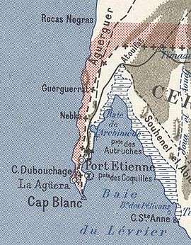
1958 French map of the Dakhlet Nouadhibou bay area
References
- ↑ GoogleEarth
- 1 2 "Dakhlet Nouadhibou". Mapcarta. Retrieved 18 October 2016.
This article is issued from
Wikipedia.
The text is licensed under Creative Commons - Attribution - Sharealike.
Additional terms may apply for the media files.