Blidinje Nature Park
| Blidinje | |
| Protected Area: Nature Park | |
 Valley and the lake | |
| Official name: Blidinje | |
| Country | Bosnia and Herzegovina |
|---|---|
| State | |
| District | West Herzegovina Canton |
| Municipalities | Jablanica, Posušje, Tomislavgrad |
| Lake | 1
|
| Rivers | Grabovica, Doljanka, Neretva |
| Elevation | 1,150–1,300 m (3,773–4,265 ft) |
| Coordinates | 43°37′N 17°37′E / 43.62°N 17.61°ECoordinates: 43°37′N 17°37′E / 43.62°N 17.61°E |
| Highest point | 1,300 |
| Lowest point | 1,150 |
| Length | 3–5 km (2–3 mi), S-N |
| Area | 364 km2 (141 sq mi) |
| Biomes | Mountain, Plateau, Lake, Forest |
| Geology | Limestone |
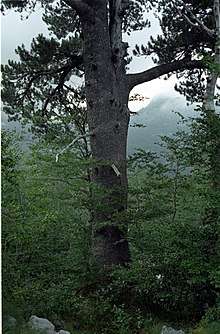
| Plants | Pinus leucodermis, Thyme, Pine |
| Founded | 1995 |
| Management | Blidinje Nature Park Public Enterprise |
| - location | Masna Luka - Posušje, Bosnia and Herzegovina |
| Owner | State of Bosnia and Herzegovina |
| For public | Free and with guide |
| Visitation | Open all year (Open all year) |
| Easiest access | State Road |
| IUCN category | III - Natural Monument |
 Location in Bosnia and Herzegovina | |
| Website: Blidinje Nature Park | |
Blidinje Nature Park is a nature park in Bosnia and Herzegovina, established on 30 April 1995. It is situated in the heart of Dinaric Alps and represent important natural, hydrogeological reservat in Dinaric karst of Bosnia and Herzegovina, with significant cultural and historical heritage. It consist of major mountains of Dinaric Alps range, plateau Dugopolje, Blidinje Lake, Grabovica valley and other characteristic karstic features.[1]
Geography and hydrology
The melting glaciers from Čvrsnica during the two past ice ages created this open and barren valley. A spacious plateau, 3–5 km long, is situated at an elevation of 1.150-1.300 meters a.s.l., between Čvrsnica and Vran mountains with a total area of 364 km². Although geomorphologically one whole, plateau is divided in two geographically and topographic distinct features, first in lower southern part, areal around the lake Blidinje, and another in northern higher part of the plateau where a flat plain Dugopolje is situated, as well as administratively between three municipalities: Posušje, Tomislavgrad and Jablanica.
Going from the north and the Doljanka river, plateau opens with a flat plain of Dugopolje at the higher end and lead toward south longitudinally between Vran at the north-northwestern side, with its highest peak on 2.074 meters a.s.l., and on the south-southeastern Čvrsnica mountain, with its highest peak Pločno at 2.228 meters a.s.l. On the opposite south-southeastern end of the plateau, beyond Blidinje lake, is Čabulja mountain with its highest peak at 1.786 meters a.s.l. further toward east beyond Čvrsnica is Grabovica valley that stretches all the way to the Neretva river and its canyon.
Grabovica valley
Grabovica valley with small Grabovica creek is a special reserve within park, squeezed deep into Čvrsnica, and form a deep canyon between steep and rugged cliffs of the mountain. Within the valley are two small villages Gornja Grabovica (Jablanica) and Donja Grabovica (Jablanica). The legend of Diva Grabovica tells the story about legendary daughter of a local shepherd who, as story goes, was killed by local nobleman whom she rejected, so that she would not marry another.[1]
Blidinje lake
The most important hydrogeological phenomena in the park is alpine lake, Blidinje Lake, largest of its kind in Bosnia and Herzegovina. Blidinje lake is the direct result of a glacial retreat, but according to the Poklečani Parishes office documents, lake is, also, a product of anthropogenic intervention and activities of human inhabitants. According to these documents, the lake is artificial and it was created at the end of the 19th century. In order to keep the water that is lost through the subterranean passage, local residents and cattle breeders sealed sinkholes with branches and clay, so that water could not find its way underground. Therefore, the lake was formed. Its surface area varies between 2,5 and 6 km², while its average depth is 1,9 m, with altitude of 1.184 m a.s.l.[2][1]
Flora and fauna
Accompanying some of the rocky and seemingly lifeless slopes are thick forests of pine, including the endemic white-bark pine at Masna Luka called Pinus leucodermis (Bosnian pine). Three types of wild thyme and dozens of wild flowers cover the valley and mountain sides in the spring and summer.
History, archaeology and culture
All around the valley is dotted with the Bosnia and Herzegovina trademark stećci from medieval ages. It is not clear how long human settlements have existed here but research began when Blidinje recently received Nature park status. Traces of Illyrian graves and Roman roads indicate that Blidinje has been settled for at least 2,500 years. The large necropolis at Dugo Polje indicates that the waves of Slavs that came in the 7th century also made this area their home.
Traditional life style
There is also a Franciscan monastery that is located within the park and open to visitors. Houses here are traditional shepherd homes with straw roofs that are mainly used during the spring and summer seasons. Winter is harsh and cold in these parts.
The park itself is free of mines with well-marked trails.
Trivia
A self-proclaimed micronation, a parodical project, is located in the middle of this Nature Park, Hajdučka Republika Mijata Tomića.
See also
References
- 1 2 3 "Nature Park Blidinje". Retrieved 16 October 2015.
- ↑ Radoš, Denis. "A history of the occurrence of Blidinje lake (Bosnia and Herzegovina)". Geoadria. 22(1): 1–40.
External links
| Wikimedia Commons has media related to Blidinje. |
Cultural–Historical National Monuments of Bosnia and Herzegovina | |||||||||||||
|---|---|---|---|---|---|---|---|---|---|---|---|---|---|
For official site names and detailed informations, see each article or the List of National Monuments of Bosnia and Herzegovina. | |||||||||||||
| Buildings and structures |
|  | |||||||||||
| Fortifications castles & walled cities |
| ||||||||||||
| Architectural ensembles |
| ||||||||||||
| Natural & cultural-historical ensembles / Cultural landscape | |||||||||||||
| Industrial architectural ensembles |
| ||||||||||||
| Traditional household | |||||||||||||
| Religious sites, properties and places of worship |
| ||||||||||||
| Antiquity |
| ||||||||||||
| Bronze Age | |||||||||||||
| Memorials, cemeteries and necropolis |
| ||||||||||||
| Movable property/Other |
| ||||||||||||
| World Heritage Sites | |||||||||||||
| |||||||||||||