Stara Ćuprija
| Stara Ćuprija | |
|---|---|
 | |
| Coordinates | 43°39′04″N 17°57′46″E / 43.651083°N 17.962722°E |
| Carries | Pedestrians |
| Crosses | Neretva |
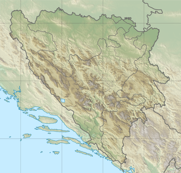
| Locale | Konjic, Bosnia and Herzegovina |
| Other name(s) | Konjička Stara Ćuprija |
| Heritage status | National Monument of BiH |
| Characteristics | |
| Design | Multiple-Arch |
| Material | Tufa |
| Trough construction | Mortar |
| Pier construction | Stone |
| Total length | - metres |
| Width | 4 metres |
| No. of spans | 6 |
| Piers in water | 5 |
| Clearance below | - metres at mid-span |
| History | |
| Constructed by | Ali-aga Hasečić |
| Construction start | 1682 |
| Construction end | 1683 |
| Opened | 1683 |
| Rebuilt | 2009 |
| Collapsed | March 1945 |
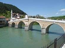
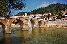
 Stara Ćuprija in Konjic, Bosnia and Herzegovina | |
Stara Ćuprija (Stara Ćuprija = English: Old Bridge) is old bridge in Konjic, and is one in series of Ottoman bridges in Bosnia and Herzegovina.
History
It was built between 1682 and 1683 by Ali-aga Hasečić (as shown by a stone plaque at the center of the bridge).
Construction, destruction and reconstruction
The bridge was built over six slightly pointed stone arches. The deck was completely destroyed with explosives, laid by the retreating German army in March 1945, while the arches suffered partial damage from explosion. However, all of the five piers remained and structural integrity was preserved. This allowed hope in future reconstruction to be much easier and reconstructed bridge wouldn't lose its authenticity. Since World War II officials decided to use bridge temporarily with makeshift deck made of iron beams laid down upon still existing piers and one track tarmac for motorized vehicle traffic. However, this solution lasted for more than five decades.
Only after the war of the nineties it was announced that bridge will be renovated, and between 2003 and 2009 it was reconstructed to its original state. Today it stands as one of the best preserved Ottoman bridges in Bosnia and Herzegovina and entire Balkans.
National Monument
The bridge is recently declared a National Monument of Bosnia and Herzegovina.
See also
References
External links
| Wikimedia Commons has media related to Konjic Bridge. |
- Municipal Website of Konjic (in Bosnian)
- Website of Konjic (in Bosnian) (in English)
Cultural–Historical National Monuments of Bosnia and Herzegovina | |||||||||||||
|---|---|---|---|---|---|---|---|---|---|---|---|---|---|
For official site names and detailed informations, see each article or the List of National Monuments of Bosnia and Herzegovina. | |||||||||||||
| Buildings and structures |
|  | |||||||||||
| Fortifications castles & walled cities |
| ||||||||||||
| Architectural ensembles |
| ||||||||||||
| Natural & cultural-historical ensembles / Cultural landscape | |||||||||||||
| Industrial architectural ensembles |
| ||||||||||||
| Traditional household | |||||||||||||
| Religious sites, properties and places of worship |
| ||||||||||||
| Antiquity |
| ||||||||||||
| Bronze Age | |||||||||||||
| Memorials, cemeteries and necropolis |
| ||||||||||||
| Movable property/Other |
| ||||||||||||
| World Heritage Sites | |||||||||||||
| |||||||||||||
| Countries | 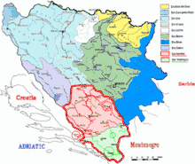 | ||||||||||||||||||||
|---|---|---|---|---|---|---|---|---|---|---|---|---|---|---|---|---|---|---|---|---|---|
| Places | |||||||||||||||||||||
| Wellsprings |
| ||||||||||||||||||||
| Tributaries |
| ||||||||||||||||||||
| Lakes |
| ||||||||||||||||||||
| Hydroelectric Power Plants | |||||||||||||||||||||
| Related articles | |||||||||||||||||||||
| Neretva river Sub-basin |
| ||||||||||||||||||||
Coordinates: 43°39′03.9″N 17°57′45.8″E / 43.651083°N 17.962722°E