Bitter Springs, Arizona
| Bitter Springs, Arizona | |
|---|---|
| CDP | |
 The Bitterspring trail, located off a Bureau of Land Management Back Country Byway in Coconino County | |
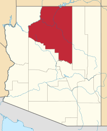
 Location in Coconino County and the state of Arizona | |
 Bitter Springs, Arizona Location in the United States | |
| Coordinates: 36°37′15″N 111°39′23″W / 36.62083°N 111.65639°WCoordinates: 36°37′15″N 111°39′23″W / 36.62083°N 111.65639°W | |
| Country | United States |
| State | Arizona |
| County | Coconino |
| Area[1] | |
| • Total | 8.03 sq mi (20.78 km2) |
| • Land | 8.03 sq mi (20.78 km2) |
| • Water | 0.00 sq mi (0.00 km2) |
| Elevation | 5,115 ft (1,559 m) |
| Population (2010) | |
| • Total | 5,575 |
| • Estimate (2016)[2] | N/A |
| Time zone | UTC-7 (MST) |
| • Summer (DST) | UTC-6 (MDT) |
| FIPS code | 04-06470 |
| GNIS feature ID | 0025249 |
Bitter Springs (Navajo: Díchʼíító) is a census-designated place (CDP) in Coconino County, Arizona, in the United States. As of the 2010 census, the CDP population was 452.[3]
Geography
Bitter Springs is located at 36°37′15″N 111°39′23″W / 36.62083°N 111.65639°W (36.620888, -111.656460).[4]
According to the United States Census Bureau, the CDP has a total area of 8.0 square miles (20.8 km2), all of it land.[5]
The mean elevation is 5,115 feet (1,559 m) above sea level. The US Postal Service ZIP code is 86040.
Bitter Springs is the terminus of U.S. Route 89A, a spur route cut off by the construction of the Glen Canyon Dam.
Demographics
| Historical population | |||
|---|---|---|---|
| Census | Pop. | %± | |
| U.S. Decennial Census[6] | |||
| Languages (2000) [7] | Percent |
|---|---|
| Spoke Navajo at home | 72.97% |
| Spoke English at home | 27.03% |
As of the census[8] of 2000, there were 547 people, 104 households, and 97 families residing in the CDP. The population density was 66.1 people per square mile (25.5/km²). There were 127 housing units at an average density of 15.3/sq mi (5.9/km²). The racial makeup of the CDP was 98.72% Native American and 1.28% White, with 0.73% of the population made up of Hispanic or Latino of any race.
There were 104 households out of which 73.1% had children under the age of 18 living with them, 57.7% were married couples living together, 26.0% had a female householder with no husband present, and 5.8% were non-families. 4.8% of all households were made up of individuals and 1.9% had someone living alone who was 65 years of age or older. The average household size was 5.26 and the average family size was 5.34.
In the CDP, the age distribution of the population shows 48.3% under the age of 18, 14.3% from 18 to 24, 24.5% from 25 to 44, 10.6% from 45 to 64, and 2.4% who were 65 years of age or older. The median age was 19 years. For every 100 females, there were 98.9 males. For every 100 females age 18 and over, there were 80.3 males.
The median income for a household in the CDP was $24,886, and the median income for a family was $30,217. Males had a median income of $11,477 versus $14,038 for females. The per capita income for the CDP was $7,985. About 25.0% of families and 29.6% of the population were below the poverty line, including 25.2% of those under age 18 and none of those age 65 or over.
Education
Bitter Springs is served by the Page Unified School District. The schools that serve Bitter Springs are located in the city of Page.
References
- ↑ "2016 U.S. Gazetteer Files". United States Census Bureau. Retrieved Jul 18, 2017.
- ↑ "Population and Housing Unit Estimates". Retrieved June 9, 2017.
- ↑ "Profile of General Population and Housing Characteristics: 2010 Demographic Profile Data (DP-1): Bitter Springs CDP, Arizona". U.S. Census Bureau, American Factfinder. Archived from the original on September 11, 2013. Retrieved December 7, 2011.
- ↑ "US Gazetteer files: 2010, 2000, and 1990". United States Census Bureau. 2011-02-12. Retrieved 2011-04-23.
- ↑ "Geographic Identifiers: 2010 Demographic Profile Data (G001): Bitter Springs CDP, Arizona". U.S. Census Bureau, American Factfinder. Archived from the original on September 11, 2013. Retrieved December 7, 2011.
- ↑ "Census of Population and Housing". Census.gov. Retrieved June 4, 2016.
- ↑ https://apps.mla.org/cgi-shl/docstudio/docs.pl?map_data_results%5Bpermanent+dead+link%5D
- ↑ "American FactFinder". United States Census Bureau. Archived from the original on 2013-09-11. Retrieved 2008-01-31.