Fredonia, Arizona
| Fredonia, Arizona | |
|---|---|
| Town | |
 | |
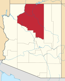
 Location of Fredonia in Coconino County, Arizona. | |
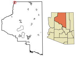
 Fredonia, Arizona Location in the United States | |
| Coordinates: 36°56′58″N 112°31′18″W / 36.94944°N 112.52167°WCoordinates: 36°56′58″N 112°31′18″W / 36.94944°N 112.52167°W | |
| Country | United States |
| State | Arizona |
| County | Coconino |
| Area[1] | |
| • Total | 8.50 sq mi (22.02 km2) |
| • Land | 8.50 sq mi (22.02 km2) |
| • Water | 0.00 sq mi (0.00 km2) |
| Elevation | 4,671 ft (1,424 m) |
| Population (2010)[2] | |
| • Total | 1,314 |
| • Estimate (2016)[3] | 1,323 |
| • Density | 155.59/sq mi (60.07/km2) |
| Time zone | UTC-7 (MST) |
| ZIP codes | 86022, 86052 |
| Area code | 928 |
| FIPS code | 04-25720 |
| Website |
www |
Fredonia is a town in Coconino County, Arizona, United States. As of the 2010 census it had a population of 1,314.[2] Fredonia is the gateway to the North Rim of the Grand Canyon.
History
Fredonia was laid out in 1886.[4]
Demographics
| Historical population | |||
|---|---|---|---|
| Census | Pop. | %± | |
| 1960 | 643 | — | |
| 1970 | 798 | 24.1% | |
| 1980 | 1,040 | 30.3% | |
| 1990 | 1,207 | 16.1% | |
| 2000 | 1,036 | −14.2% | |
| 2010 | 1,314 | 26.8% | |
| Est. 2016 | 1,323 | [3] | 0.7% |
| U.S. Decennial Census[5] | |||
As of the census[6] of 2000, there were 1,036 people, 359 households, and 287 families residing in the town. The population density was 139.7 people per square mile (54.0/km²). There were 455 housing units at an average density of 61.4 per square mile (23.7/km²). The racial makeup of the town was 85.71% White, 1.06% Black or African American, 11.39% Native American, 0.39% from other races, and 1.45% from two or more races. 1.45% of the population were Hispanic or Latino of any race.
There were 359 households out of which 37.9% had children under the age of 18 living with them, 65.5% were married couples living together, 10.0% had a female householder with no husband present, and 19.8% were non-families. 15.9% of all households were made up of individuals and 5.3% had someone living alone who was 65 years of age or older. The average household size was 2.89 and the average family size was 3.25.
In the town, the age distribution of the population shows 32.3% under the age of 18, 6.2% from 18 to 24, 27.7% from 25 to 44, 22.7% from 45 to 64, and 11.1% who were 65 years of age or older. The median age was 35 years. For every 100 females, there were 104.3 males. For every 100 females age 18 and over, there were 98.0 males.
The median income for a household in the town was $30,288, and the median income for a family was $30,913. Males had a median income of $24,904 versus $19,554 for females. The per capita income for the town was $13,309. About 12.3% of families and 15.0% of the population were below the poverty line, including 25.4% of those under age 18 and 3.2% of those age 65 or over.
Geography and climate
Fredonia is located at 36°56′58″N 112°31′18″W / 36.94944°N 112.52167°W (36.949522, -112.521700),[7] at 4,680 feet (1,430 m) in elevation. It is in the Arizona Strip, the portion of Arizona lying north of the Colorado River, and is within a few miles of the Utah border. According to the United States Census Bureau, the town has a total area of 7.4 square miles (19 km2), all of it land.
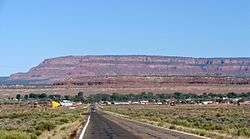
Fredonia is also located within a short distance of other national parks, national monuments, state parks, and scenic outdoor recreation spots.
| Climate data for Fredonia, Arizona | |||||||||||||
|---|---|---|---|---|---|---|---|---|---|---|---|---|---|
| Month | Jan | Feb | Mar | Apr | May | Jun | Jul | Aug | Sep | Oct | Nov | Dec | Year |
| Record high °F (°C) | 78 (26) |
72 (22) |
83 (28) |
86 (30) |
96 (36) |
107 (42) |
110 (43) |
104 (40) |
99 (37) |
96 (36) |
78 (26) |
70 (21) |
110 (43) |
| Average high °F (°C) | 46.2 (7.9) |
51.6 (10.9) |
59.7 (15.4) |
68.5 (20.3) |
77.4 (25.2) |
87.3 (30.7) |
93.7 (34.3) |
90.7 (32.6) |
84.2 (29) |
72.2 (22.3) |
58.5 (14.7) |
47.9 (8.8) |
69.8 (21) |
| Average low °F (°C) | 19.5 (−6.9) |
22.1 (−5.5) |
26.0 (−3.3) |
31.9 (−0.1) |
38.5 (3.6) |
46.6 (8.1) |
55.4 (13) |
54.2 (12.3) |
45.4 (7.4) |
35.4 (1.9) |
26.1 (−3.3) |
20.1 (−6.6) |
35.1 (1.7) |
| Record low °F (°C) | −20 (−29) |
−15 (−26) |
−2 (−19) |
2 (−17) |
18 (−8) |
26 (−3) |
34 (1) |
33 (1) |
26 (−3) |
9 (−13) |
0 (−18) |
−18 (−28) |
−20 (−29) |
| Average precipitation inches (mm) | 1.13 (28.7) |
0.80 (20.3) |
0.88 (22.4) |
0.62 (15.7) |
0.48 (12.2) |
0.29 (7.4) |
0.73 (18.5) |
1.21 (30.7) |
0.89 (22.6) |
0.90 (22.9) |
0.77 (19.6) |
0.97 (24.6) |
9.67 (245.6) |
| Average snowfall inches (cm) | 7.0 (17.8) |
3.5 (8.9) |
3.5 (8.9) |
1.1 (2.8) |
0 (0) |
0 (0) |
0 (0) |
0 (0) |
0 (0) |
0.2 (0.5) |
1.3 (3.3) |
4.8 (12.2) |
21.4 (54.4) |
| Average precipitation days (≥ 0.01 in) | 5 | 4 | 4 | 3 | 3 | 2 | 4 | 5 | 3 | 4 | 3 | 4 | 44 |
| Source: Western Regional Climate Center[8] | |||||||||||||
Education
Fredonia is a part of the Fredonia-Moccasin Unified School District. Two schools, Fredonia Elementary/Middle School and Fredonia High School, serve the town.
See also
References
- ↑ "2016 U.S. Gazetteer Files". United States Census Bureau. Retrieved Jul 18, 2017.
- 1 2 "American FactFinder". United States Census Bureau. Retrieved 23 Aug 2014.
- 1 2 "Population and Housing Unit Estimates". Retrieved June 9, 2017.
- ↑ The Utah Genealogical and Historical Magazine, Volumes 9-10. 1918. p. 128.
- ↑ "Census of Population and Housing". Census.gov. Retrieved June 4, 2016.
- ↑ "American FactFinder". United States Census Bureau. Archived from the original on 11 September 2013. Retrieved 31 Jan 2008.
- ↑ "US Gazetteer files: 2010, 2000, and 1990". United States Census Bureau. 12 Feb 2011. Retrieved 23 Apr 2011.
- ↑ "FREDONIA, ARIZONA (023250)". National Oceanic and Atmospheric Administration. 2012. Retrieved 12 May 2012.
- George R. Stewart. Names on the Land. Houghton Mifflin Company: Boston (1967)
External links
| Wikimedia Commons has media related to Fredonia, Arizona. |