Shonto, Arizona
| Shonto, Arizona | |
|---|---|
| CDP | |
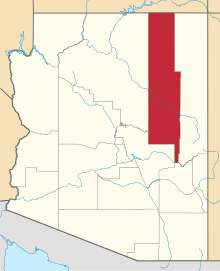
 Location in Navajo County and the state of Arizona | |
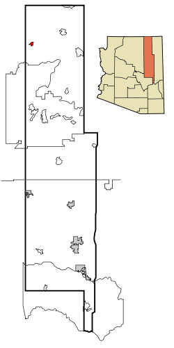
 Shonto, Arizona Location in the United States | |
| Coordinates: 36°35′54″N 110°39′29″W / 36.59833°N 110.65806°WCoordinates: 36°35′54″N 110°39′29″W / 36.59833°N 110.65806°W | |
| Country | United States |
| State | Arizona |
| County | Navajo |
| Area[1] | |
| • Total | 4.57 sq mi (11.83 km2) |
| • Land | 4.56 sq mi (11.81 km2) |
| • Water | 0.01 sq mi (0.03 km2) |
| Elevation | 6,240 ft (1,902 m) |
| Population (2000) | |
| • Total | 591 |
| • Estimate (2016)[2] | N/A |
| Time zone | UTC-7 (MST) |
| ZIP code | 86054 |
| Area code(s) | 928 |
| FIPS code | 04-66260 |
| GNIS feature ID | 0011241 |
| Website | http://www.shonto.org/ |
Shonto (Navajo: Shą́ą́ʼtóhí) is a census-designated place (CDP) in Navajo County, Arizona, United States. The population was 591 at the 2010 census.
Geography
Shonto is located at 36°35′54″N 110°39′29″W / 36.59833°N 110.65806°W (36.598209, -110.658156).[3]
According to the United States Census Bureau, the CDP has a total area of 4.6 square miles (12 km2), all of it land. In Shonto, the local Shonto Canyon is where the natural spring is located. It is connected to the canyons that stretch all the way to Navajo Mountain which is in viewing distance from Shonto. The beautiful land is rich in mineral and water deposits.
Demographics
| Historical population | |||
|---|---|---|---|
| Census | Pop. | %± | |
| 2000 | 568 | — | |
| 2010 | 591 | 4.0% | |
| U.S. Decennial Census[4] | |||
As of the census[5] of 2000, there were 568 people, 149 households, and 118 families residing in the CDP. The population density was 124.3 people per square mile (48.0/km²). There were 220 housing units at an average density of 48.2/sq mi (18.6/km²). The racial makeup of the CDP was 1.94% White, 0.18% Black or African American, 96.30% Native American, and 1.58% from two or more races. 1.06% of the population were Hispanic or Latino of any race.
There were 149 households out of which 52.3% had children under the age of 18 living with them, 53.7% were married couples living together, 19.5% had a female householder with no husband present, and 20.8% were non-families. 18.1% of all households were made up of individuals and 4.0% had someone living alone who was 65 years of age or older. The average household size was 3.81 and the average family size was 4.40.
In the CDP, the population was spread out with 43.3% under the age of 18, 9.2% from 18 to 24, 24.6% from 25 to 44, 19.0% from 45 to 64, and 3.9% who were 65 years of age or older. The median age was 22 years. For every 100 females, there were 91.2 males. For every 100 females age 18 and over, there were 86.1 males.
The median income for a household in the CDP was $42,500, and the median income for a family was $46,094. Males had a median income of $34,063 versus $26,875 for females. The per capita income for the CDP was $12,411. About 16.5% of families and 14.0% of the population were below the poverty line, including 22.3% of those under age 18 and 100.0% of those age 65 or over.
Education
Shonto Preparatory School is a K-8 school that serves the community.
Shonto Preparatory Technology High School educates grades 9-12.
From Kayenta, Kayenta Primary School, Kayenta Intermediate School, Kayenta Middle School, and Monument Valley High School also serve the community.
Events
Rock the Canyon: Art & Music Festival is an annual event in the community of Shonto since its initial launch in 2009.
Next event date: Saturday, June 3, 2017
References
- ↑ "2016 U.S. Gazetteer Files". United States Census Bureau. Retrieved Jul 18, 2017.
- ↑ "Population and Housing Unit Estimates". Retrieved June 9, 2017.
- ↑ "US Gazetteer files: 2010, 2000, and 1990". United States Census Bureau. 2011-02-12. Retrieved 2011-04-23.
- ↑ "Census of Population and Housing". Census.gov. Retrieved June 4, 2016.
- ↑ "American FactFinder". United States Census Bureau. Retrieved 2008-01-31.